Hike through some of the prettiest sections of New Jersey’s Pine Barrens along the scenic Mullica River.
9.5 or 5.5 miles. Easy, flat, soft sand trails covered in pine needles. Moderate to challenging only due to length.
- Shorter: 5.5 miles – Out and back along Mullica River (YELLOW), turning around at the junction with the Beaver Pond – Quaker Bridge (noted below).
- Short: Just turn around even sooner than the junction above.
- Nearby: Apple Pie Hill; Batsto Lake Trail; Tom’s Pond Trail; Black Run Preserve; Franklin Parker Preserve; Franklin Parker – Chatsworth.
Our two cents:
Probably our favorite pine barrens hike – beautiful pine trees, the Mullica River, easy navigation. All that green pine is especially welcome in winter months.
9.5 miles is long for many people, but since the hiking here is so easy-peasy you may find this doable if you normally handle around 6-7 miles on more rugged trails with elevation changes.
A negative is this area is that the sand roads (not the trails) are heavily used by off-road vehicles. We’d feel like we had the forest to ourselves for quite a time then suddenly see a car or dirt bike drive by on a sand road that we didn’t even realize was nearby.
Ticks can be terrible in the pines, especially in warmer months, take appropriate precautions or hike in the winter. For tips, see our page on Lyme Disease and West Nile.
Updated: 2/2022 Re-hiked, minor edits, new photos. 8/2020 – Page refreshed, not re-hiked.
Map:
Trail map on the park site plus we’ve scanned the map areas of the previous brochure into one PDF that will print on letter-size paper, both linked in the Hike Info box above.
The scanned map shows more detail as well as the sand roads but isn’t absolutely needed for the hike.
Books:
This hike is now in Best Day Hikes in New Jersey – though their map is wrong as it shows the route in the opposite direction of the description.
Different hikes along the Mullica River can be found in Best Day Hikes Near Philadelphia (Atsion-Batsto shuttle hike), Hiking New Jersey (2023) (loop from Batsto), and 50 Hikes in New Jersey (longer out-and-back from Batsto).
There is an entry on Wharton State Forest in the The New Jersey Walk Book.
Parking: N39 44.525 W74 43.555
Atsion Office, 744 US-206, Shamong, NJ 08088. From the north: NJ Turnpike S to Rt. 206S. In the town of Shamong across from Atsion Lake, turn left into the parking lot.
Across the street is Atsion Recreation Area, where swimming is allowed and a parking fee charged Memorial Day to Labor Day – but the parking for this hike at the lot above is no fee.
Restrooms:
Portable toilet and a composting toilet across the field behind the parking area (as of 2/2022). From the parking lot, with Rt 206 behind you, look across the field to spot it.
If approaching from the north via Rt 206 S there are gas stations that might have restrooms, and a super Wawa about 20 min before the park that does.
Hike Directions:
Overview: Mullica River (YELLOW) – Beaver Pond/Quaker Bridge (PURPLE) – Wilderness Camps Connector (GREEN) – Mullica River (YELLOW)
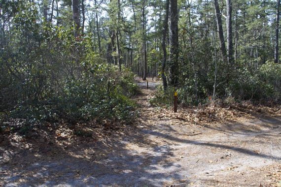
This area is full of unmarked sand roads. The trails are very well-marked and have mileage signs along the way and at intersections.
But if you don’t see a marker for a while, turn around and look behind you. If you don’t see blazes in the other direction either, backtrack and make sure you are on an actual trail.
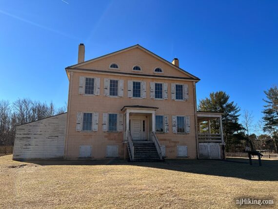
0.0 – Mullica River (YELLOW) technically starts to the right of the Atsion Mansion next to the parking lot. But we always just head through the field.
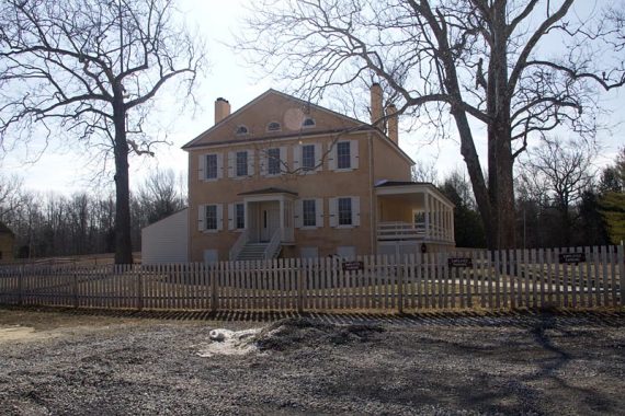
Fun Facts: The Atsion Mansion was built in 1826 and still retains its original Greek Revival style of architecture.
The property was used by several families, then by Joseph Wharton for cranberry production, before the State of New Jersey acquired it in 1955. [Source: NJ State Park web site.]
Walk across the grass and start following the wide sand road. This is Mullica River (YELLOW) and also Quaker Bridge Road.
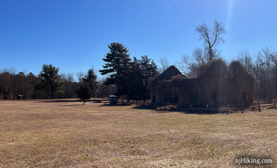
Continue on the sand road, past an old church on the left and a building on your right.
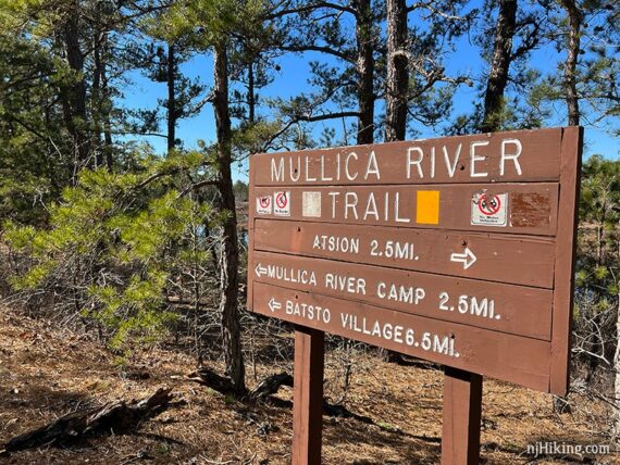
0.4 – At a marker post with a yellow blaze, turn LEFT as Mullica River (YELLOW) heads into the woods and off of the sand road. In a few steps there was a NJ State Forest sign.
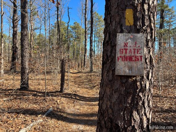
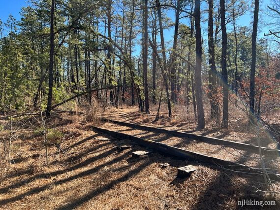
0.5 – Cross old railroad tracks. Continue following Mullica River (YELLOW).
In some open spots, the blazes are hard to locate amongst the junction of sand trails/roads.
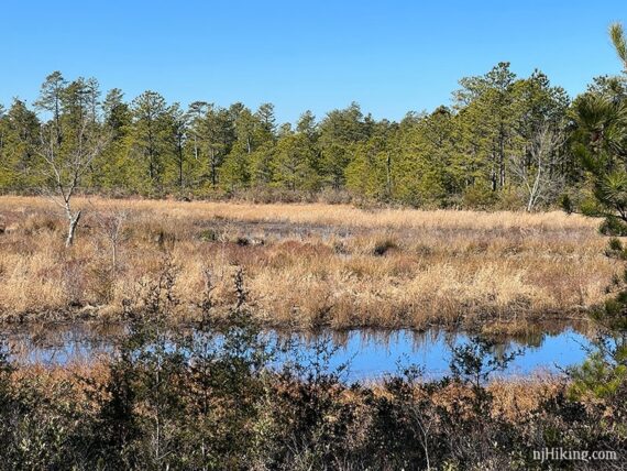
Continue through and open intersection with water and a sandy beach off on the right.
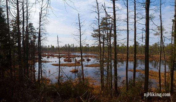
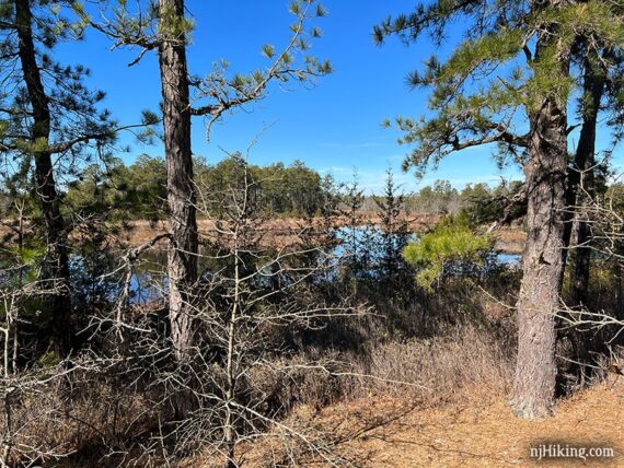
Along Mullica River (YELLOW) get a peek at the water here and there.
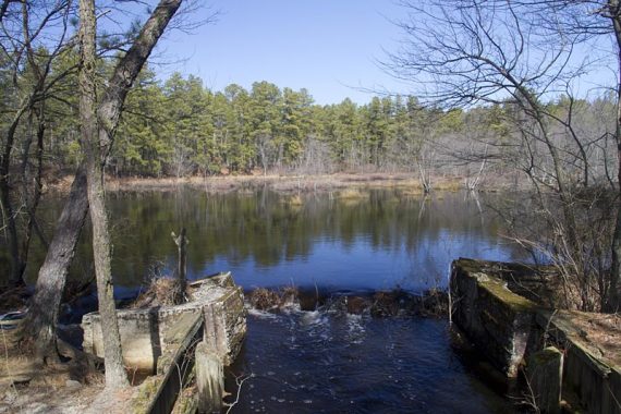
Mullica River (YELLOW) briefly follows the sand road (Quaker Bridge Road) for a little bit, passing a small pond with a spillway, before heading back on a trail.
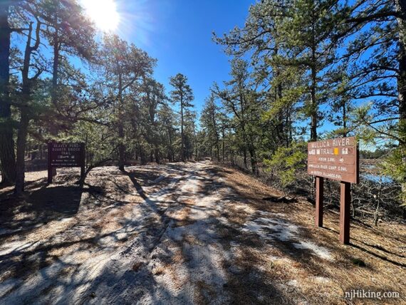
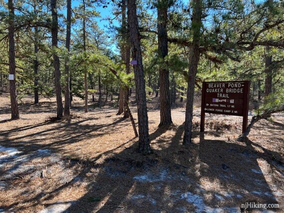
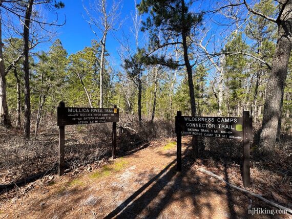
2.8 – Big wooden signs for “Quaker Bridge Beaver Pond Trail, Batona Trail 1.7 miles, Lower Forge Camp 3 miles” and the Mullica River Trail.
Views of the Mullica River through the pine trees.
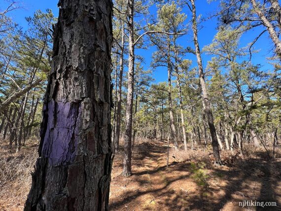
Turn LEFT, now following Beaver Pond/Quaker Bridge (PURPLE).
// Shorter Option: For a 5.5-mile hike, turn around at this sign and retrace your route. //
4.4 – Turn RIGHT, now following Wilderness Camps Connector (GREEN). A small green arrow pointing to the right is posted on a tree. [Beaver Pond/Quaker Bridge (PURPLE) continues straight].
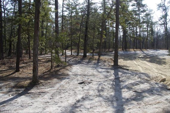
If you miss this turn very soon you’ll reach an open area with multiple sand roads. In the photo below a car on these sand roads is just visible.
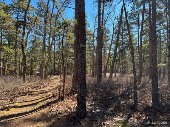
Wilderness Camps Connector (GREEN) simply connects the two main trails. There was evidence of fire damage in this section.
Where the trail crosses a sand road (Middle Road) there was a long log that made a nice break spot.
5.2 – Wilderness Camps Connector (GREEN) ends at two large signs. Turn RIGHT, towards “Atsion 4.5 miles”, now following Mullica River (YELLOW) again.
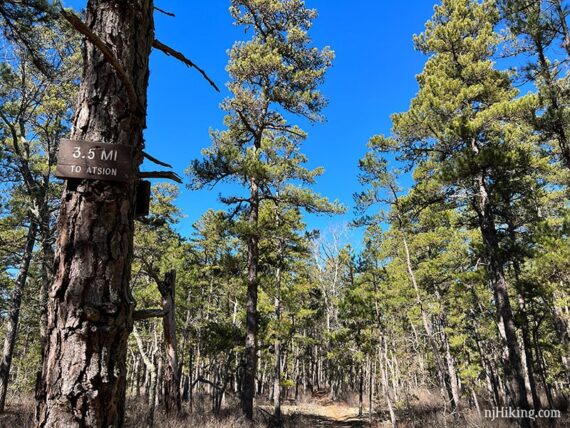
Continue following Mullica River (YELLOW). There are occasional wooden marker signs to count down the miles. These match the distance back to the parking lot for this route.
6.9 – Arrive back at the junction with Beaver Pond/Quaker Bridge (PURPLE). Continue following Mullica River (YELLOW) straight, the entire way back.
—–
Hiked: 2/21/22.
Hiked: 1/1/13 [opposite direction]. Trail Blog: “Wharton State Forest – Atsion“
Hiked: 2/27/11. Trail Blog: “Wharton State Forest – Atsion to Quaker Bridge Loop“