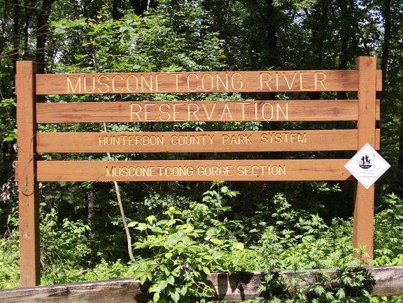
First time hiking at the Musconetcong Gorge Preserve.
Mileage: 3.1 miles (about, our GPS lost sats a lot at the end). WHITE/YELLOW/TEAL Ridge Trail to WHITE Switchback Trail to WHITE Railroad Trail to BLUE to WHITE/YELLOW/TEAL Ridge Trail.
For complete hike info visit our main Musconetcong Gorge page.
Thanks to RidgeSearchers for the hike suggestion.
We found the trail map for this park to be annoying… trails are marked with various dotted lines on the trail map – this makes the map somewhat confusing.
The trails are blazed with colors, but the colors are not noted on the map, just the name of the trail. [Update: the map has since been updated and is easier to understand]
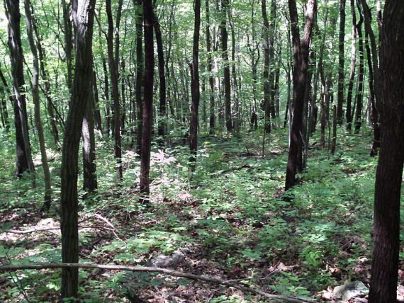
The trail starts heading up on the Highlands trail, and is not as rocky here as Highlands trail usually is. There are no views from the ridge, just nice forest walking.
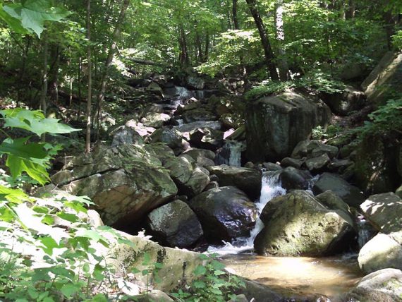
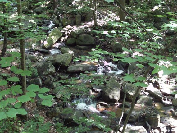
We rock hopped across a stream.
At this point, the waterfall and gorge are to your left, and I imagine the majority of visitors just hang a left here and go to that area and then return for a small loop or come back via the nature trail – and we’d recommend this option.
Related: Waterfalls in NJ / Best Waterfall Hikes in NJ
But this is only at around .7 miles in so we kept going.We continued following the Highlands trail, up a short muddy scramble.
Continued for some nice forest walking, nothing too spectacular, no views, streams etc. All of a sudden a dog came rustling out of the brush on the hill above us.
He was dragging a short leash, and looked really hot and worn out, like he was gone from his owner awhile. We couldn’t get him to come over so we could see if his tag had a phone number and he took off down the trail.
Finally we came up a family taking a rest and snack break and the dog was now with them, which was a relief. They seemed unconcerned however. It always perplexes us that so many people let their dogs off leash as they hike.
In the midst of worrying about a “lost” dog, we missed the turn for the Switchback Trail and had to backtrack a ways.
The Switchback trail was annoying: An old trail went directly and steeply down. The Switchback trail weaved back and forth across this and was confusing in spots and overgrown.
After getting sick of basically bushwhacking, we just took the direct trail down for the last half. It wasn’t clear to take the gravel rail trail or the red trail or either was ok.
At the end of the rail trail there were 3 trails to choose from and the dotted lines on the map were hard to decipher. We checked out the gorge area and waterfall then headed back on the trail we came in on.
Maybe it was because the map was irritating us, the switchbacks annoyed us, or it was our 2nd park of the day… but overall this park wasn’t a fave of ours. The gorge area was pretty, but small.
We’d recommend doing a short loop to the waterfall and back. We went further… and it wasn’t really all that fantastic.
Took a loop hike through this gorge on 6/7/2015. No maps were available at the Dennis Rd. kiosk, so I recommend you print one in advance. Walked counterclockwise, starting on the Ridge/Highlands trail (marked with white, teal and yellow blazes). Ascended the ridge , traversing Scout Run, eventually reaching the Switchback Trail (plastic white blazes). Turn left on the Switchback. It is well marked, and no longer over grown. After walking downhill a 1/2-mile or so, the Switchback Trail reaches the abandoned railroad grade (marked with red and white blazes). Turn left, continuing the counterclockwise loop. The red trail soon leaves the railroad grade, and reenters the woods. (Caution: By continuing on the RR grade you will leave the Hunterdon County preserve property.) Eventually, the red trail reaches an old logging road, descending from the ridge. A metal gate is on your right. This is the junction of the Waterfall, Nature and Railroad Trails. Proceed straight across to the Waterfall Trail (burnt orange and blue blazes). You will soon cross Scout Run on some boulders and a wooden footbridge. The Nature Trail (blue) splits off and rejoins the Waterfall (orange) trail, ultimately climbing the ridge back to the Dennis Rd. parking area. This is a nice 2 or 3 hour walk in the woods. Some of the trail markers are confusing, and there’s no signage in the Preserve. So, remember to bring your map.This is not a particularly challenging outing; however, I echo the comments about the copious amount of poison ivy lurking at your ankles.