Hiking the Beaver Brook trail to Lost Lake, where there is a beaver lodge and dam.
8.2 or 5.1 miles. Varies between rocky trail and some wider woods road. Beaver Brook trail section is less traveled and may be overgrown.
| 8.2 miles | This hike guide: Detailed instructions, photos, and video follow below. |
| Shorter | 5.1 – Cut the Beaver Brook to Lost Lake section. Noted below. |
| Longer | Continue past Lost Lake. Noted below. |
| Nearby | Kittatinny Valley State Park; Splitrock Reservoir Loop; Four Birds (Splitrock); Four Birds (South); Four Birds (North); Allamuchy Mountain North |
| Nearby | Paulinskill Valley Trail – Warbasse Junction to Cedar Ridge; Great Valley Trail Loop; Splitrock Reservoir Kayak; Lake Aeroflex Kayak; Cranberry Lake Kayak |
Our two cents:
Up for a wee bit of an adventure on the trail-less-taken? Then this wild-n-remote feeling hike may be for you.
We’ve always enjoyed hiking to Lost Lake for it’s off-the-beaten path feel – but it’s not for everyone.
Not recommended for casual or new hikers. Beaver Brook trail was very overgrown in many places so be sure to use tick protection, spot check at breaks, and reapply as needed.
There’s always the option of trying it and turning back if it’s not for you. And the 5.1 mile version without Beaver Brook Trail is more of a standard hiking experience.
There are two 8.2 mile options: Out-and-back or a loop that includes Headley Overlook (a little limited as far as viewpoints go but still nice). Both described below.
Beaver Brook Trail is within Rockaway River Wildlife Management Area; you may want to avoid hiking it in hunting season or be sure to wear blaze orange.
Updated: 1/2026 – Minor edits and adjusted the description to reflect trail changes; not re-hiked. Older change log at page bottom.
Hike Info:
Map/Books:
This hike starts in Mahlon Dickerson Reservation and then enters Rockaway River WMA for the Beaver Brook Trail. There isn’t one current map that shows this whole hike.
This entire hike is covered by the Morris County Highlands Trails (2023 version) BUT areas of that map are now out of date. The Mahlon Dickerson park map is updated, but no longer shows the Beaver Brook Trail.
You can follow along on your smartphone with our Beaver Brook Interactive Map. While the points are updated for trail colors, it only estimates the new junction of the YELLOW trail.
There may be paper Mahlon Dickerson maps in the kiosk in the parking lot, or print out from the park site ahead. A complete description of the Beaver Brook trail is found the The New Jersey Walk Book.
Parking: N41 00.462 W74 35.144
Saffin Pond, Lake Hopatcong, NJ 07849 or Weldon Brook Lake, Jefferson, NJ 07849. Could not locate a street address for the lot, located on Weldon Road. Saffin Pond is also called “Weldon Brook Lake” on Google.
If approaching rom Rt 287 N take Rt 80 W. Exit 34 to Rt 15 North. Right onto Weldon Road. Large parking area on the right.
Restrooms:
Portable toilets may be in the parking lot. If approaching from Rt. 15 North, there is a QuikChek about a quarter mile before the exit for Weldon Road (it’s on the left and not well marked).
Hike Directions:
Overview: Highlands (TEAL DIAMOND) – BLUE – Beaver Brook (WHITE) to Lost Lake and then retrace – YELLOW – Highlands (TEAL DIAMOND) – PINK – YELLOW
Highlands Trail may use a TEAL DIAMOND as well as a “Highlands Trail” Diamond.
DESCRIPTION UPDATED BUT NOT RE-HIKED. PHOTOS BELOW COULD DIFFER FROM CURRENT TRAILS.
0.0 – Start following Highlands (TEAL DIAMOND). The trailhead is at the back middle of the lot. Pass the YELLOW trail on the left (might not notice it).
Almost immediately arrive at Saffin Pond. It’s easier to see if you step a bit to the right.
Head LEFT, following Highlands (TEAL DIAMOND).
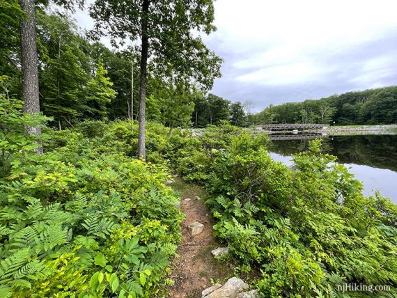
The trail hugs the pond and is very rocky. There may signs of beaver activity.
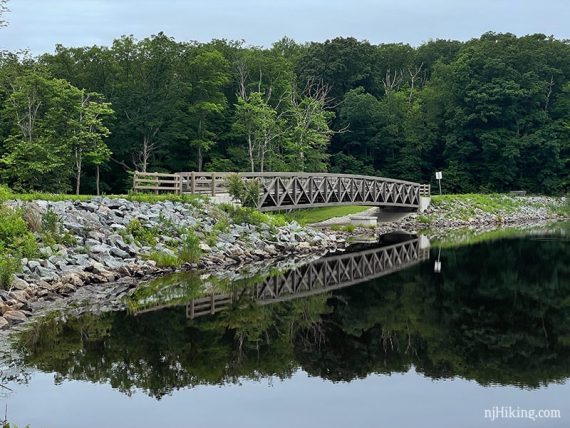
The short spur trail continues next to Saffin Pond and approaches the bridge on the other end.
0.3 – At the end of the pond, just beyond a bench, make a sharp LEFT onto a gravel path to continue following Highlands (TEAL DIAMOND).
This route does not go over the bridge at the end of the pond. [Highlands Spur (BLACK DOT on TEAL DIAMOND) is on the right]
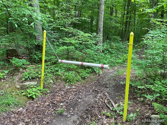
0.5 – At a T-intersection with a bench and gate, turn LEFT to continue following Highlands (TEAL DIAMOND).
On the right may be a gate to block the old route of the Highlands Trail.
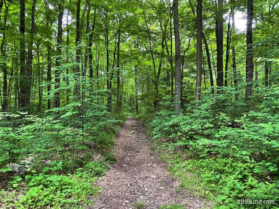
Highlands (TEAL DIAMOND) is a flat and wide in this section.
0.8 – Turn RIGHT to start following BLUE. [Highlands (TEAL DIAMOND) continues ahead. There’s a sign for Saffin Pond.]
BLUE heads downhill and curves almost on to itself a few times because it’s a mountain bike trail. It continues downhill until it reaches a bridge.
2.1 – Follow BLUE as it turns LEFT. Another gate may be on the right for the old Highlands Trail.
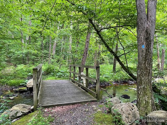
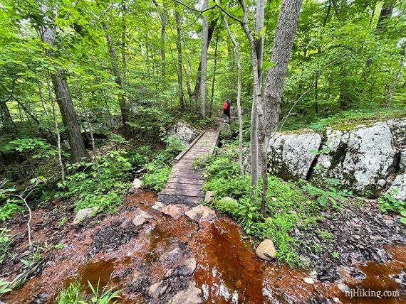
Cross Weldon Brook on a wooden footbridge. The trail starts to head uphill gradually after the bridge.
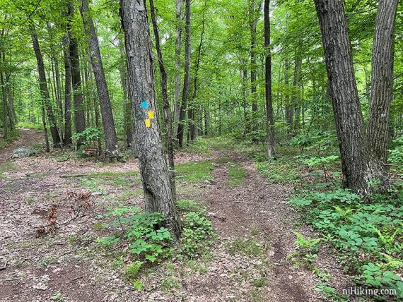
2.4 – Turn RIGHT to continue following BLUE. [BLUE DOT starts here].
// Shorter 5.1 miles, skipping Lost Lake: Instead, take BLUE DOT directly to the YELLOW. Scroll down to “Shorter 5.1 mile version” to continue. //
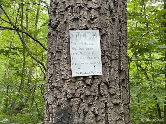
This intersection has changed since we hiked it: There may still be a sign noting that to the left the old route of the Highlands Trail is closed. Old markers were painted over but there was a WHITE one leftover on the back of a tree, from when Beaver Brook used to start here.
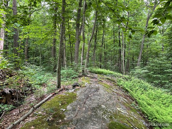
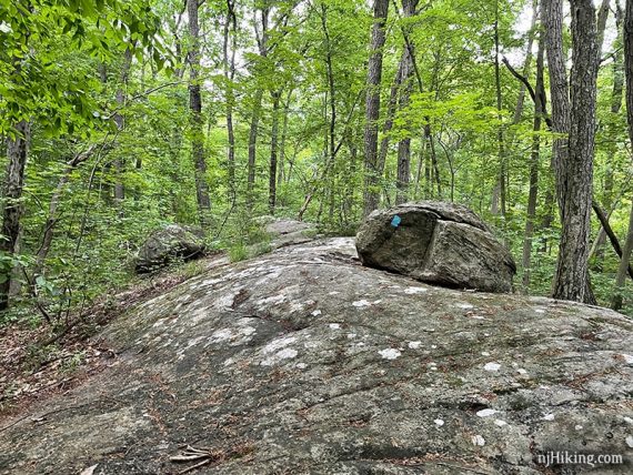
Continue following BLUE over a large rock slab.
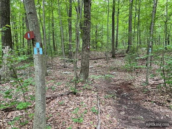
2.8 – Continue straight to now follow Beaver Brook (WHITE). [YELLOW crosses left and right].
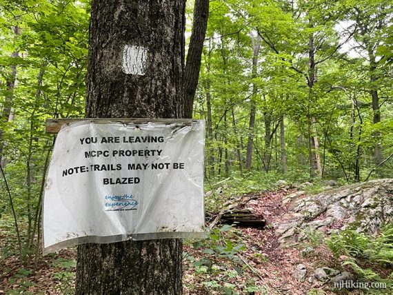
There is a trail kiosk and sign stating you are leaving a Morris County Parks Property.
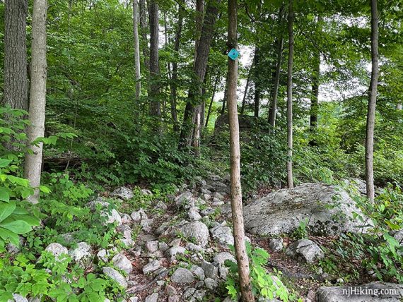
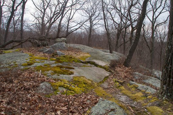
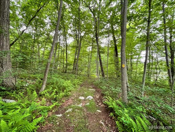
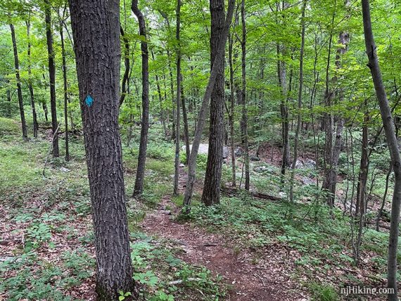
Beaver Brook (WHITE) becomes more rugged, traversing some rock slabs and eventually heading downhill on the way to the lake.
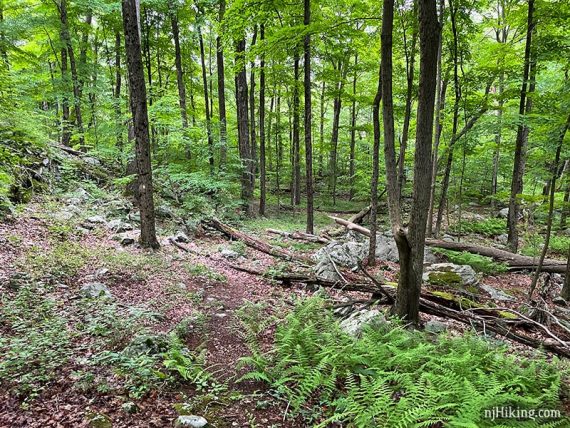
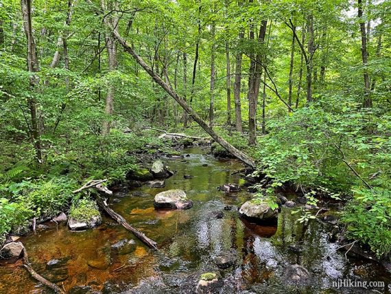
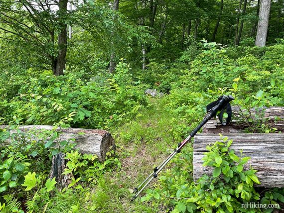
3.2 – Cross an unmarked trail. Sometimes Beaver Brook (WHITE) can be overgrown in areas or hard to spot.
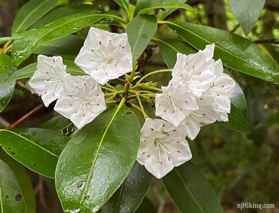
Head through an area with mountain laurel thickets.
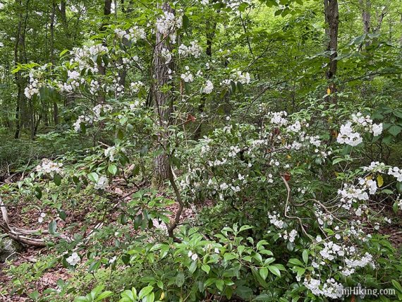
The small white cup-shaped flowers were blooming the day we hiked.
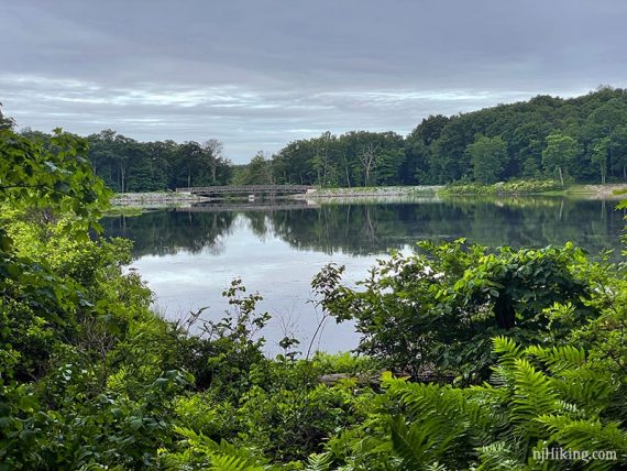
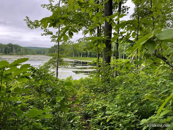
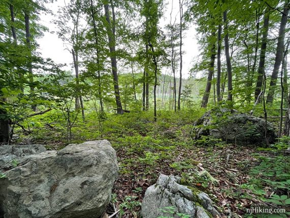
3.7 – Cross another unmarked trail. Lost Lake will come into view through the trees.
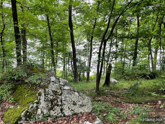
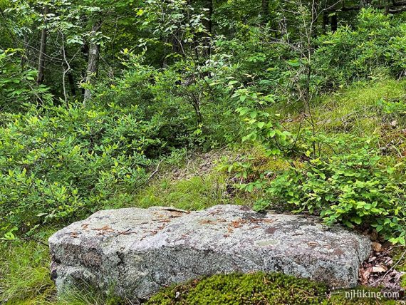
3.8 – An open grassy area with a little more of a view of Lost Lake and a large flat rock to sit on.
This is an obvious stopping point and hikers might assume this limited view of the lake is the end goal.
But we’ve always continued down to the edge of Lost Lake for our break, 0.2 miles from here.
It’s hard to tell where the trail continues after the clearing but the trail becomes more noticeable after the rock. Beaver Brook (WHITE) was less used beyond this point so take that into consideration.
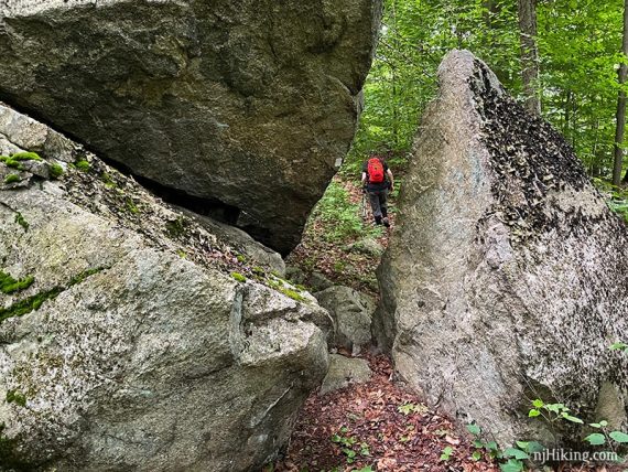
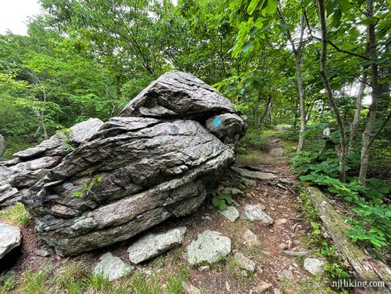
4.0 – Beaver Brook (WHITE) goes through a huge split rock. A smaller piece sits next to the gigantic boulder it used to be part of.
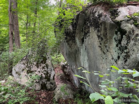
Split Rock looks cool coming back the other direction too, with several sharp angles.
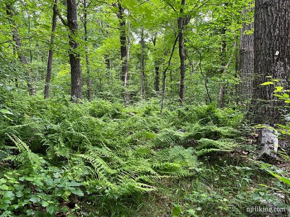
Continue following Beaver Brook (WHITE) through some ferns and overgrown areas.
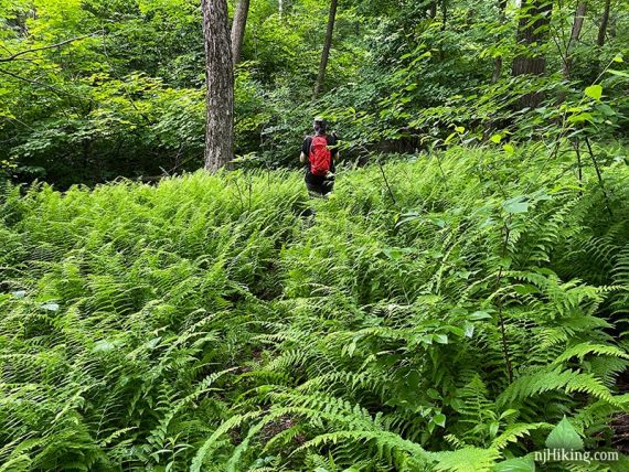
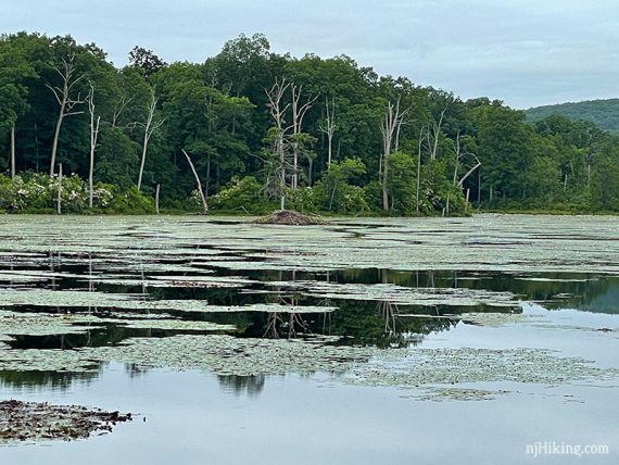
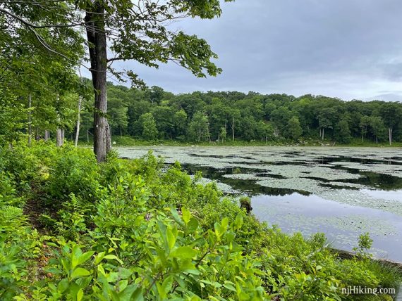
Soon the trail approaches the shore of the lake.
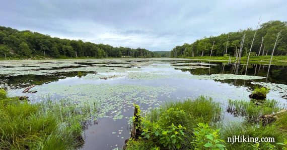
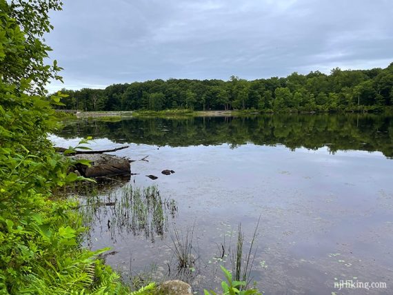
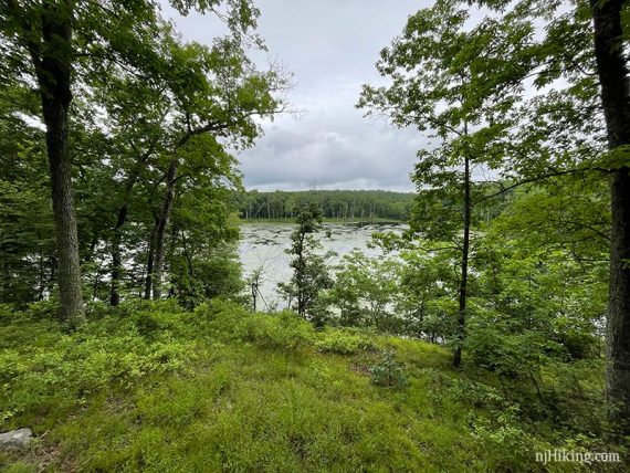
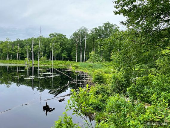
4.1 – Beaver Brook (WHITE) comes to the edge of Lost Lake where there are logs to sit on and enjoy the view.
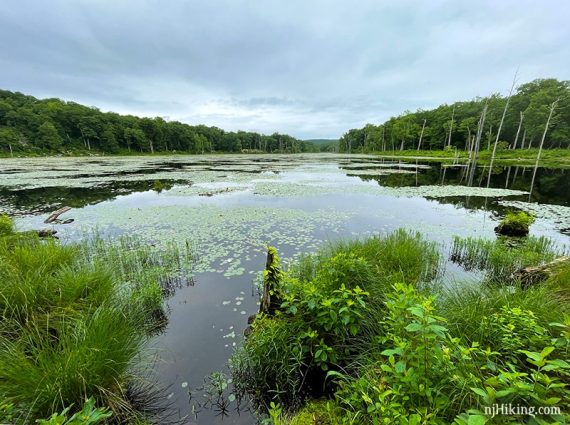
This is the turn around point, but the trail does continue past this log (note below).
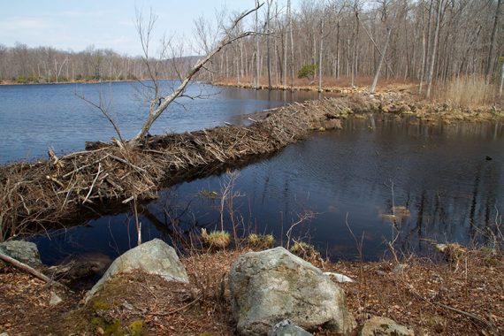
A beaver lodge is across the lake and they’ve dammed the water on one end.
Zoom in to a beaver dam on Lost Lake, circa April 2014:
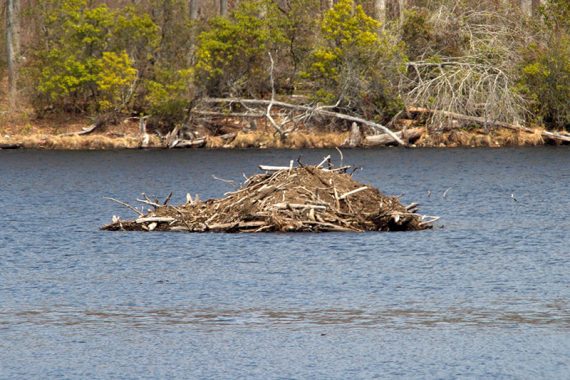
The dam from another angle, also from 2014. We were able to get closer to the edge of the water then.
Looking back at the trail along the lake.
When ready, turn around and retrace the route back on Beaver Brook (WHITE) to the YELLOW trail junction.
// Optionally, continue the adventure… The Beaver Brook (WHITE) trail continues another ~3.1 miles to a parking lot on Berkshire Valley Road. There is a water crossing on planks not long after this spot. HOWEVER we last did that 2015 so we don’t know the condition. Couple of viewpoints later are quite limited, and the trail is more rugged with several elevation changes from Lost Lake on. See Trail Blog links at page bottom for more detail. //
5.4 – Back at the junction with YELLOW from earlier, turn RIGHT to now follow YELLOW. [BLUE is ahead, and YELLOW is also to the left.]
// Out-and-back option: 8.2 miles. Instead, retrace the route back, BLUE to TEAL. //
// Shorter 5.1 mile version from here on. //
YELLOW is a more defined trail than Beaver Brook (WHITE) and an open swampy area is visible through the trees to the right.
Cross a wooden footbridge. It may be wet and muddy before it. After this, YELLOW zig-zags uphill for a stretch.
6.2 – Veer RIGHT to now follow Highlands (TEAL DIAMOND). [YELLOW and Highlands continue ahead].
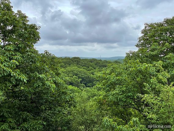
6.3 – Follow a side trail off to the RIGHT for two limited views – if you miss it, no biggie. The second view has a rock to sit on. Soon, the side trail meets back up with Highlands (TEAL DIAMOND).
Continue following Highlands (TEAL DIAMOND) as it meanders through the forest.
Pass a large glacial erratic on the side of the trail.
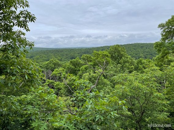
6.7 – Arrive at Headley Overlook. Trees block the view but a telephoto lens or monocular helps to see past them.
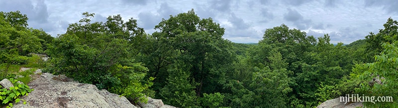
Directly behind is an arrow sign for “Lake Hopatcong” but we didn’t notice the lake in the distance.
We’ve been to Headley Overlook twice before this (2010 and 2012) and recalled Lake Hopatcong being just slightly visible. It could be blocked with foliage or we weren’t at the proper angle.
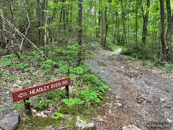
6.8 – Turn LEFT and now follow PINK (this used to be marked as a service road on the park map). There should be a sign for Headley Overlook. [Highlands (TEAL DIAMOND) continues ahead].
Continue following the wide gravely woods road downhill.
7.1 – Continue straight, now following YELLOW (co-joined with Highlands (TEAL DIAMOND)). [YELLOW and TEAL also go left].
Pass a campground driveway on the right. Pass PINK DOT on the right.
7.5 – Turn RIGHT to just follow YELLOW. [Highlands continues straight]. Follow YELLOW back to the parking lot.
—-
Hiked: 6/12/21. Revised route.
Hiked: 8/15/15. Trail Blog: “Hiking Beaver Brook Trail Past Lost Lake“
Hiked: 4/13/14. Trail Blog: “Mahlon Dickerson – Beaver Brook to Lost Lake“
Hiked: 9/26/09. Trail Blog: “Beaver Brook Trail… and a bear in a tree“
Hiked: 4/14/06. 6.5 miles. To Lost Lake from Berkshire Valley Road.
—
Updated: 6/2021: Re-hiked; major changes to route and description due to a change to the Highlands Trail; made into a loop that includes Headley Overlook. 8/15/15 – Beaver Brook can be crossed at the power line cut via a long plank on a dirt embankment. 4/21/14 – re-hiked, description updated, photos added, and GPS track added. Due to it now being difficult to cross Beaver Brook at the power line cut (construction work disturbed the crossing), we’ve changed this hike to stop at Lost Lake instead of continuing into a 10 mile hike.