Explore the remains of a Revolutionary-era Ironworks plantation, scramble to a viewpoint, and hike across the NJ/NY border.
7.4 miles. Moderate; mix of easy woods roads and rugged Highlands terrain, some uphill scrambling approaching the viewpoint, several minor rock hops over wet areas or streams.
| 7.4 miles | This hike guide: Detailed instructions, photos, and video follow below. |
| Shorter | 4.4 – Out-and-back on sterling to the viewpoint only. Noted below. Also in Hiking the Jersey Highlands. |
| Variation, shorter: | ~5.5 – 6 – Do Jennings Hollow as a loop instead. Noted below. |
| Longer | Add-on a side trip to a mine, and/or additional viewpoint; or continue further into Sterling Forest, NY. Noted below. |
| Nearby | Monks Trail Loop; Governor Mountain; Bearfort Ridge Loop – Surprise Lake; Terrace Pond North; Surprise Lake Loop via State Line; Skylands Manor – Ilgenstein Rock. |
| Nearby kayaking | Monksville Reservoir; Wawayanda Lake. |
Our two cents:
We like this route, but many hikers might prefer the shorter out-and-back to the viewpoint as the trail can be a little sloppier once on Lake to Lake.
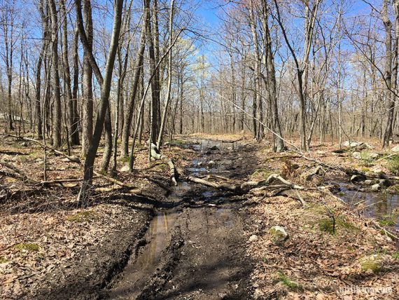
Marked on recent maps is a “difficult crossing” on Jennings Hollow (YELLOW), but trail volunteers have created a sturdy crossing using large flat rocks and even included ropes to hold.
When we last hiked this, it was a rock hop over a stream with not a lot of water flowing. The other part of the Jennings loop has one marked too, but we’ve not hiked it.
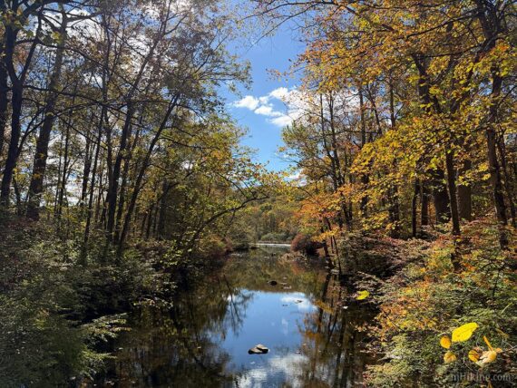
Fall foliage around the old buildings and along the water can be absolutely stunning, and it’s worth popping by for a stroll around just thar area even if you don’t want to do a long hike (as we did in 2025).
NOTE! We haven’t hiked this recently. The route remains the same but some details could have changed.
NOTE: The northern part of this loop that goes into New York may still be closed due to fire damage; check the NY State Park site for current status. If so, modify the route by not continuing on Sterling Ridge in NY – veer off and do Jennings Hollow YELLOW as the lolipop and then retrace Sterling back.
Updated: 4/2026 – Minor edits, added photos; not re-hiked. Older change log at page bottom.
Hike Info:
–Trail Map
–Trail Map (Option)
–Park info
–Park info 2
–Interactive Map
Map:
Use Northern New Jersey Highlands Trails Map or Sterling Forest Trails. Check the visitor center for brochures on the historical areas.
Books:
Hiking the Jersey Highlands has 2 hikes in Long Pond: a shorter out-and-back that is contained within this route, the other is south of the trailhead.
A longer variation is found in 60 Hikes Within 60 Miles: New York City. Trail descriptions can also be found in the The New Jersey Walk Book.
For some history of the area and information about the ironworks, check out the online article on “Long Pond Ironworks“, by Mary Jasch.
Parking: N41.14111° W74.30915°
Long Pond Ironworks State Park, 1334 County Rd 511, Hewitt, NJ 07421. If approaching via Rt 287 N, take exit 55, follow 511 North. Follow 511 through Wanaque. Bear left at the Y-intersection of Skyline Drive by the reservoir and travel past Monksville Reservoir.
Just after crossing the water, the small lot at Long Pond Ironworks Visitor Center is on the right.
Note: The actual trail head parking is just past the visitor center and is now marked “seasonally closed Apr-Oct” on maps.
This is a large dirt area… but it’s been blocked off every time we’ve been in this area for ages. If it is open and you park here: the trail starts across the street, to the right of the road facing you (East Shore Rd).
It’s hard to see but there are trail markers and a guardrail to hop over (…or at least there was in 2009… the last time we were able to park here…). This will meet up with the description below.
Restrooms:
Gas station and a few stores if approaching from Rt 511. The Long Pond Ironworks Museum & Visitor Center has restrooms but is only open open weekends 1pm-4pm, Apr-Nov. Portable toilets at all three Monksville Reservoir launch locations (as of 10/2025).
Hike Directions:
Overview: Unmarked connector trails – Sterling Ridge (BLUE DOT on WHITE) – Lake to Lake (RED BAR on WHITE) – unmarked – Jennings Hollow (YELLOW) – Sterling Ridge (BLUE DOT on WHITE)
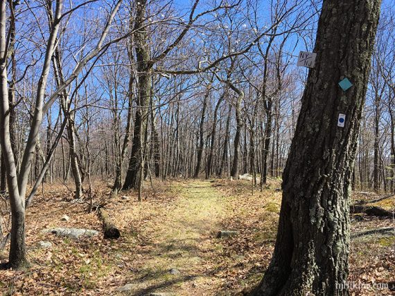
Sterling Ridge (BLUE DOT on WHITE) is co-aligned with Highlands Trail (TEAL DIAMOND), for simplicity we’re using just Sterling.
Note: Most of the photos in this guide were taken in 2017, or earlier. We visited just the furnace area in 10/2025 and found some buildings significantly more worn and overgrown and have added comparison photos.
0.0 – Start following the unmarked trail from the left side of the parking lot. This ends at a gravel path, turn RIGHT on that.
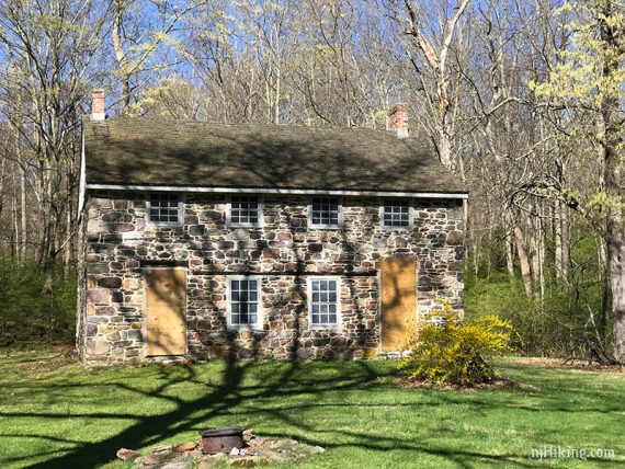
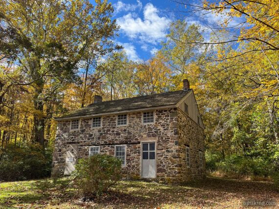
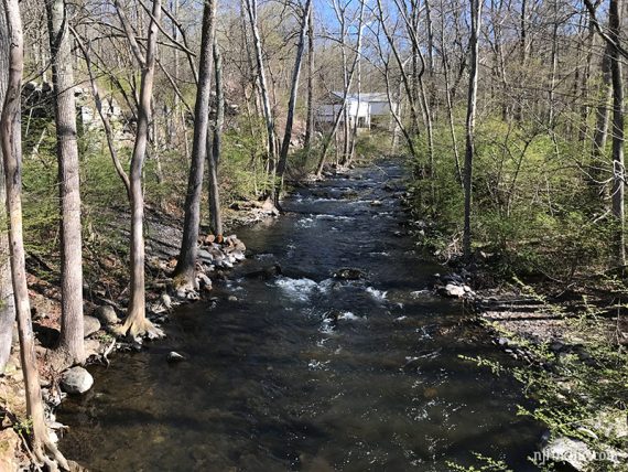
Pass the “Stone Double House” on the left before going over a bridge. Sterling Ridge (BLUE DOT on WHITE)/Highlands Trail (TEAL DIAMOND) joins in from the left.
The house in 2025, then 2017 below – not much has changed but there are now doors on it.
0.3 – Pass the Company Store building on the left. First photo is 2025, second is 2017 – quite a difference. Followed by 2009 where part of the building is in the trees.
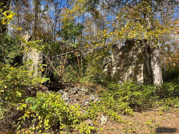
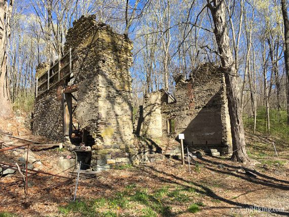
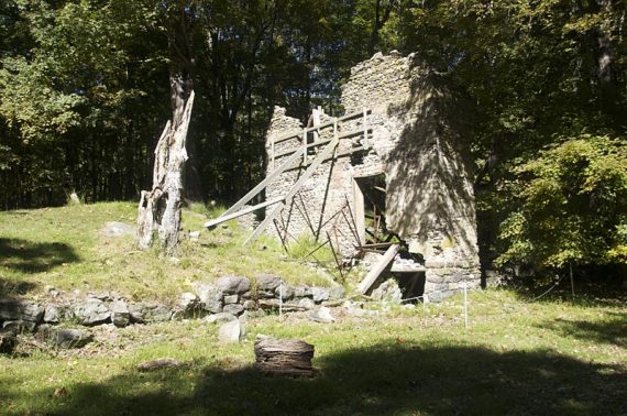
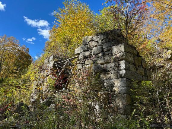
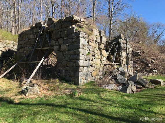
0.5 – Arrive at the main buildings. Wander over to look at the furnace remains. Overgrown in 2025, followed by 2017, and then 2009.
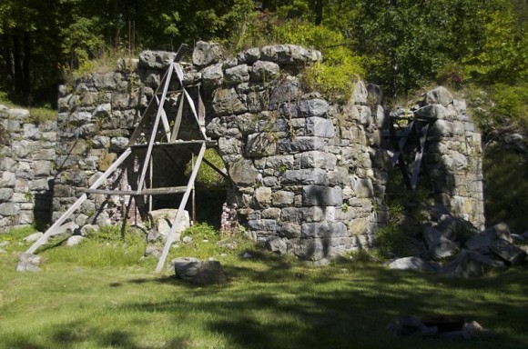
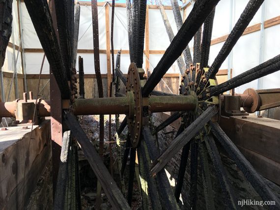
And 2 waterwheels housed in protective coverings, 2025 then 2017 – not much has changed.
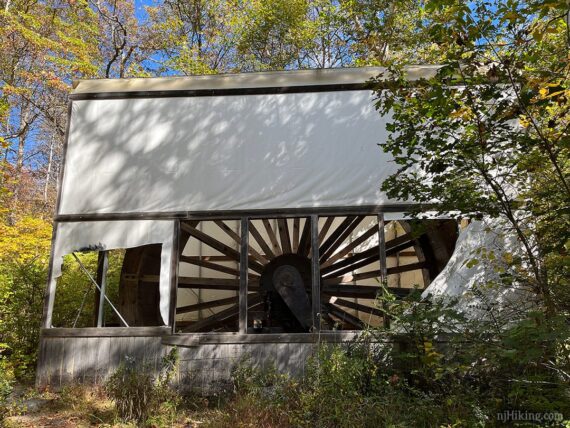
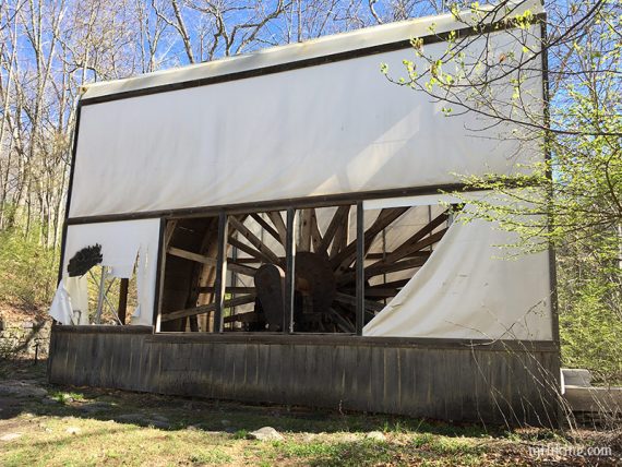
Peek inside the building to see the giant wheels – not much changed here either. First photo is 2025, next two are 2017.
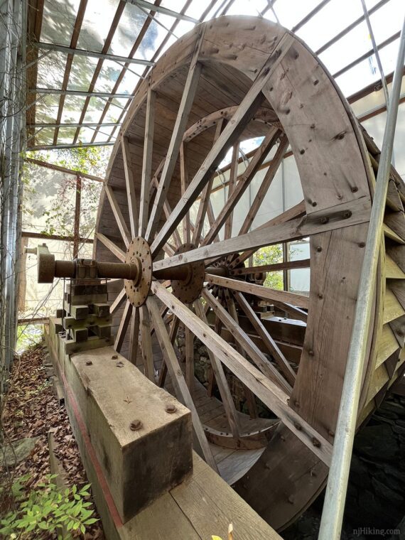

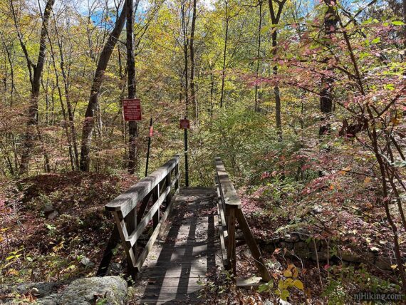
Up behind the last waterwheel is a small bridge that overlooks an old foundation.
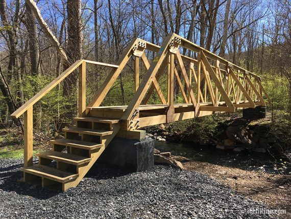
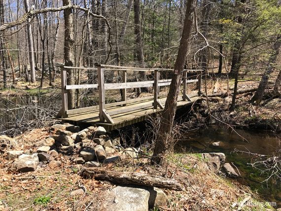
Retrace your steps and cross the Wanaque River on a footbridge to follow Sterling Ridge (BLUE DOT on WHITE). These photos are from 2017 after it was just installed.
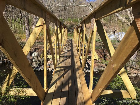
View from the bridge towards the waterwheels, 2017:
View from the bridge the other direction, 2025:
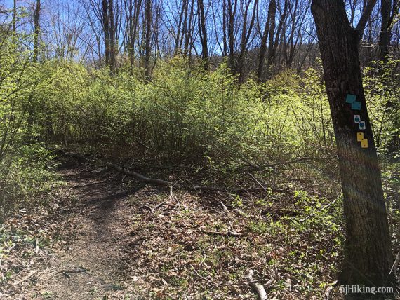
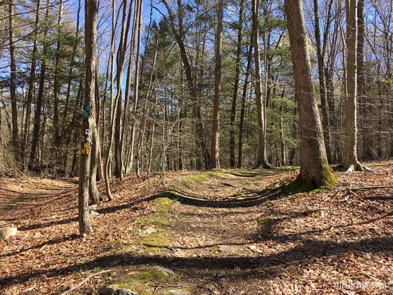
Sterling (Blue Dot), Highlands (Teal), Hasenclever (Yellow) trail markings:
0.7 – Continue following Sterling Ridge (BLUE DOT on WHITE). [Hasenclever (YELLOW) leaves on the right.]
1.3 – Bear RIGHT to continue following Sterling Ridge (BLUE DOT on WHITE). [Jennings Hollow Loop (YELLOW) starts straight].
Shorter Variation, ~5.5 – 6 total miles (we have not done this route) – Do Jennings Hollow as a loop instead: From this point, start following YELLOW instead of keeping on BLUE. Follow YELLOW around in a lollipop loop past the swampy area, you’ll return to this same spot. Retrace BLUE back.
1.6 – Bear LEFT to continue on Sterling Ridge (BLUE DOT on WHITE).
Optional add-on: Head straight on the woods road to open mine pits of the Paterson Mine. They are unmarked but a trail leads to them. Then backtrack to this junction. Adds 0.5 miles RT.
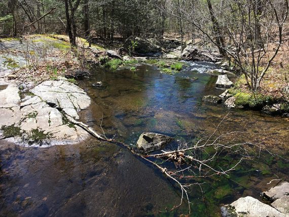
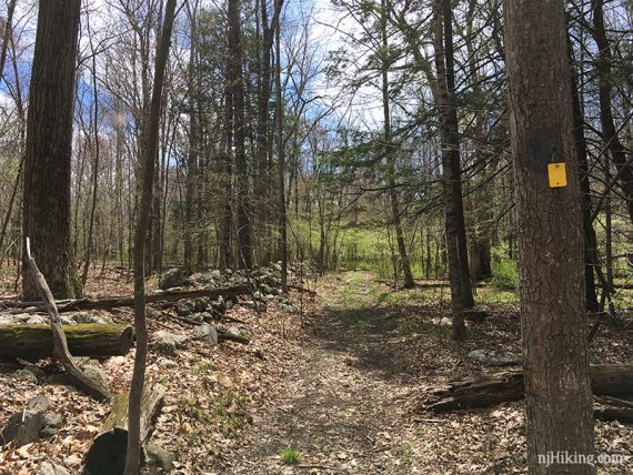
Cross over a little stream. The trail becomes more rugged and wet in spots from this point, and heads uphill with some rock scrambles to negotiate.
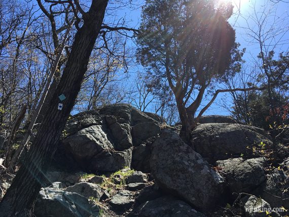
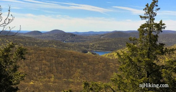
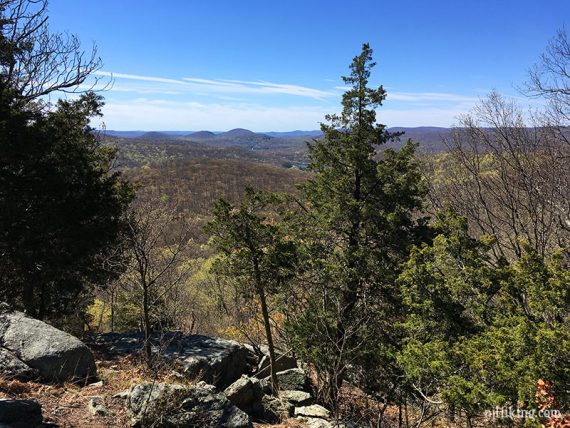
2.2 – Overlook on Big Beech Mountain with view of the Monksville reservoir and the mountains around it. A good spot for a snack.
Shorter Option: Turn around and retrace from here for a 4.4 mile hike.
2.4 – Little more scrambling to the 2nd overlook, with limited views.
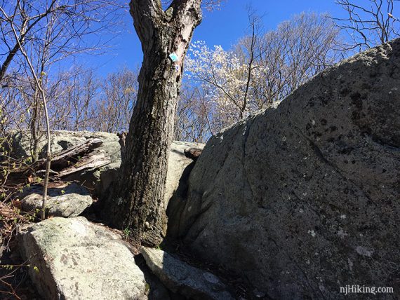
Continue following Sterling Ridge (BLUE DOT on WHITE).
2.8 – Walk across the NJ/NY border (there is a little sign on a tree). An optional “I just walked from NJ into NY” dance/jig is up to you.
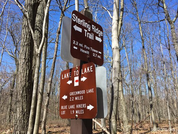
3.0 – Turn LEFT to start following Lake to Lake (RED BAR on WHITE). A trail sign has directions and distances posted.
/// Optional add-on: Instead continue straight on Sterling Ridge (BLUE DOT on WHITE). Scramble up a steep section to another viewpoint. Retrace back to intersection. On the trail map, it may look like the starred view is off Lake to Lake to the east, but it’s not. Adds about 0.4 miles RT. ///
Lake to Lake (RED BAR on WHITE) is woods road that is rutted and very muddy or flooded in spots. The whole trail is not like this but there are wonky sections.
There are also unmarked woods roads here and there, some marked on trail maps and others not… just pay attention to the blazes.
3.4 – Sterling Ridge (BLUE DOT on WHITE) dips back into NJ for a bit…
3.6 – … and then enters NY again.
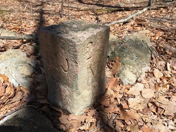
Look to the left of the trail for a stone marker with NJ and NY and “24” – which means this point is 24 miles from the Hudson River.
[For some history on these boundary stones see “Searching for boundaries at Bearfoot Mountain“.]
3.9 – Continue following Sterling Ridge (BLUE DOT on WHITE) on a bridge over a small stream.
Watch the markers as Lake to Lake (RED BAR on WHITE) will bear LEFT off the main woods road.
4.2 – Come to a 4-way intersection, and turn LEFT to start following an unmarked woods road. [Lake to Lake (RED BAR on WHITE) also continues straight. West Valley (GREEN) is on the right.]
4.4 – Turn RIGHT to start following Jennings Hollow (YELLOW). [Jennings Hollow (YELLOW) also goes sharply left and will end up in the same place, at the end of the lollipop loop.]
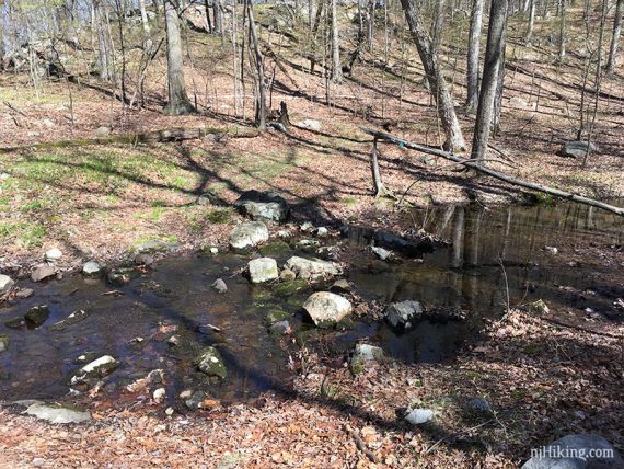
An interesting swampy area will come into view on the left, with a beaver dam out in water. A good spot to watch for wildlife.
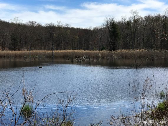
The route will bear right away from the swamp, just before the path ends in water.
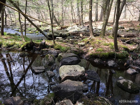
5.2 – Cross a stream on a bunch of rocks, with ropes for hand holds. This may be marked “difficult crossing” on some trail maps.
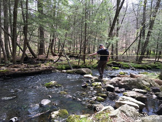
Looking back at the crossing and the handiwork of trail volunteers:
5.5 – Arrive at the start of the Jennings Hollow loop. Continue straight on Jennings Hollow (YELLOW). There is a old stone farm fence along the trail.
[Jennings Hollow (YELLOW) also goes left, which will go back around whence you came… which you don’t want to do.]
6.3 – Start following Sterling Ridge (BLUE DOT on WHITE), retracing the route back to the lot. [Jennings Hollow (YELLOW) ends].
—-
Hiked: 10/10/25. Just the furnace area, after hiking Monks Trail Loop.
Hiked: 4/23/17. Full route.
Hiked: 9/19/09. Trail Blog: “Long Pond Ironworks in September“
Hiked: 10/6/07. Shorter; Trail Blog: “Highlands to Lake to Lake“
Hiked: 9/29/07. Nearby area; Trail Blog: “Hewitt Butler, Horse Pond, Burnt Meadow“
Updated: 4/2020 – Page refreshed, not re-hiked. 4/2017: Re-hiked, description updated, changed parking lot start, new photos, moved old gallery to 2009 trail blog. 12/2016: Bridge over the Wanaque River has been replaced.