A long loop from Horse Pond Mountain to Lake Sonoma and Overlook Rock.
8.2 or 1.2 miles. This isn’t a really long hike but with a decent amount of rugged up/down and a bit of scrambling – we’d rate it on the low end of “challenging”.
- Short, 1.2 miles: To the overlook over Monksville Reservoir and back. Noted below.
- Nearby variations: Lake Sonoma Loop; Lake Sonoma, Overlook Rock, Manaticut Point.
- Overlaps a small portion of: Stonetown Circular.
- Nearby: Long Pond Ironworks; Wyanokie High Point, Chikahoki Falls, Otter Hole; Wyanokie High Point, Carris Hill, Buck Mountain.
- Nearby kayak: Monksville Reservoir Kayak.
Our two cents:
This hike starts with an impressive viewpoint over Monksville Reservoir and then meanders over multiple rugged trails to pretty Lake Sonoma and on to Overlook Rock.
For a short-n-steep 1.2 mile version to a big payoff, retrace the route back down after the viewpoint over Monksville Reservoir. Noted in the description below.
Many hikers may want to do a shorter loop from a different parking lot that focuses on Lake Sonoma. This route is for avid hikers wanting a longer loop.
Updated: 3/2022 – Trail map info; added new intersection for Manaticut-Lake Sonoma; emphasized location of the viewpoint over Monksville. 5/2021 – Hike route changed to start at a better parking area. Rest of change log at page bottom.
Map:
Northern New Jersey Highlands Trails Map is best as it contains the whole route. The start/end of this hike is in Long Pond Ironworks State Park while the rest is in the northern section of Norvin Green State Forest.
Books:
A good shorter loop containing Lake Sonoma and Overlook Rock is in 50 Hikes in New Jersey (from 2014 edition and on). The rest of Norvin’s trails can be found in the The New Jersey Walk Book.
Parking: N41.11872° W74.32703°
If coming from Rt 287N, take exit 55, head north on 511, after you pass Monksville Reservoir and then Long Pond Ironworks State Park visitor center, turn left onto Burnt Meadow Road. The parking area has no street number.
There is a pullout on the left side of Burnt Meadow Road with room for ~3-5 cars, or park on the shoulder of this very low traffic road. Looking back towards the parking pullout from the trailhead, which is just past the parking:
Note! This parking is not accessible from the other direction up Burnt Meadow Road. It’s not passable (very rough with large potholes) and is marked as closed on the trail map BUT Google or a GPS might try to direct that way.
Restrooms:
None. Options are gas stations on 511 well before the turn onto Burnt Meadow, portable toilets at the two Monksville Reservoir parking lots.
Also at the visitor center for Long Pond Ironworks (generally only open 1-4pm weekends).
Hike Directions:
Overview: GREEN (Burnt Meadow) – TEAL DIAMOND (Highlands) – RED TRIANGLE on WHITE (Stonetown Circular) – ORANGE (Lake Sonoma) – YELLOW (Manaticut) – WHITE (Overlook) – BLUE (Tapawingo – used to be “Hewitt Butler”) – GREEN (Burnt Meadow)
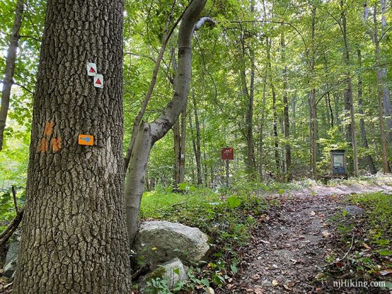
0.0 – Start following GREEN (Burnt Meadow). The trail starts on the pullout side of the road, and just past it. There is a wooden trail kiosk across the road for the other end of the trail, and is where you’ll return from.
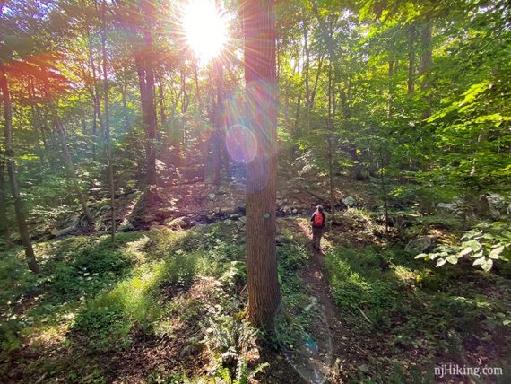
Head steeply uphill on GREEN (Burnt Meadow).
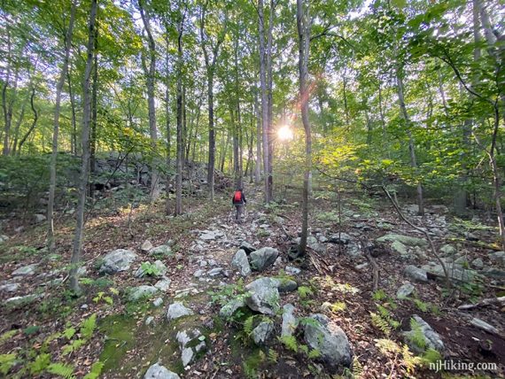
0.5 – Turn LEFT to continue on GREEN (Burnt Meadow), which is co-joined with TEAL (Highlands). [TEAL (Highlands) also goes right.]
Pass a partial/limited view off on the right – this IS NOT the viewpoint you are looking for. Sometimes I see photos posted online of this partial view with disappointed hikers thinking “this is it?”.
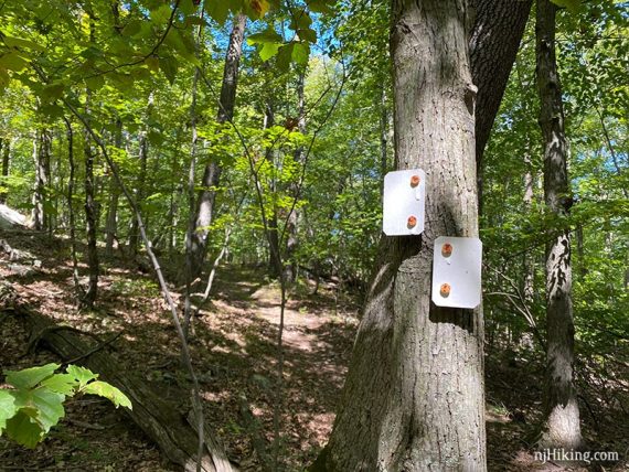
Just after this limited peek of the view, watch for the GREEN (Burnt Meadow) veering to the right. The marker may be hard to spot on a tree. And a path appears to go straight… probably because everyone misses the turn.
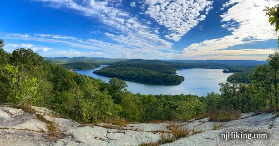
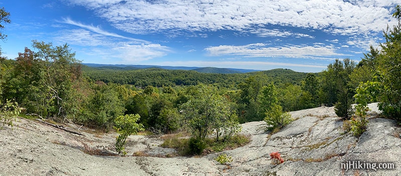
0.6 – Come to a rocky outcrop with an impressive panoramic view over the distinctive curved shape of Monksville Reservoir.
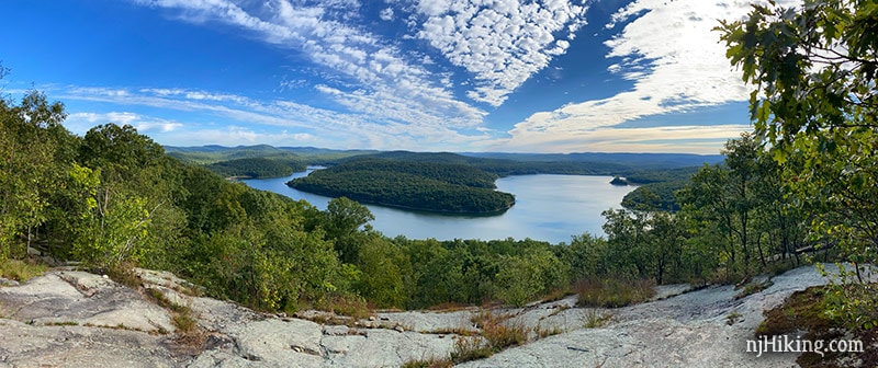
The many hills surrounding the reservoir are visible.
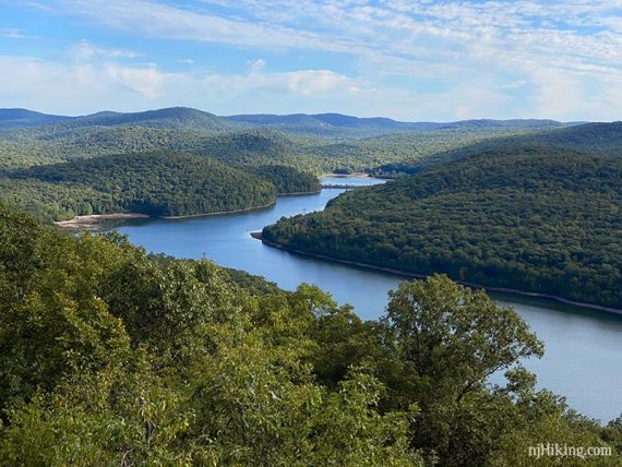
If you’ve ever gone kayaking at Monksville Reservoir (or want to), this is a great spot to see what the reservoir looks like from above.
Close up of Monks Mountain in the middle of the reservoir:
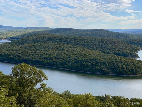
And one more photo because it’s just such a pretty and impressive view.
When ready, retrace GREEN (Burnt Meadow) back to the junction, where you came up and met TEAL (Highlands).
0.7 – Continue ahead, now following TEAL (Highlands). [GREEN (Burnt Meadow) leaves to the right, back down to the parking area.]
// Shorter, 1.2 mile: Instead, turn RIGHT and retrace GREEN (Burnt Meadow) back down. //
Continue following TEAL (Highlands), eventually there will be a steep push straight up Harrison Mountain.
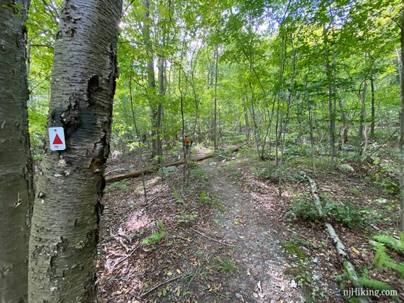
1.6 – At a 4-way intersection, turn RIGHT to now follow RED TRIANGLE on WHITE (Stonetown Circular). [RED TRIANGLE on WHITE (Stonetown Circular) and TEAL (Highlands) go left, BLACK DIAMOND on TEAL (Highlands Spur) continues ahead.]
If you’ve ever done the challenging Stonetown Circular hike, this next section will be familiar.
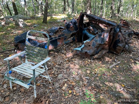
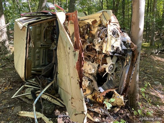
Head downhill on RED TRIANGLE on WHITE (Stonetown Circular) and hang left at a rusted vehicle… because it’s not hiking in Jersey without at least one of these along the way. Maybe the chair will still be there for you – bonus!
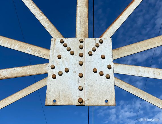
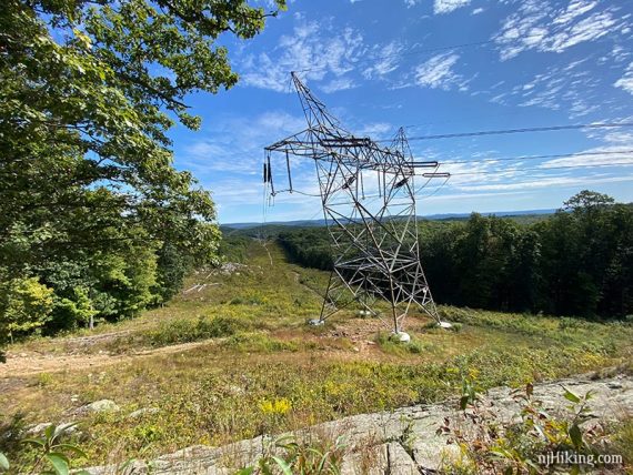
Follow RED TRIANGLE on WHITE (Stonetown Circular) as it crosses a power line cut.
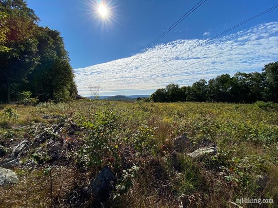
The towers are always ugly but can make for some interesting shots.
2.2 – Pass another crumpled abandoned vehicle… because one is never enough.
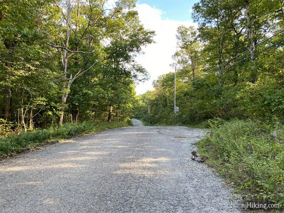
2.8 – At Burnt Meadow Road (a rutted dirt road at this point), turn LEFT to continue on RED TRIANGLE on WHITE (Stonetown Circular) which is co-joined with ORANGE (Lake Sonoma). [The other end of ORANGE (Lake Sonoma) continues across the road].
2.9 – Shortly, RED TRIANGLE on WHITE (Stonetown Circular) leaves to the left. Cross Burnt Meadow Road to now follow ORANGE (Lake Sonoma).
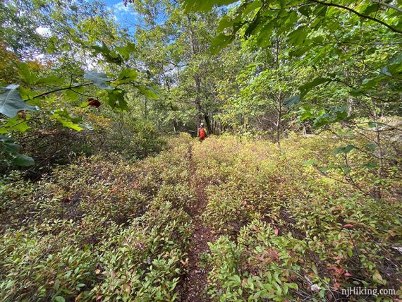
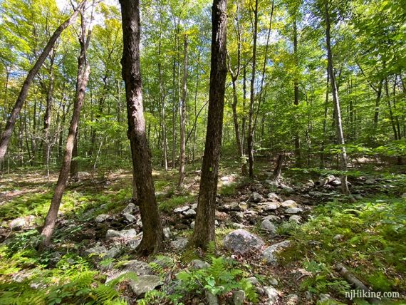
Continue following ORANGE (Lake Sonoma) through some low brush.
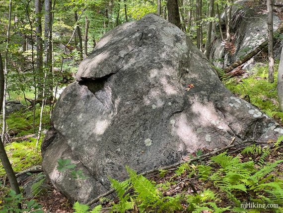
In an area with lots of ferns and some larger boulders there is a rock that kinda sorta looks like the profile of a gorilla.
3.9 – Turn RIGHT to now follow YELLOW (Manaticut) which is co-joined with ORANGE (Lake Sonoma). Soon pass ORANGE-YELLOW (Manaticut-Sonoma Connector).
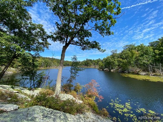
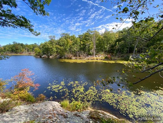
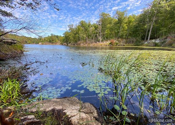
4.1 – Lake Sonoma comes into view.
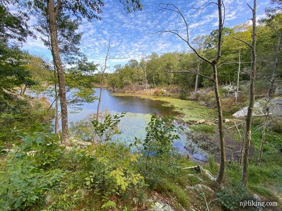
There are a few open rocky spots to take a break with views of the lake.
The area seemed cleared out from the last time we hiked Lake Sonoma (2018). It used to be harder to get near the lake.
This was also the only area we saw other hikers the entire day but Lake Sonoma is a short hike from from another trailhead.
4.5 – Continue following YELLOW (Manaticut). [ORANGE (Lake Sonoma) leaves to the right.]
4.9 – Continue following YELLOW (Manaticut). [Pass WHITE (Overlook) on the right but you’ll be back tracking to this turn]. The trail now also has WHITE blazes.
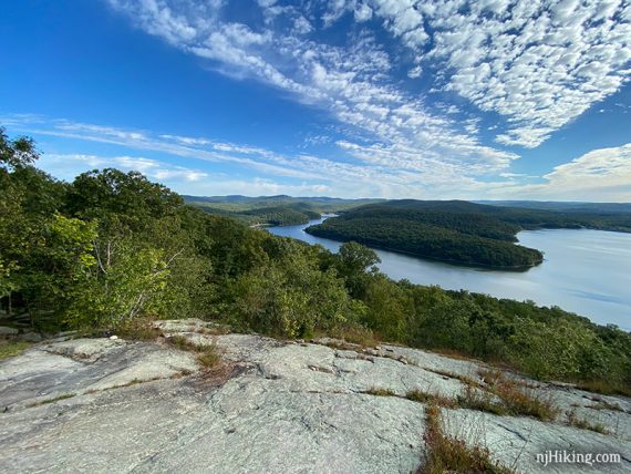
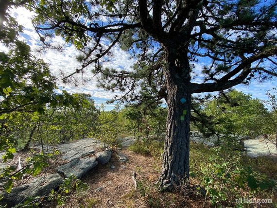
Shortly after, where YELLOW and WHITE blazes indicate the trail turns to the right, instead turn LEFT for a brief scramble up to a panorama from Overlook Rock.
Come back down off of Overlook Rock. With your back to Overlook Rock, turn RIGHT to follow YELLOW (Manaticut) back.
5.0 – Shortly, turn LEFT to now follow WHITE (Overlook).
5.5 – After following a woods road for a while, WHITE (Overlook) turns off of it to the left, just after a stream crossing.
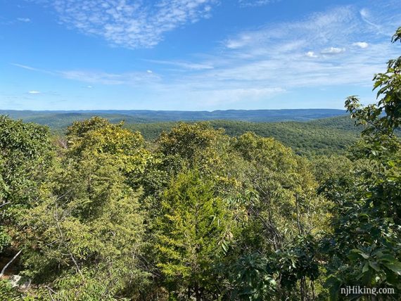
5.6 – Another viewpoint along WHITE (Overlook).
Continue following WHITE (Overlook) over a rock slab.
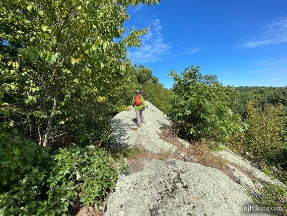
There may be a new trail, blazed blue, on the right not long before coming to a power line.
6.0 – WHITE (Overlook) runs along a stone wall then crosses a power line cut.
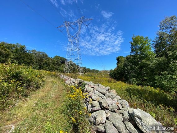
After crossing the cut, turn RIGHT to now follow BLUE (Tapawingo). [WHITE (Overlook) goes to the left.]
There may blazes for a co-joined trail, WHITE-BLACK, that eventually leaves to the left. Continue following BLUE (Tapawingo).
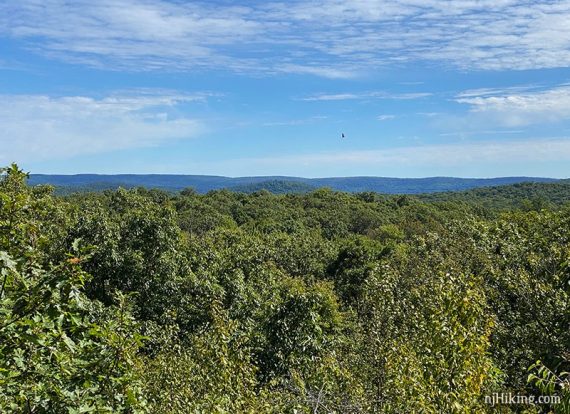
6.5 – Side trail to a view over large power lines.
6.9 – Viewpoint along BLUE (Tapawingo).
7.5 – Turn RIGHT to now follow GREEN (Burnt Meadow). [GREEN (Burnt Meadow) and BLUE (Tapawingo) go left].
Possibly pass a new blue trail on the left, and later a new blue on the right.
Continue following GREEN (Burnt Meadow) until back at Burnt Meadow Road. The parking pullout is to the left.
—
Hiked: 9/20/20.
Hiked: 7/26/14. Trail Blog + archive of old route: “Overlook Rock Panorama and Lake Sonoma“.
Hiked: 3/20/10. Trail Blog: “Hiking Lake Sonoma and Overlook Trails in March“
—
5/2021 – Hike route changed to start at a better parking area. The old start was further down Burnt Meadow Rd where it turns to a rougher dirt road and that parking area is no longer on the trail map. The video is from this original route. 9/2020 – Hiked. 7/2020 – Page refreshed, not re-hiked. 7/2016 – Added a new video.