Hike to Hawk Rock and Cactus Ledge viewpoints, continue to Bear Swamp Lake, and end with a pretty waterfall.
7.4 miles. Rocky trail surface, hills, multiple stream crossings on rocks or logs.
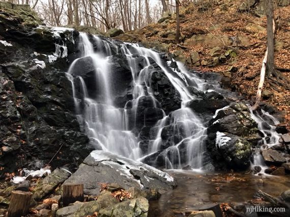
- Short: 1.4 miles – YELLOW to the waterfall and back the same way.
- Shorter: 2 miles – Hawk Rock viewpoint and back the same way.
- Shorter: 3.7 miles – Vista Loop (YELLOW) or 3.5 miles Ridge Loop (BLUE).
- Nearby: Grand Castle Loop, Van Slyke Castle Loop.
Hike Info:
Our two cents:
The NY-NJ Trail Conference reworked the trails in the main section of the park into easy-to-follow loops in 2016.
For hikers wanting a shorter hike or a good hike for beginners – just follow the 3.7 mile Vista Loop (YELLOW the whole way) as it packs the best bits (views + waterfall) in a manageable length.
For a short 1.4 mile roundtrip hike just to the waterfall, take YELLOW and turn left at the sign for “waterfall”, and then retrace.
The parts of this trail around the Reservoir and Hawk Rock are VERY popular. The park does suffer from highway noise.
“No-Hunting” Park.… but note that the parks adjacent to this one do allow it – Ringwood to the NW, and Ramapo Mountain Forest to the south.
Those boundaries are hard to discern on maps but it seems that the area around Bear Swamp is within Ringwood State Park and therefore open to hunting. Just be aware of the surrounding parks if you like to hike far.
Keeping to the main area like the Vista or Ridge loops are all non-hunting.
Updated: 8/2021 – Page refreshed; not re-hiked. 1/2019 – New description to reflect trail changes. Added GPX. New photos, originals moved to Trail Blog entry.
Map/Books:
Northern New Jersey Highlands Trails Map. Be sure to use a current map as many of the trail names/routes were changed in 2016. A longer variation is the book Take a Hike New York City. Trails are described in the The New Jersey Walk Book.
Related: Waterfalls in NJ / Best Waterfall Hikes in NJ
Parking: N41.07758° W74.18748°
Rt. 287N, exit 58 to 202N/Ramapo Valley Road in Mahwah. Large lot is on the left.
Restrooms:
Located around the back of the tan building (with a NJ Search and Rescue sign) a short walk from the parking lot. Open on a Friday in December, unsure if they are seasonal.
There were also portable toilets down the main trail a bit, off on the right.
Hike Directions:
Overview: Vista (YELLOW) – Halifax (GREEN on WHITE) –Hoeferlin Memorial (YELLOW) – Shore (BLUE) – RED-SILVER – Ridge (BLUE) – Vista (YELLOW)
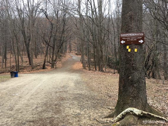
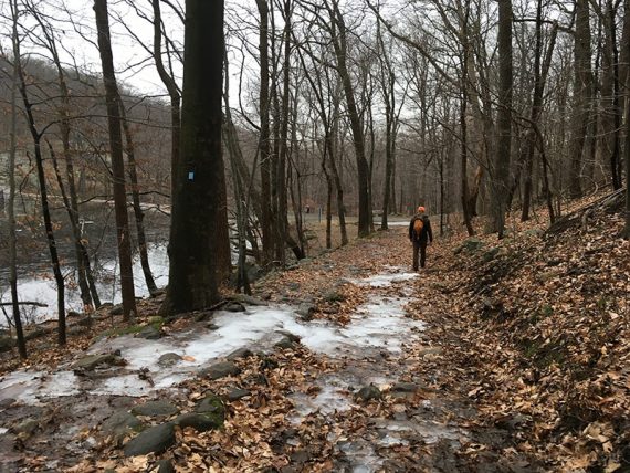
0.0 – Start by the wooden kiosk in the left corner (if your back is to the road) of the lot.
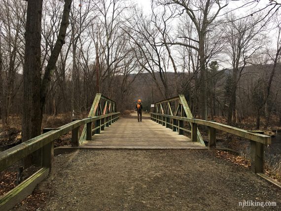
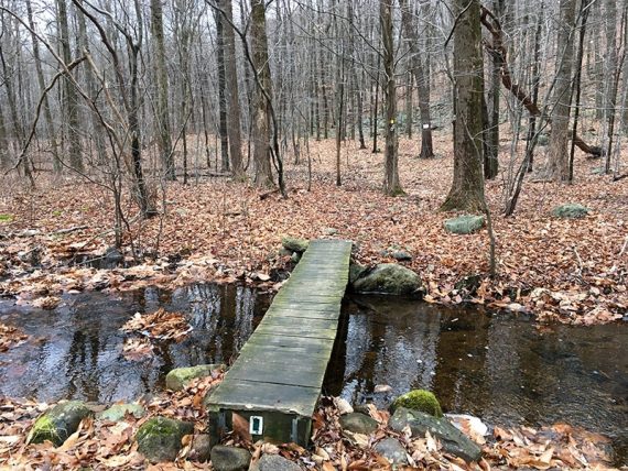
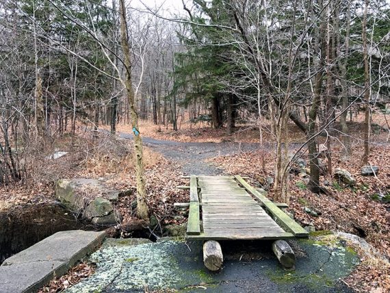
Follow the main wide path, Vista (YELLOW), over a bridge.
Pass Scarlet Oak pond on the right.
0.4 – After the pond, turn RIGHT to continue on Vista (YELLOW). [Vista (YELLOW) also goes to the left to a waterfall. Ridge (BLUE) is ahead].
0.5 – Turn LEFT to continue on Vista (YELLOW) over a footbridge. [Pond (SILVER) continues straight].
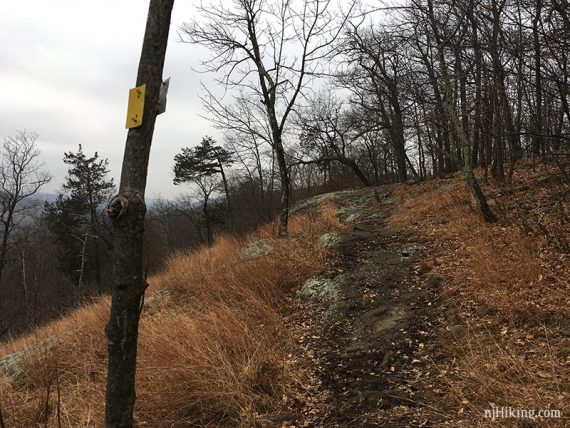
Head uphill toward Hawk Rock. Pass a smaller viewpoint on the right before getting to the main one.
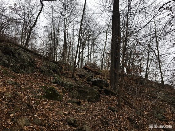
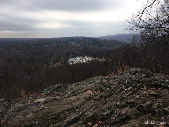
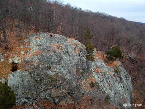
0.9 – Hawk Rock viewpoint with a large rock outcrop to sit on.
For a foliage filled view from Hawk Rock, I dug up a photo from before we created this site; taken October 2004. Fun Fact: For many years this was the intro screen for our videos.

Looking down on Hawk Rock.
Continue on Vista (YELLOW) steeply uphill.
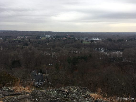
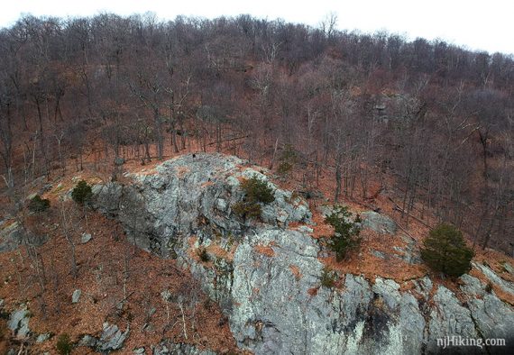
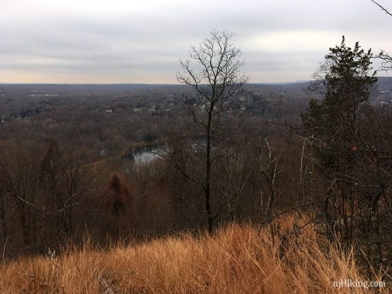
1.0 – Cactus Ledge, another view. On a clear day the NYC skyline might be visible.
Why it’s called cactus ledge.
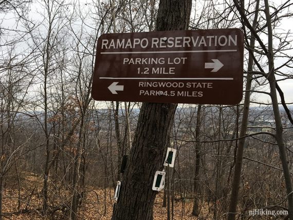
1.4 – Turn RIGHT to now follow Halifax (GREEN on WHITE) at a sign marking distances to the parking lot and Ringwood SP. [Vista (YELLOW) continues straight]
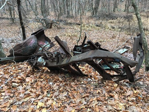
1.6 – Turn LEFT onto a wide woods road with an old car nearby to continue on Halifax (GREEN on WHITE) – not really any indication of a turn here. Because it’s not hiking in NJ without a junked car.
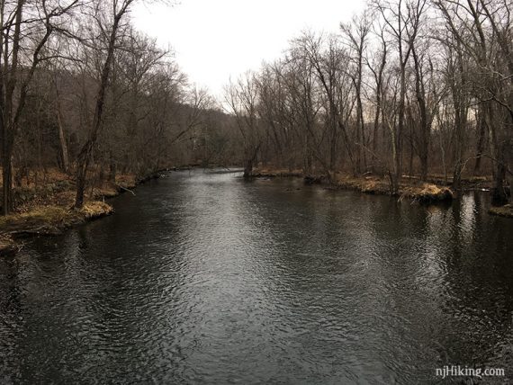
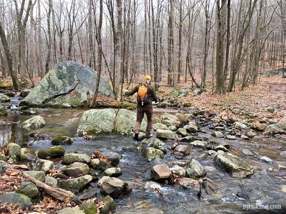
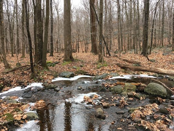
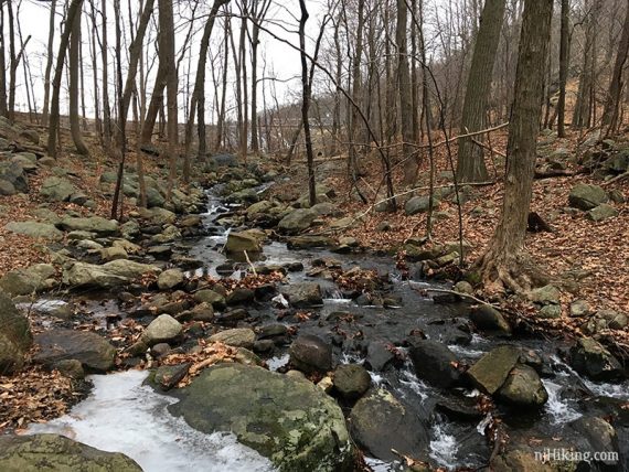
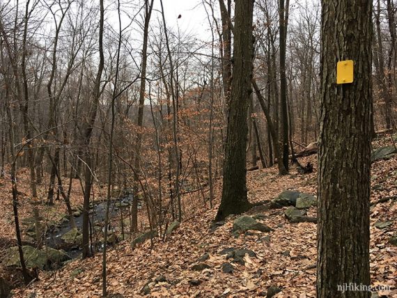
1.8– Pass Havemeyer (PINK) on the left. Continue straight on Halifax (GREEN on WHITE), rock-hopping across a wide stream.
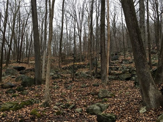
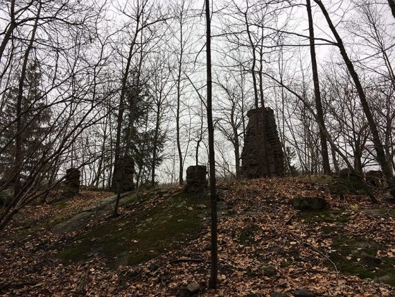
1.9 – Pass another junked car then arrive at building ruins on the right, marked “Halifax Ruins” on the map.
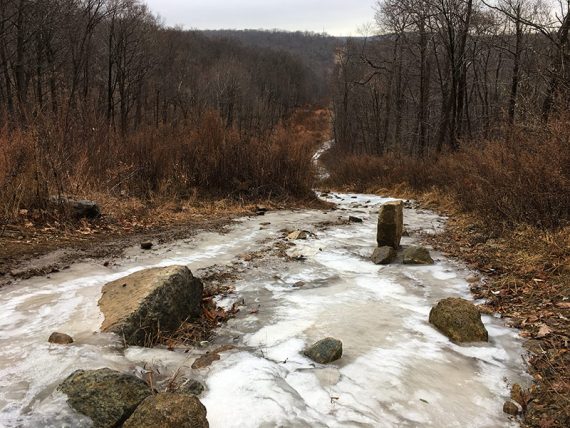
2.6 – Continue on Halifax (GREEN on WHITE). [WHITE is on the left]. Cross a pipeline cut. (Here it’s turned into a winter slip-n-slide).
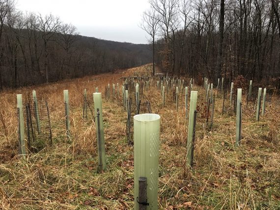
Replanted trees in a pipeline cut.
3.1 – Cross a pipeline cut again, with a paved road.
Go down the paved road a bit, looking for Halifax (GREEN on WHITE) markers on the right to continue on the trail.
3.4 – Cross a stream on a footbridge. Start following Hoeferlin Memorial (YELLOW). [Halifax (GREEN on WHITE) leaves to the right].
Pass Bear Swamp (RED) on the right.
3.6 – Shore (BLUE) joins in from the extreme left. Continue straight to follow Hoeferlin Memorial (YELLOW) / Shore (BLUE).
3.7 – Continue following just Shore (BLUE) as Hoeferlin Memorial (YELLOW) leaves to the right. Rockhop another stream, or two.
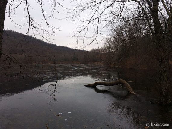
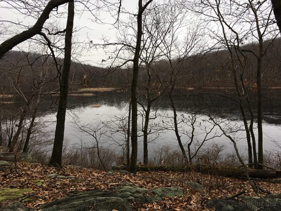
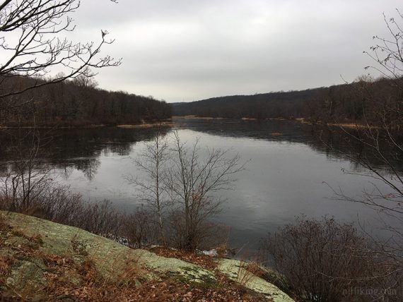
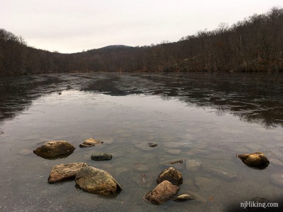
Bear Swamp Lake comes into to limited view (less so if leaves are on).
4.0 – On the left, off the trail a bit, are rocks that we’ve always ended up taking a snack break at (because our tummies are too impatient to wait until the ruins at the end of the lake).
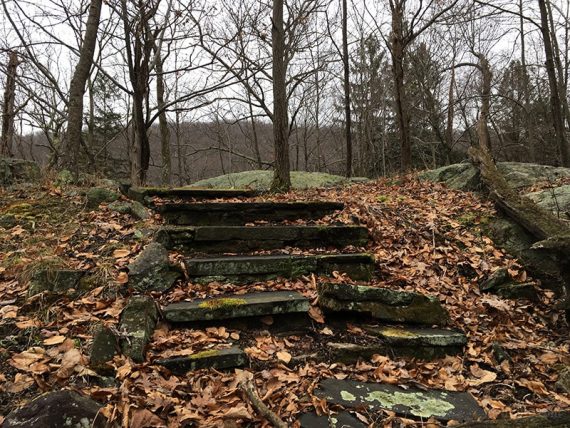
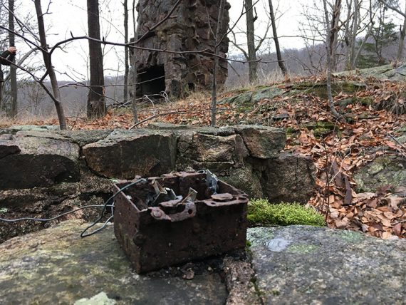
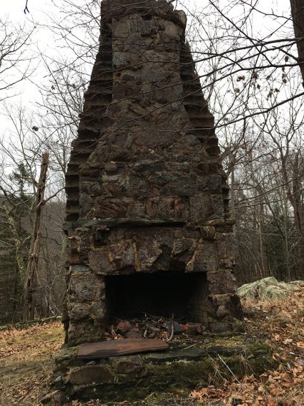
4.3 – Up a hill on the left are remains from an old lake house. It’s mainly a chimney and steps.
There is a rock outcrop with an overlook of the lake that makes a nice break spot. Last time here, there were a few chairs.
Continue following Shore (BLUE) past Cannonball (WHITE C on RED) on the right.
Cross a bridge over a small dam, and turn LEFT to continue on Shore (BLUE) as it goes around the lake on a paved road. There are more building remains visible along the shore.
4.9 – Turn RIGHT to now follow RED-SILVER. [Shore (BLUE) continues on the paved road.
5.6 – Continue following RED-SILVER [Schuber ORANGE starts on the right].
5.8 – Now follow Ridge (BLUE). [Ridge (BLUE) also goes left. RED-SILVER ends.]
Continue on Ridge (BLUE) as Marsh (RED) crosses it.
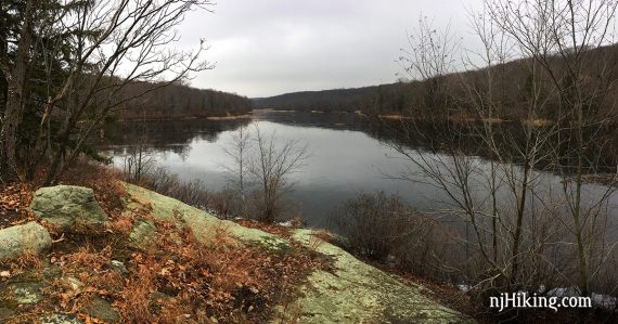
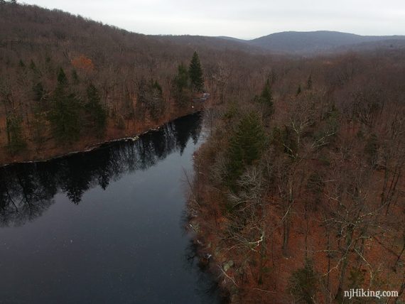
6.2 – Continue on Ridge (BLUE) as Macmillan Reservoir and dam come into view on the left.
Pass Reservoir (PINK) on the left and Marsh (RED) on the right. Continue on Ridge (BLUE) past another intersection of multiple trails.
6.5 – Turn LEFT and now follow Vista (YELLOW) at a “WATERFALL” sign.
The trail follows a stream with a few cascades then down steps crafted out of stone to a pretty waterfall.
6.7 – Continue on Vista (YELLOW) [River (ORANGE with GREEN DOT) is on the right].
Follow Vista (YELLOW) as it approaches Scarlet Oak Pond, turning RIGHT to head back to the parking lot.
—
Hiked: 12/14/18. Trail Blog: “Ramapo Valley in December“
Hiked: 1/16/10. Trail Blog: “Ramapo Valley on Ice“
Hiked: 10/23/04. With B, T, & B.