Hike through a dense forest before climbing to Sunrise Mountain for views over northern New Jersey from the Appalachian Trail.
8.5 miles. Moderate to difficult, typical rugged north Jersey trail surface.
- Shorter – Extensive trail system, use the trail map to create shorter options.
- Longer, ~10 miles – Pass Stony Book and take Tower (GREEN) back. Noted below.
- Nearby, this lot: Stony Lake Loop.
- Nearby: Sunrise Mountain – Culvers Gap; Culvers Gap – Blue Mountain; Blue Mountain Loop; Tillman Ravine; Stony Brook Falls.
- Casual Day Out – Combine a drive to the view at Sunrise and walk down the Appalachian Trail for a bit, or add in a short hike at Tillman Ravine and stop at Buttermilk Falls.
Hike Info:
Our two cents:
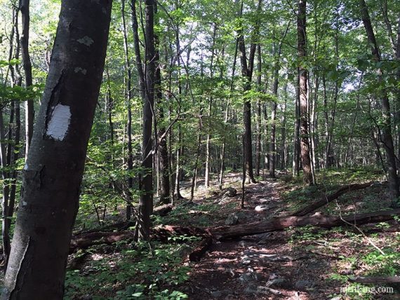
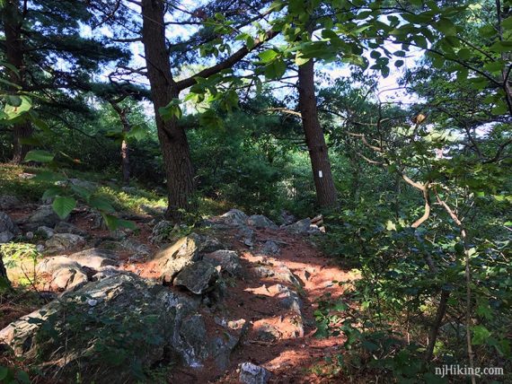
The AT is not as rocky here as it is closer to the Gap. Steady rocky uphill on the approach to the Appalachian Trail. Stony Brook can be wet in areas and has several stream crossings via rocks or logs.
Updated: 5/2023 – Minor edits, added photos; re-hiked 4/2023. Older change log at page bottom.
Map:
Kittatinny Trails or a park map may be available at the park office at the entrance. Follow along on your smartphone with our Interactive Map link above.
NOTE: A 17-mile Blue Mountain loop was created which affected some trail names/colors (Swenson, Cartright) from older maps. The directions below are current.
Books:
Detailed trail descriptions found in Kittatinny Trails and the The New Jersey Walk Book. A similar but longer 9.5 mile route is in 60 Hikes Within 60 Miles: New York City.
A 5.9 mile loop in Stokes that does not take in Sunrise Mountain can be found in Hiking New Jersey (2023).
Parking: N41.20292° W74.77338°
Stokes State Forest, 1 Coursen Rd, Branchville, NJ 07826. Note: This is for the main entrance at the park office. The hike starts at the Stony Lake parking lot which has no street address.
Take Rt 206 North until you enter Stokes, pass Rt 636 and then turn right for the park entrance. Drive down Coursen Rd and make a right at the end to get to the trail lot (follow signs for Stony Lake).
Fee: Charged from Memorial to Labor day. Info on the NJ State Park Pass.
Restrooms:
At the Visitor Center. Also at Stony Lake (walk up the hill from the parking lot) from Memorial to Labor Day.
Near this parking lot, at the Kittle Field lot, bathrooms may be open if the Stony Lake ones aren’t.
Around halfway through the hike is a rustic outhouse at the sunrise mountain viewpoint parking lot. The lot is above the trail slightly, on the right. FYI, lock on the ladies’ side doesn’t latch.
Hike Directions:
Overview: Blue Mountain Loop (BLUE) – Blue Mountain Loop Connector (BLACK DOT on BLUE)– Appalachian Trail (WHITE) – Stony Brook (BROWN).
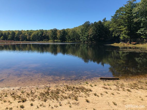
Optional: Before starting, or after your hike, walk up from the parking lot to check out at Stony Lake as it’s not along this trail route.
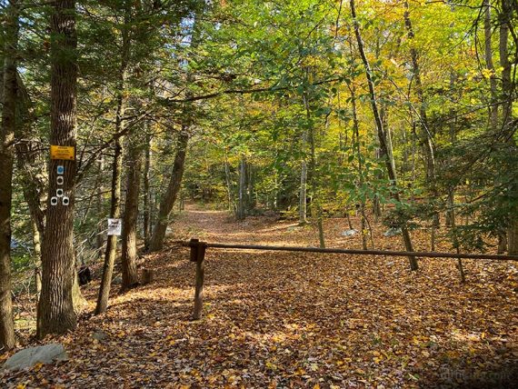
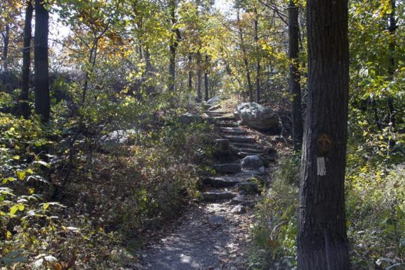
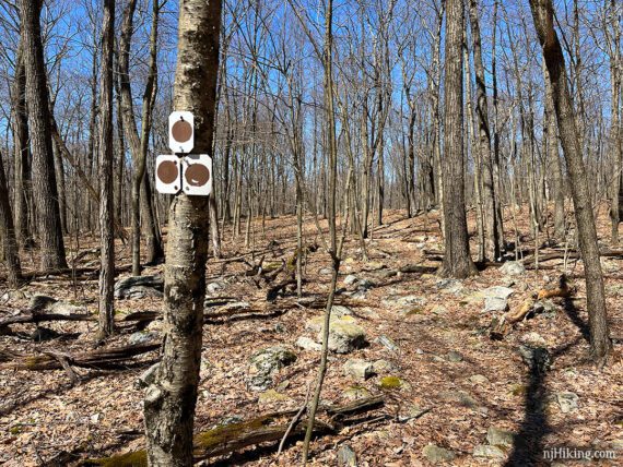
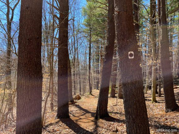
0.0 – From the parking lot, walk towards the trail kiosk and then past the metal gate. There are multiple trail markers on a tree. Start following Blue Mountain (BLUE).
0.1 – Continue ahead on Blue Mountain (BLUE). [Stony Brook (BROWN) and Tower (GREEN) leave to the right and will be the return route].
1.8 – Continue following Blue Mountain (BLUE). [Tinsley (YELLOW) joins in from the RIGHT, and is co-aligned for a bit.]
1.9 – Turn RIGHT to continue on Blue Mountain (BLUE). [Tinsley (YELLOW) goes straight.]
2.2 – Arrive at a cabin. Continue following Blue Mountain (BLUE).
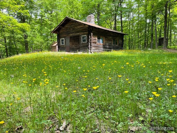
Look for trail markers across the open area, well to the right of the outhouse and near where there used to be a woodpile shelter (seen below). (Not sure I’ve ever checked that outhouse – my hiker instincts tell me to avoid it).
2.8 – Turn RIGHT to continue on Blue Mountain (BLUE). [Swenson (RED) goes straight].
3.7 – Cross Sunrise Mountain Road and continue on Blue Mountain (BLUE), which heads uphill.
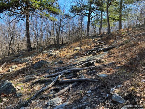
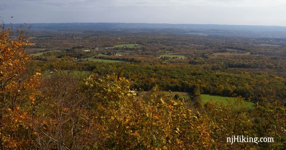
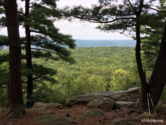
3.9 – Arrive at a slanted slab of rock area with a wide viewpoint. This is looking back downhill and it was a steeper climber than it looks.
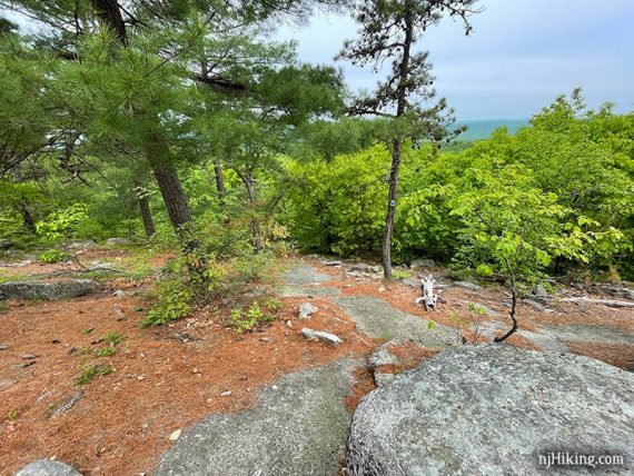
It helps to stand on a large rock and peek around/through the trees. And those rocks make for a nice break spot.
The view changes depending on if the leaves are on. And also how much the trees have grown over the years.
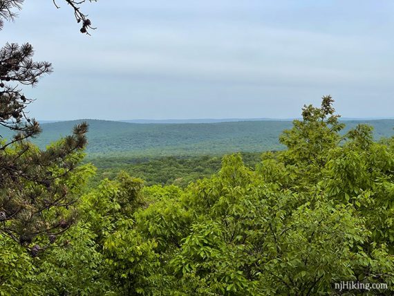
The photos shown above with bright green leaves were taken in May of 2021, and the following two in October of 2012.
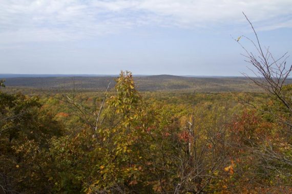
To the north is the High Point Monument in the distance (on the left, when going up the hill). This photo was taken with a zoom lens.
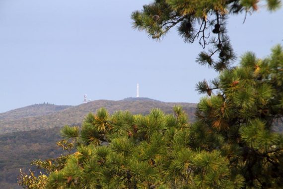
It may be harder to spot the monument around the trees now. It can be seen through the lone evergreen tree, but that is less obvious when all the trees are green.
Continue uphill. Shortly, start following Blue Mountain Loop Connector (BLACK DOT on BLUE) ahead when Blue Mountain (BLUE) leaves to the left.
4.2 – Turn RIGHT and now follow the Appalachian Trail (WHITE). It’s mostly level along the ridge. Pass a short side trail to a now very obscured view; probably won’t notice it.
4.4 – Pass the parking lot for Sunrise Mountain view point (it’s above and to the right). There is a rustic outhouse in the lot and a casual path up to it just before the lot. Continue up stone steps.
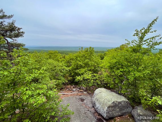
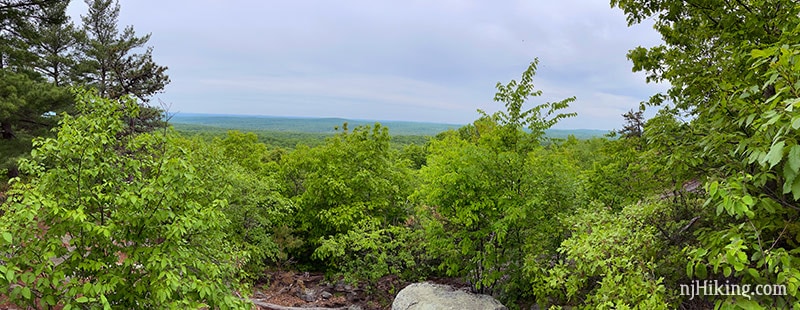
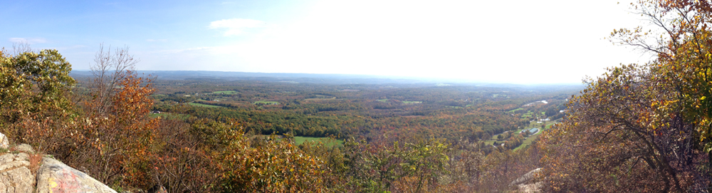
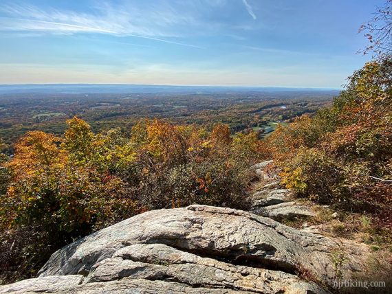
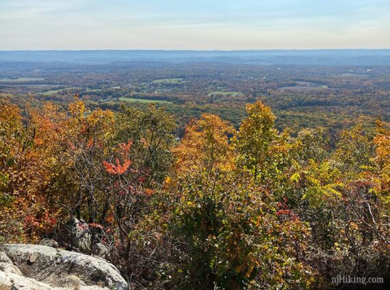
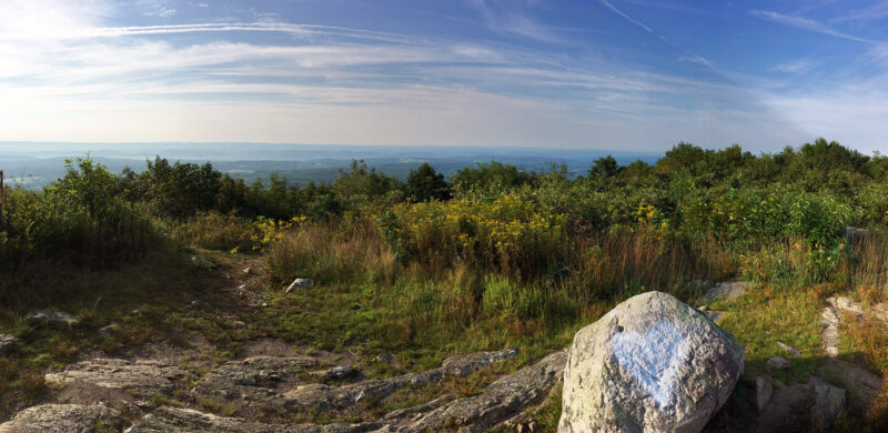
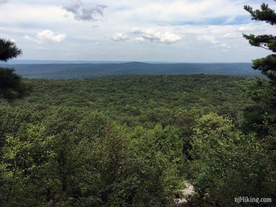
On the left is a short trail to a more open view from Sunrise Mountain. Panorama, normal, and zoom:
Continue following Appalachian Trail (WHITE) and soon head up to approach a large pavilion.
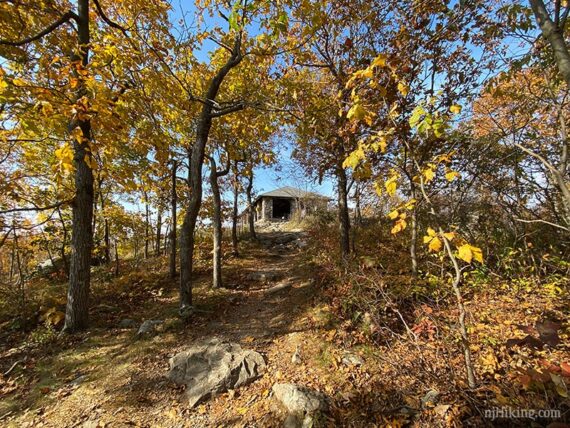
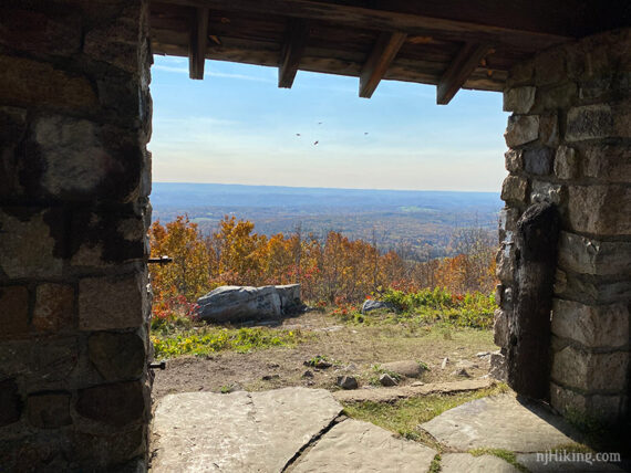
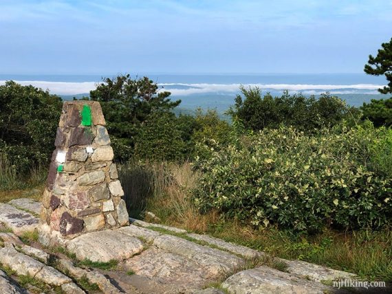
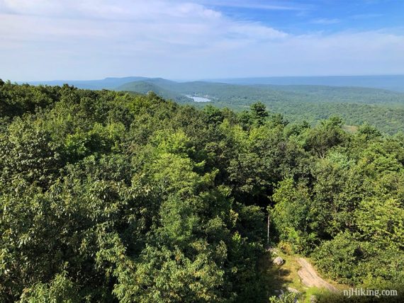
4.6 – Walk through the large stone pavilion. There are views from the pavilion and both sides of the ridge, though somewhat obscured with brush.
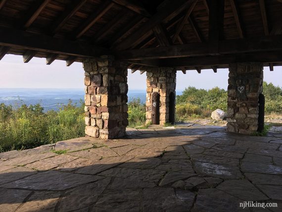
Looking out from the pavilion.
Sunrise Pavilion Fun Facts: The Civilian Conservation Corps (CCC) built Sunrise Mountain Road, erected pavilions, lean-tos, and cabins, dammed streams to create Lake Ocquittunk and Skellinger Lake, and planted hundreds of trees throughout the forest from 1933 to 1942. [Source: Park site.]

View to the east, looking out over New Jersey.
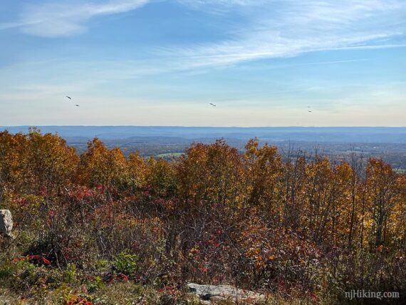
View to the west from the pavilion.
Continue following the Appalachian Trail (WHITE) – just after the pavilion the trail veers to the left if facing the direction of travel (south). [A trail appears to go toward the stone pillar but that’s not it.]
Continue on Appalachian Trail (WHITE).
5.5 – Pass Tinsley (YELLOW) on the right, and an unmarked trail goes left. Continue following Appalachian Trail (WHITE).
5.6 – After the intersection with Tinsley the trail briefly flattens out then goes uphill into section of evergreens. Just after this is on the right is an easy-to-miss short side trail to a view.
Sunrise Mountain Road is actually just below this viewpoint. Return to the Appalachian Trail (WHITE).
6.9 – Turn RIGHT and now follow Stony Brook (BROWN). There is a small sign for the Appalachian Trail shelter at this intersection.
Longer Option, ~10 miles: See below.
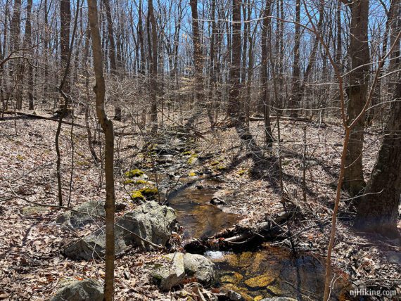
An Appalachian Trail shelter is off on the right but; likely won’t notice it. Stony Brook (BROWN) is rocky and can be quite wet, as it follows along a brook.
7.1 – Cross Sunrise Mountain Road.
7.7 – Continue following Stony Brook (BROWN) as it turns left and becomes a wider, more level, and less rocky path.
8.0 – Tower (GREEN) comes in from the left and is co-joined with Stony Brook (BROWN) for a short time.
8.3 – Turn RIGHT and follow Stony Brook (BROWN)/Tower (GREEN) [Coursen (BLUE that looks Green) starts ahead].
Continue on Stony Brook (BROWN)/Tower (GREEN) back to the parking lot.
Longer Option, ~10 miles
Instead of turning on to Stony Brook (BROWN), continue on the Appalachian Trail to the next intersection, with Tower (Green).
There is a fire tower and a view just past the intersection.
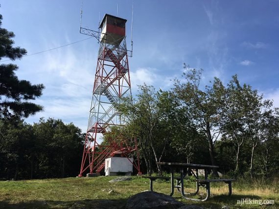
After checking out the tower, follow Tower (Green) back to the parking lot.
—-
Hiked: 4/9/23.
Hiked: 10/4/15.
Hiked: 10/14/12. Trail Blog: “Sunrise Mountain in the Fall“
Hiked: 5/22/10. Trail Blog: “Sunrise Mountain in Spring“
Updated: 10/2020 – Page refreshed, not re-hiked. Description/Interactive map adjusted to reflect naming changes due to the creation of the Blue Mountain Trail. 8/2017: Park map link.
10/2015: Revised the directions to exclude the Station Trail (Light Green) which is closed and being removed from maps; continue on Stony Brook (Brown) instead. Thanks to Jessica O. for the updated info. 10/2012: Description updated, a new set of photos and GPS coordinates added.