Hike a mix of pine trees and deciduous forest, past the Metedeconk and Manasquan Rivers, and a lake.
6.8 miles. Trail surface is easy, dirt and some roots, and mostly level. Can have deep mud/wet areas after a lot of precipitation.
- Short: Lots of opportunities for short hikes in this park (distances noted on the park map)
- Longer: 8.0 miles. This route plus the Blueberry Path loop add-on. Noted below.
- Shorter: Version of this route, from the main parking area: “Turkey Swamp County Park“.
- Nearby: Manasquan Reservoir; Monmouth Battlefield; Perrineville Lake Park; Forest Resource Education Center; Clayton Park.
Hike Info:
Our two cents:
This loop is geared for hikers looking for a longer route for this park. It extends our hike guide for the main section of Turkey Swamp County Park.
Updated: 7/2021 – Page refreshed; not re-hiked. 2/2019 – re-hiked, description updated and changed to make Blueberry Path an optional add on. Updated GPX, Interactive Map; added photos.
Map:
There should be printed maps in the trail kiosk, or print out the map ahead.
Parking: N40.18277° W74.31370° [Nomoco Road]
The lot on Nomoco Road has no street number. Nomoco Rd, Freehold, NJ 07728. A small dirt lot by a maintenance building.
From the park’s website: State Hwy. 9 to route 524 west. Follow 524 west to Georgia Rd., turn left and follow Georgia Rd. 1.7 miles to main entrance.
The Nomoco Activity Area is located 1.5 miles past the main park entrance. Continue south on Georgia Rd. to Nomoco Rd.; turn right and follow signs to Activity Area. From further away, see directions on the park page.
Restrooms:
Located in the main parking area of the park and not at the Nomoco parking where this loop starts. In season, also in the Nomoco Activity area.
Hike Directions:
Overview: Metedeconk Trail – Link Trail – Old Lenape Trail – Manasquan Trail – Alder Trail – Link Trail – Metedeconk Trail
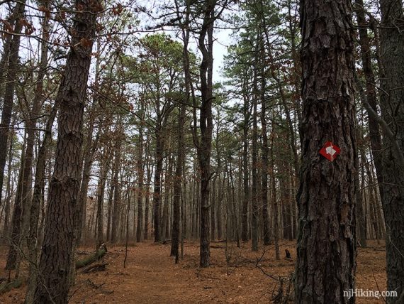
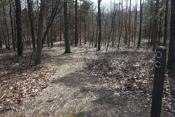
The trails are mostly well marked… but can be confusing because trail markers indicate difficulty and not the trail blaze – Green Circle means easy, Blue Square means moderate.
Intersections have posts indicating directions but there were a few questionable instances where markings just were not there. Be sure to have a park map to follow along the directions.
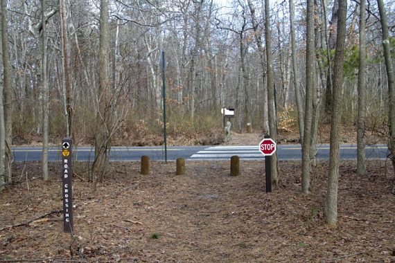
0.0 – Starting at the small parking area along Nomoco Rd, walk past the trail kiosk and the building, and across the field.

500 ft – Turn LEFT to start following the Metedeconk Trail at the sign indicating Nomoco Area to the right.
// Optional add-on: Blueberry Path loop (+1.2 miles) – see below then return here //
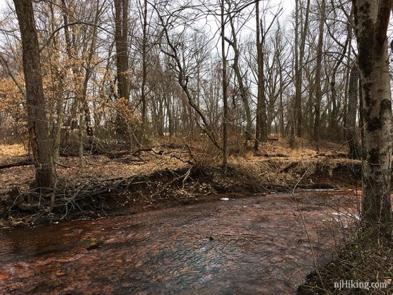
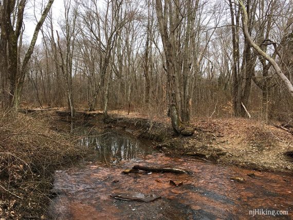
Cross the Metedeconk River on a wooden bridge.
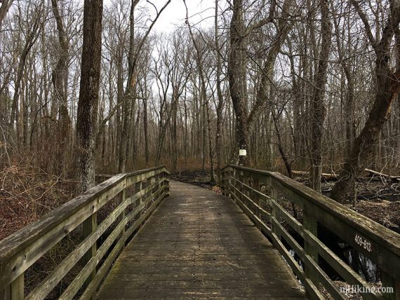
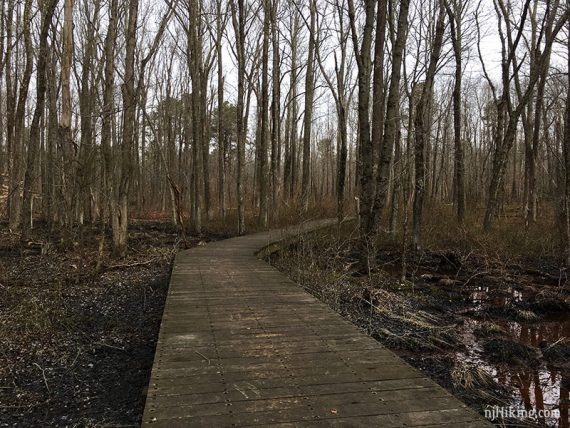
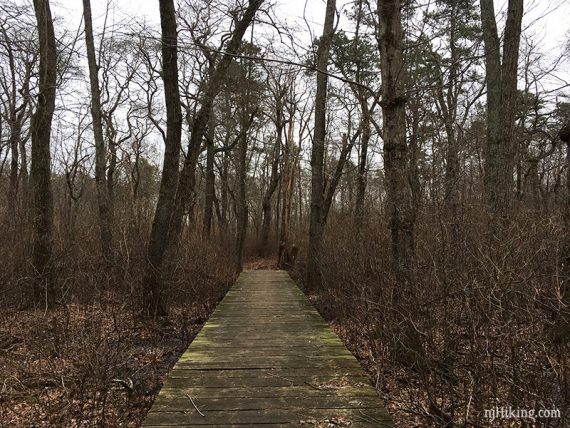
Continue on the Metedeconk Trail on a boardwalk.
0.2 – Cross Nomoco Road.
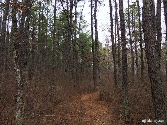
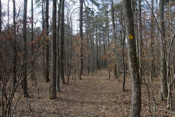
Along the Metedeconk Trail.
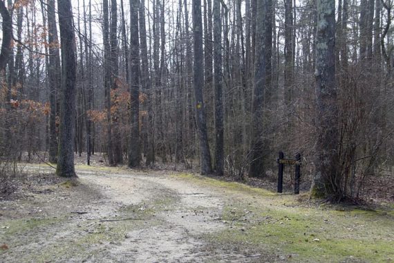
1.0 – The Metedeconk Trail arrives at a wide dirt road with a trail kiosk and post with “Trail head”. Turn LEFT and follow the dirt road for a bit.
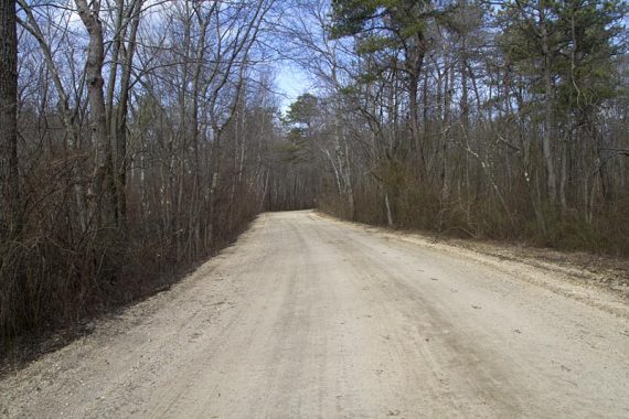
1.1 – Make the first LEFT, onto a wide path. [The path also goes to the right, and the wide dirt road continues straight].
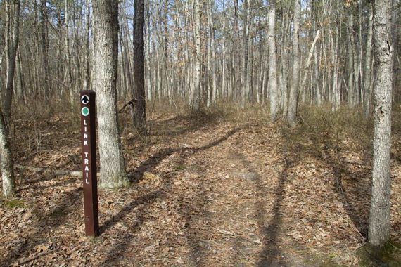
Very shortly, turn RIGHT at the marked trail post to now follow the Link Trail.
There may be occasional white arrow on colored background markers, unsure if they simply indicate direction or are trail markings.
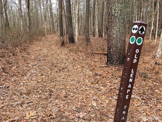
1.5 – Link Trail ends at Old Lenape. Turn LEFT to now follow Old Lenape. [Old Lenape also goes right and leads to the main parking and trail network, allowing to cut this hike shorter]
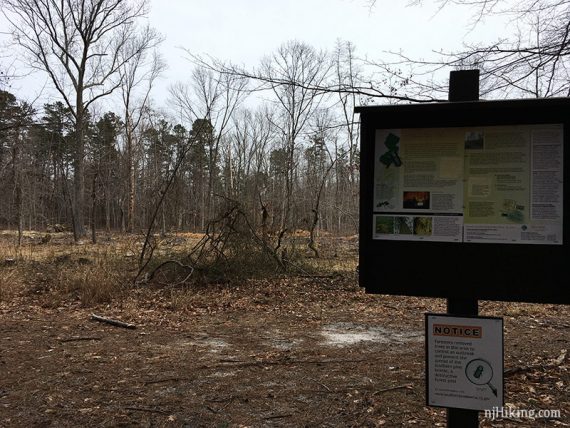
1.7 – Arrive at a sign indicating this area of trees had to be cut down because of the pine beetle. There were no markers when we were here so it was a tad unclear… Continue ahead on the wide path to follow Old Lenape.
[The wide path also goes to the right, and off to the left it seems like there is a trail.]
1.8 – Continue straight, now following the Manasquan Trail.
[Old Lenape goes right and leads to the main parking and trail network, allowing to cut this hike much shorter]. Cross a park sand road.
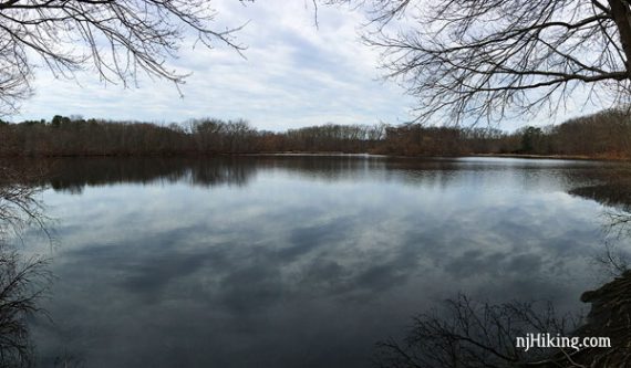
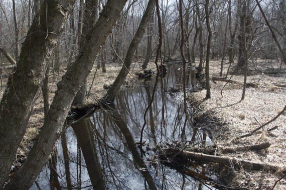
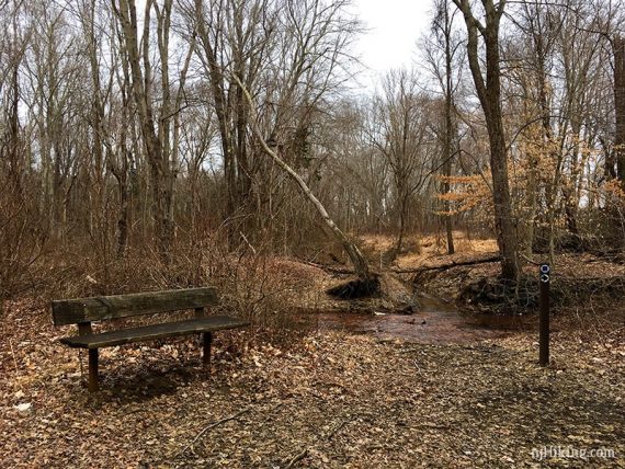
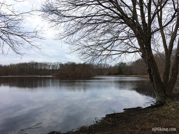
3.0 – Arrive at the Manasquan River and a bench.
Continue following the Manasquan Trail as it will turn back and start heading back towards the main parking area. Ignore any unmarked side trails.
4.6 – Cross the park road. Pass a post on the right with “P” and “to trailhead” and an arrow pointing right.
4.7 – Manasquan Trail ends at the Alder Trail.
Continue straight towards the lake, where there are a few benches. Alder technically goes left but check out the lake first. [Alder also goes right and leads to the main parking area]
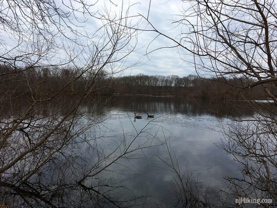
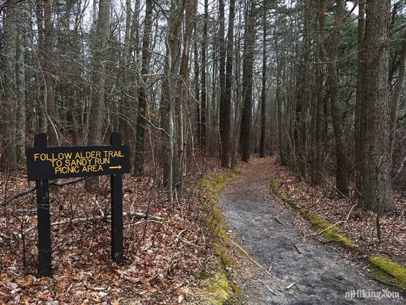
Continue to hug the lake edge and come around to a sign: “Follow Alder to Sandy Run”.
Continue on Alder around the lake. It’s not really marked, just follow the path around.
5.2 – At a sign post for Alder Trail, Turn LEFT to continue on Alder. [There is a structure off to the left, a path continues straight]
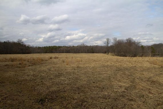
Follow around the edge of a large lot, the Sandy Run Area.
5.5 – Alder Trail arrives at a field edge and an intersection with Fitness and Link trails.
Turn LEFT and follow the Fitness/Link trail as it follows the edge of the field. [right heads toward the lake]
5.8 – Arrive back at the wide dirt road from earlier. Turn LEFT and follow the dirt road a bit.
5.9 – Turn RIGHT to now follow the Metedeconk Trail and retrace the route back to the parking area.
Blueberry Path loop add-on:
To add Blueberry Path loop and about 1.2 miles overall… instead turn RIGHT at the Metedeconk Trail/Nomoco Area sign.
Following BLUE markers, come out of the woods. BLUE goes to the LEFT, now following the dirt road into the main Nomoco area. Veer to the RIGHT where the road splits ahead.
After a building and near a triangular structure, watch on the RIGHT for a small “SWEETGUM” sign, YELLOW blaze, and just beyond that is a post with “Blueberry Path”.
Re-enter the woods here, on the Blueberry Path, now following the YELLOW.
The Blueberry Path loops around on an easy trail, passing some campground buildings and returning to the dirt road.
Follow the dirt road back to the sign from earlier and continue straight. Return to the description above to continue.
—
Hiked: 2/23/19. Without Blueberry Path loop.
Hiked: 3/5/11. Trail Blog: “Turkey Swamp – Metedeconk to Manasquan in March“