First time hiking around Butler (Kakeout) Reservoir.
On the trail map for Pyramid Mountain there are two trails that head off the top of map that we’d been meaning to go check out.
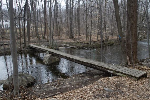
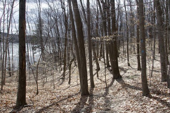
This is a long route in the northern part of Pyramid Mountain Natural Area and around Butler Reservoir (also known as Kakeout Reservoir on maps).
Detailed hike info and more photos on our main Butler (Kakeout) Reservoir page.
The reservoir and Pyramid is really pretty, but a lot of this route is just so-so. This route doesn’t go to the main attraction of the park, Tripod Rock.
The trail runs near a LOT of houses (which would be less visible when the leaves are on the trees), and there is a lot more road walking than we like… you literally walk on several streets through a neighborhood.
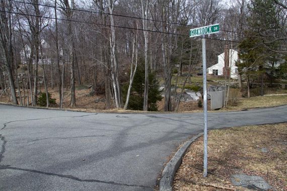
Not sure how popular this trail is, so perhaps people are used to seeing hikers walk down their street with backpacks on… but it’s always weird to pop out of the woods and have to walk on a street.
Also, as we came out of the woods, all the dogs in the neighborhood came rushing out to the edges of their yards, barking… if you are hiking with a dog that might feel uncomfortable with that – avoid this trail.
So… this isn’t a hike for a beginner or to put at the top of your “must-do” list, but maybe give it a shot. Though, honestly, we’re not sure we’d do this route more than once.
8.5 miles. Trail is mostly moderate, some steep sections, rocks. There were very very wet sections, but we’d had an unusual amount of rain recently.
NOTE: Since there isn’t one overview map of this, there is potential for getting yourself off-track and a GPS is handy. See updated map info below.
Parking: at the Kinnelon Recreation Fields, on route 511, north of the Pyramid Mountain visitor center. The bathrooms here are only open when games are being played, there are facilities at the main Pyramid visitor center.
Route: Trail starts in the north corner, by a gate. GREEN – right on WHITE – BLUE w/ WHITE STRIPE – LEFT on BLUE – RED w/ WHITE STRIPE – LEFT on WHITE – GREEN
MAP: update – The Morris County Highlands Trails map set came out after we hiked this, and covers the entire hike on one map – highly recommended instead of piecing together what we used:
- The Pyramid Mountain Trail Map (online, or at the trail kiosk in the main Pyramid Visitor lot.
- We also used the map from Localhikes for part of the route not covered (note: this map does not show all the trail).
Butler Reservoir from Kakeout Rd – Similar to this route, but starting from a different parking lot and also going to Bear and Tripod rocks.
Localhikes – Shorter loop around reservoir, but with long stretch of road walking on busy road.
–4/2026, 6/2020 – Links removed that no longer exist (bold).