“Almost Perpendicular” is a steep rocky scramble to a nice viewpoint, and “Elbow Brush” is a short squeeze through a rock crevice.
Oh Harriman, we adore your wacky place names: Almost Perpendicular, Elbow Brush, Claudius Smith Den… and this moderate to difficult hike takes in all three.
| 6.2 miles | Rocky with some steep scrambling. |
| Shorter/Longer | Huge network of trails = endless options. |
| Nearby | Pine Meadows Loop; Seven Hills, HTS, Pine Meadow; Seven Hills, HTS, Raccoon Brook, Pine Meadow; Seven Hills, HTS, Reeves Brook. |
Our two cents:
It was another practically balmy “in-the-50s-in-January!” day and the Johnsontown Rd. parking lot was nearly full when we arrived.
We’d last hiked from this lot in September 2006, and I’d forgotten how nice the Blue Disc trail is.
The return route via R-D and Kakiat is on the “eh” side in our opinion, perhaps next time we’ll try something with White Bar instead.
Updated: 5/2024, 6/2020: Page refreshed, not re-hiked. Last hiked 2012.
Hike Info:
Map/Book:
Harriman-Bear Mountain Trails is best but the park site has one too.
Harriman Trails: A Guide and History is a great source for the origin of place names and park history, along with description and mileage charts of every trail in the park.]
Parking: N41 10.793 W74 09.816
Johnsontown Rd. parking lot.
Route:
Overview: Blue Disc (Blue Dot on White) – Ramapo/Dunderburg (Red Dot on White) – Kakiat (White) – Blue Disc (Blue Dot on White)
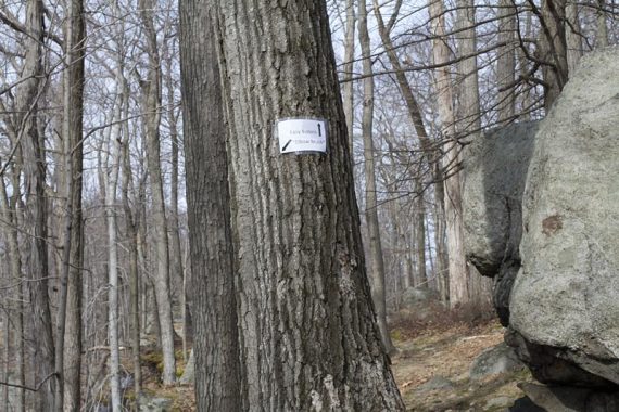
There is a trailhead for Kakiat (WHITE) within the parking lot, but for this route we started on Blue Disc. Walk back out of the lot to the paved road that heads off to the RIGHT. There are Blue Dot on White markers.
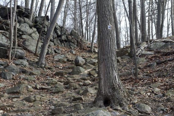
The paved road curves up and around, past a house and a gas utility area before heading into the woods.
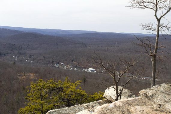
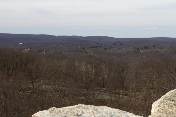
“Almost Perpendicular” is a steep rocky section on the Blue Disc trail, with a little scrambling that leads to a nice viewpoint. From here, we could see that the visitor center parking lot at Pine Meadow was quite full too.
Our GPS data puts the “Almost Perpendicular” section at an elevation change of about 275 feet in .25 mile.
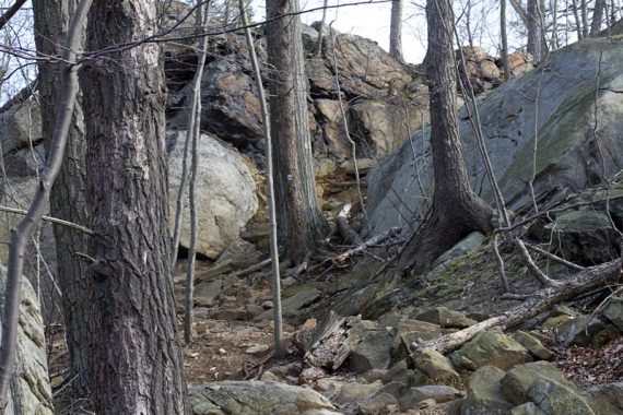
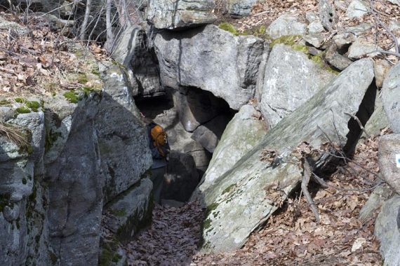
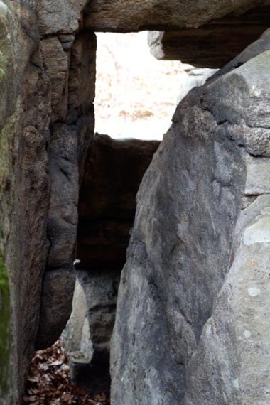
“Elbow Brush” is a short squeeze through a rock crevice, along Blue Disc. This is easily bypassed by following the sign as you approach, however right at the actual “Elbow” you can decide to bypass or go through.
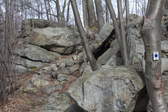
At the large rock face that contains “Claudius Smith Den” we scrambled up, continuing on Blue Disc to another viewpoint.
/// Shorter: To cut this route short, take Tuxedo-Mt. Ivy to the left to meet up with Ramapo-Dunderburg instead of heading up Blue Disc. ///
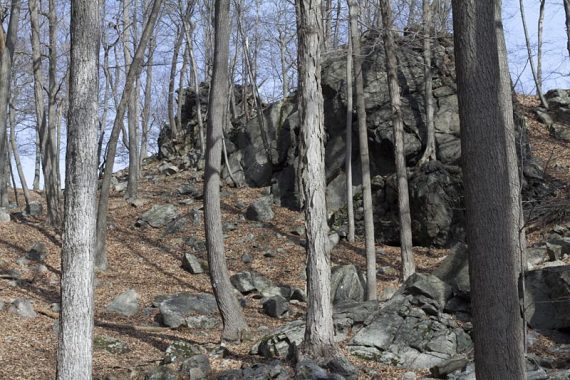
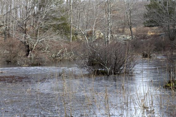
After Claudius Smith Den, the Blue Disc continues downhill on a rather rugged section, then up to another view. It ends at Black Ash Swamp.
Follow the trail around to the left along the water and pick up Ramapo-Dunderburg (Red Dot on White).
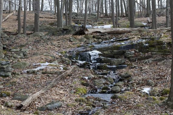
The return route on R-D is more level, on a loose rock and a sometimes muddy woods road, with a few small rock hops over streams.
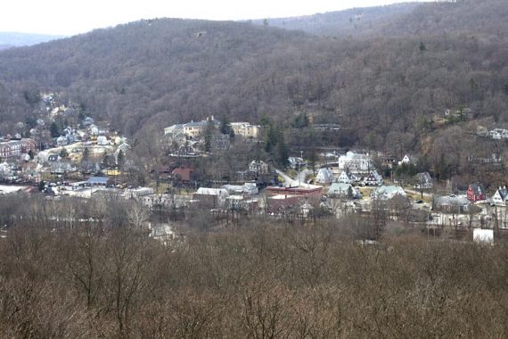
The trail crosses a gas line cut and heads toward Rt. 87. (with much traffic noise), coming to a view over Tuxedo.
RD goes down almost to a small road to pick up Kakiat (White). Follow Kakiat back, passing Orange (from Dater Mtn Park) on the right.
Arrive at Blue Disc again, and turn RIGHT on it, which will go back to the lot.
Wildlife spotted: Two sets of deer; one hanging out at the bottom of a hill on the pipeline cut, and another that kept running away in front of us.
—
Hiked: 1/29/12
Hiked: 9/1/06. Trail Blog “Almost Perpendicular and Elbow Brush in September“