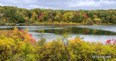
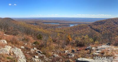
Coppermines, Appalachian Trail, Catfish Fire Tower, Rattlesnake Swamp
Loop with streams, water cascades, mines (closed), ridge views, the Catfish fire tower, rhododendron tunnels, and a swamp.
Loop with streams, water cascades, mines (closed), ridge views, the Catfish fire tower, rhododendron tunnels, and a swamp.
Hike up the Rattlesnake Swamp Trail to expansive views from the Appalachian Trail and Catfish Fire Tower.
A steep but short approach to Sunfish Pond via Garvey Springs, then expansive views along the Appalachian Trail at Raccoon Ridge.
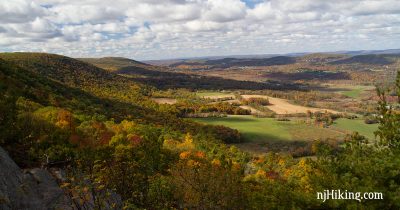
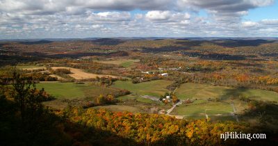
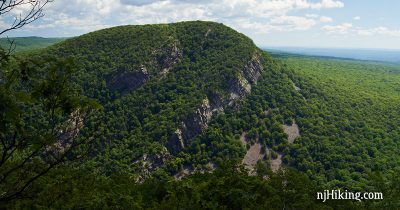
Hike the Appalachian Trail to an impressive panoramic view from Mount Mohican.
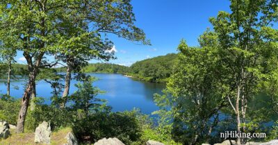
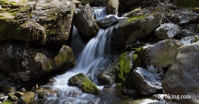
Short-but-steep loop to Sunfish Pond via the Garvey Springs trail and includes Laurel Falls.
Hike over boardwalks and a suspension bridge before climbing the “Stairway to Heaven” to one of the best viewpoints in NJ.
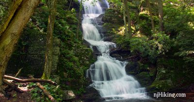
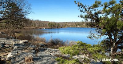
Start at NJ’s highest waterfall then hike steeply uphill to the Appalachian Trail, Crater Lake, and Hemlock Pond.
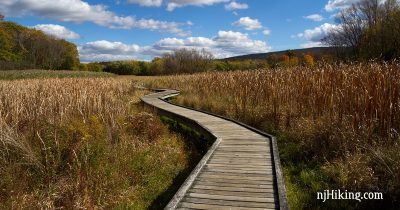
Easy hike through a scenic marshy area on a long boardwalk and over the Pochuck Suspension Bridge.
Hike the “Stairway to Heaven” up a series of steep rock slab steps to a panoramic view from Pinwheel’s Vista.
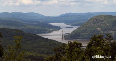
Enjoy views of Bear Mountain Bridge, Perkins Tower, the Hudson River, and NY – and hike through Doodletown, the remains of a town from the 1700s.
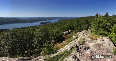
Fantastic views of Greenwood Lake and the surrounding area, Surprise Lake, multiple scrambles.
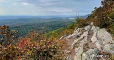
Wonderful view of New Jersey’s Mt. Tammany and the Delaware River from this short, steep route.
Hike from beautiful Crater Lake and enjoy views along the Appalachian Trail to Rattlesnake, Bird, and Blue Mountains.
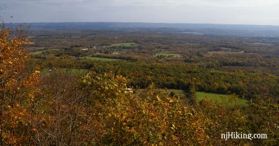
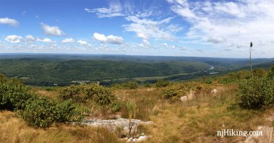
Hike through a dense forest before climbing to Sunrise Mountain for views over northern New Jersey from the Appalachian Trail.