Loop featuring Lake Sonoma and views from Overlook Rock and Manaticut Point.
6.8 or 4.6 miles. Rugged, rocky surface with multiple rock hops over streams.
- Shorter: 4.6 miles – noted in the description below, just do the YELLOW loop.
- Short: ~3.0 – just out-and-back to Lake Sonoma using YELLOW.
- Also from this lot: Lake Sonoma Loop.
- Nearby longer variation: Horse Pond Mountain to Lake Sonoma Loop.
- Other nearby hikes: Wyanokie High Point, Chikahoki Falls, Otter Hole; Wyanokie High Point, Carris Hill, Buck Mountain; Stonetown Circular; Apshawa Preserve; Apshawa Waterfall.
Hike Info:
Our two cents:
The shorter loop is a solid pick: it packs Lake Sonoma and all the main viewpoints into a rugged but pretty hike, the miles are manageable and the navigation is straightforward.
Do the longer version if you are like us and want the miles. That gets you a couple more viewpoints but does utilize eroded woods roads sometimes and crosses a power line cut (but runs in the forest along it, not in it).
Mostly shady but the viewpoints are in full sun with no real shade to rest in.
There are so many photos from this hike I put the panoramas and the overflow pics in the Trail Blog for it, “Overlook Rock and Manaticut Point with Mama Bear and Cubs“.
Updated: 3/2022 – Trail map info; added new intersection at 1.5 miles. 5/2021 – Page refreshed, minor description adjustments to reflect trail changes that don’t affect the route. Not re-hiked. 8/2018 – description, GPX, Interactive Map added; re-hiked; new photos.
Map/Book:
Northern New Jersey Highlands Trails Map. Our Interactive Map includes both the 6.8 and 4.6 hikes. The shorter route is in 50 Hikes in New Jersey.
Parking: N41.09077° W74.32124°
If coming from Rt. 287 N, take exit 55; Rt. 511 to West Brook Rd.; then Magee to Burnt Meadow Rd. to Crescent Drive. Google search: “Manaticut Point Trailhead”.
Parking is on Crescent Dr. along the curb. The trailhead is near a large rock.
Restrooms:
None. Gas stations and convenience stores along Rt. 511.
Hike Directions:
Overview: Manaticut Spur (YELLOW with BLACK DOT) – Manaticut (YELLOW) —Overlook Rock (WHITE) – Manaticut (YELLOW) – Manaticut Spur (YELLOW with BLACK DOT)
Shorter 4.6 loop: Manaticut Spur (YELLOW with BLACK DOT) is a connector trail from the parking area to the YELLOW trail… if you want the shorter loop, simply stick with the YELLOW blazes – with and without a dot – for the whole hike.
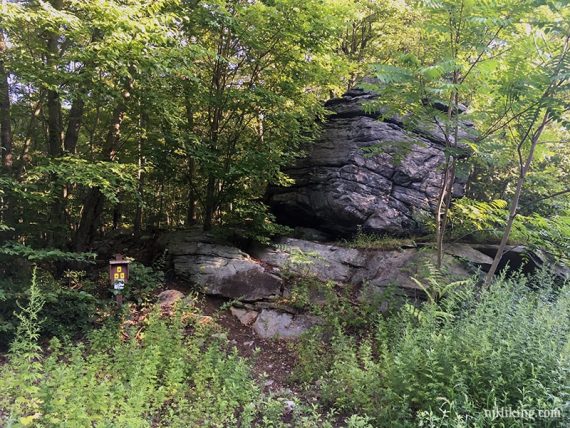
0.0 – Start following Manaticut Spur (YELLOW with BLACK DOT) at a trail sign and near a large rock.
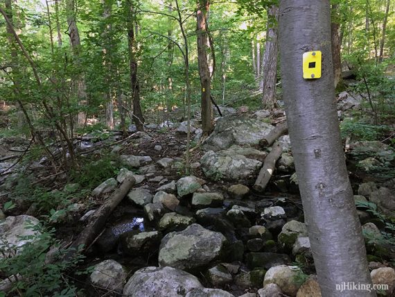
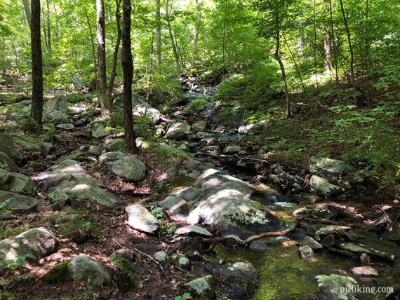
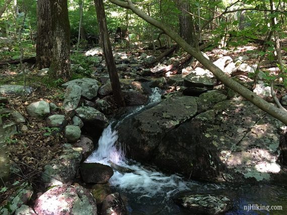
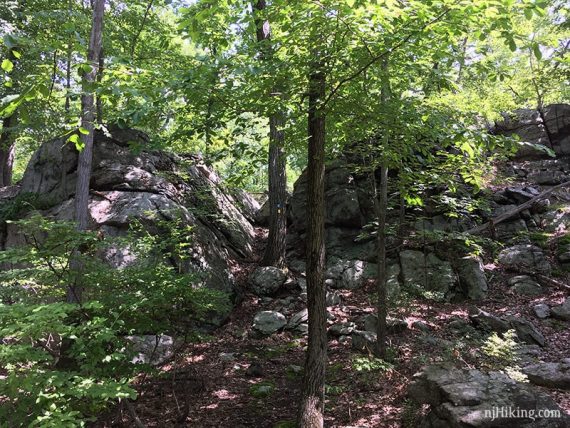
Large rocks loom above and there are several stream crossings.
0.3 – Turn RIGHT to start following Manaticut (YELLOW). [Manaticut (YELLOW) also goes left]
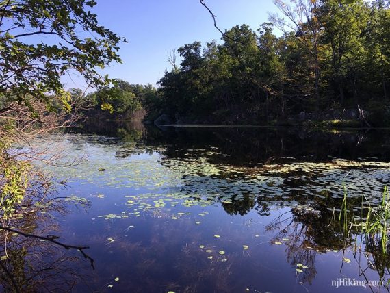
1.0 – Continue following Manaticut (YELLOW) passing Lake Sonoma (ORANGE) then Manaticut Sonoma Connector (ORANGE-YELLOW… like candy corn!).
The trail is co-joined with Lake Sonoma (ORANGE) along the lake.
1.2 – Lake Sonoma comes into view.
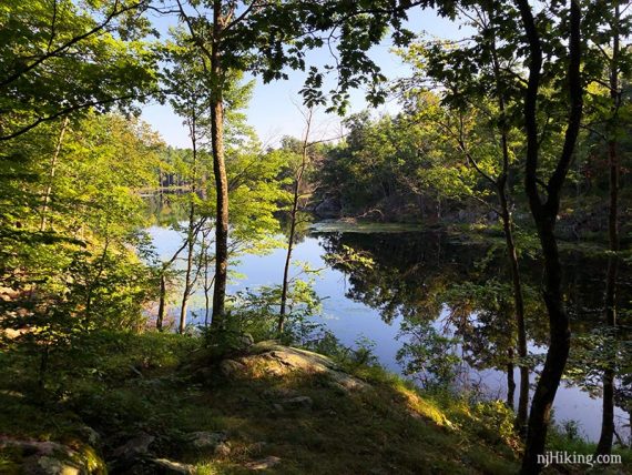
The trail runs along the edge with views over the lake.
1.5 – Continue following Manaticut (YELLOW). [Lake Sonoma (ORANGE) leaves to the right].
2.0 – Continue following Manaticut (YELLOW). [Overlook Rock (WHITE) goes to the right]. The trail now also has WHITE blazes.
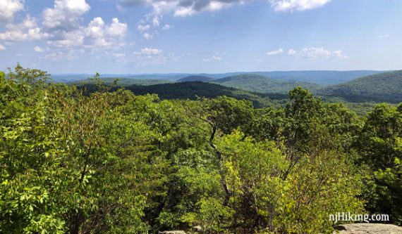
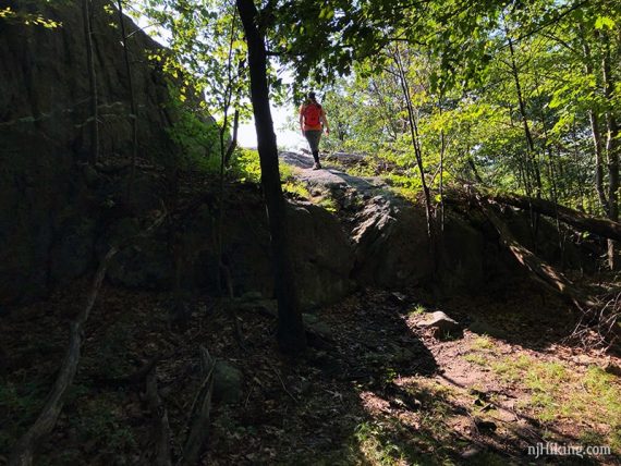
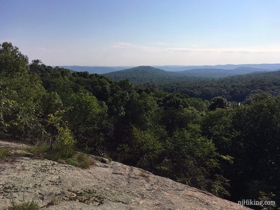
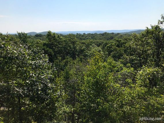
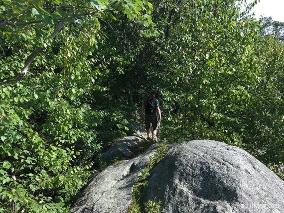
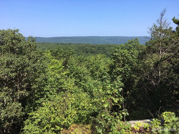
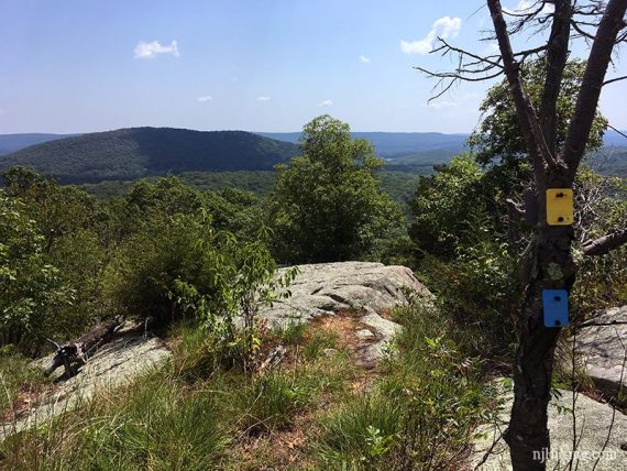
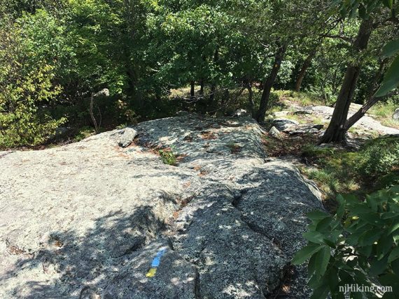
Shortly after, where YELLOW and WHITE blazes indicate the trail turns to the right, instead turn LEFT for a brief scramble up to a wide panorama from Overlook Rock.
View from Overlook Rock.
Come back down off of Overlook Rock.
// Shorter 4.6 Version: With your back to Overlook Rock, turn LEFT to continue following Manaticut (YELLOW)/Overlook Rock (WHITE). At the next intersection turn LEFT to now follow Manaticut (YELLOW). [Overlook Rock (WHITE) goes right]. Continue following the description for the shorter version noted below. //
For the longer version: With your back to Overlook Rock, turn RIGHT to continue following Manaticut (YELLOW).
Shortly, turn LEFT to now follow Overlook Rock (WHITE).
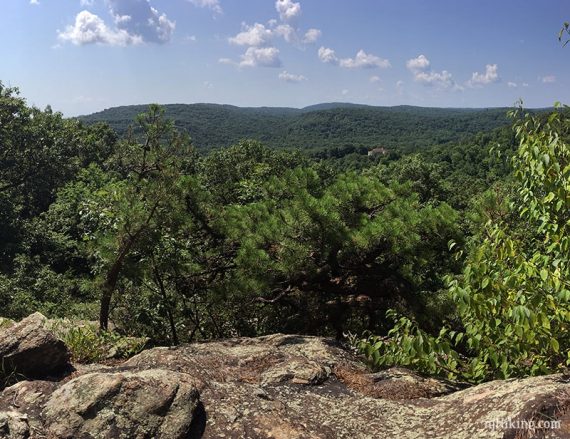
2.5 – After following a wood road for a while, Overlook Rock (WHITE), turns off of it to the left, just after a stream crossing. A small cascade is off to the left.
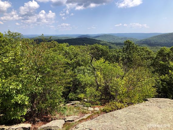
2.7 – Viewpoint on Overlook Rock (WHITE).
Continue following Overlook Rock (WHITE).
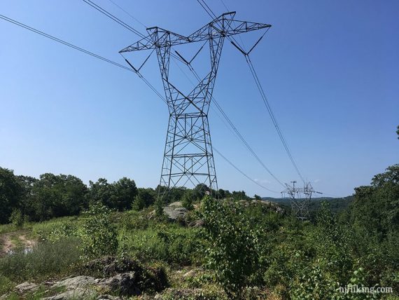
3.0 – There is a stone wall before a power line cut.
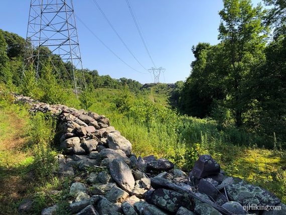
Continue following Overlook Rock (WHITE) across the power line cut.
3.1 – Turn left and continue on Overlook Rock (WHITE). [Tapawingo (BLUE) goes right].
3.6 – View from a rock slab. We found that the viewpoint marked on the TC map was before this and only a very limited view.
Cross the power line cut again, continuing on Overlook Rock (WHITE).
The blazes on the ground direct to a woods road that is overgrown and grassy and that’s the route, though we walked on rocks around it a bit. We didn’t spot the blaze on the other side till we were over there.
In this section, the trail follows woods roads for a bit and sometimes it’s a little overgrown and feels like the “trail less taken”.
4.8 – Start following Manaticut (YELLOW) straight. [Overlook Rock (WHITE) and Manaticut (YELLOW) also go left and is where you’d come in from the shorter version].
// Shorter 4.6 Version continues from this point. Subtract 2.2 from the mileage. //
4.9 – Continue following Manaticut (YELLOW), pass a limited viewpoint.
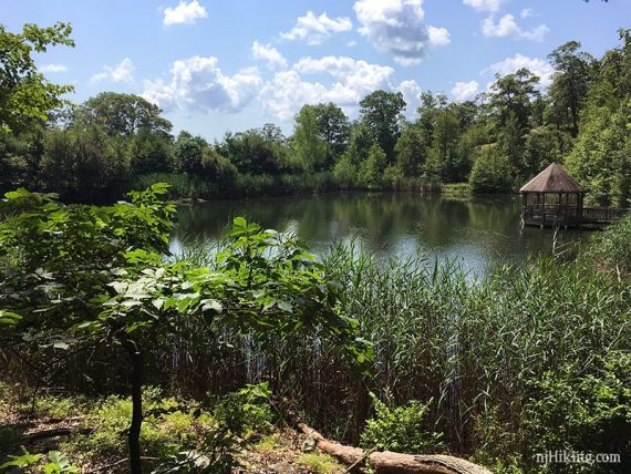
5.3 – A pond comes into view off on the right, which might not be visible seasonally.
Off the right side of the trail, we found a large flat group of rocks for a break spot, overlooking the pond.
We were surprised to see not only a gazebo at the edge but large koi fish swimming in the pond. (Unsure of what the deal is with the gazebo area, we assumed it was private so stayed away).
5.4 – Shortly, after a small rock scramble, continue following Manaticut (YELLOW) as it turns right. [Manaticut Sonoma Connector (ORANGE-YELLOW) goes to the left].
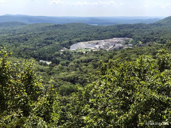
5.8 – Manaticut Point. (Any blue markers in the photos are from when the trail was also Hewitt-Butler (BLUE) in this section).
Expansive views over Norvin Green State Forest ahead and left.
To the right a quarry is visible in the distance.
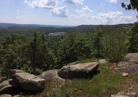
Close up of the quarry:
After a short steep downhill section, continue following Manaticut (YELLOW). [Pass West Brook Connector (PINK)].
6.5 – Now follow Manaticut Spur (YELLOW with BLACK DOT), retracing steps from earlier.
—
Hiked: 8/5/18. Long version, Trail Blog: “Overlook Rock and Manaticut Point with Mama Bear and Cubs“
Hiked: 10/6/13. Short version, Trail Blog: “Overlook Rock and Manaticut Point in the Fog“