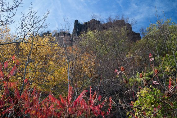
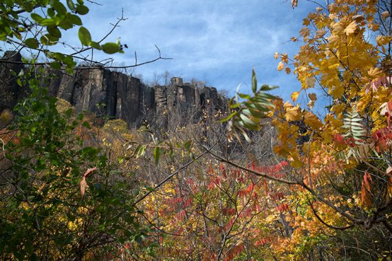
Sweeping views of the huge cliffs of the Palisades and New York, a rocky hike along the shore, and the castle-like Women’s Federation Monument.
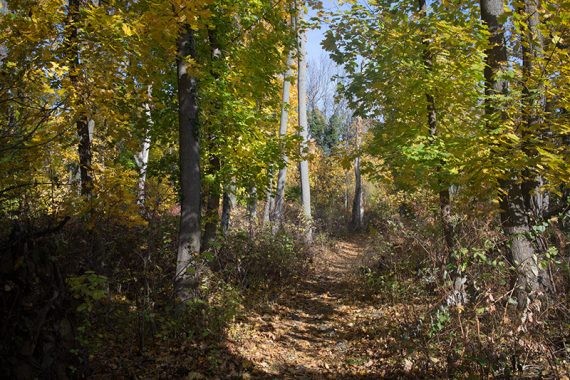
6.4 miles, surface ranges from easy path to rocky trail.
Upper and lower portions are level but there is a very steep descent via old and potentially super slippery stone steps (consider reversing this route in wet or icy conditions so that you go up these instead).
There is another uphill trail later to get back to the upper trail. Shore trail is rough and uneven stone in some areas.
- Nearby, same parking lot: Alpine to Huyler’s Landing – same lot, but head south.
- Nearby: The Giant Stairs, Tenafly Nature Center and Lost Brook Preserve.
- More options on the park site – this is a loooong park so there are much higher mileage hike loops possible.
Hike Info:
Our two cents:
This is one of those hikes where there are so many vistas that it almost gets old. Almost.
While not a wilderness experience, hikes in the Palisades are worthwhile due to the abundant views and the uniqueness of a sliver of nature tucked between a river and a parkway.
There is considerable road noise along upper trail, the park can be popular, but the Shore Trail feels a million miles away – even though New York is in constant view.
Updated: 4/2020 – Page refreshed, not re-hiked.
Map:
Topo map: Hudson Palisades Trails. Also, nice map brochure within the Park Headquarters building and online.
Books:
This hike without the side trails and done in the opposite direction can be found in 50 Hikes in New Jersey.
Other hikes in the area can be found in: Hiking New Jersey (2023), Hike of the Week and Take a Hike New York City. Trail descriptions are in The New Jersey Walk Book.
Parking: N40.95321° W73.92099°
Alpine Park Headquarters. Exit 2 off the Palisades Interstate Parkway.
Restrooms:
Inside the Park HQ building.
Hike Directions:
Overview: Long Path (TEAL) – Forest View (BLUE/WHITE) – Shore (WHITE) – Closter Dock (ORANGE) – Long Path (TEAL)
0.0 – Start following the Long Path (TEAL) from the north end of the parking lot. (When in the parking lot facing the HQ building, the trail head is on the left end of the lot).
0.7 – Optional side trail on the right leads to Grey Crag, the first of many viewpoints.
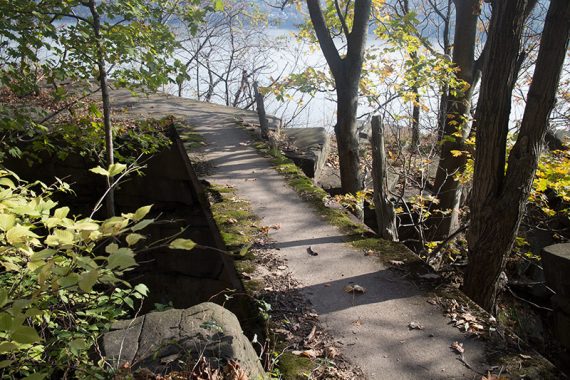
Cross a large ditch on a concrete slab. Not difficult but there are no railings and enough of a drop off to get hurt.
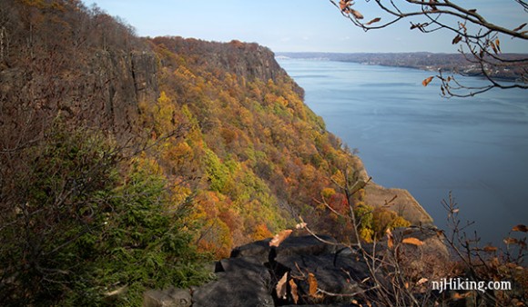
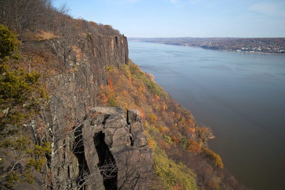
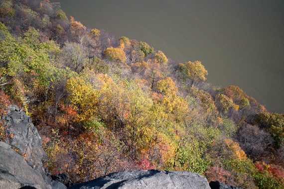
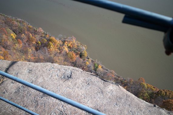
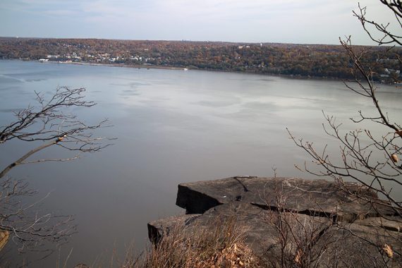
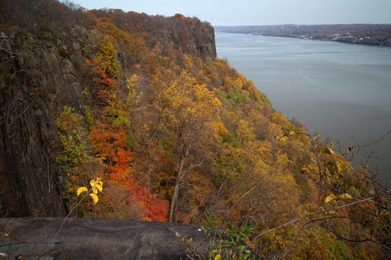
1.6 – View, and looking down.
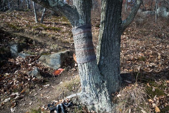
Tree sweater? (2014)
1.8 – View.
1.9 – Ruckman Point. Many viewpoints have fences, but not all.
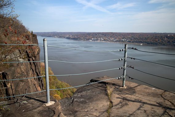
Looking down through the fence.
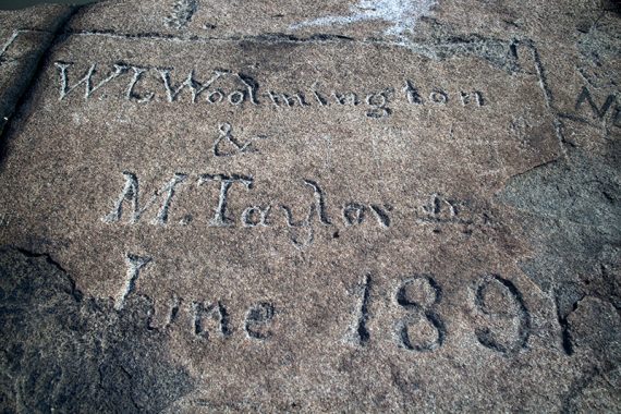
Fancy old timey graffiti.
Shortly after the trail turns sharply left, watch on the RIGHT for an unmarked side trail. Take this out-and-back for additional views.
/// Option: skip this first unmarked trail (or if you miss it) and stay on the Long Path. This removes about .4 miles from the hike.
Retrace back to Long Path (TEAL) and turn RIGHT to continue.
2.4 – After a very brief time back on the Long Trail, turn RIGHT onto another unmarked side trail for additional views.
Continue following this unmarked trail to its intersection with the Long Path (TEAL) and Forest View (BLUE/WHITE).
/// Option: Skip turning down this second unmarked trail (or if you miss it) and stay on the marked Long Path (TEAL) – at the next step below, continue straight to follow the co-joined trail]
2.9 – Turn RIGHT, now following the co-joined Long Path (TEAL) and Forest View (BLUE/WHITE).
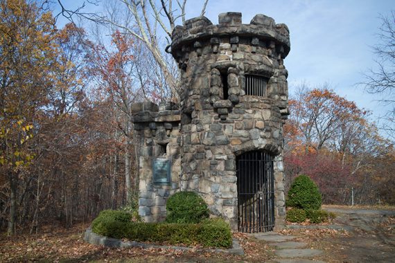
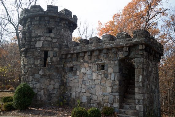
3.0 – Women’s Federation Monument (a small, castle-like stone building with a few steps to climb up into it; but the view is better from below).
Continue following Long Path (TEAL) and Forest View (BLUE/WHITE).
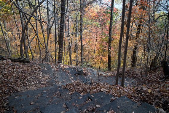
3.1 – Continue following just Forest View (BLUE/WHITE) as it descends STEEPLY on old, stone steps. [Long Path (TEAL) leaves to the left]
3.4 – Turn RIGHT and now follow Shore (WHITE) as it hugs the shoreline. [Forest View (BLUE/WHITE) ends].
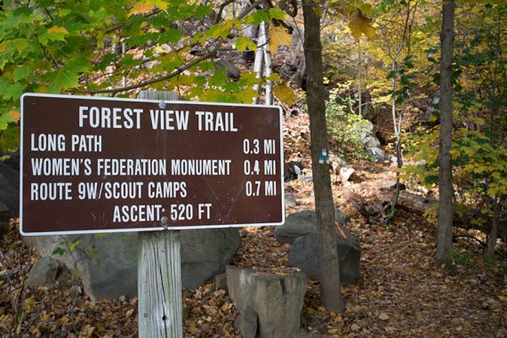
Guess that was steep… Forest View descends 520 feet in .3 miles.
4.5 – Keep following Shore (WHITE) as it hugs the shoreline where an unmarked Upper trail goes off the right.
/// Option: The Upper trail to the right is an easier option than the rocky shore trail and leads to a picnic area – but is in the forest with limited views.
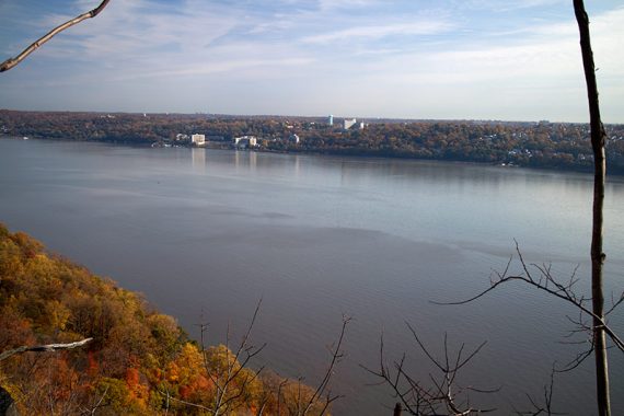
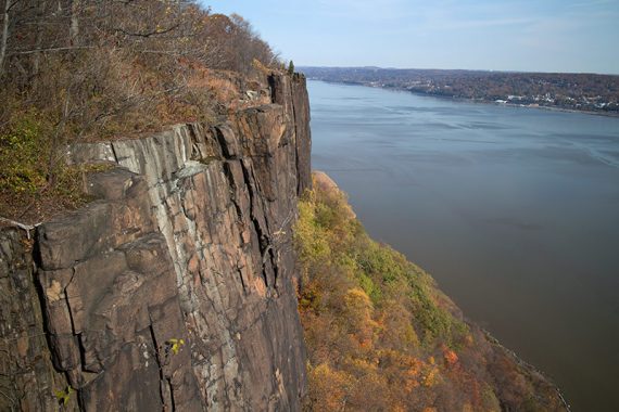
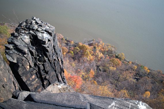
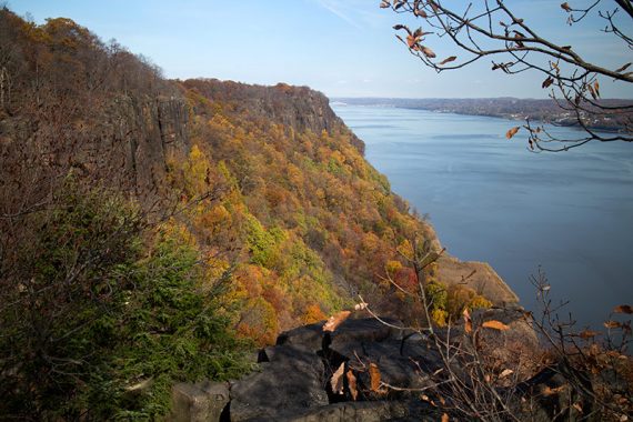
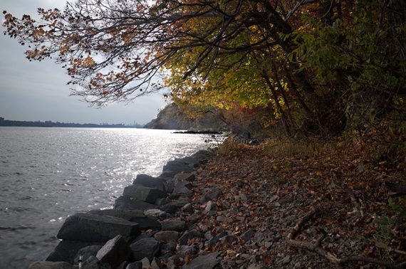
Looking up at the Palisades from the Shore trail:
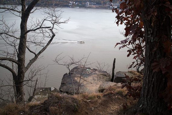
5.3 – Continue following Shore (WHITE) where the Upper trail comes in from behind and to the right, at a painted rock.
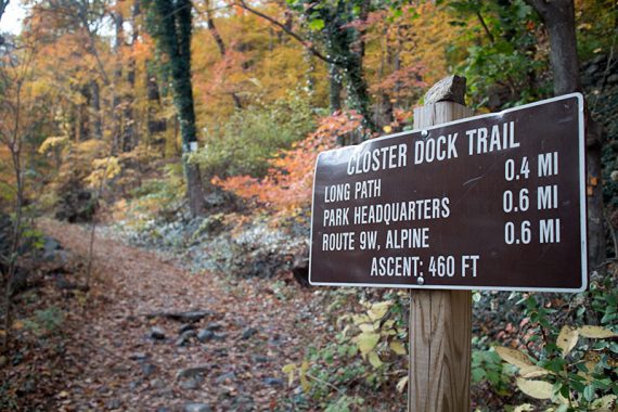
5.8 – Start following Closter Dock (ORANGE) uphill. [Shore (WHITE) continues straight]
6.1 – Turn RIGHT and now follow Long Path (TEAL) back to the parking lot. [Long Path (TEAL) and Closter Dock (ORANGE) also go left]
—-
Hiked: 11/9/14.