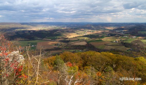
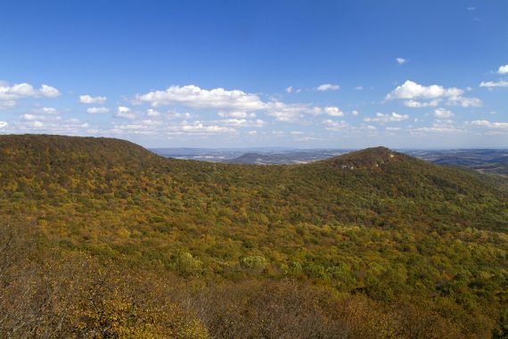
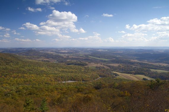
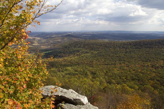
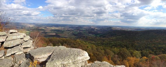
Rocky route along the Appalachian Trail in Pennsylvania with an expansive view of the surrounding hills and the patchwork of farmland in the valley below.
8.7 miles, total round trip. Very rocky.
- Nearby (within an hour drive): Lehigh Gorge Trail; Green Lane Park.
Our two cents:
While this hike is absolutely a “must-do” on any NJ-area hiker’s list, it is popular so it can be crowded due to the incredible views and accessible routes up.
We had the chance to do this on a weekday, saw only a handful of people, and managed to have the viewpoints to ourselves on a beautiful fall day.
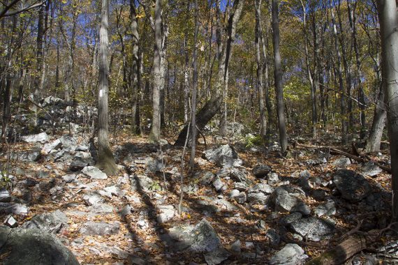
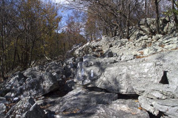
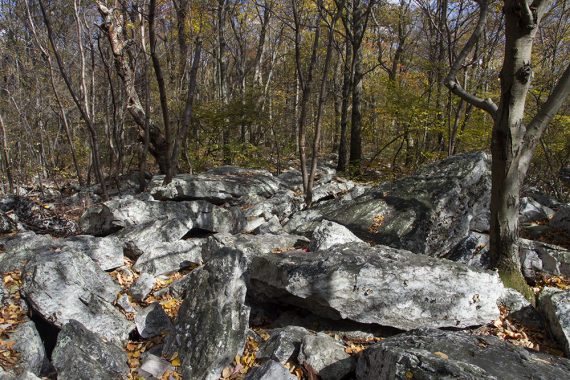
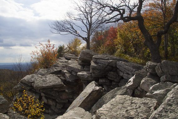
The Appalachian Trail in Pennsylvania is notoriously rocky and is nicknamed “Rocksylvania”.
Updated: 4/2020: Page refreshed, not re-hiked. 7/2016 – added a video to the page.
Map:
There are now NatGeo Trails Illustrated map sets for the Appalachian Trail, and the Swatara Gap to Delaware Water Gap one covers this area.
The various maps online are of varying quality but OK enough for this hike, see links.
For an overview of the various approaches, see Routes to the Pinnacle.
Parking: N40.58330° W75.94193°
Rt 78W to exit 35 for 143 towards Lenhartsville. Right onto 143/Willow St, Right onto Old 22. Right onto Reservoir Rd. About 1.75-2 hrs from central NJ.
Restrooms:
None. There is a rest area on Rt. 78 about 30-40 minutes from trail head or you’ll need to exit for a gas station or store.
After exiting 78 for the trail head there really wasn’t much of anything on the way to stop at.
Book:
A similar route and map diagram can be found in Best Day Hikes Near Philadelphia.
Hike Directions:
Overview: BLUE (gravel road) – APPALACHIAN TRAIL (“AT” – WHITE) – Spur to Pinnacle (BLUE) – APPALACHIAN TRAIL (“AT” – WHITE) – BLUE – BLUE (gravel road)
Note: there are multiple trails marked with BLUE blazes
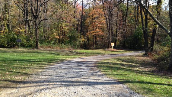
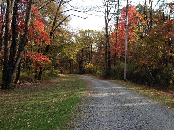
0.0 – From the parking lot, walk past the gate and start walking on the gravel road (BLUE).
0.5 – Turn RIGHT, following the gravel road as it bends to the right, and start following the Appalachian Trail (WHITE). [Straight is a gated woods road, a sign, and another path]
Immediately cross Furnace Creek on a bridge and bear RIGHT, continuing on Appalachian Trail (WHITE). [left is BLUE, your return route].
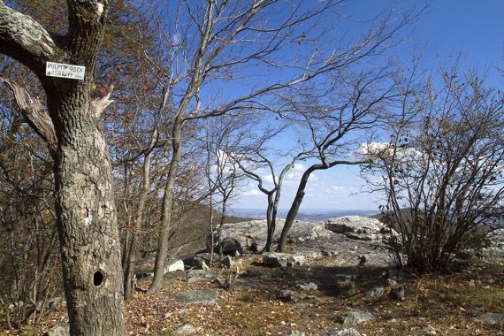
0.8 -Turn RIGHT, continuing on Appalachian Trail (WHITE). There is a small sign tacked to a tree, “Pulpit Rock, Rim Trail, Pinnacle” with an arrow pointing right. [BLUE goes straight].
1.8 – Continue straight on Appalachian Trail (WHITE) while passing BLUE on the right. [BLUE leads to Blue Rocks Campground]
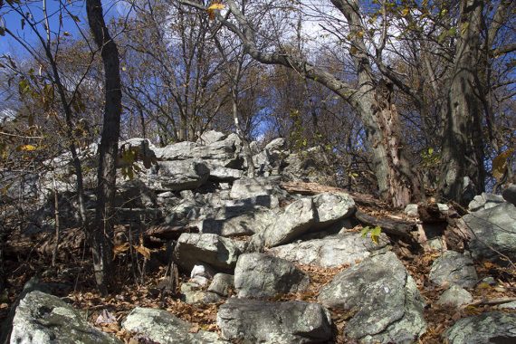
Head uphill up stone steps and a few rock scrambles.
2.3 – Pulpit Rock viewpoint. [Nearby is a building, an observatory, that the BLUE gravel road lead to.]
Continue on Appalachian Trail (WHITE). Rocks, rock, and more rocks.
3.0 – Continue straight on Appalachian Trail (WHITE) while passing RED on the left.
4.1 – Continue straight on Appalachian Trail (WHITE) while passing YELLOW on the right. [YEL leads to Blue Rocks Campground]
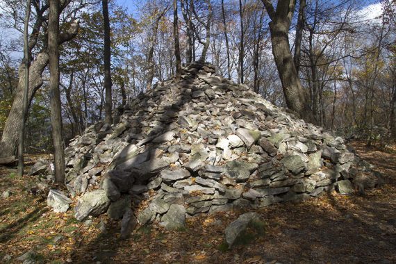
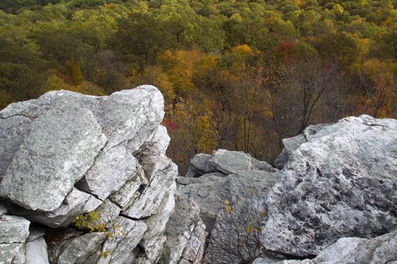
4.5 – Take the spur trail, marked with a sign “Overlook 250” to The Pinnacle. The biggest cairn you may ever see in your whole life marks the turn.
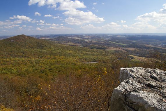
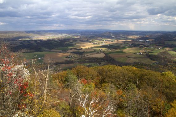
4.6 – Arrive at The Pinnacle and enjoy the view.
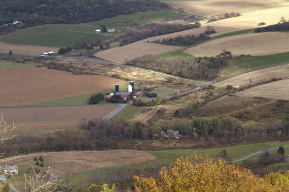
Patchwork of farms in the valley below, with a zoom into one.
Looking down from The Pinnacle.
Wide panorama from the Pinnacle.
Retrace your steps to the cairn.
At the cairn, bear right on Appalachian Trail (WHITE). [The AT also goes off to the left, in the direction you came]
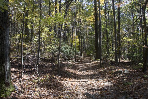
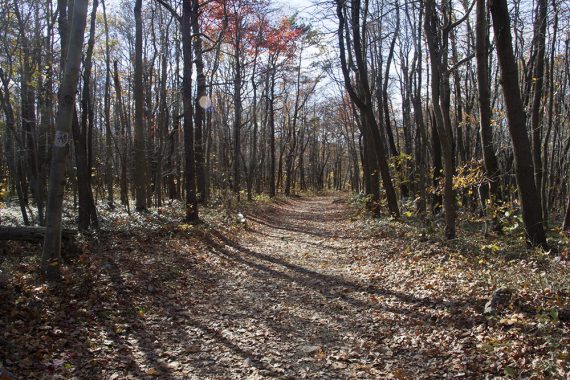
The Appalachian Trail (WHITE) becomes a wide easy woods road, leaving the majority of it’s rocky surface behind. (Perhaps all the rocks have gone into that whopper of a rock pile…)
6.4 – Arrive at open grassy area known as the helipad. Turn LEFT, now starting to follow BLUE. [Appalachian Trail (WHITE) continues straight and is an optional way back via BLUE later on]
Head downhill on BLUE, a wide woods road through a pretty forest filled with rhododendron, with Furnace Creek running nearby.
7.0 – Continue straight on BLUE while passing RED on the left.
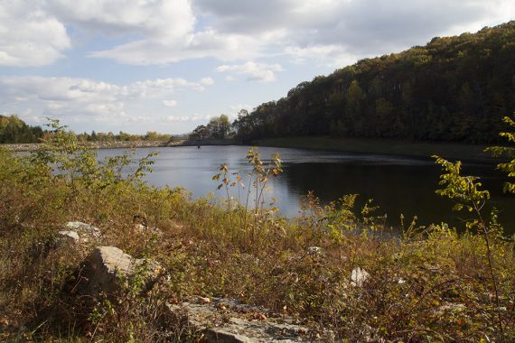
7.7 – Hamburg Reservoir comes into view. Continue along the reservoir, thru a gate at the end. BLUE markers are spotty or non-existent at this point.
8.0 – Continue straight on the while passing a woods road on the left.
8.2 – Turn RIGHT and walk over the bridge from earlier, then follow the gravel road as it curves to the left. Take the gravel road you started on back to the parking lot.
—
Hiked 10/24/13.