Explore an ice cave, a waterfall, and enjoy spectacular views of the Shawangunks region and the Catskill mountains.
11.3 miles – or 7.1 or 5.9 or 3.8 miles, total round trip. Moderately rocky, minor scrambling on the High Point Trail.
- This route: 11.3 – Sam’s Point, Ice Caves, Verkeerder Kill Falls, High Point.
- Shorter: 7.1 – Sam’s Point, Ice Caves, Verkeerder Kill Falls [noted in description].
- Shorter: 5.9 – Sam’s Point, Verkeerder Kill Falls [skip ice caves].
- Short: 3.8 miles – Sam’s Point & Ice Caves [noted in description].
- Nearby: Bonticou Crag; Gertrude’s Nose; Labyrinth and the Lemon Squeeze.
- Combine two hikes into a getaway: “The Gunks Overnighter: Sam’s Point and Bonticou Crag“
Hike Info:
Our two cents:
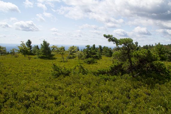
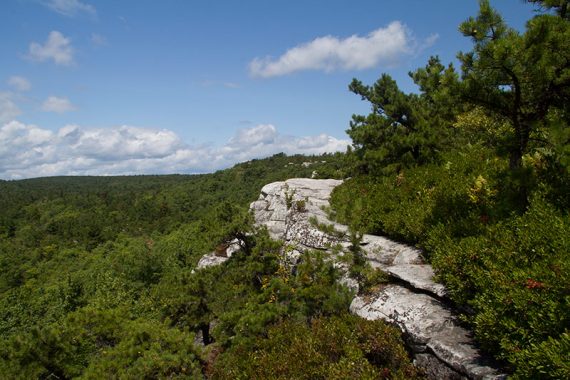
Several good destinations, plenty of views, and a bit of scrambling make this a consistently enjoyable hike. The white cliffs are simply stunning when contrasted against a sea of green trees.
- Most hikers will want to go to Sam’s Point, the ice caves, and falls only – which is still an outstanding hike. Only avid hikers should include High Point.
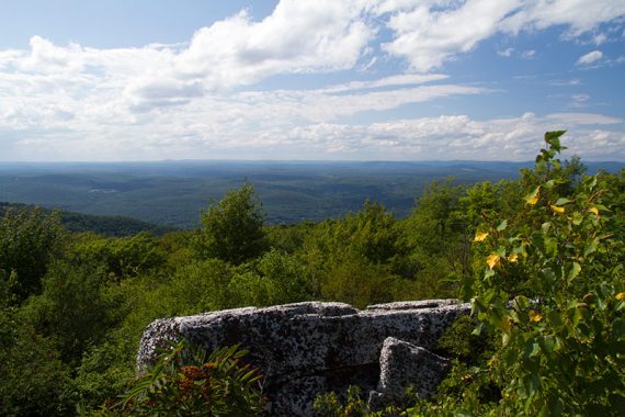
- We found the return trip on the High Point Carriage Road a bit dull but realistically it was fine to have an easy ending to a long day. The side trip to Indian Rock was very worthwhile but could be skipped if really tuckered.
- We don’t recommend reversing the loop – that puts most of the stuff toward the end when you aren’t as fresh and makes the High Point scrambling mostly downhill.
This area is super popular (with good reason) – arrive early or on a weekday if you can swing it.
Updated: 5/2022 – Added seasonal parking reservation info, not re-hiked. 4/2020: Page refreshed, not re-hiked.
Seasonal Notes:
The ice caves fill with ice and are closed until passable in spring or summer – but by late summer won’t have much or any ice in them. Skipping the ice caves loop removes 1.2 miles from any hike route.
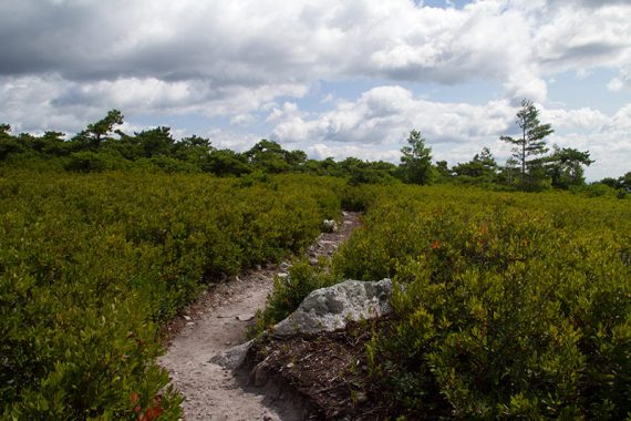
Verkeerder Kill Falls can dwindle to a trickle in the summer. With dwarf pines and ridge hiking there is significant sun exposure so prepare accordingly (plenty of water, sunscreen, hat) or chose a cooler time of the year.
Map/Books:
Shawangunk Trails is recommended but the online park map will do. Shorter Sam’s Point, Ice Caves & Falls found in Hike of the Week, and a variation in 50 Hikes in the Lower Hudson Valley.
Parking: N41.67031° W74.36133°
400 Sam’s Point Road, Cragsmoor, NY 12420. From New Jersey… take Rt. 287N or 17N through Mahwah over the border into NY. Take New York Thruway Rt. 87 to Exit 16 for Rt. 17W. Follow 17W to Exit 119 for Rt 302. Turn L on to Rt. 52. R on Cragsmoor Rd. R on to Sams Point Rd. [Roughly 2.25 hrs from central NJ].
Sam’s Point opens at 9:00am and closing times vary throughout the year.
Parking Fee: $10 fee per vehicle. Medium sized lot that often fills to capacity early; there is no overflow lot. Respect the surrounding communities and do not park on adjacent roadway shoulders.
NOTE!!! Sam’s Point Parking Reservations are now required weekends and holidays from May 1 through the last weekend in October. RESERVE SAM’S POINT PARKING here.
- Vehicle entrance fee is $10.95; none for Empire Pass holders.
- Morning reservation sessions start at 9am and end at 2pm; must arrive between 9 AM and 11 AM.
- Afternoon sessions start at 2pm and end at park closing time.
- Reservations may be purchased up to 14 days before a visit.
- Limit of 65 reservations issued per session.
- No drop-offs or pickups will be allowed in the Sam’s Point Area.
Restrooms:
Two regular bathrooms next to the visitor center. [Unsure if these are open all the time, it had passed 9am as we were gearing up so they were unlocked at that point.]
Hike Directions:
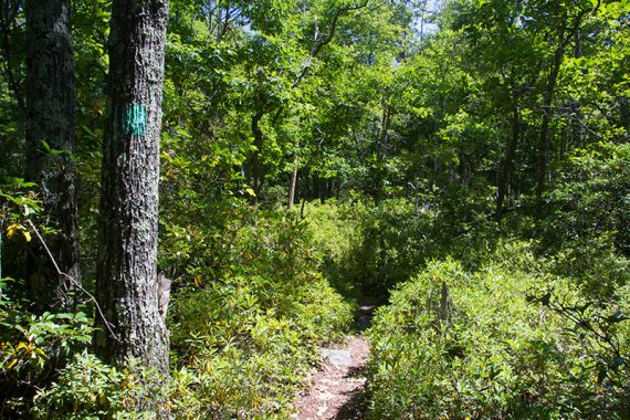
Overview: Loop Road – Ice Point Trail – Verkeerder Kill Falls Trail (TEAL) – High Point Trail (RED) – High Point Carriage Road – side trip out-and-back on Indian Rock (YELLOW) – High Point Carriage Road – Loop Road
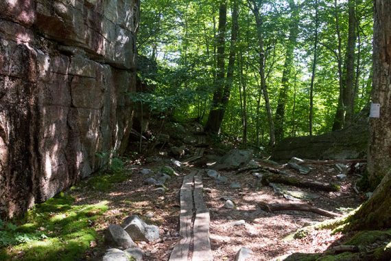
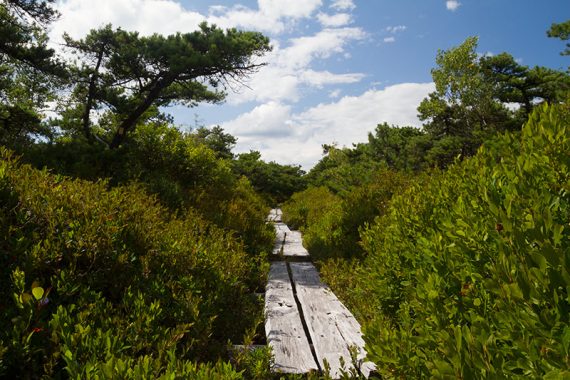
0.0 – At the gate at the edge of the parking lot, start following the loop road (Teal), following the signs toward Sam’s Point. It heads uphill, looping around a huge rock face.
There is a rock outcrop with views but keep heading up and around for even more.
0.6 – Turn LEFT on a short side trail to Sam’s Point to enjoy panoramic views. Retrace and continue on the dirt road.

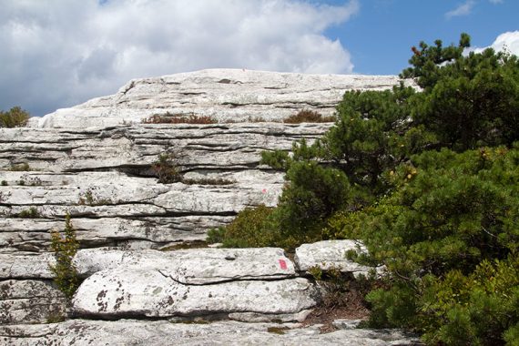
1.2 – Turn RIGHT at the sign for the Ice Caves.
Shortly, pass the Verkeerder Kill Falls (TEAL) on the left, making note of it.
// Option: If the ice caves are closed or to skip them and go directly to the falls, turn LEFT onto the Verkeerder Kill Falls (TEAL) trail instead. Skipping the ice caves loop reduces any of the hike routes by about 1.2 miles. //
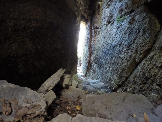
1.5 – Ice Caves Loop Trail. Go down stairs into the ice caves. Follow the path through the caves.
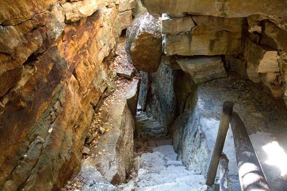
The trail leaves the caves before going back in.
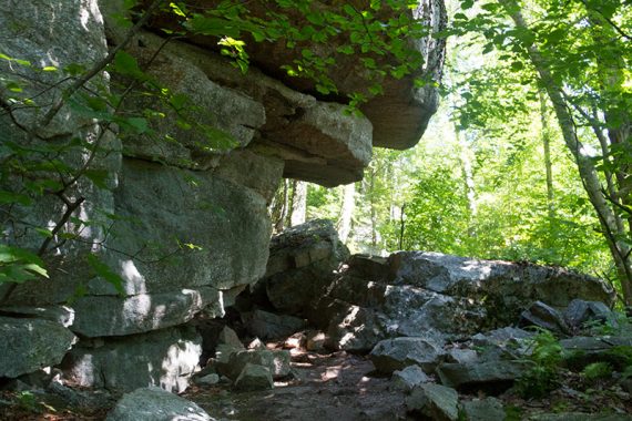
At the end, near a solar panel that powers the lights in the cave, there are some wide views and a few spots to take a break.
Continue following the path back to the wide dirt area where the ice cave trail started, and retrace your route back up the path to the sign for the falls trail.
2.4 – Turn RIGHT and now follow Verkeerder Kill Falls (TEAL).
// Shorter Option, 3.8 miles total: Return to the parking lot instead. //
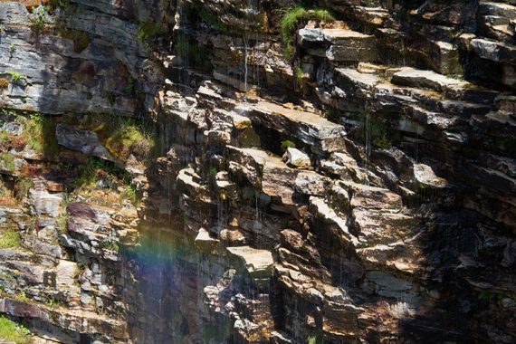
4.2 – Cross a stream on rocks, passing over the top of Verkeerder Kill Falls.
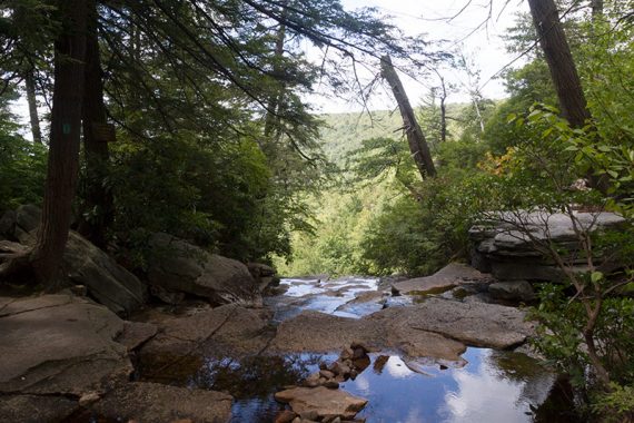
Look for an offshoot trail on the right that goes to a rock overhang for a view of the falls. This was just a trickle in August.
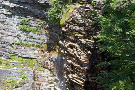
Close up of a rainbow over the falls.
Continue following Verkeerder Kill Falls (TEAL).
// Shorter Option, 7.1 miles: Retrace the route from here. //
4.6 – Start following High Point Trail (RED). [Verkeerder Kill Falls (TEAL) ends. Scenic (LILAC) starts.]
Small scrambles like this along High Point keep the trail interesting… as do all the views.
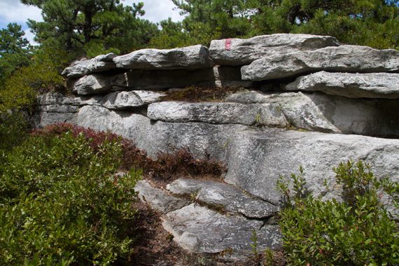
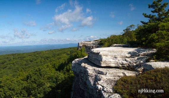
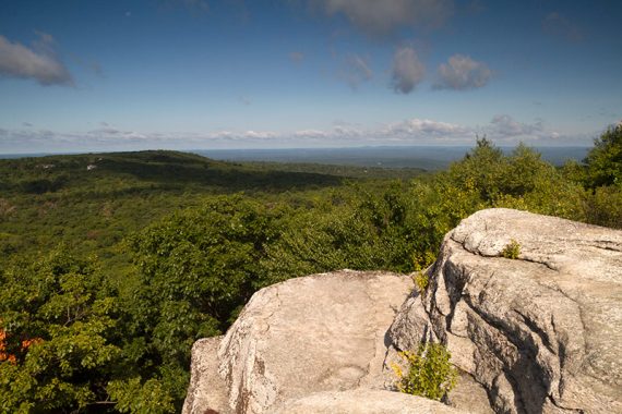
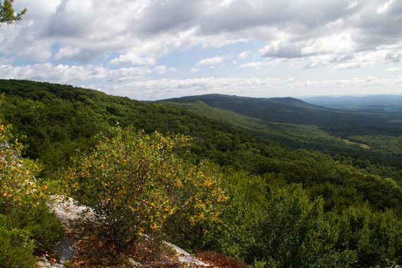
6.8 – Views from High Point.
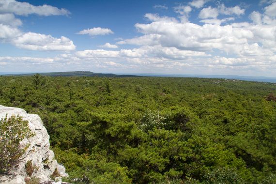
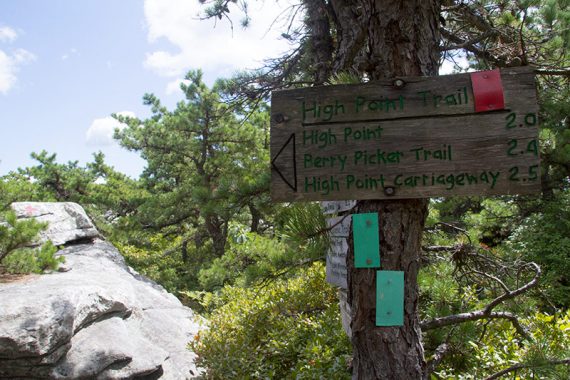
7.1 – Sign at junction of High Point Trail (RED) and Berrypicker Trails.
Go straight a bit past this on the Berrypicker trail to a wide viewpoint of the Catskill mountains.
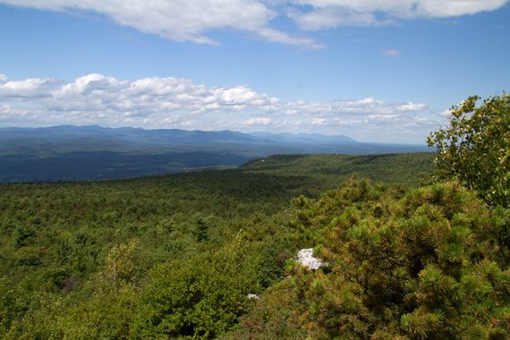
7.2 – Viewpoint over the Catskills. Retrace back to the sign, and turn RIGHT, following High Point Trail (RED) to it’s end.
7.3 – Turn LEFT, now following the High Point Carriage Road.
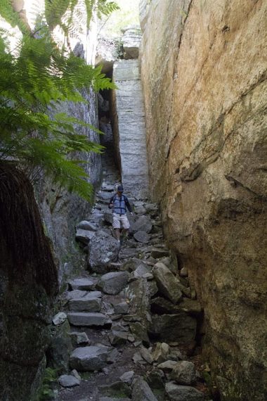
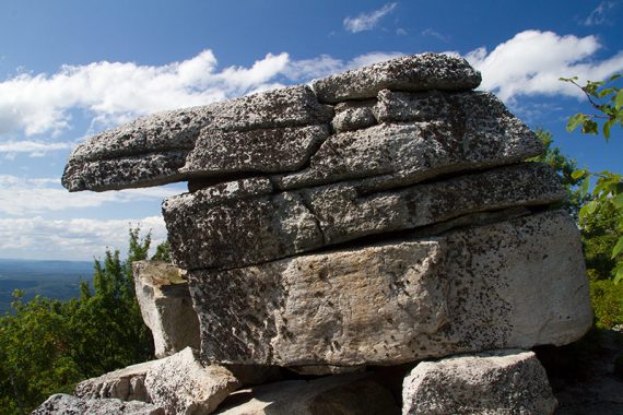
8.6 – Turn RIGHT to Indian Rock (YELLOW). Shorter option: Skip the out-and-back to Indian Rock and remove 1.1 miles from the route.
Nearing the rock, there is a small scramble down a tight crevice to get to the actual rock and views.
Retrace to High Point Carriage Road, and turn right back onto it.
10.1 – Junction with the loop road; turn RIGHT. At one point there is a side trail on the left to see the lake that we didn’t do.
Pass some towers and the remains of berry picker shacks on the way back to the parking lot.
—
Hiked: 08/14/14. Trail Blog: “The Gunks Overnighter: Sam’s Point and Bonticou Crag“