Short rocky hike in a beautiful gorge with waterfalls plus a viewpoint over a valley.
2.3 miles or less, total round trip. Very rocky along Electric Brook. The other trails are more dirt than rocks.
| 2.3, or less | This hike guide: Detailed instructions, photos, and video follow below. 2.3 miles: Full route 1.2 miles: Falls and overlook and back; noted below 0.8 miles: Falls only and back; noted below |
| Longer | Include WHITE down to Fairview then back up BEELINE (might be better to start at the lot on Fairview Ave for that) or continue out of the park using the Patriot’s Path. |
| Nearby | Hacklebarney State Park; Kay’s Cottage Ruins; Black River – Cooper Mill; Point Mountain Reservation; Stephens State Park |
Our two cents:
The BLUE trail is very rocky but this hike offers a solid reward-to-effort ratio.
Just to the falls and back is less than 1 mile round trip but it’s very scenic the entire way, shady, with a pretty waterfall as your reward. The viewpoint is decent and worth continuing for.
From that point on, the hike is pleasant but nothing amazing so if you aren’t into getting miles, we’ve included notes below on bail-out options.
Updated: 10/2023 – Edited to reflect that trail names (such as Falling Waters etc) are no longer on the park map, adjusted side trail to rock outcrop directions, minor edits; re-hiked. Older change log at page bottom.
Hike Info:
Map/Books:
Print map ahead, did not see any at the trail kiosk. Appears in 50 Hikes in New Jersey. A different hike is in Hiking New Jersey (2023). Follow along on your smartphone with our Interactive Map link above.
Related: Waterfalls in NJ / Best Waterfall Hikes in NJ
Parking: N40.80095° W74.78373°
Schooleys Mountain Park, Long Valley, NJ 07853. Rt 206 N to Chester, L on Main St/Rt 5. R on Coleman into Naughright Rd., L on Springtown Rd., L into park.
Continue on the park road until reaching the final large parking lot. The hike starts from the far right corner of this lot.
Restrooms:
Portable toilet in the lot (as of 10/2023). Bathroom building is near the trailhead (possibly seasonal).
Optionally, there is usually a portable toilet in the Cooper Grist Mill lot if approaching that way, or multiple stores around the intersection of Rt 206 and Main St. in Chester.
Hike Directions:
Overview: Unmarked path towards lake – BLUE – Patriot’s Path (WHITE) – PINK – YELLOW (Grand Loop)
0.0 – From the far end of the parking lot, walk toward the bathroom building and to the edge of the woods where the trailhead is.
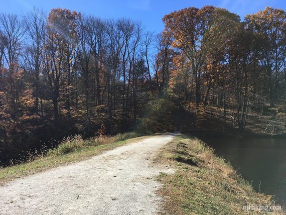
Facing the trailhead turn RIGHT and take an unmarked gravel path downhill to the edge of Lake George. [Straight leads to Grand Loop (YELLOW)]. Keep RIGHT where it soon splits.
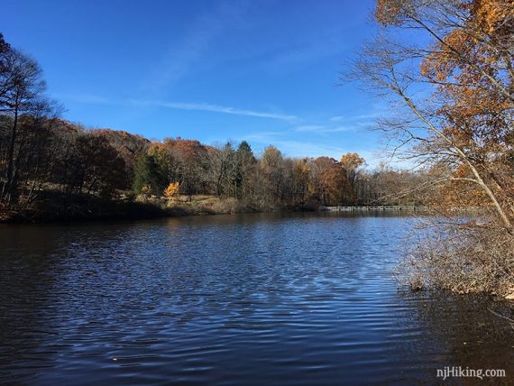
Turn LEFT to walk along the edge of the lake towards the dam.
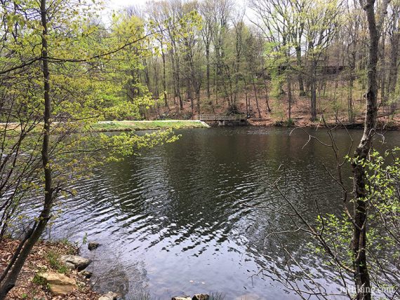
Continue past the dam, don’t go over it’s dirt walkway.
Fun Fact: Schooley’s Mountain has mineral rich springs which the Lenape used for its healing properties. European colonists also seeking its health benefits starting visiting in the mid-1700s and eventually the area became a resort destination in 1800s. [Source: Morris County Historical Society]
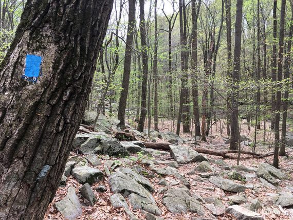
Once past the dam, head towards three BLUE blazes on a tree indicating the start of the blue trail.
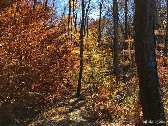
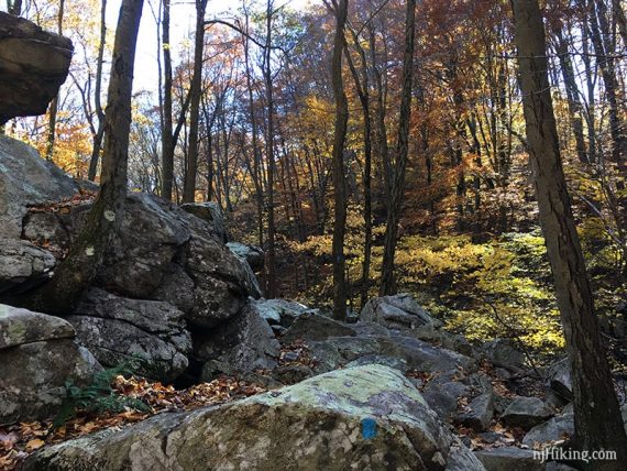
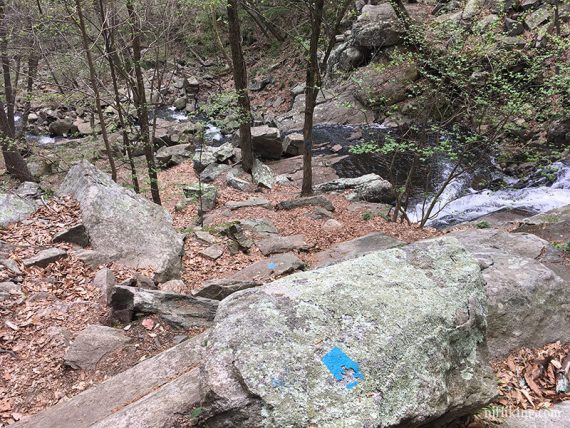
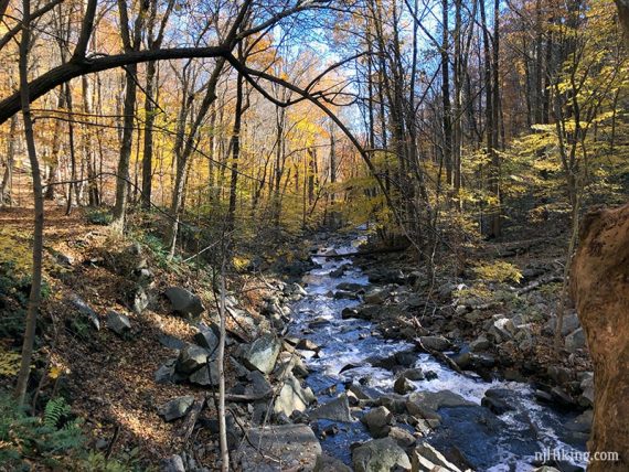
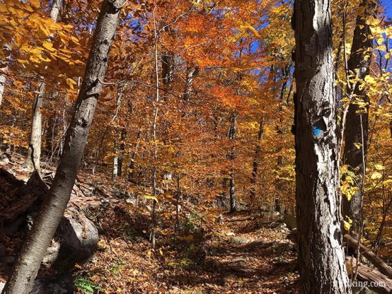
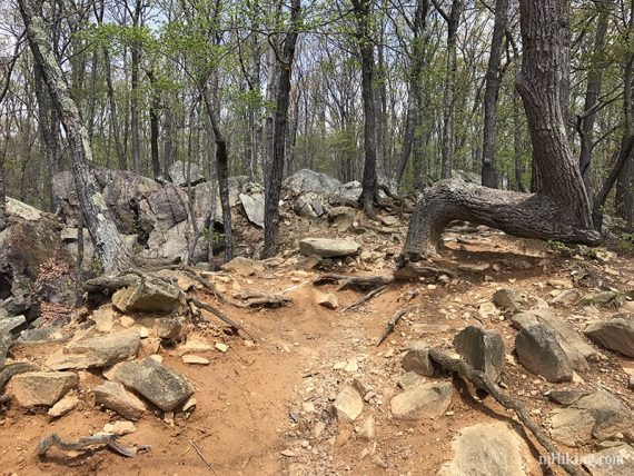
0.2 – Start following BLUE. This is a very rocky path that follows along Electric Brook.
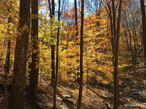
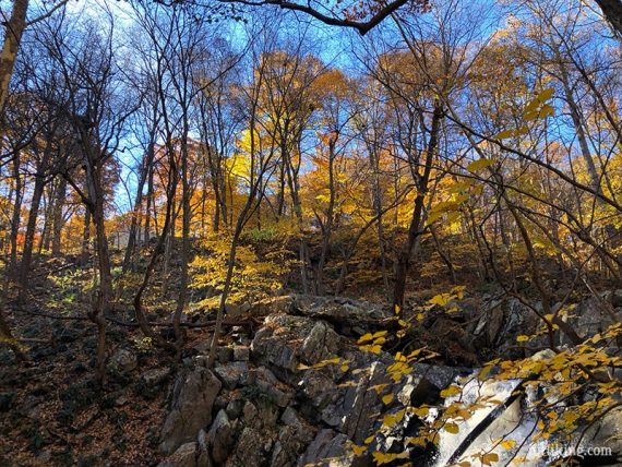
The fall foliage can be quite stunning if caught at the right time.
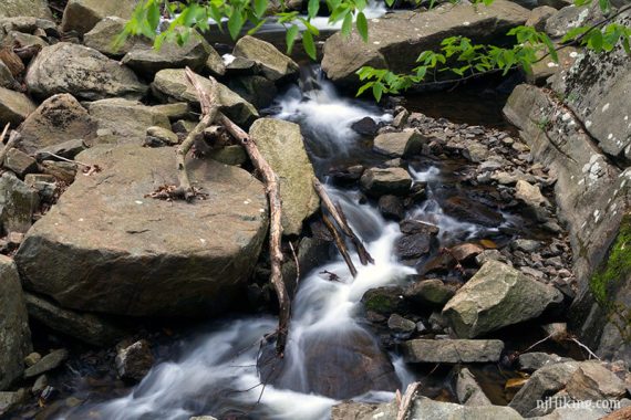
There are small cascades early on, with water tumbling over the jumble of rocks in Electric Brook.
Fun Fact: Electric Brook is named for a small electric generating station that used the brook for power. Continue negotiating a very rocky trail.
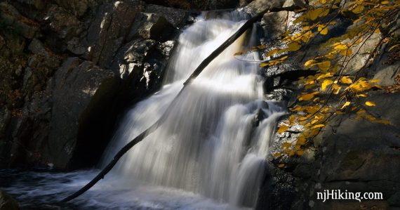
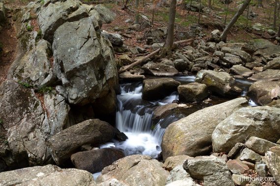
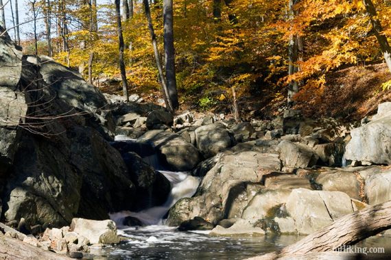
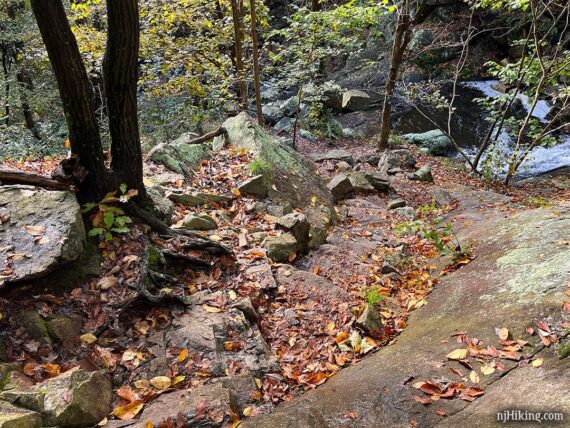
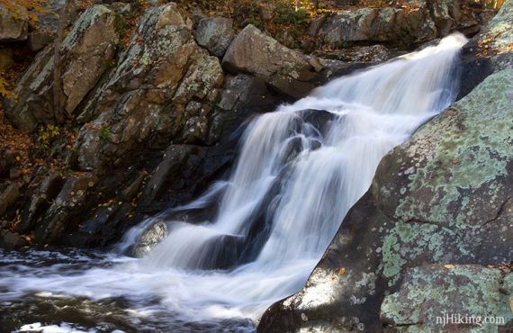
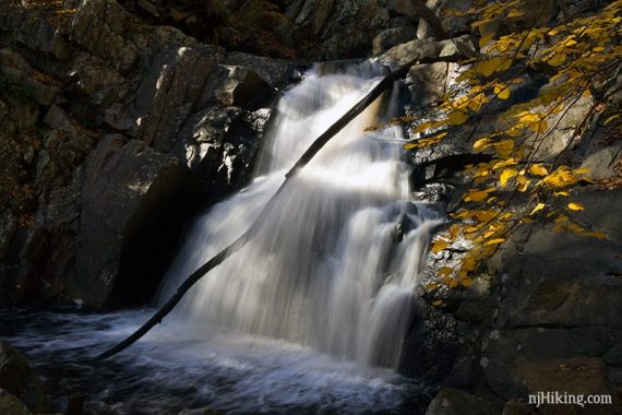
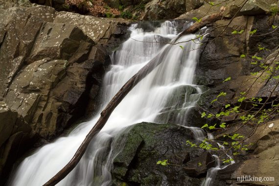
0.4 – Arrive at the waterfalls along Electric Brook. There is an upper then a lower falls. There are now rock steps down where once it was a minor scramble:
The same area before the steps. It is steeper and was more of a scramble than it looks in the photo:
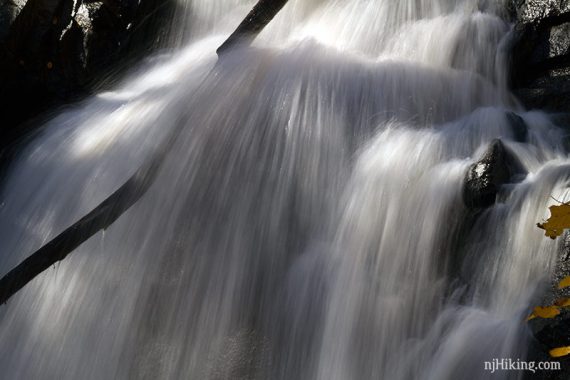
Upper waterfall, with high water flow:
Upper waterfall on a different day, with a little less water flowing over the rocks and a close up of water streaming over the rock:
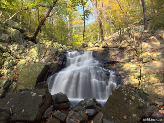
Fall foliage seen above Schooley’s Falls. The falls are also known as “Electric Brook Falls”.
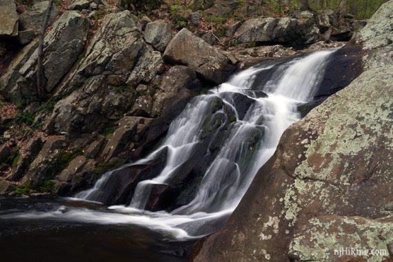
Keep heading down for the lower waterfall. The falls no longer have this distinctive branch laying on it (had it in 2017 and 2018, no longer there by our 2023 hike).
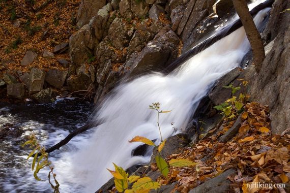
Schooley’s happens to be a rather photogenic waterfall, so bear with me on all the photos.
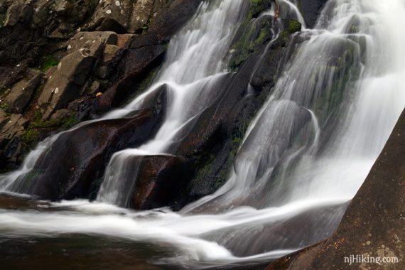
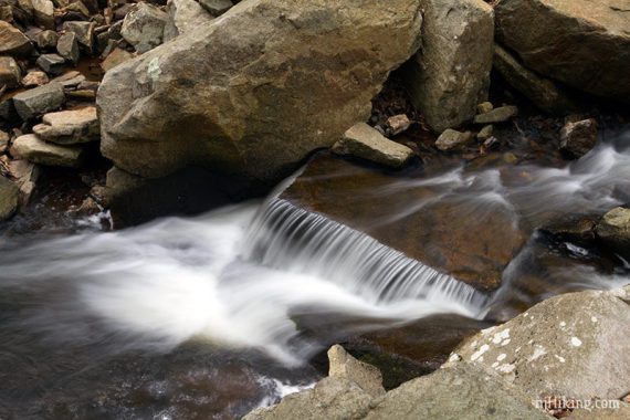
A few more with less water flowing, where it seems more delicate as it cascades over the rocks.
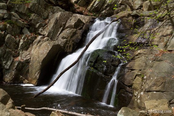
The falls seen straight on and without the branch.
There are interesting small cascades all around the falls.
// Shorter, 0.8 miles total: Backtrack from the waterfalls on BLUE for a short-n-rocky but rewarding hike. //
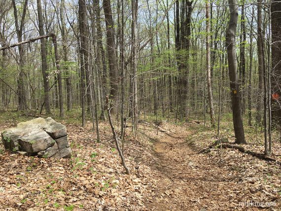
Continue following BLUE. The rocky trail continues along the brook for a bit before heading uphill.
0.6 – Trail intersection of BLUE, PINK and Patriot’s Path (WHITE)/Highlands (TEAL), with several benches.
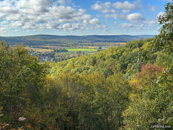
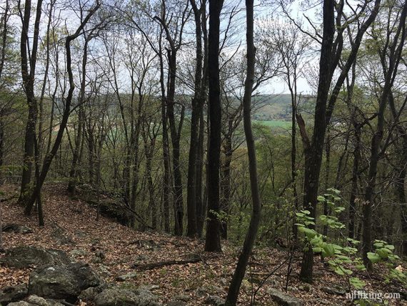
Turn RIGHT on Patriot’s Path (WHITE) for a just a short bit to a viewpoint through the trees at a bunch of rocks.
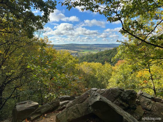
Zoom into the fields and farms in the valley below. Fun Fact: Schooley’s Mountain County Park is named for the family that owned large amounts of land in the area around 1700. [Source: Park web site.]
From the viewpoint retrace back to the intersection, returning back through the rocky old quarry area (there are some benches here now).
Be sure not veer onto the continuation of Patriot’s Path (WHITE)/Highlands (TEAL) that is beyond the viewpoint, as that leads downhill towards the Fairview Ave lot.
Back at the intersection, continue straight to start following PINK. Soon, Patriot’s Path (WHITE)/Highlands (TEAL) leaves to the left.
// Shorter, 1.2 miles total: Instead, turn left on Patriot’s Path (WHITE) for a more direct way back. We like longer loops but you’ve already seen the best bits and won’t be missing anything but nice forest. //
1.0 – PINK ends at an intersection with a side trail to the right and YELLOW (Grand Loop) ahead and to the left. There’s a trail sign. You’ve got some choices here – add a side trail, cut the hike shorter, or continue on.
//Optional side trip, adds 0.1 mile total – At this intersection, turn RIGHT and follow a short unmarked trail to “rock outcrop” marked on the map. A very large clump of interesting rocks awaits and might be fun for some to clamber around on them.
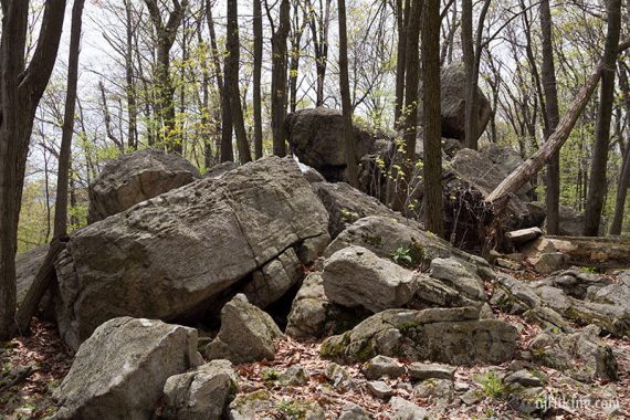
At the end of the side trail a limited view also awaits (with full leaves on the trees you won’t see much so we changed this to an optional add-on).
// If you’ve taken the side trail, turn around and return to the intersection.
To follow the full hike route – start following YELLOW (Grand Loop) in the direction of “Bee-Line 0.3” on the sign.
// Shorter, 1.8 miles total: Instead, turn LEFT on YELLOW (Grand Loop) to go directly back (follow the sign in the direction of “parking area (0.6 miles)”. //
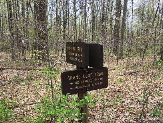
1.3 – At another intersection with a sign, turn LEFT to continue on Grand Loop (YELLOW). [BLACK DOT on YELLOW (Bee-Line) goes to the right and leads down to Fairview Ave and a parking lot for the Columbia Trail].
Grand Loop (YELLOW) starts to climb steeply uphill.
1.7 – Pass Highlands Cut (RED) on the right (this also leads back but away from the parking at first). Head downhill. Grand Loop (YELLOW) turns LEFT, with an unmarked trail ahead.
1.9 – Pass ORANGE on the right. The trail ends at a grassy area, turn LEFT and head towards the parking lot.
—
Hiked: 10/15/23.
Hiked: 11/4/18. Variation: BLUE to view then return on WHITE; 1.2 miles RT.
Hiked: 4/29/17.
Updated: 6/2021 – Page refreshed, not re-hiked. 11/2018 – Added fall foliage photos.