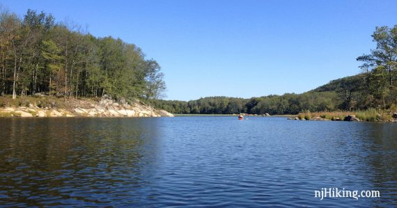
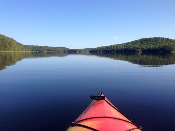
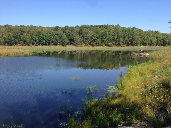
Incredibly scenic reservoir ringed by hills and rock cliffs, with several islands.
Explore rocky shorelines reminiscent of areas further northeast. Plenty of herons and cormorants, and once we even spotted a trio of beavers swimming by – a first for us.
Miles: up to ~7.1, which is pretty much the whole perimeter. Lake Size: 625 acres. Average Depth: 20′
- Surrounded by: Farny State Park and Wildcat Ridge WMA.
- Nearby hiking, this lot: Splitrock Reservoir Loop; Four Birds Trail.
- Nearby hiking, same park: Four Birds Trail – Wildcat Ridge; Four Birds Trail (North).
- Nearby hiking: Pyramid Mountain – Tripod Rock; Valhalla Falls – Turkey Mountain; Turkey Mountain- Perimeter Loop; Butler (Kakeout) Reservoir.
Our two cents:
Gorgeous destination, very enjoyable paddle, and some of the best kayaking in New Jersey. We usually land on one of the islands for a picnic lunch.
Fun Fact: Though often spelled “Split Rock Reservoir”, it is actually one word – “Splitrock“. The road it is on is “Split Rock”.
Paddle Boards: Sign posted that these are NOT allowed (as of 9/2022). Also, no swimming.
Updated: 9/2022: Page improved; re-kayaked 8/2022. Older change log at page bottom.
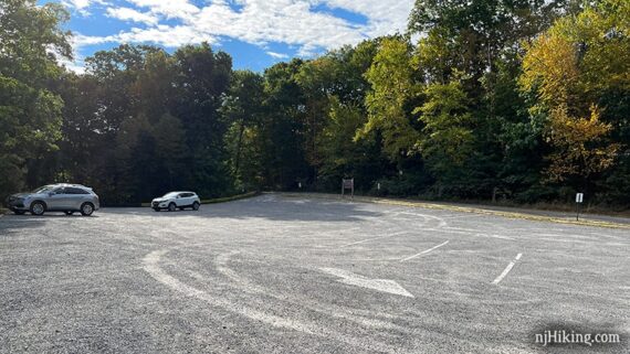
Parking: 40.96252, -74.45800
“Split Rock Reservoir Boat Launch”, 342 Split Rock Rd, Boonton, NJ 07005. Large gravel lot off of Split Rock Road.
This often fills up and if it is, you are out of luck…. only park in the lot, you will get ticketed if you park along the road.
From the south: 287N to exit 43, at the end of the ramp turn left, then right onto Fanny Rd to Powerville, left on Valley, right on Rockaway Valley, stay left onto Split Rock and follow to parking lot.
From the south, alternate: 287N to Rt 80 W to exit 37 for Rt 513/Green Pond Rd. Right on Meridian. Left on Lyonsville. Left onto Split Rock Rd to parking lot.
If you are traveling from elsewhere the exit may be different, so you’ll want to check directions from where you are. Split Rock road in good shape as of 9/2022.
Restroom:
Portable toilet in the parking lot, as of 9/2022. The Fanny Road route doesn’t offer much in the way of restroom possibilities.
If you don’t want to chance the toilet not being there or prefer a real bathroom… use the alternate Rt. 80 route for gas stations and a Dunkin once getting on 513.
Book:
Appears in Quiet Water New Jersey (2010) and Quiet Water Mid-Atlantic (2018).
Note: Our go-to kayaking book is Quiet Water New Jersey (2010), available as an e-book or a used printed book.
The newer version is “Quiet Water Mid-Atlantic (2018)”. This contains 13 of the 52 locations in the New Jersey-only book and is available both in printed and online formats.
Related: Kayaking NJ overview page.
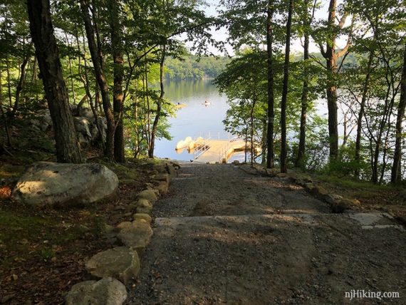
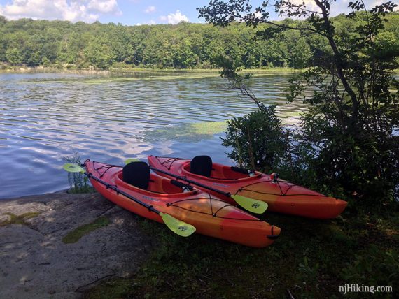
Launch:
There are two launch areas, each with floating docks. The one closer to the parking lot is on a incline that is stepped down to the dock:
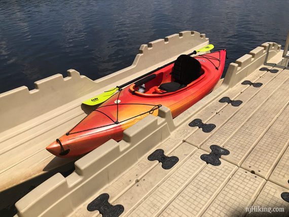
There is a bay on either side of the dock to set a boat in.
Set your kayak in the bay towards the water and sit in it. Put the paddle across into the slots and use it to pull yourself ahead into the water.
We didn’t even get our feet wet. Reverse the process to get out. Easy peasy!
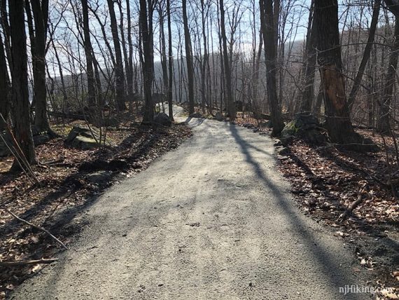
The second dock is at the end of a longer but more gradual gravel path.
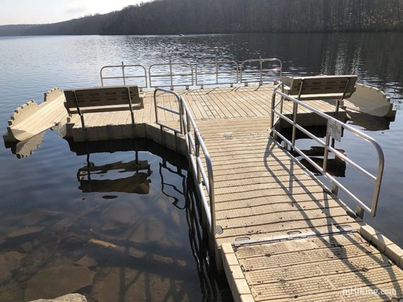
Kayak launching bays on this dock as well.
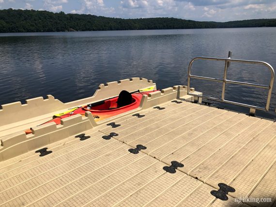
In August of 2022 we launched from this dock from the right bay because the left was occupied. We didn’t realize that the water level was so low that this side was being propped up by a large rock.
So launching was sort of a nose dive into the water which was a surprise. Just a heads up in case this continues.
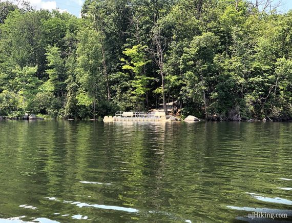
This dock seen from the water:
We’ve used both to see if we had a preference and either was fine for us. The closer one is likely intended for hand carry, and the longer path for those with wheels.
If you are interested in what the launch area used to look like, see “Kayaking Splitrock Reservoir in July“.
The Route:
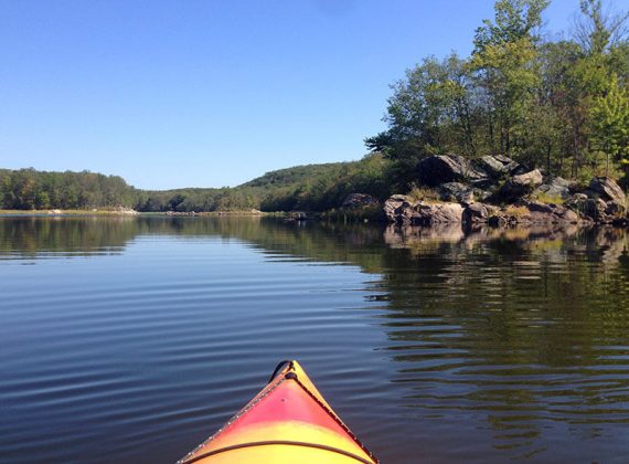
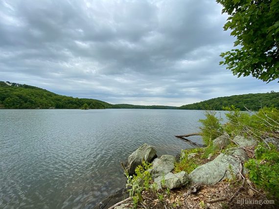
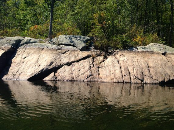
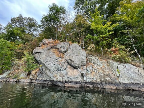
Splitrock Reservoir is surrounded by hills and has a very rocky shoreline. From the launch we normally follow along the right (east) side of the reservoir.
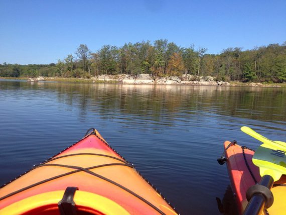
Sometimes it almost seems more like paddling somewhere like Maine rather than New Jersey.
Fun Facts: Splitrock Reservoir provides water for Jersey City’s system and was opened for paddling and fishing in 2004. The state of New Jersey purchased the land around the reservoir in 2015 and now manages it. [Source: nj.com – DEP’s $3.1 million purchase of Split Rock Reservoir in Rockaway ‘a win-win’.]
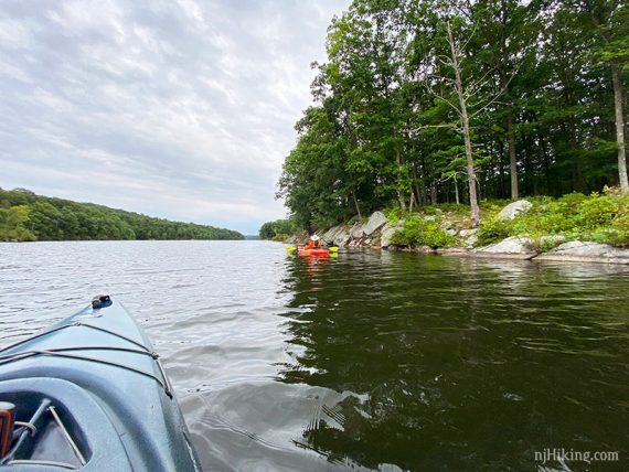
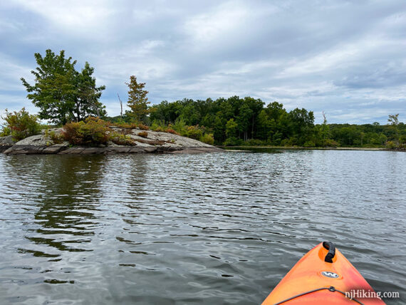
There is a large island roughly half-way down the reservoir that we usually go to the right of it when heading out.
That side is narrower and has more plants and trees to navigate around, especially if the water level is lower.
Keep hugging the shoreline towards the back of the reservoir – or turnaround whenever! There’s a lot of space to spread out away from other boats, too.
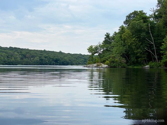
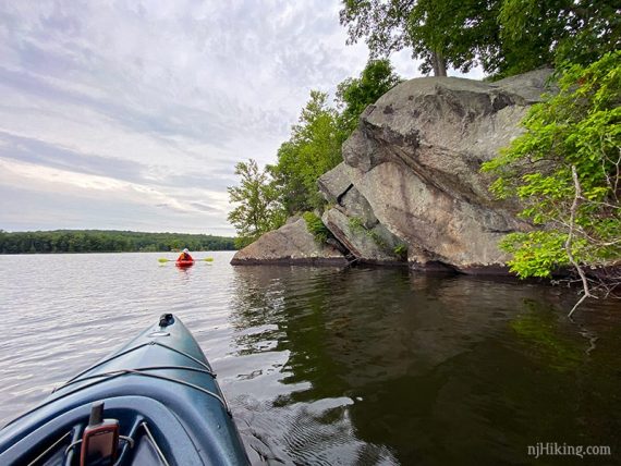
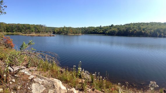
Overall, the first half is more open and tends to have more boats. The further half of the reservoir is the most interesting because it’s dotted with islands and the shore is more rocky.
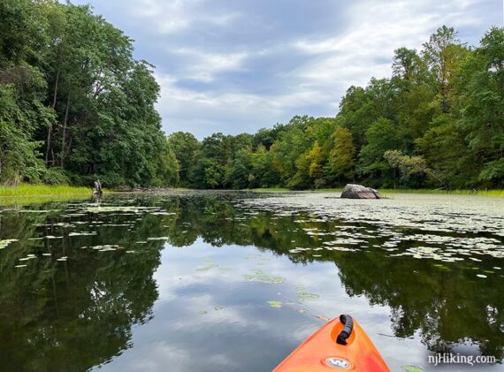
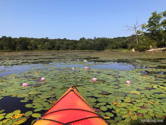
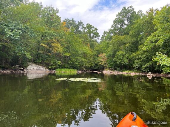
The very end can get thick with lily pads but in August 2020 we could have gotten all the way to land on shore.
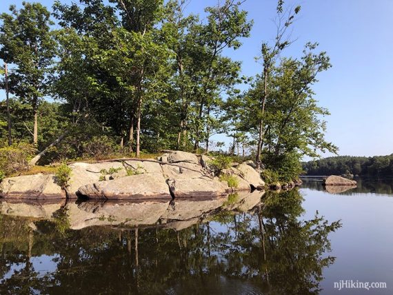
From the end we usually keep following around, now on the west side of the reservoir, and approach where most of the islands are.
Some are small bits of rocks with some vegetation or a couple of trees, others are larger.
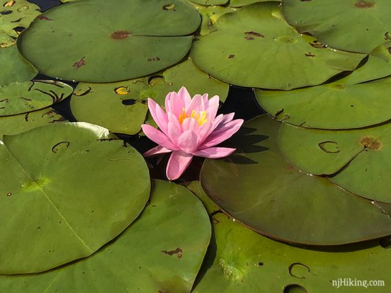
Lots of lily pads around the islands… mostly white but a few pink ones in the mix:
This island has a rocky slope to land on. With lower water the rocks would be at more of an angle getting out of the water.
This island was large enough that it had a faint path around it so we could check out different views.
View looking out on Splitrock Reservoir from the shore of one of the islands.
And around the other side of the island, looking back at the end of Splitrock Reservoir.
From here we usually keep hugging the western shore as we make our way back. There are a few spots along the way that might be suitable to pull off for a break as well.
The rocky shoreline shows how much the water level can fluctuate. 2015:
Eventually pass a tall cliff face with “keep out” signs posted all over it (jumping off the cliff isn’t allowed).
Pass a cove or two back towards the end of the reservoir. Believe this one is the outlet of a stream. Tall power lines and the dam at the far end also come into view.
—
Kayaked 8/17/22. 5.6 miles.
Kayaked 8/6/20. 7.1 miles. w/ the new yaks.
Kayaked 7/27/19. 6.6 miles. Trail Blog: “Kayaking Splitrock Reservoir in July”
Kayaked 8/20/16. 7.1 miles.
Kayaked 9/6/15. 6.7 miles.
Updated: 8/2020 – Re-kayaked. 4/2020: Page refreshed, not re-kayaked. 7/2019: Launch area changes are done, photos added. 4/2018: The launch area was under construction the last time we hiked Splitrock.