
Small county park located in Old Bridge, NJ with a very nice trail system tucked away behind a ball field.
We had no idea this existed until I stumbled on the Middlesex County Parks and Recreation website one day… and found they have map PDFs for all their parks. Nice!
Detailed hike info and directions on our main John A. Phillips Preserve page.
We managed to put a 5.0 mile loop together, and it would be easy to do less if you like. It’s not worth driving from far away to, but if you are in the area it’s a nice close-by park to get an easy hike in.
We often go to Cheesequake for quick hikes, and now we have another option.
5.0 miles. There are several well marked loops, with mileage marked on the park map. We made the longest route we could, without taking out-and-backtrack spurs.
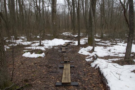
Trail surface is very easy: level and soft pine needles, with boardwalks to cross brooks and wet areas.
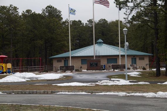
Trailhead: There is a large parking lot surrounded by ball fields, a nice playground, and a restroom building… but we saw no indication that a trailhead even existed here.
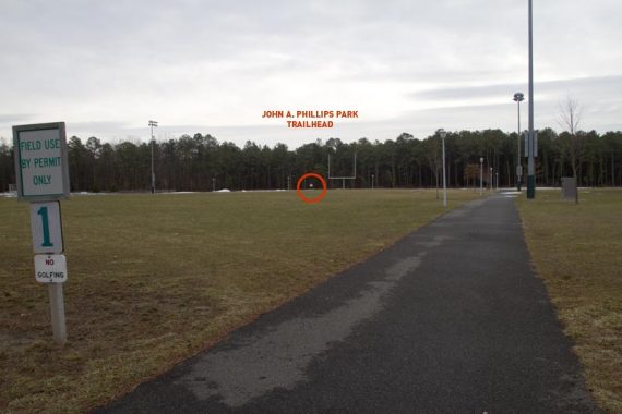
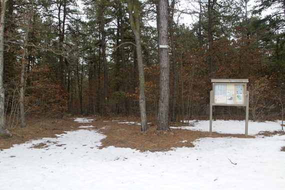
If you are facing the restroom building look off to your right across the football field to see a trail kiosk. Trails are well blazed.
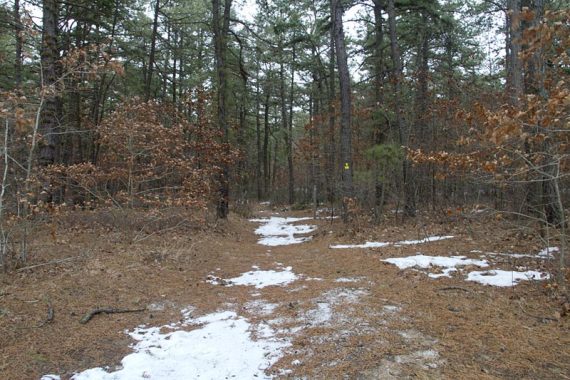
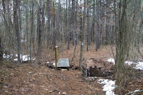
The trail became a little less traveled and more remote after crossing Pleasant Valley Road, with some wet areas to hop w/o boardwalks.
In this section we also ran into snow on the trail in many areas… a surprise after the warm spell and rain we had.
There is no hunting north of Pleasant Valley, while south allows it. As soon as we crossed the road, there were deer stands EVERYWHERE… so during hunting season don’t go to this side unless it is Sunday.
Route: Follow the Nature Trail (YELLOW) trail blazes. It starts to the left and crosses a wide path several times (this is also YELLOW and we used it on our return).
When that ends at WHITE, turn right onto that (Pleasant Valley Trail). At Orange (Blueberry Flats), turn left and follow that loop. Take BLUE (Old Sands Trail) when you hit that. This will take you across Pleasant Valley Road.
Blue ends at the southern portion of WHITE (Pleasant Valley Trail).
Turn left onto WHITE and take that loop (**it is slightly confusing here, we missed a trail section due to a downed tree blocking it and went down the connector trail without realizing at first, so keep an eye on where you are**).
After looping around, stick on WHITE (Pleasant Valley Trail) to the Nature Trail (YELLOW) and follow the straight section back to the trailhead.
This place is awesome and there is NEVER anyone there. Even though you are close to a major highway and many homes you rarely feel like it. There are tons of side trails to explore too if you are inclined to be adventurous. And yes, they do hunt regularly during the season so stay way from the noted section.
I just learned of this place, so I have only seen it in spring. Trails are very level and well-marked, quite easy to hike except for an occasional tree blocking a trail.
In six visits I have seen nobody on the trails.
The park also has a fitness course with stations for exercises, and, a cricket field.
Print a trail map, they run out.
Pine needles and sandy ground make trails soft like a deep carpet – great for older feet!
There are blueberry bushes everywhere, more so along the Blueberry Flats trail. But there are many deer, who eat them unripe, so we shall see what they leave for us.
Pretty nice trails. This was the first place I went with a friend and we spent about 2 hours hiking the outlined trails. Planning on doing it more often at this place