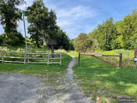
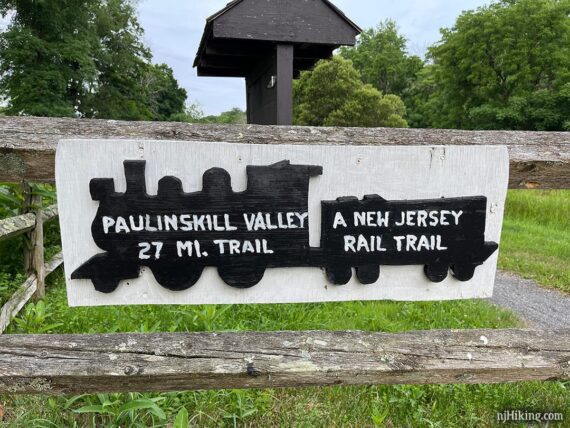
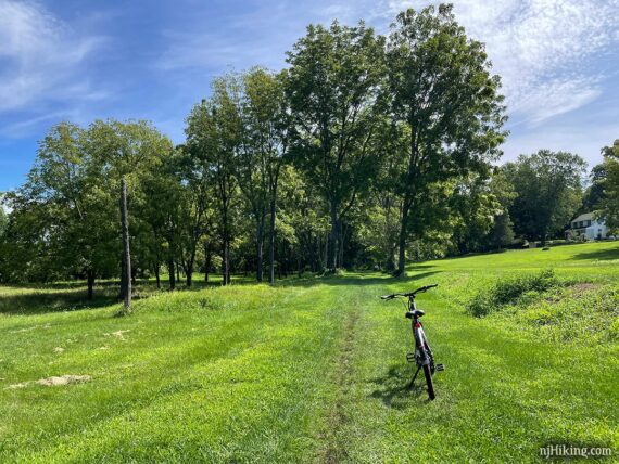
Follow a shady rail-trail along the Paulins Kill river from Cedar Ridge Road to the Paulinskill Viaduct.
26 miles or less, total round trip. Surface is gravel and dirt, ranging from 4-6’ wide to a narrow strip. A few rutted areas that can be deeply muddy. Generally level with minor elevation change.
| 26 miles | This biking guide: Detailed instructions and photos follow below. |
| Shorter | Simply turn around at any point. |
| Longer | Guide for the other section: Paulinskill Valley Trail – Warbasse Junction to Cedar Ridge |
| Nearby | Great Valley Trail Loop; White Lake; White Lake Kayak; Kittatinny Valley State Park; Lake Aeroflex Kayak Swartswood State Park; Swartswood Grist Mill Trail; Jenny Jump – Ghost Lake; Jenny Jump Trail. |
Our two cents:
Shady rail-trail with a variety of scenery – forest, large bridges, a small airport… and a huge viaduct!
Can be muddy – avoid after heavy rain. Combine with Sussex Branch and Great Valley Rail Trail for even more options. Trail is shared with horses.
For biking, the Paulinskill Valley is rougher and can be more rugged than compared to other New Jersey rail-trails like the Columbia Trail or the D&R Canal Towpath. Recommend hybrid or mountain bikes – road bikes are probably not a good idea.
For hiking/trail running, this is an easy surface, mostly level, and its straight out-and-back so no navigation required.
The entire Paulinskill Valley Trail is 27 miles one-way, though each end might be a bit unkempt and unridable, reducing mileage. Neither of our guides go all the way to the very end.
Updated: 7/2024 – Re-biked, minor edits, added a few photos.
What type of bike to use for rail-trails?
Overall, a hybrid bike is good. This bike type works for flat dirt trails as well as asphalt (but maybe not on true mountain bike trails).
Gravel bikes and mountain bikes are good for rail-trails. A road bike might be alright. Skinny tires are not ideal unless it’s paved, and even then there might be the occasional buckled asphalt from roots.
Currently, we love our chain-less, no maintenance Priority 600 bikes for all fun and no fuss. If you’re new to biking and don’t want to commit, try renting, Craigslist for used, or start with an inexpensive bike.
Related: NJ Bike Trails overview page.
Parking: N41.02518° W74.86324°
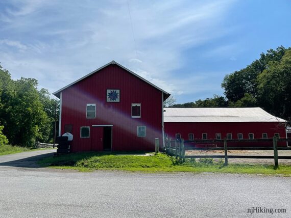
Paulinskill Valley Trail, 928 Cedar Ridge Rd, Newton, NJ 07860. Small dirt lot along Cedar Ridge Road across from a red barn. Note that this street address is for the parking area but also a house and buildings in the area.
Multiple other access points, see maps. Note that parking at the other end of this route along Station Road is permit only (near the viaduct, not used in this guide).
Restrooms:
Nothing at the trailhead or not many stores nearby (on our approach these is a super QuickChek about 20 min. from the trailhead). Portable toilet at Footbridge Park (as of 7/2024).
Biking Info:
Trail Maps/Books:
Trail maps linked above. Follow along on your smartphone with our Interactive Map link above. Our map shows the entire Paulinskill Valley Trail.
This is managed by Kittatinny Valley State Park but doesn’t appear on their trail maps.
Appears in Rail-Trails New Jersey & New York which contains a map and description of the whole trail, with parking lots noted.
Refreshments:
Passed on the route: Blairstown has a diner, market, etc. which can be accessed via Footbridge Park, and a cafe at the Blairstown Airport.
We’ve never stopped at any of those, however, as we usually pack a picnic lunch. There are covered tables at Footbridge Park and a benches at the last two road intersections near the turnaround point.
The Details:
0.0 – Start following the Paulinskill Valley Trail through the break in a fence and immediately runs next to water. [The Paulinskill Valley also continues in the other direction, across the road and next to the barn].
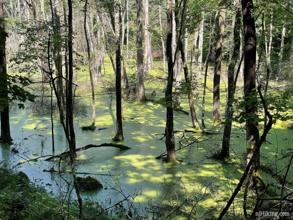
A section of deeper water with trees growing out of it.
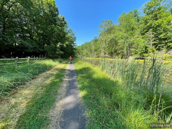
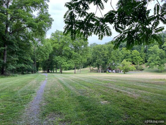
Continue following the Paulinskill Valley Trail as it passes an open area with a house off on the right.
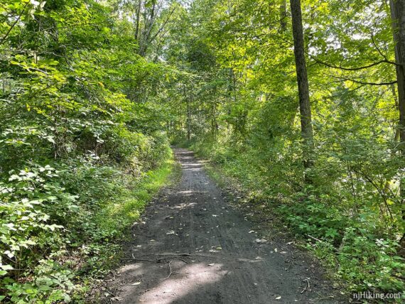
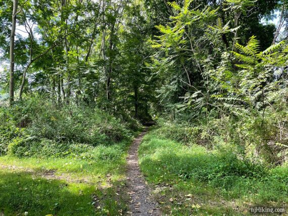
The surface of the Paulinskill Valley Trail ranges from wide to narrow single track with grass on either side. There is an occasional gate to ride around.
The trail can also have deep ruts that get muddy with a lot of rain. The sections are usually short but can be annoying. And we have encountered some serious mud on this section of the trail (photo is 8/2021).
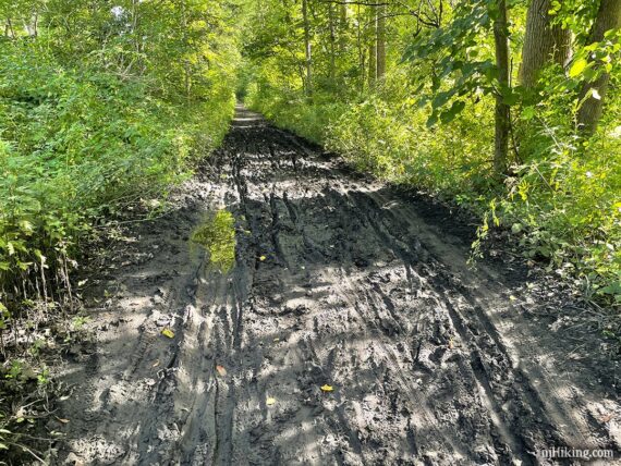
The conditions were dry on our last ride (7/2024) and the mud we encountered was minimal. However we’re wondering if they had put something down on the trail in this section.
When we stopped at the bridge I noticed the water bottle on my bike frame was covered in a black grit. I wiped the dirt off the nozzle like usual but realized the black wouldn’t come off my hand or shirt – never a good sign – so I unscrewed the cap to drink from then on. Anyway, heads up just in case.
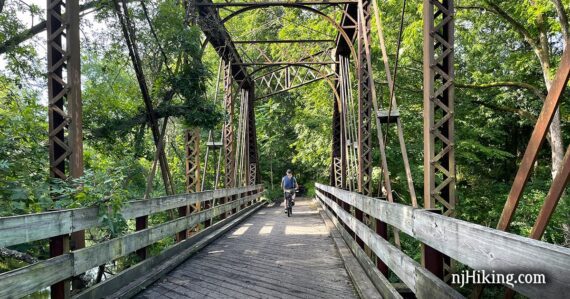
2.8 – Continue over a large bridge, the first of several along this section of the Paulinskill Valley Trail.
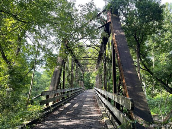
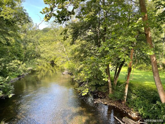
The trails runs along the Paulins Kill, seen from the bridge.
Fun Facts: Find out how Len Frank lead a grassroots conservation effort to the turn the former railway into a recreation trail.
3.5 – Cross Spring Valley Road, which should have room for a couple cars.
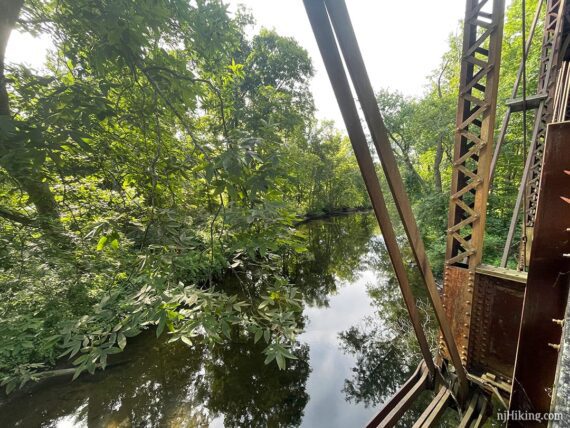
4.7 – Cross another bridge with views of the Paulins Kill.
Cross another bridge which had short metal sides I couldn’t see over and was covered with graffiti. Then there’s another one soon after.
6.5 – Go under the Rt. 94 overpass and through a parking area.
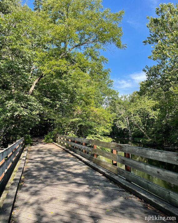
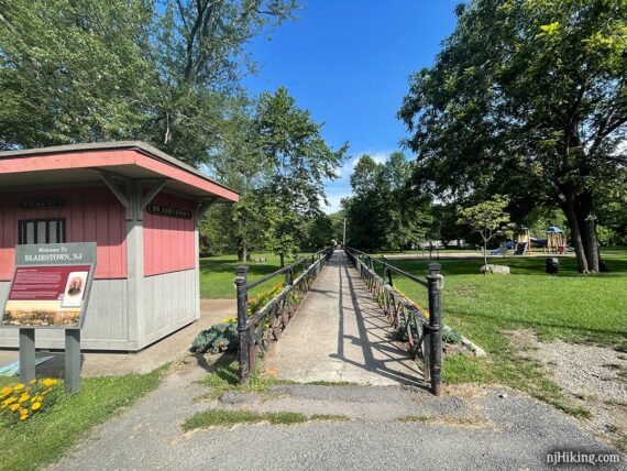
6.7 – Arrive at Footbridge Park. There’s a large parking lot, covered picnic tables, grassy area and playground, and portable toilet.
The little building has historic photographs and the long bridge leads into Blairstown where there is a diner and market etc. Head through the parking lot to the far end for the continuation of the trail.
Fun Fact: Scenes from Friday the 13th were filmed on Blairstown’s Main Street and at the diner. [Source: Blairstown, New Jersey on Wikipedia].
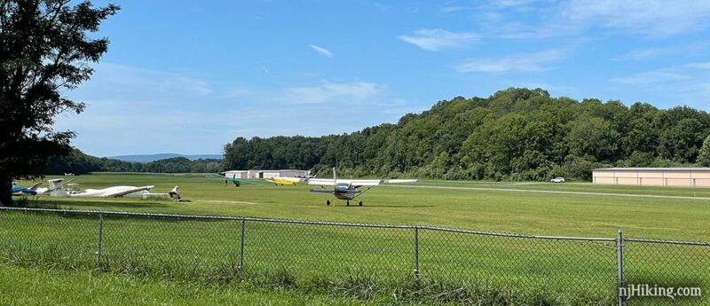
8.6 – Arrive at Lambert Road, facing the open field of the Blairstown Airport. This is a break in the Paulinskill Valley Trail. There was no indication for what to do here or sign for the trail.
Turn LEFT and ride down Lambert Road. There is a strip of grass but not much, if any, road shoulder but the road was newly paved. Make the first RIGHT onto the airport driveway, Airport Road. There is a sign for the Airport Cafe but not for the airport.
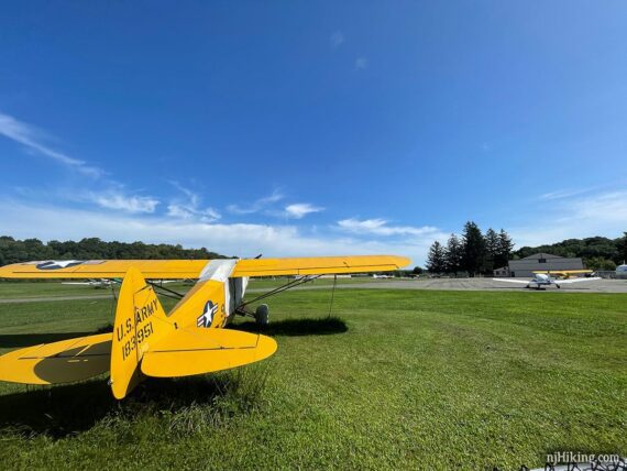
8.9 – Continue through the airport on the paved driveway where you can watch planes land and take off, plus there is a cafe.
9.2 – Continue past the airport along the driveway, following the chain link fence. The driveway turns RIGHT and then LEFT after the main part of the airport. Now the trail continues on grass for a bit.
Continue following the Paulinskill Valley Trail, crossing a few streets. The trail narrows in places.
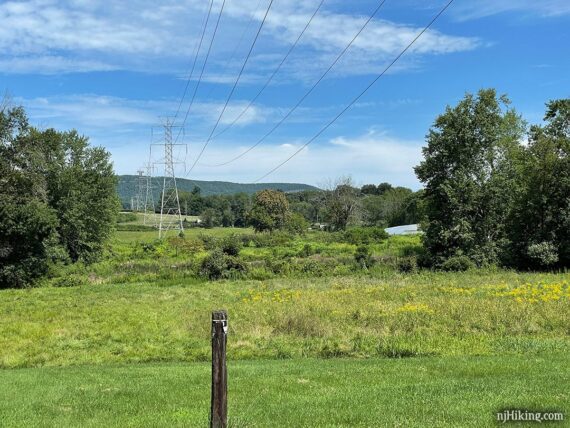
Cross open grassy areas and a power line with views of the Kittatinny Ridge in the distance.
Tons of great hikes run across that ridge in the distance such as Sunfish Pond and Raccoon Ridge.
12.6 – Arrive at Station Road. This is another break in the Paulinskill Valley Trail with no signage to indicate where to go next.
There is a small pullout with room for a few cars (which should be a permit parking area but it’s not clear – there is a sign on the road but not at the pullout). Off on the right is a bridge.
Turn LEFT and follow Station Road either on the grass on the left, or the road (but there’s not much room along the guardrail).
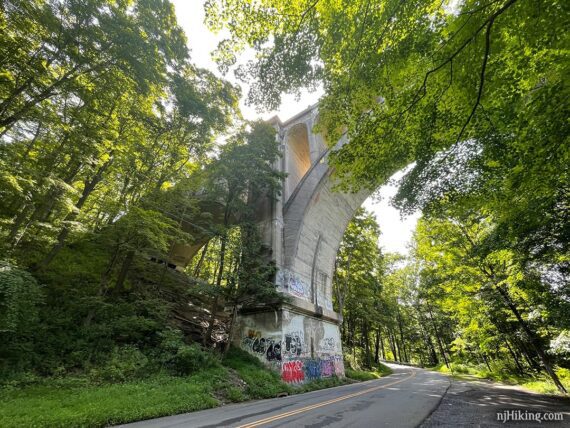
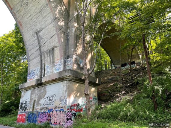
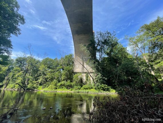
Arrive at the massive Paulinskill Viaduct, looming far overhead. There is a small pullout on the right (parking permit needed here as well, but also not clear).
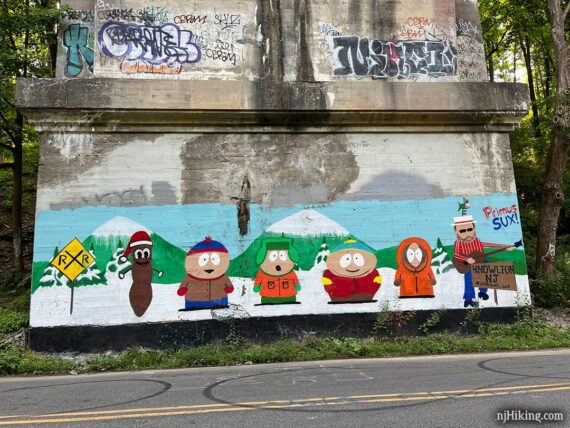
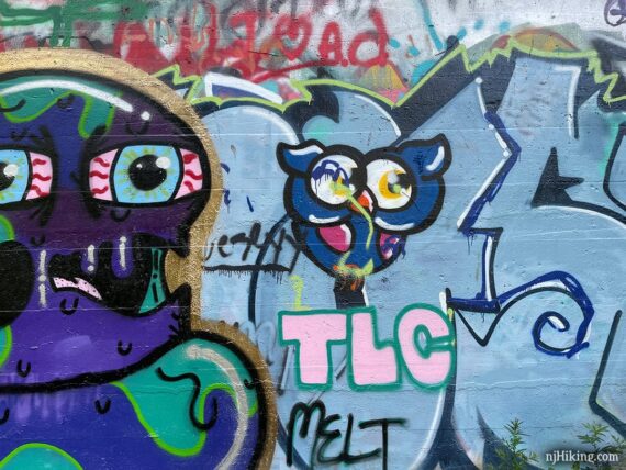
There’s graffiti everywhere. Much of what was here in 8/2021 was the generic scribbles we normally encounter on trails but at least some had a little more effort put into it.
The graffiti had changed dramatically by our 7/2024 ride. Much is by the same person and is of higher quality than what was here before, with large murals covering the old random scribbles. There is much more than we’re showing here and I didn’t update all the photos.
Now a huge South Park scene is on the span across the road.
Fun Facts: The Paulinskill Viaduct, also known as the Hainesburg Trestle, was built in 1910 by the Delaware, Lackawanna & Western Railroad and was in use until 1978. The tracks were removed soon after.
The seven arches span 1,100 feet and are 115 feet above the Paulins Kill river. At one time it was the largest reinforced concrete structure in the world. [Source: TrailLink]
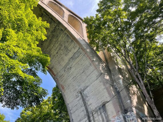
Walk towards the other base of the viaduct to check out river. Fun Fact: A viaduct is a specific type of bridge consisting of a series of arches and columns that supports a long elevated railway or road [Source: Wikipedia].
The other base of the arch now has a mural of a Roman aqueduct (bridge to carry water) or viaduct (bridge for a road/railway).
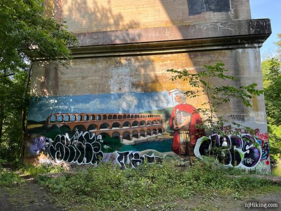
!! NOTE: For those with kids… around the left side of this arch is an adult themed mural tucked behind the overgrowth. So… left side of the base closest to the water, while facing the water. Everything else seemed OK when we were there.
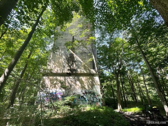
That same arch in 2021:
People used to bungee jump off of the viaduct over the river! Hopefully the water was deeper than in our photo. It’s considered trespassing to climb up into/on the viaduct (even though you can find videos and such online).
Under this arch there is now graffiti of “the old A&P” logo (…???).
Check out “This N.J. rail bridge is beloved by many, but nobody knows what to do with it” for more info, plus historic and aerial photos of this impressive structure.
This was behind the base of the viaduct near the water on 8/2021 but is now a different mural.
The viaduct makes for an obvious turnaround point, but the Paulinskill Valley Trail continues for about another mile until ending at Brugler Road (we haven’t done that section – felt there was no reason to continue just to turn around, and think it might be rough/overgrown).
// Longer: Once back at the parking lot, you can continue further in the other direction – head past the barn and follow our guide in reverse: Paulinskill Valley Trail – Warbasse Junction to Cedar Road.
—
Biked 7/4/24.
Biked 8/15/21.
Biked 6/20/21. Partial, extended the upper section past Cedar Road.