How to visit New Jersey’s highest waterfall, Buttermilk Falls.
Buttermilk Falls is mere steps away from a parking lot and requires no hiking to see it. A set of elaborate stairs can be climbed to get views from the side and top of the waterfall.
| ~0.2 miles, to top of stairs | This guide: Detailed instructions, photos, and video follow below. |
| Nearby, same lot | 1.5 – Silver Spray Falls (Hidden Falls) 7.2 – Buttermilk Falls, Crater Lake, Hemlock Pond |
| Alternate/Winter | Walking Mountain Road from: 4.2 total, round trip – Walpack Cemetery; noted below. 3.2 total, round trip – Haneys Mill Road; noted below. |
| Nearby | Tillman Ravine, Van Campens Glen; Millbrook Village and Van Campens Glen; Blue Mountain Lake Loop; Appalachian Trail – Crater Lake to Blue Mountain; Crater Lake and Hemlock Pond Loop. |
Our two cents:
Consider combining a stop at Buttermilk Falls with Silver Spray Falls and/or a short hike at Tillman Ravine on the way.
From the top of Buttermilk Falls you can continue up on the BLUE (Buttermilk Falls) trail, but be aware it is very steep right from the start and much more than a stroll in the woods.
Walk up access to the waterfall means the area could get crowded. The parking lot right at the falls cannot be driven to in winter as noted below.
Note! There are other Buttermilk Falls in New Jersey. This one is located in the Delaware Water Gap National Recreation Area in Layton, New Jersey.
Updated: 3/2026 – Minor edits; not re-hiked.
Hike Info:
Map:
Kittatinny Trails map set covers the area or use the map on the park site. Follow along on your smartphone with our Interactive Map link above.
How to get to Buttermilk Falls
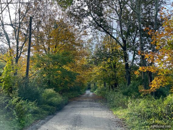
Buttermilk Falls is on Mountain Road between Walpack Cemetery and Haneys Mill in Layton, New Jersey and is within the Delaware Water Gap National Recreation Area.
There are several approaches which can vary due to closures for winter or road/bridge damage. Road names may vary depending on map source, and they aren't always marked on the road.
We've provided a coordinate link for the parking lot and an address for a GPS – but the actual approach will depend on where you start and any closures in effect.
Check the Delaware Water Gap park site (link above) for current road closures before setting out.
Parking: N41.13702° W74.88917°
Buttermilk Falls Trail Parking, Mountain Road, Layton, NJ 07851. This is a park road and doesn't have a street number. This phrase entered into Google Maps should work.
!! DOUBLE CHECK the route that Google (or other navigation) is directing. While this is the correct coordinate link and address of the parking lot on Mountain Road, Google etc may direct incorrectly, especially if it thinks a road is still seasonally closed. It may instruct to park on an adjacent road and walk through woods without a trail - do not do this!
Winter: Buttermilk Falls is usually a short stroll from the parking lot – except during the winter. Mountain Road is one of the roads in the park that are closed to vehicles from January 2 (or at first significant snowfall) until April 15 (open date may vary).
If Mountain Road is closed to vehicles you can walk down the road to access the falls. Park at Walpack Cemetery or at the other end, Haneys Mill Road. Other roads may be closed before this which affects where you can park.
Mountain Road / Parking Lot
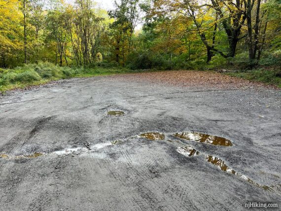
Mountain Road is a dirt/gravel road that has bumps and potholes, possibly deep ones. It's usually fine with a regular car if you take it slow – but if you tool around in a really sweet ride you may want to have someone else drive :) or park at either end and walk down Mountain Road to the falls.
Approaching from either direction on Mountain Road, turn into the parking area for Buttermilk Falls:
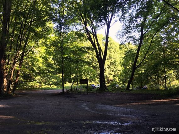
The dirt lot for Buttermilk Falls often fills to capacity and may be wet or muddy. An empty lot in early morning:
Restrooms:
None at the parking lot. If you approach from Rt. 206 to Tilman Road to Walpack Cemetery, you’ll pass outhouses at the two Tillman Ravine parking lots on Tilman Rd.
If you approach from another direction that passes Millbrook Village this has restrooms in season and possibly portable toilets otherwise.
Related: Waterfalls in NJ / Best Waterfall Hikes in NJ
Checking out Buttermilk Falls
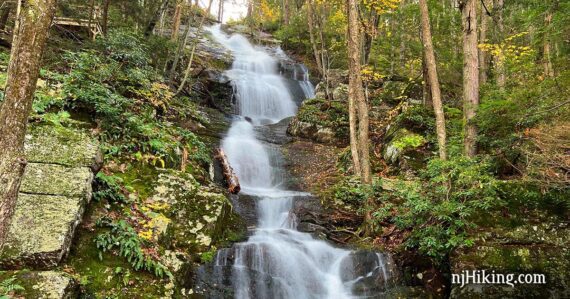
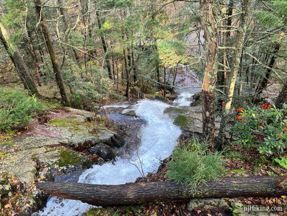
From the parking lot or Mountain Road, just mosey on over to Buttermilk Falls. The tall waterfall is nestled in an rock alcove just off the road.
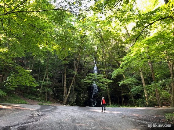
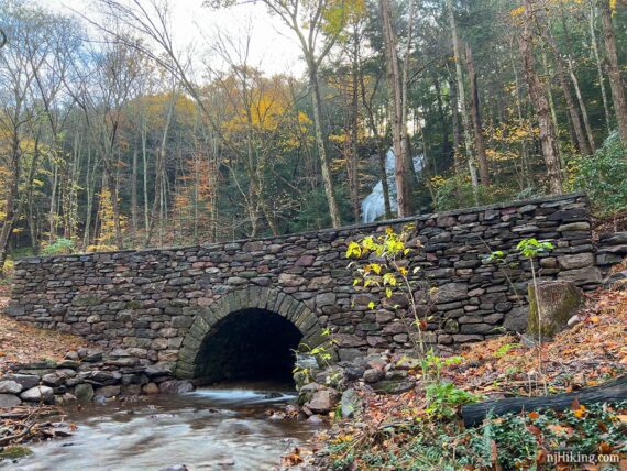
Water collects into a very shallow pool in front of the falls after tumbling over moss covered rocks. It then flows under a nearby bridge and continues in a small stream next to the parking lot.
Abundant rhododendron line either side of Buttermilk Falls. To the left of the falls is a staircase, just visible in this photo.
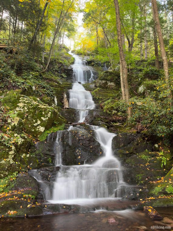
Buttermilk Falls is most impressive after recent heavy rain.
How high is Buttermilk Falls? Sources vary and have changed over the years… the newest is a geographic survey pegging it at 130’ tall. Older sources spec it at 75 to 85 feet, while the book Kittatinny Trails (2007) and a few others have it at 200′ feet. You’ll just have to visit and see what you think it is!
So… is Buttermilk Falls the highest waterfall in New Jersey? Technically, there are two taller waterfalls: 250′ Greenbrook Falls and 200′ Lost Falls, located in The Palisades. Both are multi-tiered, with the biggest drop at only 80-85′, and are hard to view in their entirety – so Buttermilk Falls is considered the tallest.
Buttermilk Falls can dwindle to a trickle during dryer conditions but with delicate streams of water cascading over the tall rock face the falls are pretty in any season.
Fun Fact: There used to be a house/mill to the left of Buttermilk Falls, where the stairs are today. The mill can be seen in this old photo posted by Sussex County Excursions.
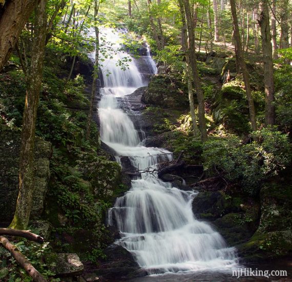
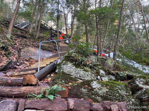
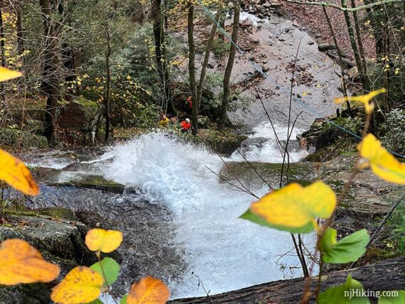
Optionally climb the steep stairs for more views of the falls from the side and top. Search and Rescue teams were training at the falls when this photo was taken (10/2019).
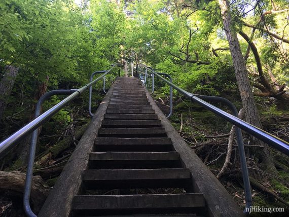
The stairs don’t really hang over the falls or get that close to edge for anyone that is wary of that. Looking up one section of the stairs:
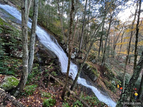
From the stairs get side views of the water rushing down the rock face at a steep angle.
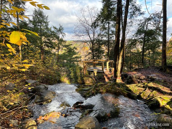
At the top is a wooden platform hanging out a bit over the water. From here you can look right down Buttermilk Falls.
Closer look at the falls rushing over the rocks, along with the search and rescue team training below. It was neat getting to see them in action.
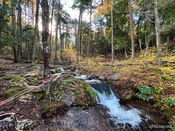
Beyond the top viewing platform is small cascade at the top and a bridge beyond it. The BLUE (Buttermilk Falls) trail continues over this bridge and soon climbs uphill – steeply – but this is the turn around point for this guide.
From the wooden bridge, looking back at the top viewing platform at the edge of the falls and the stream:
From the bridge or viewing platform, return down the stairs to the parking lot.
—
Hiked: 10/1/23. Falls only; with Silver Spray; Stony Lake and Falls
Hiked: 10/31/21. Falls only; with Tillman Ravine and Van Campens Glen.
Hiked: 6/22/19. Full Buttermilk, Hemlock, Crater route.
Hiked: 4/10/16. Silver Spray Falls and Buttermilk Falls only, for photos.
Hiked: 6/15/13. Trail Blog: “Buttermilk Falls, Crater Lake and Hemlock Pond Loop“
Hiked: 10/4/09. Trail Blog: “Buttermilk Falls, Crater Lake, Hemlock Pond… and a bear hiking the AT“
Hiked: 4/10/06. Trail Blog: “Buttermilk Falls to AT to Crater Lake and Hemlock Pond“