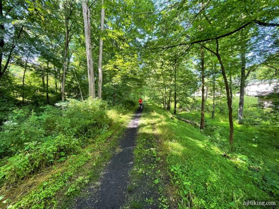
Shady rail-trail through rural New Jersey, along farms and the Paulins Kill river, from Warbasse Junction to Cedar Ridge Road.
22 miles or less, total round trip. Surface is gravel and dirt, ranging from 4-6’ wide to a narrow strip. A few rutted areas that can be deeply muddy.
| 22 miles | This biking guide: Detailed instructions and photos follow below. |
| Shorter | Simply turn around at any point. 11.6 total round trip – To the first bridge out, noted below. |
| Longer | The trail continues. Guide for the other section: Paulinskill Valley Trail – Cedar Ridge to Aqueduct |
| Alternate, same lot: | Great Valley Trail Loop |
| Nearby | Kittatinny Valley State Park; Mahlon Dickerson/Beaver Brook to Lost Lake; Swartswood State Park; Swartswood Grist Mill Trail; Lake Aeroflex Kayak. |
Our two cents:
Nice-n-shady with many access points to change it up. Can be combined with Sussex Branch and Great Valley Rail Trail for more options. Avoid after heavy rain. Trail is shared with horses.
Generally level with minor elevation change – slight uphill in the beginning from Warbasse Junction then downhill so on the return while technically uphill most of the way then down at the end… it’s minor.
Street crossings are more frequent in the beginning. Some have a brief up or downhill to them. Two missing sections require a brief detour down an embankment – described below.
For biking, the Paulinskill Valley is rougher and can be more rugged than compared to other New Jersey rail-trails like the Columbia Trail or the D&R Canal Towpath. Recommend hybrid or mountain bikes – road bikes are probably not a good idea.
For hiking/trail running, this is an easy surface, mostly level, and its straight out-and-back so no navigation required.
The entire Paulinskill Valley Trail is 27 miles one-way, though each end might be a bit unkempt and unridable, reducing mileage. Neither of our guides go all the way to the very end.
Updated: 10/2025 partially re-biked with GVT loop. 6/2025 – minor edits. 7/2024 – Re-biked, minor edits; restroom availability. 4/2024 – Created new, more detailed guides for each half of the trail.
What type of bike to use for rail-trails?
Overall, a hybrid bike is good. This bike type works for flat dirt trails as well as asphalt (but maybe not on true mountain bike trails).
Gravel bikes and mountain bikes are good for rail-trails. A road bike might be alright. Skinny tires are not ideal unless it’s paved, and even then there might be the occasional buckled asphalt from roots.
Currently, we love our chain-less, no maintenance Priority 600 bikes for all fun and no fuss. If you’re new to biking and don’t want to commit, try renting, Craigslist for used, or start with an inexpensive bike.
Related: NJ Bike Trails overview page.
Parking: N41.08519° W74.69973°
Paulinskill Valley Trail Parking, Lafayette, NJ 07848. Warbasse Junction lot is a small dirt parking area that can fill up. Multiple other access points, see maps.
If approaching from Rt 206N through Newton, turn right onto 94N. Right on Warbasse Junction Road (Route 663). Half mile to the lot on the right.
If approaching from Rt 80 W, take 15 N through Sparta. Turn left onto 94. Left on Warbasse Junction Road (Route 663). Half mile to the lot on the right.
Restrooms:
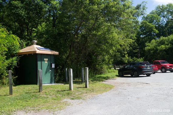
Portable toilet at Warbasse Junction Road lot (it’s next to the now closed composting toilet in the photo) but there also a Quick Chek about 5 minutes from the trailhead.
Note: There is no longer a portable toilet available mid-way through this route (locked as of 7/2024).
Biking Info:
Trail Maps/Books:
Trail maps linked above. Follow along on your smartphone with our Interactive Map link above. Our map shows the entire Paulinskill Valley Trail.
This is managed by Kittatinny Valley State Park but doesn’t appear on their trail maps.
Appears in Rail-Trails New Jersey & New York which contains a map and description of the whole trail, with parking lots noted.
Refreshments:
Accessed right from the Paulinskill Valley Trail… at around 2 miles into this route is Cafe Serendipity but we’ve never tried it. Angry Erik Brewing is also early in this route so it’s perfect to hit on the way back (or drive over afterwards). There’s even a “Paulinskill Ale” named for the trail.
Multiple stores when approaching the trailhead via Rt. 206 or Rt. 15.
Trail Surface:
The surface of the Paulinskill Valley Trail ranges from wide to narrow single track with grass on either side.
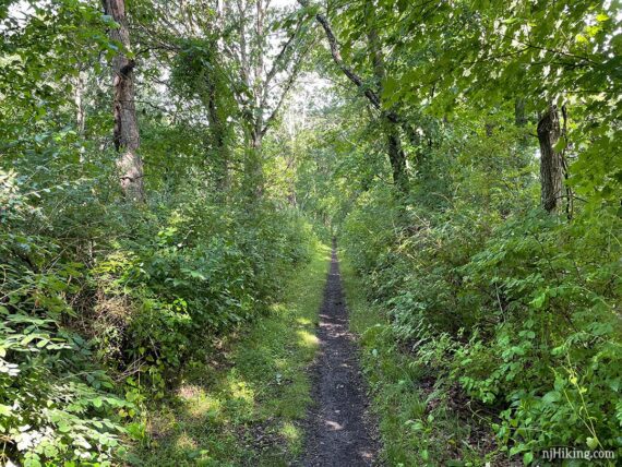
The Paulinskill from Warbasse Junction parking was resurfaced in 2025. It appears in photos like it might be loose or sandy but it’s a hard packed gravel-ish surface. The trail appeared widened as well.
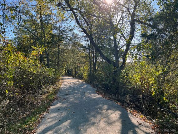
This makes a BIG difference – smoother, no ruts or mud, and we were zipping along faster than we’d ever had here. I forget to note where the resurfacing ended but believe it went at least as far as the Rt. 206 crossing.
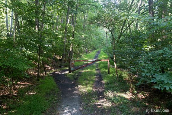
There is an occasional gate to ride around.
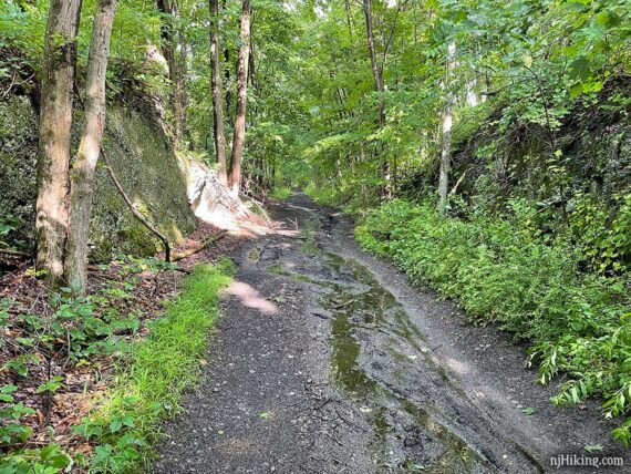
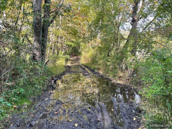
The trail can also have deep ruts that get muddy with a lot of rain. The sections aren’t usually too long but they can be a little thick to trudge through.
However, we have encountered some serious mud on occasion. Like when we hadn’t taken into account that while there hadn’t been rain where we live, this area had gotten a lot. Oops. But if they continue resurfacing that should take care of areas like this.
Route Details:
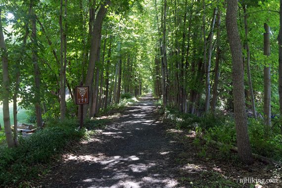
0.0 – Start following the Paulinskill Valley Trail around the gate near the trail signs. [Across the road is also Paulinskill Valley for a short distance before it intersects with the Sussex Branch trail].
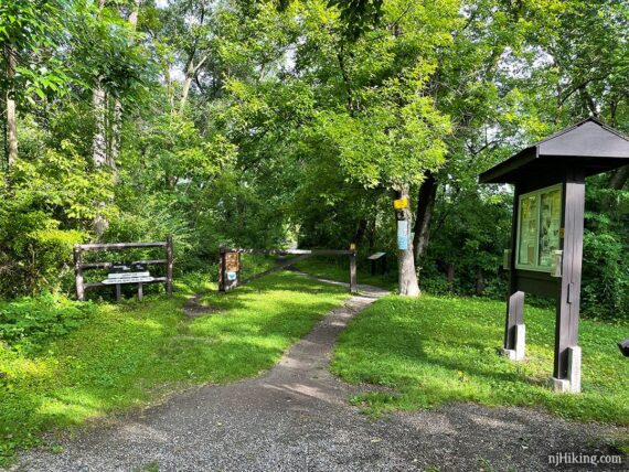
Starting from Warbasse, the first bit of the trail heads uphill slightly, has a little loose gravel, and frequent road crossings.
Fun Facts: The parking area was the location of Warbasse Station – a passenger station, freight house, and milk depot for up to 50 trains daily that ran along the banks of the Paulins Kill, a tributary of the Delaware River. The station was named for the family who’s farm the railroad passed through. [Sources: park signage; history brochure].
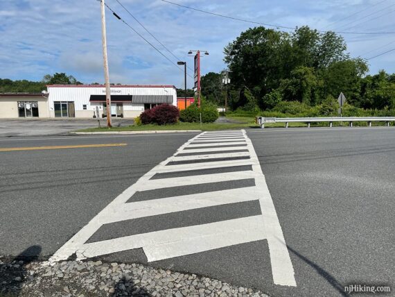
1.8 – Cross Rt. 206. This can be busy and fast moving. A small cafe is across the street, on the left end of the buildings.
Eventually it’s more level and there aren’t as many road crossings.
2.1 – A casual path on the right leads to Angry Erik Brewing (there might be a sign, or look for the red building through the trees. The obvious path goes down wooden steps then back up and around to the right.
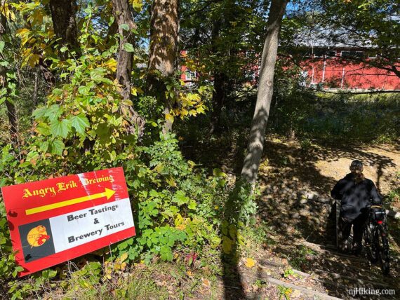
Once at the back of the brewery, head to the left to enter through a gate in the fence to where there are picnic tables, or mosey around to the front. Return to the Paulinskill Valley Trail when ready.
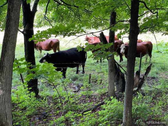
Houses and farms are visible along the way. Possibly spot some cows peeking through the trees from a field adjacent to the trail.
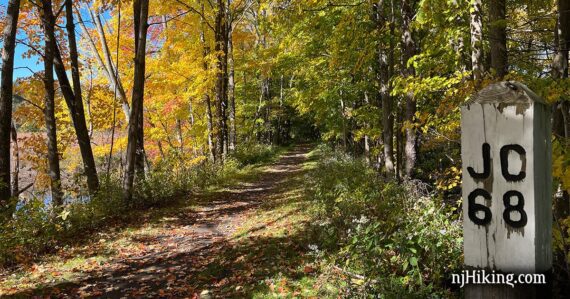
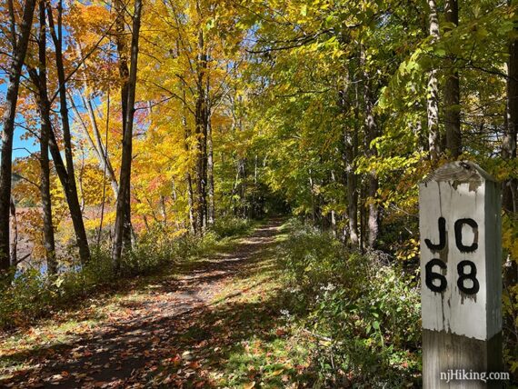
2.8 – Cross Rt. 519. Soon pass a marker post with “JC 68” painted on it.
A rail-trail is basically an old railroad that has been converted for recreational use. Signposts along the railroad would mark the miles to the terminal station. This post indicates “68 miles to Jersey City”.
Fun Facts: The Paulinskill Valley Trail is the location of the New York, Susquehanna and Western Railroad. It was built in 1886 and ran from Columbia to Sparta until 1962 when the tracks were removed. [Source: Paulinskill Valley Trail on Wikipedia]
Soon Paulinskill Valley Trail bears left and crosses a quiet paved road. There’s a pullout on the side of the road with room for one car. Pass around a trail gate.
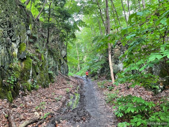
3.2 – The trail passes through several areas with tall rock faces, where the railroad was cut right through. Paulinskill Valley curves to the left.
A country road with the Great Valley Trail beyond that might be spotted through the trees, on the right, as they run parallel to the Paulinskill Valley in this section.
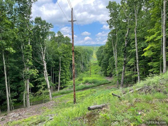
3.9 – Pass a marker post with “JC 69” and almost immediately cross over an unmarked wide path. Cross a power line cut with a view.
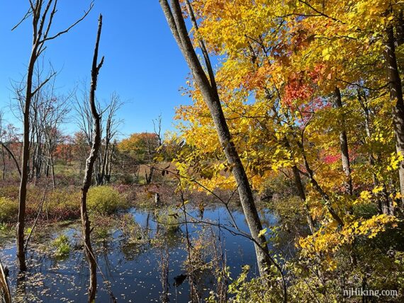
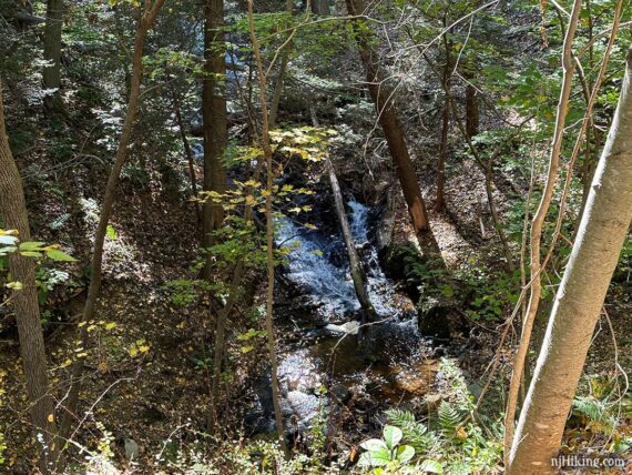
4.9 – Cross Plotts Road and go downhill a bit. Soon a waterfall is on the left, below the trail. This may be harder to see with leaves on the trees, or may be not flowing at all if it’s been dry.
Fun Facts: Find out how Len Frank lead a grassroots conservation effort to the turn the former railway into a recreation trail.
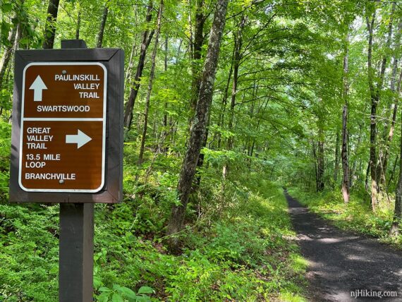
5.4 – Junction with Great Valley Trail. [Paulinskill Valley Trail continues straight ahead.] When last here, there was no sign facing this direction, just in the opposite. [Great Valley Trail to the right makes a loop back but is much more rugged.]
5.8 – First bridge out. This section of the Paulinskill Valley Trail has two bridges that used to go over the road but have been removed.
Both of these require a detour around the missing bridge by walking the bike down to the road, ride the road a bit to cross, and then rejoin the rail-trail.
Getting down to road level is totally doable but not the funnest thing in the world. Keep in mind you’ll do the reverse on the ride back.
// Shorter, 11.6 miles, round trip: If you prefer a shorter trip, this is a non-issue – just turn around at the first bridge out.
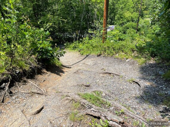
To continue, walk the bike down the short, steep, rooty path. It is steeper than the photo conveys.
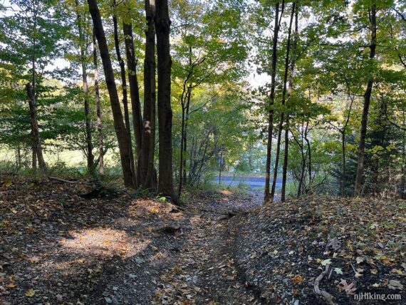
Cross Swartswood Rd / Rt 622. After crossing the road the trail continues through a small parking area.
8.1 – Second bridge out. Turn right and walk the bike down a short dirt path. Turn left onto a paved road and pass a large open grassy area and the end of Paulins Kill Lake.
Cross Rt. 614 to Kohlbocker Road. There is a parking lot for a small park Kohlbocker Road but the last time here we noticed a sign saying it’s private (which explains why the portable toilet is no longer available).
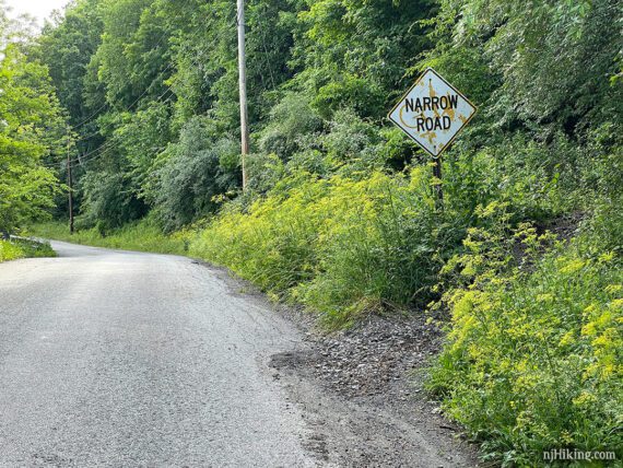
From Kohlbocker Rd. there are several steep paths on the left that lead back up to the rail-trail level but it’s not worth doing that because you’ll need to come down and cross the road anyway. Ride along Kohlbocker Rd. for a half mile and rejoin the trail.
8.6 – Leave Kohlbocker Rd. and rejoin the rail-trail at a gate.
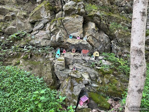
10.0 – Cross Old Station Road (bench is now gone). Small parking area. Soon, spot little houses nestled in the rocks on the left, “Smallville”.
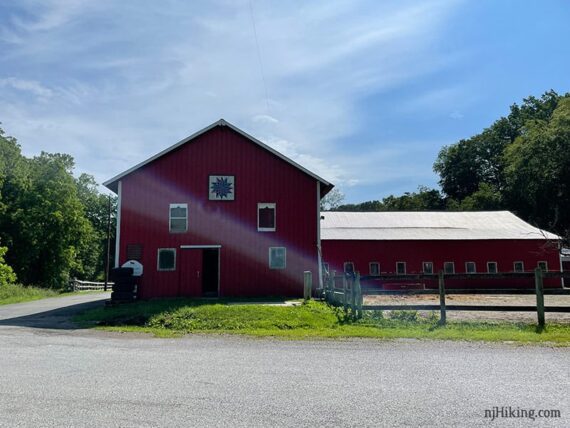
10.9 – Small parking area at Cedar Ridge Road across from a large red barn. Turn around and retrace the route.
// Longer: Or, continue further, see: Paulinskill Valley Trail – Cedar Ridge to Aqueduct.
When heading back from Cedar Ridge Road, there a few things of note on the return trip.
13.3 – Ride down Kohlbocker Rd. again, past the park, then cross Rt. 614. Head back up the path to trail level at the road sign on the right.
15.9 – Keep LEFT where the trail splits just before reaching Swartswood Rd / Rt 622 again. The path straight ahead dead ends at the bridge out. It’s a short section and not a big deal if you miss and have to backtrack.
16.5 – Pass the junction with Great Valley Rail Trail.
19.1 – Pass the JC 68 marker and cross Rt. 519.
19.8 – Side trail to Angry Erik.
20.0 – Cross Rt. 206.
—
Biked 10/4/25. Partial, as part of Great Valley Trail Loop.
Biked 7/27/24. 22.0 Warbasse to Cedar Ridge Rd.
Biked 10/9/22. 16.6 to Kohlblocker.
Biked 6/20/21. 25.7 to past Cedar Ridge Rd.
Biked 6/24/16. 20.2 miles; to old Station. Trail Blog: “Paulinskill Valley Trail – Warbasse Junction to Old Station“.