NJ Trail Maps for parks and trails in the New Jersey region.
We’ve listed the major trail maps below but each of our hike guides also link to the appropriate trail map(s), either from the state/county park site or trail organization.
Excellent trail maps are published by the NY-NJ Trail Conference that cover the majority of Northern New Jersey and New York trails.
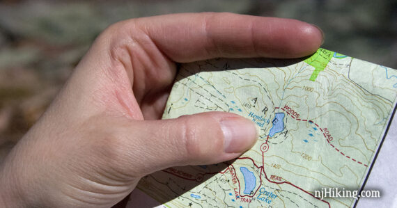
These are detailed topographic maps with trails and parking areas clearly marked on them (example shown in the photo above), and are waterproof and tear resistant.
We use these maps extensively and consider them “must-haves” if you are doing anything more than a casual hike. The various maps are listed below along with links to some hike guides for each area covered.
New Jersey Trail Maps
Morris County Highlands Trails – Feb. 2023
Covers trails across Morris, Passaic, Sussex, and Warren counties and hikes such as Pyramid Mountain and Tripod Rock, Turkey Mountain, Splitrock Reservoir, Wildcat Ridge, High Mountain, Allamuchy Mountain, and Mahlon Dickerson. Formerly titled “Jersey Highlands Trails”.
Northern New Jersey Highlands Trails Map – Dec. 2021
Covers portions of Bergen, Passaic and Sussex counties and is filled with great hikes like Norvin Green – Wyanokie High Point; Wawayanda State Park, Stairway to Heaven, Terrace Pond, Long Pond Ironworks, Ramapo Mountain – Van Slyke Castle, Ramapo Valley County Reservation, Ringwood State Park, and Wallkill River NWR. Formerly titled “North Jersey Trails”.
Kittatinny Trails – Feb. 2021
Covers the northwest corner of New Jersey along the Delaware River that is packed with classic hikes. From Mount Tammany and Sunfish Pond to Van Campens Glen and Catfish Fire Tower along the Appalachian Trail to Buttermilk Falls and Crater Lake and on up to Sunrise Mountain in Stokes and across High Point State Park.
Hudson Palisades Trails – Sept. 2023
Covers the Palisades region of northeastern New Jersey along the Hudson River in Bergen County that runs into New York. Hikes in this map set include The Giant Stairs, Peanut Leap Cascade, Alpine to Huyler’s Landing, Alpine to Forest View, and Tenafly Nature Center and Lost Brook Preserve.
New York Trail Maps
Many are within day-trip range of New Jersey.
Harriman-Bear Mountain Trails – Aug. 2023. See all Harriman & Bear Mountain hike guides.
Sterling Forest Trails – May 2020. See Bare Rock & Fire Tower hike guide.
Shawangunk Trails – 2023. See all Shawangunk hike guides.
East Hudson Trails – 2023. Clarence Fahnestock, Hudson Highlands region.
West Hudson Trails – 2019. Schunemunk State Park, Storm King State Park.
Westchester Trails – 2025. Rockefeller State Park, Ward Pound Ridge, Teatown.
Catskills Trails – 2023. Covers designated trails within Catskill Park.
Old Trail Maps
Historical New Jersey State Forest & State Park Maps
Blast from the past! Park brochures/maps with old photos from the 1960s for Batsto, Cheesequake, High Point, Jenny Jump etc. via Rutgers Special Collections.