The Lemon Squeezer is a rock formation on the Appalachian Trail in Harriman State Park, NY.
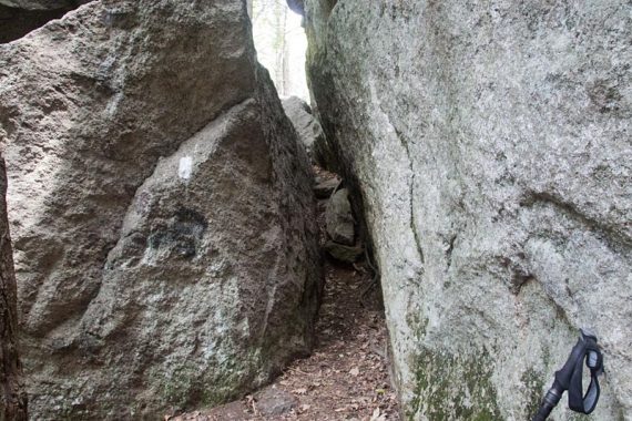
It’s a really interesting and fun section of the trail: The AT goes through an opening created by rocks, then you need to squeeze through a narrow section about 8-10′ long.
After the Squeezer, you can scramble up a rock face, or skirt off to the left and follow the “easy way” sign.
Detailed hike guide is on our main Lemon Squeezer page.
This loop passes by Island Pond, then gets to the Lemon Squeezer.
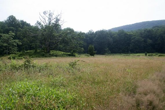
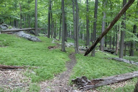
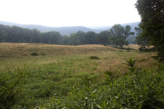
Cross a field from the parking lot to the woods
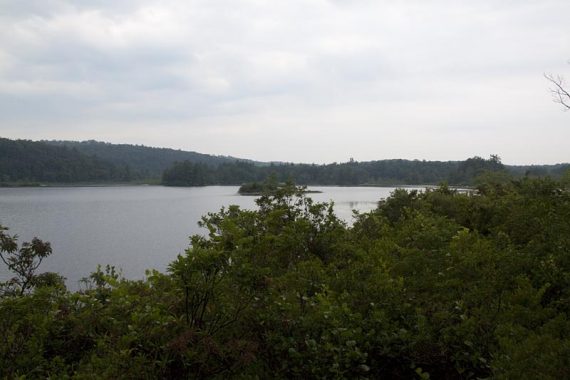
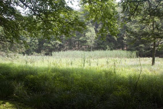
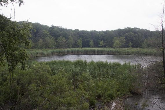
Island Pond:
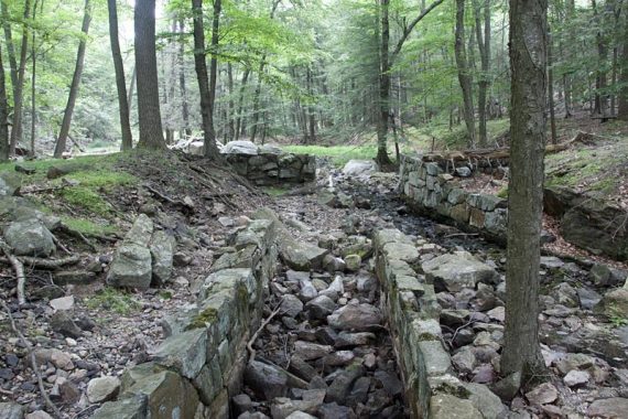
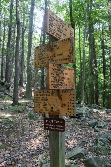
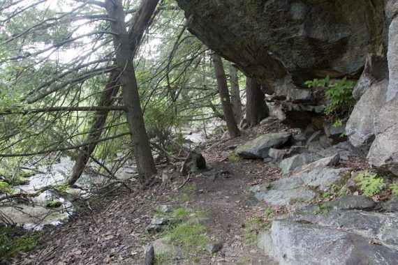
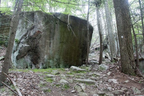
Stonework along the Appalachian Trail
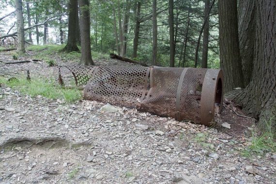
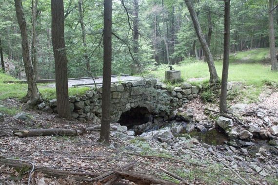
Old gravel sorter along the Appalachian Trail.
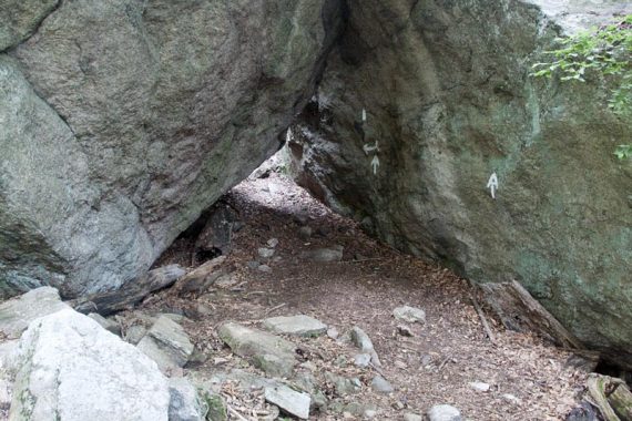
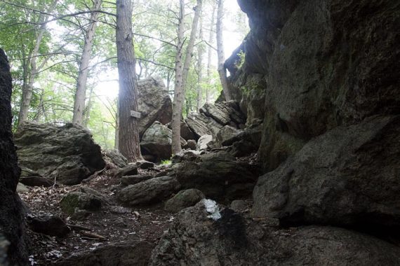
Approaching the Lemon Squeezer
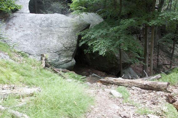
Entrance to the Lemon Squeezer
The section of rock you squeeze through
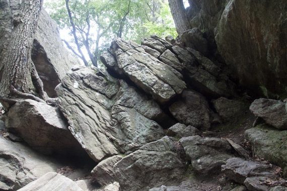
Approaching the scramble section. Note the small sign, it shows the easy way is to the left
The scramble up is harder than it appears – or at least it was harder than I recalled. It’s been a few years, but a guy with a backpack going before us yelled out a few choice words as he went up it so…
It’s taller than it appears in the photo below:
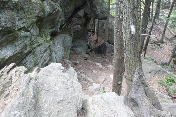
Looking back on the Lemon Squeezer from atop the rock scramble
Decisions, decisions.
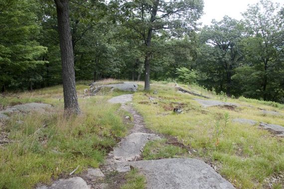
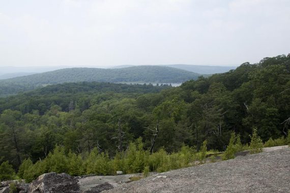
Continue on the AT then loop back on the Long Path near a low, swampy area. The Lichen trail was really overgrown but leads you to a wide rocky face with views to the west.
Views from the Lichen Trail
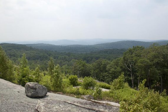
Plenty of boulders to sit and take a break on, and one with a tree providing shade. The trail ends at Ramapo-Dundenberg and continues over these open rock slabs with lots of blueberry bushes.
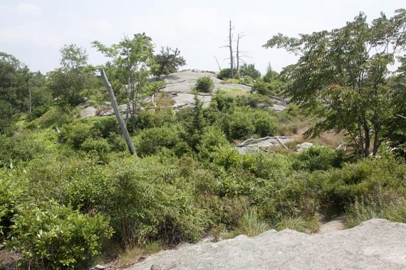
The terrain reminded us a little of being out West.
We started heading back on Dunning (Yellow), which skirts around Green Pond.
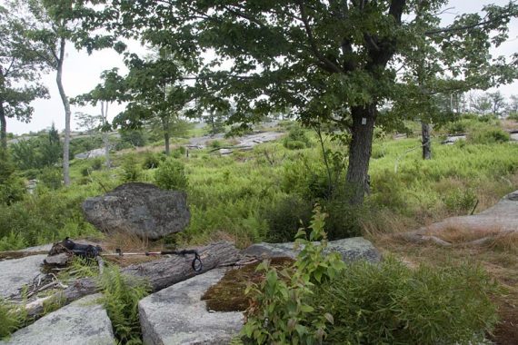
Yellow ends and you pick up Nurian (White) and go through an area with huge rocks called “Valley of Boulders”.
Turn right onto Stahahe Brook trail, which becomes Arden-Surebridge trail. [Update: this bridge was later destroyed in a storm].
Both follow a woods road. It would be more pleasant on this easy stroll back, except for the very loud highway noise.
8.5 miles round trip from the Elk Pen parking lot. Hot and humid, somewhere in the 90s… not great hiking weather for sure. Blueberries were ripe and tasty in areas, mostly where the trail was sun baked and up higher. It’s a little early for them I think – usually late July into Aug.
Route: AT (WHITE) – Long Path (TEAL) – Arden-Surebridge (RED) – Lichen (Blue L on White) – Ramapo-Dundenberg (RED) – Dunning (YELLOW) – Nurian (White) – Stahahe Brook (RED) – Arden-Surebridge (RED)
Map: #119 of the Harriman-Bear Mountain Trails mapset.
Parking – There are many parking areas to access the extensive trail system at Harriman, and you can approach the Lemon Squeezer from a lot of directions. We chose to start at the Elk Pen lot, which is the closest to the Squeezer.
Parkway North to the NY border, pick up the NY State Thru-Way North to exit 15a for 17N. Pass the main entrance to the park and keep going, then turn right on Arden Valley. Cross the bridge over the Thruway, and turn right into the large dirt lot next to a field.
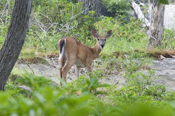
Wildlife spotted: A deer munching on leaves and that could care less that we were standing watching it, and several little lizards.
A friend and I drove an hour and a half and took this hike. it was gorgeous, but we got lost several times by taking wrong turns. The route description could be a bit more descriptive. Also, the trails are not well-marked in many places. A lot of the first half of our trip was spent backtracking and searching for blazes. After the first half, we never found Dunning (yellow), and ended up taking another trail back to a road, where we had to call a cab to bring us back to our car (which ran us $25), because we wouldn’t have gotten back before dark, being 5 miles away. This route would be really nice if it was a lot more descriptive, especially as to where the turns are and where landmarks are so you know you’re heading on the right path. We were really enjoying it until we got lost with the sun going down.
Luke – Sorry to hear you had some difficulties on your Lemon Squeezer hike.
I’d like to just confirm that you were using the detailed hike description page along with a Harriman trail map, and not just relying on the route overview on the blog page?
There is a link on top of the blog entry to a hike page with a detailed description of the route that should be used, along with a trail map.
Great hike ! … I used the Interactive Map from your website on my gps and I am glad I did it. There is so many different trails that is very easy to lose correct path. Advice for other hikers – invest in gps handheld :D
We hiked this 7/1/18 and your instructions were faultless – would not have been able to do it without them. Sometimes the trail is not worn/obvious, especially over the Lichen, and Ramapo-Dunderberg portions over the rock faces. We spread out on occasion to hunt for blazes. The overgrown portions on the way down gave welcome relief from heat in the small pines. The triple blazes for the end of the YELLOW trail are now posted. Really liked the narrow and overgrown Lichen trail and the Boston Mine entrance was swampy and worth a quick exploration.