Hiking to Mt. Misery in Brendan Byrne State Forest.
We tried this hike nearly one year ago to the day but had to cut it short due to snow (see “Brendan Byrne and Pakim Pond in the snow“).
So this time we waited for the snow to be finally gone from South Jersey before we headed down.
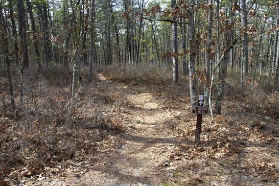
9.9 miles. While long in length, we’d rate this hike somewhere between moderate and challenging. Moderate, since the trail surface is level, and covered with soft pine needles or sand roads.
Route: From Pakim Pond, take Batona Trail (PINK) to Mt. Misery Trail (White). This route follows the entire Mt Misery WHITE trail.
Detailed hike directions on our main Brendan Byrne State Forest page.
Challenging, because it still is almost 10 miles plus we feel it can be easy to get lost here.
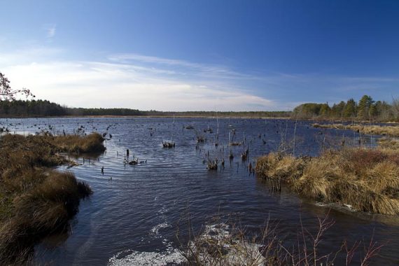
This trail is a great sample of New Jersey’s pine barrens: endless pine, sandy trails covered in pine needles, and cranberry bogs.
It’s also a hike that is more about the journey than the destination:
Mt. Misery is the end point but there is not much to see… just the back of some old, uninteresting buildings. And it’s not even a hill, let alone a mount!
If you’ve never hiked 10 miles but regularly do 7 or 8 (or even 6) mile hikes on the hills and rocks of Northern Jersey, this could still be doable for you.
Where Mt. Misery trail ends at RED, turn left onto RED (this is not entirely clear) and take it back to the parking lot. Eventually RED will be co-joined with Batona Trail (PINK).
NOTE: Pay attention to blazes in this park, and make sure you have a map and compass (or better, a GPS).
There are marked trails, unmarked trails, sand roads, park roads… and endless pine that all looks the same.
And this time, we ran into some hikers at Mt. Misery who were following the Brendan Byrne hike in the older 50 Hikes in New Jersey book.
They were so off track that where they thought they were on the map was actually a couple miles off from where they actually were. (that hike in that book can be confusing) So, please be careful when you hike here.
Also NOTE: The pine barrens in the summer means hot sun and lots-o-ticks. We prefer the barrens in the winter for this reason. Bug spray, sunscreen and a hat if you go in the summer.
Bonus: There is a Wawa just as you get on 72, for pre- or post-hike sustenance. Shorties! (hey, it’s just not south Jersey if there isn’t a Wawa on the corner)