First time hiking at Washington Valley Park.
We were looking to do less driving during the holiday weekend.
I didn’t have a lot of info on the park, it’s not in any of our books, no trail mileages to really gauge the park by… but it was only 30 minutes away so we but figured we’d try it.
Boy was it HOT though …. 95-ish and sunny HHHHOT. The weather has been brutal for hiking lately.
For detailed hike directions, see our main Washington Valley Park hike guide.
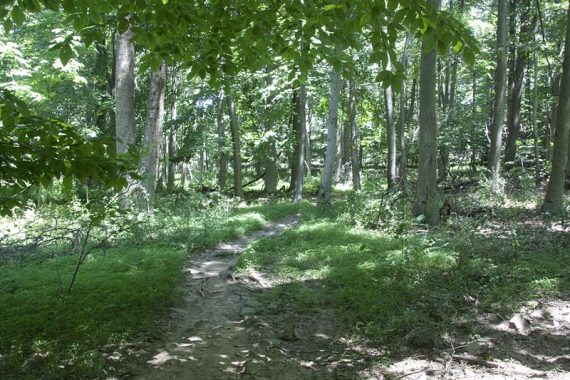
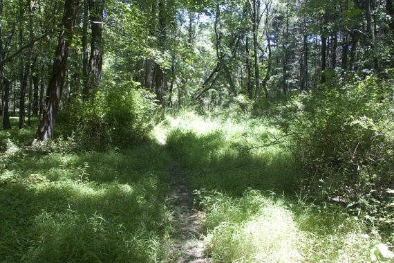
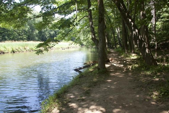
The park was just OK for trail interest and scenery. Other than walking by the reservoir on the RED trail… not too much to see. The hawk watch looks over a quarry.
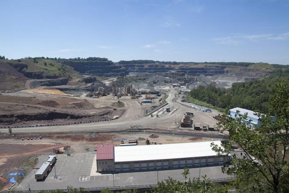
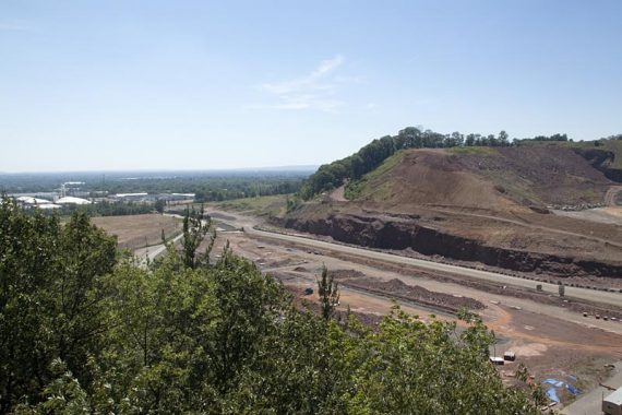
While interesting… it’s not the best view. It’s certainly decent for a park in Central NJ, but it lacks ooomph.
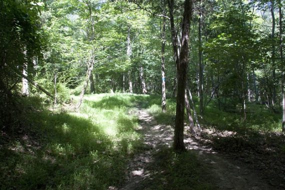
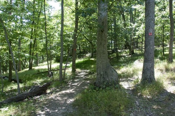
This is a biking-allowed park and the trails are geared as such… some seemed to twist around more than needed.
We find that a bit tedious to hike, but since there are fewer parks available for bikers than hikers in NJ… it’s not really a complaint… just an observation.
Slight road noise throughout the park… you are never far from a road.
9.5 miles roundtrip (8.8 if we hadn’t got off track a bit) – easy to moderate trail surface. Hard-packed and rocky, but with loose, smaller rocks… easy to slide on. Minimal elevation changes.
Route: The park is split into sections but connectible by crossing roads.
We first did the BLUE trail from the parking lot on Newman’s Lane (2 miles), then from the lot again, we took the RED trail along the Reservoir, crossed Chimney Rock Rd. to the ORANGE trail to Gilbride Road to the YELLOW trail.
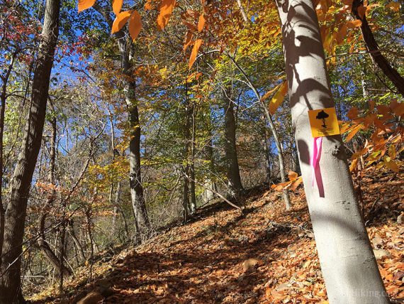
The trails are somewhat confusing: there are ‘inner’ and ‘perimeter’ loops for each trail color, denoted by square signs (perimeter) and circle (inner).
There are also “connector” trails blazed by a black C on white, but shown as a solid color of the main trail on the map. There are also unmarked trails not on the map.
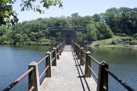
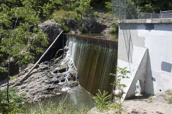
Buttermilk Falls is a dam:
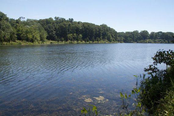
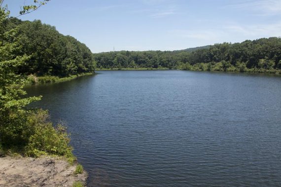
East Branch Reservoir:
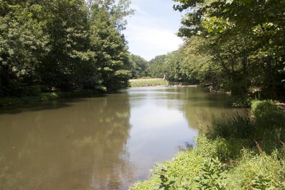
Wildlife spotted: a lone deer, then later a doe with two fawns, tons of fish and tadpoles in the East Branch Reservoir, and a 4-foot black snake hidden in a grassy trail that I nearly stepped on – yowza!
And unfortunately, we had to finish putting out a campfire…
We took a break on rocks overlooking the reservoir and smelled a faint whiff of a campfire… we found a still smoldering fire putting off a decent amount of heat.
“Luckily” we found several bottles laying by the water, and scrambled up and down the bank a few times to bring water up to it till it was out.
Fires are not allowed at the park to start with, but to set one with everything being so incredibly dry is just mindbogglingly stupid.
**Archives of prior hike guide versions**
2017 version removed from main page 4/2022 – east park of park YELLOW to below cliff
2.6 – Cross a paved road to continue on YELLOW Perimeter (YELLOW SQUARE).
[Option: Turn right and follow the paved road straight to the hawk watch to shorten the hike].
2.8 – Continue on YELLOW Perimeter (YELLOW SQUARE) passing a Connector on the right.
[Option: Turn right and follow the Connector to shorten the hike, it should loop around and rejoin YELLOW Perimeter and reduce the mileage… but we’ve not done this to check and think the trail map is missing some trail detail here so heads up if you decide to try it.]
Continue on YELLOW Perimeter (YELLOW SQUARE), passing a trail coming in on the right then quickly leaving left, then passing another trail on the right.
3.0 – YELLOW Perimeter (YELLOW SQUARE) approaches a road, then curves to the right as it heads downhill around an old building foundation.
Continue above Vosseller Ave which can be seen (and heard) below, before heading back uphill on a series of long switchbacks (the zig zag of the trail is not noticeable on the trail map).
3.5 – Turn sharply LEFT to continue on YELLOW Perimeter (YELLOW SQUARE). [A Connector goes straight].
3.8 – Veer LEFT to continue on YELLOW Perimeter (YELLOW SQUARE). [A Connector veers right].
Old hike directions removed from main page; 2010 version – RED to ORANGE to YELLOW back to ORANGE to RED
—
Because of how the trails are on the map, with all the connector trails, it’s hard to describe our route…
We’ve highlighted the trail map [deleted from server 3/2020] to show the route and noted the key points below, but the map is the prior version.
BLUE loop: Cross the road to the trail, follow the SQUARES for the perimeter trail. Return to lot.
RED – ORANGE – YELLOW loop:
0.0 – Pick up RED perimeter (RED SQUARE) from the lot. It will follow the reservoir, and there are some rocks to sit on overlooking the water.
0.7 – connector to a woods road that takes you to Chimney Rock Road. This area was unclear, it seemed like you were supposed to continue on the trail at this point. Facing the woods road from the trail, you need to make a left.
Follow this woods road downhill a bit, it then turns right and you will see a bridge out to a building on the reservoir.
1.1 – Cross busy Chimney Rock Road. The trail marker is not obvious: cross the road and walk left to where the guardrail ends. The ORANGE trail starts here, but is not marked right away.
1.7 – Trail hits Gilbride Road – turn right and walk over the bridge, then right after the bridge turn right again onto the trail… it’s not clear. There is actually another path a few steps down, and both take you to the same spot.
You are now on the YELLOW perimeter trail (YEL SQUARE) Follow this, paying attention to the markers to skip over the inner (CIRCLE) and connector trails as you go.
At the end of the yellow, all the way on the east side, there is a connector loop. We took this to see how it was… and it was very overgrown and grassy. In fact, I almost stepped on a 4 foot black snake hidden in the grass. The loop wasn’t that interesting, and it was a little confusing with extra trails not on the map, so we recommend you just keep on the perimeter trail here.
3.4 – The trail ends up on a road… it seems like you want to make a left… but you want to turn RIGHT here, then LEFT at the road in a few steps. This is the parking lot for the hawk watch. Walk past the gate on a paved path.
The view is of a rock quarry… so while interesting, it’s not that scenic. Hawks like it though, and a hawk count is kept from August-November, more info here.
Continue on the YELLOW trail. We went down to look at the dam and Buttermilk Falls (just OK, the falls is just the water coming over the dam), then followed the trail along the East Branch Reservoir. This isn’t technically the YELLOW trail, but you meet back up with it.
Continue on YELLOW to end up back at the same spot on Gilbride Road… turn left,over the bridge, then left again on to the trail.
Meet up with ORANGE again, it splits in a Y… we went left and took the portion of the ORANGE perimeter trail we hadn’t before.
5.5 – Back at Chimney Rock Rd again, cross the road, retracing your steps to the RED perimeter trail.
5.8 – took the other section of RED perimeter back to the lot.
We did that hike in June 2010 when it was horribly hot. They were pumping out the port-a-potty that day- very odiferous, but I guess they have to do it sometime! The wild roses were in bloom by the lake, which were lovely, and it was cooler under the pines. I didn’t like crossing the busy road, nor the suprise of mountain bikers. But there were herons, a waterfall, and it was short drive!
Just wanted to mention that there IS a place with paper maps, but it’s not very noticeable. I didn’t see it until I watched someone pull a map out of it. There is a little wooden mailbox labeled “maps” that is actually on the fence between the trail and the parking lot. It’s near the kiosk, to the right if you are in the parking lot. We (the dog and I) hiked there yesterday, both the Red and White trails. They were confusing and yes, not too many picturesque scenes, but the sun coming through the trees was nice. We saw a LOT of wildlife there, esp on the White trail, more than any other hike we’ve taken, in NJ and Maine.
Thanks for the info; totally missed the map mailbox. I’ll add it to the hike description so others will know to look for it.
Dawn
I live in Bridgewater, and whenever I need a quick breath of fresh air, I hit the park. In addition to the (poorly) marked trails, there are small partially hidden trails all over the place. The view was much better when there actually was a chimney rock and the quarry was smaller, but the raptors don’t care when they show up in the early fall. Sitting on a large (dry) rock in the middle of the stream, just below Buttermilk Falls, is awesome on a hot day.