We intended to take a short hike at Six Mile but just kept going.
Note: This route was hiked in January of 2010 and the hike description that follows the Trail Blog post is may be outdated due to trail changes. This page is archived and is no longer updated.
At the very least, the section of the RED trail to Canal Rd is no longer on the park map and it may be closed. That section of this hike can easily be removed from the route below.
For a shorter hike from this parking lot, visit our main “Six Mile Run Reservoir – Red Trail” page.
11.7 miles but you can certainly do shorter loops.
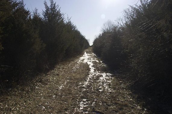
It was supposed to be bitter cold so we wanted to do a short hike, nearby. We hadn’t been to Six Mile Run in quite awhile, after doing the short BLUE there trail years ago and didn’t think that much of it, as it skirted a lot of fields and such.
Just wasn’t that much of a hiking-thru-the-forest type of hike, when you compare it to North Jersey, but we came to realize that a lot of central hikes are like that.
(With central Jersey being so developed, you often find yourself skirting backyards and fields, crossing streets… which can still be fun of course)
I had just read that JORBA had been developing trails there, and found a new map on their site that listed more trails so we gave it a shot. It turned out to be a nice sunny day and we ended up doing 11.7 miles, all of the park but the Blue trail.
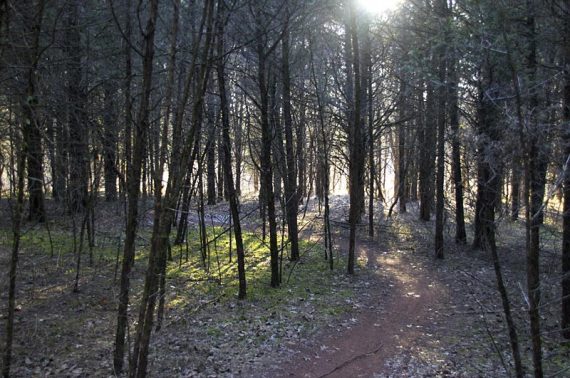
If you go, skip the orange trail… it’s loops and twists upon itself thru a dense pine forest… which has to be lots of fun on a bike but rather tedious for hiking.
We expected as much from looking at the map, but wanted to check it out regardless.
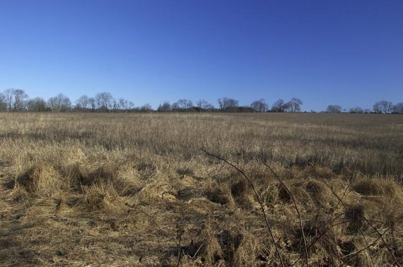
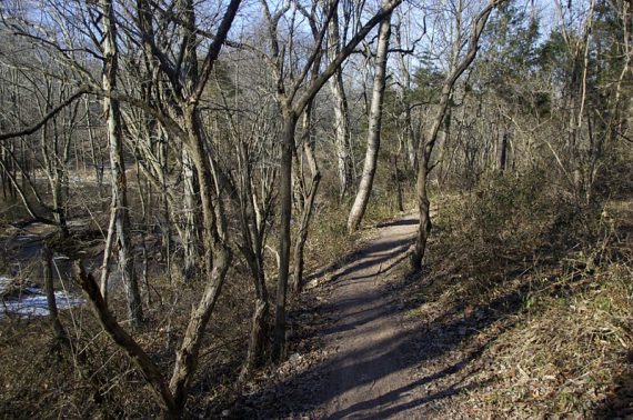
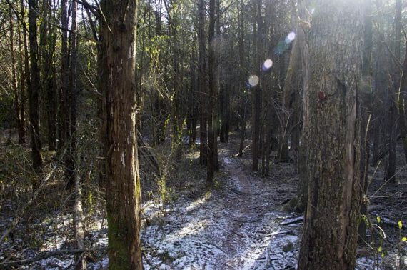
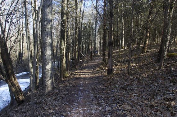
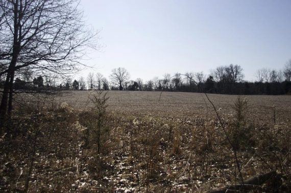
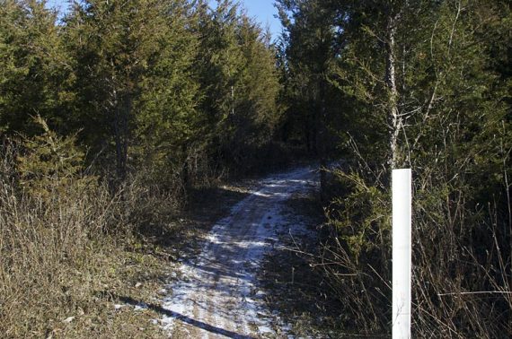
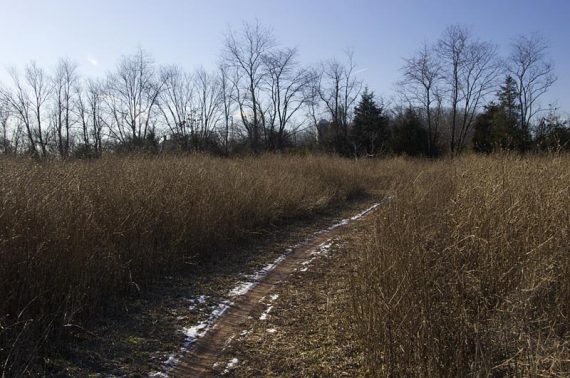
JORBA did a nice job creating the trails, and the park is prettier and more varied than I expected (forested, fields, a stream and some dense pine).
The signage is good, although there are a few places where it’s missing and left up to you to guess.
One caveat… all the trails are multi-use and even on a 30 degree day there we saw several mountain bikers and no other hikers.
The trails are built with bikes in mind and are very twisty… many times bikes came up on us and we never heard them. If there were this many bikers when it was this cold, I imagine a summer day would be packed.
Everyone was exceptionally friendly and pleasant, but hiking on biking trails can get a little annoying… and I assume it’s annoying for the bikers to run into hikers too.
11.7 miles. Moderate trail surface, some small hills. You can make shorter hikes; we hit up all but the BLUE trail to see what the all new trails were like.
- Shorter: 6 miles: Take RED to where BLUE starts, then turnaround and retrace your steps.
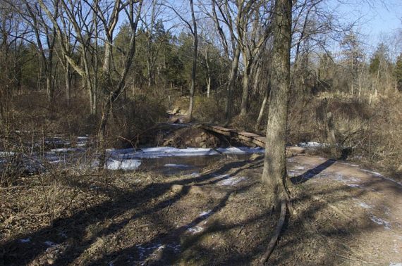
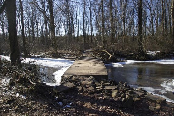
- Short: 4.4 miles: Take RED to the concrete bridge (it’s obvious, in an open area in the backyard of a couple buildings), then turnaround and retrace your steps.
Hike Info:
Our two cents:
We recommend skipping the ORANGE trail even though it’s an obvious choice to make a loop and not have to retrace your route (it’s in the description below but simply stay on the RED trail).
It passes through a very nice area of pine trees but the trail has been created for biking and is very twisty, almost looping onto itself in places. Super tedious to hike.
Map:
The trail is marked pretty well with a few intersections that are questionable. Please note that there are several new trails and changes, so if you have an old Six Mile pamphlet from the park, it is very different now.
Books:
A different route from this park now appears in Best Day Hikes in New Jersey (2019) None of our books have this park, except for a and a brief description is in The New Jersey Walk Book.
Since the park’s trails have been added to considerably; trail descriptions found in a book may be out of date anyway.
Parking: N40.45645° W74.51399°
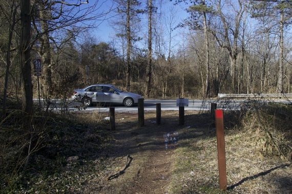
There are 3 parking areas. This hike starts from the large parking lot on Rt. 27 South, on the right side, a few streets down from Rt 608/Cozzens Lane, there is a brown trail sign.
There is also a parking area on Jacques Ln, and the main park office on Canal Rd (check the trail map).
Restrooms:
Porta-john in the parking lot. The Jacques Ln lot had nothing.
Hike Directions:
Overview: We took RED to past where BLUE starts, went to Canal Rd, backtracked, Took RED to Jacques Ln to WHITE, to RED, then took ORANGE, which ends up at RED again.
0.0 – The RED trail starts on the left corner of the lot (if your back is to the road).
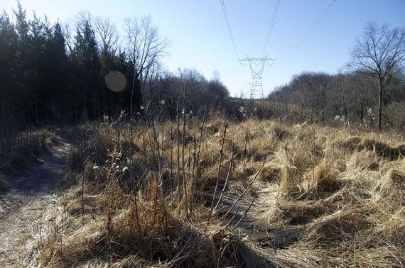
0.7 – Shortly after passing a power line clearing, turn left and continue following RED. [ORANGE goes straight here.]
1.5 – Continue following RED. [ORANGE comes in from the right]. Cross a wooden bridge shortly after.
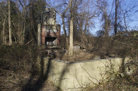
2.1 – Pass a large chimney, the ruins of a structure.
2.2 – Cross a concrete bridge, near the backyard of a house.
2.9 – Cross busy Middlebush Rd. Pass behind a house.
3.0 – Continue on RED. [BLUE trail starts, to the right.]
3.3 – Continue on RED. [WHITE starts, to the left.]
3.8 – The trail map shows RED turning to the LEFT on a wide straight woods.
When we last hiked this in 2010, the markers didn’t reflect this because the RED trail used to go straight here, and is like that on old park pamphlets.
We just kept heading straight on RED, to see what was there and it was still marked RED.
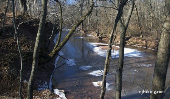
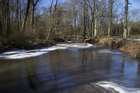
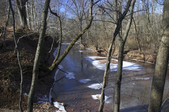
It was pretty along the Six Mile Run River, and we also passed some fields on the left.
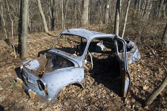
At one point there was an abandoned car (I swear these are required on trails, we’ve run into so many).
4.5 – We continued on RED until it ends at Canal Rd. and then backtracked to where the trail had split at 3.8 miles.
[A right turn and a road walk gets you to the Canal Rd. parking, likely a porta john, and the start of the BLUE trail. BLUE will meet up with RED but it will be even longer than this loop.]
5.3 – Once back to the junction, turn RIGHT onto RED (this was not marked RED in 2010, but markers were visible further down).
5.7 – Jacques Ln parking lot. RED ends here, start following WHITE.
Didn’t see any trail sign for that, we just followed tracks out of one side of the parking lot. (If your back is to the road, on the right side)
Follow that a bit and you start to see WHITE plastic wand markers. The trail here is odd… a mix of going along woods roads and thru stands of pine and then some fields – just an odd mix.
6.0 – It’s mostly well marked but there are some spots where you are left wondering why there isn’t a marker.
For example, we headed to the right at this point based solely on what direction a couple of bikers went – it was not marked and both options looked like they could be it.
7.2 – Turn RIGHT, now following RED. [WHITE ends].
7.4 – Continue following RED. [Pass BLUE on the left].
9.0 – Junction with ORANGE. We took Orange back but we don’t recommend it (see above). The choice is yours.
NOTE: If you want RED, it’s to the right; Orange is straight. RED is a little easy to miss… you’d easily just keep walking straight down Orange and not even realize it, in the late afternoon sun the colors were very similar.
If you choose RED, retrace your steps to the lot. ORANGE winds and twists it’s way back to RED further on, then retrace your steps to the lot.
—
Hiked: 1/10/10.