We had limited time this weekend and only could manage a quick hike at our go-to park for that, Cheesequake.
While there, we figured we may as well collect new GPS data on the change to the GREEN trail, and also the small reroute around the damaged boardwalk in the cedar swamp.
Check the link below for a new trail description.
Miles: 4.0
Route: GREEN – back to parking lot – YELLOW
Detailed hike guide on our main Cheesequake State Park- Green Trail page.
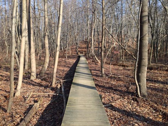
The GREEN is now a tad longer at around 3.3. The main reroute is around the Atlantic cedar swamp section.
Detour signs direct the route onto an unmarked trail that leads out to the park road, then turns right and follows the park road for a bit before turning left back onto GREEN.
The detour signs were wet, however, and what I think used to be a green arrow was smudged.
And once onto the park road, there were no more detour signs along the road – so it was left open for going the wrong way if you weren’t familiar with the park.
The group in front of us did just that, we think. They were out in front of us along the green trail until that park road and then we lost sight of them… until much later in the hike and coming AT us on the GREEN trail.
Pretty sure they had gotten turned around by the reroute.
The other main new area is a reroute around a section that is always wet and muddy.
Years ago a scout project rerouted this with several stairs and boardwalk areas, but water tends to go where it wants to so the area became a mess again. A whole new section of GREEN trail has been created well away from this wet area.
Once we got back to the parking lot we scampered off for a quick spin around the YELLOW trail too, just to make it a little longer hike.