In search of the Pygmy Pines in a section of the pine barrens called the “Pine Plains”.
8.7 miles on sand roads. Mild, sunny day. About 1 hr 20 min from Central NJ via 206.
Our route… From parking at Oswego Lake and using the online map: take Jenkins Rd, left onto Cabin Rd, right onto Sooy, right up to Bear Swamp Hill, come back down…
Right back onto Sooy, right on Chatsworth, left on Stave (not marked on park map) thru plains, left onto Lost Lanes to it’s end, then left again, follow back to lot.
Complete hike details on our main Penn State Forest page.
The “Pine Plains” is where the trees average 5 feet tall and you can see over tree tops for acres.
We’ve never hiked Penn State Forest before and didn’t know much about it, other than seeing a few pics of the pines.
They are mentioned in both an older (1998) edition of 50 Hikes in New Jersey as well as a 2009 Hiking New Jersey (2023) book and sounded intriguing – both as an interesting hiking destination and as a photography subject.
We parked at Oswego Lake and followed the route in the “50 Hikes” book (8.7 miles) but were quite disappointed to never find trees less than 7 or 8 feet high – certainly too tall to see over.
I re-read the trail descriptions after the hike, and sure enough, we were on the right paths. The books made it seem like you would be strolling right thru these awesome, unique short pines.
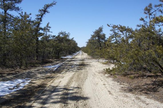
The hiking here is 100% on wide sand roads – not a favorite trail surface for us (hence our annoyance at hiking all day on less than favorable conditions and not seeing what we hoped for).
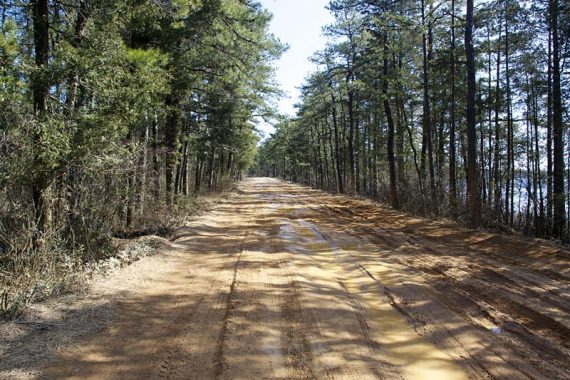
It ranged from hard packed to the soft bright white “sugar” sand. There was still some avoidable snowpack on some trails, and it was quite wet on one road.
The roads are not marked. No paper maps were at the trail kiosk, it’s just an overview of the pine barrens.
It’s mostly easy to find your route but there are a couple extra unmarked roads along the way, so a GPS is nice insurance. On our GPS map, the roads were named which made it super easy.
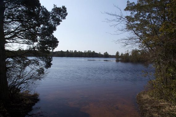
Oswego Lake in the beginning is pleasant enough for brief views, then its non-stop straight sand roads and relentless pine.
We “climbed” Bear Swamp Hill – which is probably nice when the abundant mountain laurel blooms… but was the “limited views” the book mentioned were so limited you basically could see nothing.
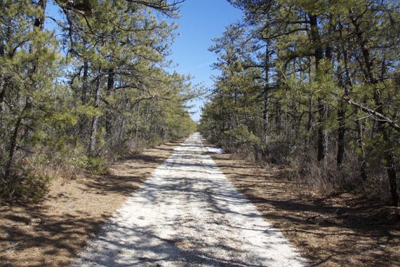
As we approached the pine plains, the trees did get gradually shorter and were interesting… but never low enough to see over.
We passed a path on the left, then on the right and afterwards we wondered if we had needed to veer off the main road in order to see the short pines.
I searched when we got home and found this link talking about “Spring Hill” as being the best place to see pygmy pines – so it looks like we needed to take a trail on the right in order to get to see any short pines.
Neither book mentioned this, and if I’d known ahead, we could have checked it out. A lot of the area around this park in posted “private property” and I can’t be sure these paths don’t go into that.
We saw no other hikers but passed a gravel pit with a bunch of vehicles parked for dirt bikes, then some quads as well.
A couple of trucks passed us, and McGuire AFB is nearby so planes go overhead. So we can’t even give this park a thumbs-up for solitude.