Hike along Washington Valley Reservoir, East Branch Reservoir, Buttermilk Falls and a hawk watch.
6.4 miles, total round trip. Easy to moderate trail surface. Hard-packed and rocky, but with loose, smaller rocks… easy to slide on. Several minimal elevation changes. Busy road crossing.
- Shorter: Just do a single color loop from this lot: BLUE: (2.0 miles), RED, or WHITE.
- Longer: Add BLUE or WHITE to this route and/or extend YELLOW.
- Nearby (within 25 min): Duke Farms; Rutgers Ecological; Six Mile Run.
Hike Info:
Our two cents:
This route samples most of the park and packs in all of the highlights: Washington Valley Reservoir, Hawk Watch and Chimney Rock, Buttermilk Falls, and East Branch Reservoir.
Varying amount of road noise. Requires crossing busy Chimney Rock Road twice. Popular area for mountain biking. Not the Buttermilk Falls in Sussex County or the one in Mendham, NJ.
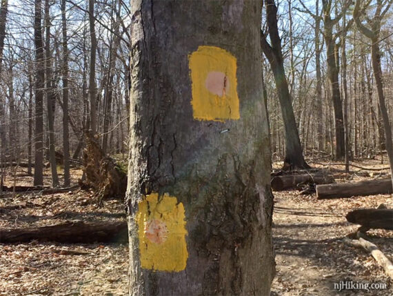
Update 4/2022: Re-hiked, route adjusted/improved on east side where YELLOW is now GREEN/PINK which changed the total mileage to 6.4 from 7.1; trail markers have changed from plastic to paint. Older changes at page bottom.
Trail Map:
Print out from the park site or paper maps might be available in the kiosk near the parking lot entrance. Follow along on your smartphone with our Interactive Map link above.
Note: As of 4/2022, the park map was outdated for the east end of the park (YELLOW on map, YELLOW/GREEN/PINK in reality). And while digital maps (AllTrails etc) show more trails, the blaze colors don’t match what is on the trail. Best bet is to use our Washington Valley Interactive Map in addition to the park map.
The park is split in two sections that connect by crossing busy Chimney Rock Road. From the Newman’s Lane lot: BLUE loop (2 miles) is across the road, RED starts at the far end of the lot, and WHITE starts by the trail kiosk closer to the lot entrance. ORANGE and YELLOW are on the other side of the park.
On the park map: trails are marked as ‘interior’ (dotted line) and ‘perimeter’ (dashed line) with ‘connector’ trails (solid line). On the trail: ‘perimeter’ are rectangular blazes and ‘interior’ have a dot on a rectangular blaze, connector markings seemed inconsistent.
The trail markers are geared for short loops within each section of the park, which is how most people probably hike here, so it can get a little confusing to piece together a longer hike like this.
Parking: N40.59582° W74.57358° [Newman’s Lane lot]
Washington Valley Park, Newmans Lane Parking Lot, Bridgewater Township, NJ 08807. If approaching from 287N take exit 14A for 22E. Turn L on Chimney Rock Rd. L on Washington Valley. L on Newman’s Lane. Note: Google may go another way via Foothill Rd.
Large paved lot. On the other side of the park is a lot at the hawk watch and a small lot on Gilbride Rd not marked on the map.
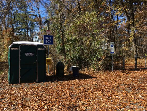
Restrooms:
Portable toilet in the Newman’s Lane Lot. No longer in the hawk watch lot (as of 4/2022; possibly seasonal).
Hike Directions:
Overview: RED – ORANGE – YELLOW – GREEN – YELLOW – ORANGE – WHITE
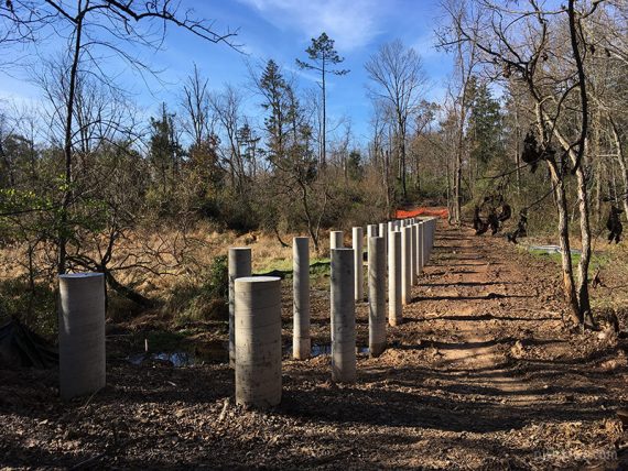
Note: Some photos show the old plastic SQUARE and CIRCLE trail markers. They are now paint blazes. The route below only uses “perimeter” trails and not “interior” so we’ve simplified the description to RED from RED (Perimeter) etc.
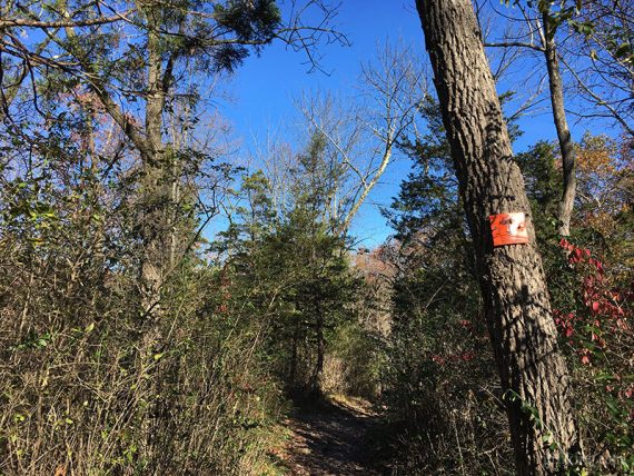
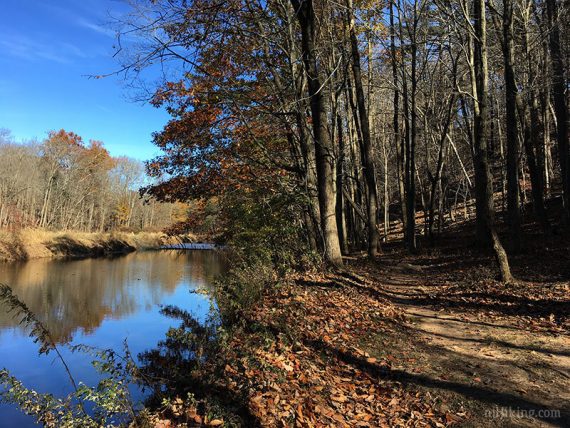
0.0 – Start following RED from the end of the lot furthest from the road entrance.
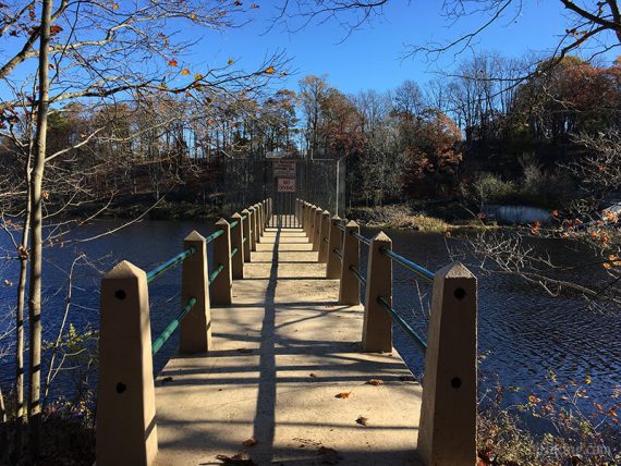
It will follow the reservoir with some viewpoints overlooking the water.
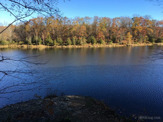
0.5 – Veer LEFT to follow an unmarked trail along the water. [RED goes right].
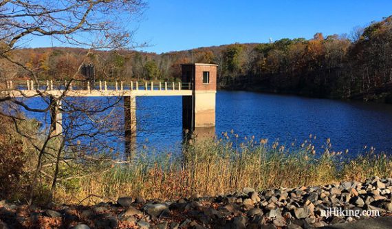
Continue curving along the water. A building over the reservoir comes into view.
0.7 – Go through a break in a fence and turn LEFT onto a woods road. [RED also goes to the right and loops back to the lot).
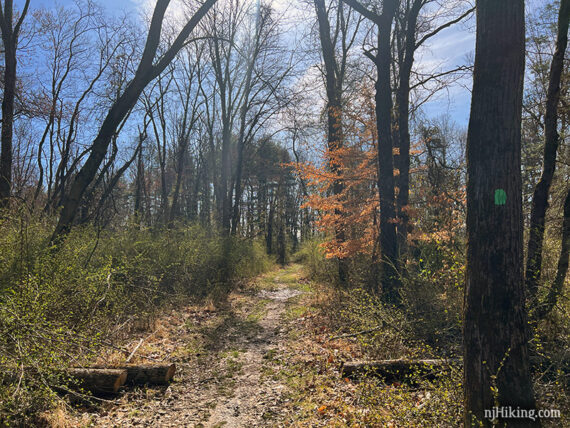
Continue following the woods road, which may have RED and/or RED with dot markers.
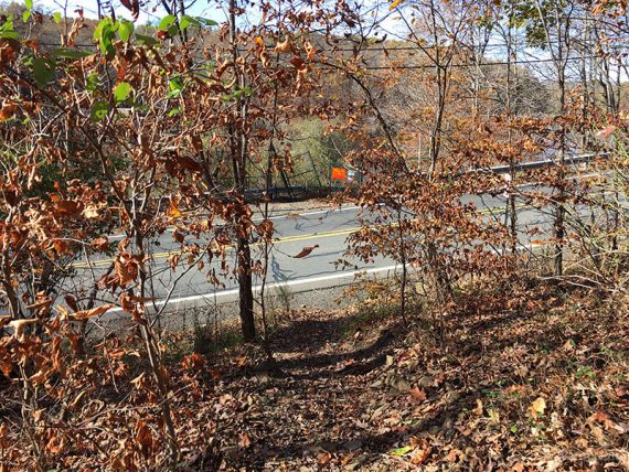
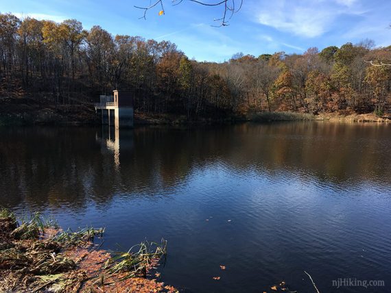
Behind a fence, a bridge out to a building on the reservoir comes into view. These photos are looking through the fence – the bridge and building are not accessible.
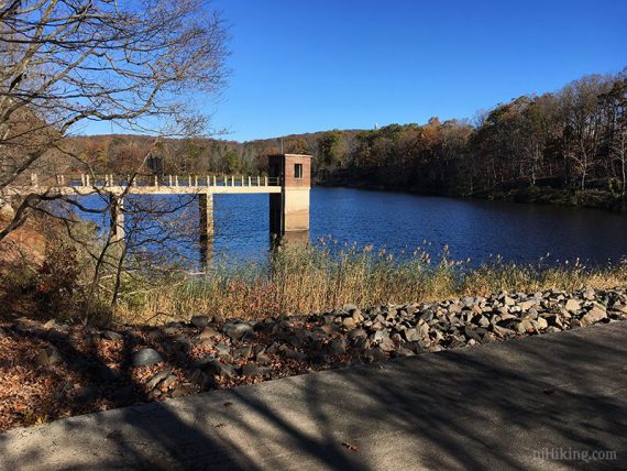
On the other side of the concrete dam was a waterfall squeezed in next to the shore. We don’t recall ever noticing this before so it might be water flow dependent.
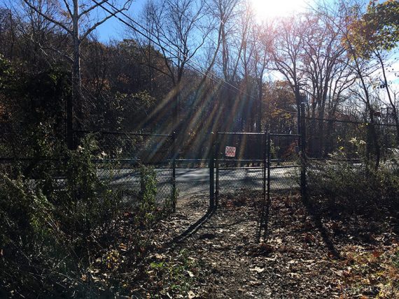
0.8 – The continuation of the trail is hard to spot: Exit through the fence gate, cross busy Chimney Rock Road, and walk to the left end of the guardrail.
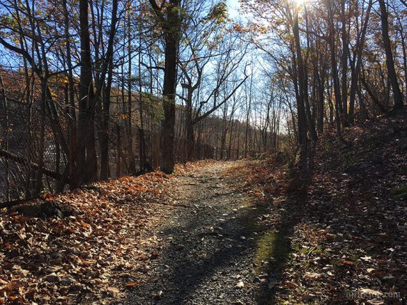
Now follow ORANGE (markers have hard to see dots). A quarry may be visible off on the right if there are no leaves on the trees.
1.1 – After a short steep section, arrive at a fork. Turn LEFT and start following ORANGE. [ORANGE also goes right].
1.3 – Continue following ORANGE past an ORANGE with BLACK DOT connector trail.
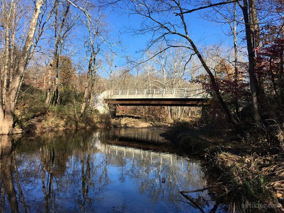
1.6 – The other end of ORANGE merges in and then ORANGE ends. Continue to Gilbride Road and turn RIGHT over the bridge. There is a small parking area across the road.
After the bridge, turn RIGHT to start following YELLOW. An immediate right runs closer to the water, while in a few steps more is the actual YELLOW trail (look for the large rock with blazes). Both routes meet up at a footbridge in a moment.
Looking back at the bridge on Gilbride Rd while on the trail running closer to the water:
We usually follow the unmarked trail for views of the water, and take the actual YELLOW trail on the return route through here.
Shortly, arrive at a footbridge. Cross the bridge and turn LEFT to follow YELLOW. [YELLOW also goes to the right and is the return route].
2.0 – Arrive at a YELLOW 3-way junction and turn LEFT to continue following YELLOW. [YELLOW (Interior, with faded dot) also goes right and straight.]
2.6 – Cross paved Miller Ln to now follow GREEN. [As of 4/2022, from this point until GREEN ends does not match the park map.]
[Option: Instead, turn right and follow paved Miller Ln straight to the hawk watch to shorten the hike].
2.7 – Trail splits. Veer RIGHT to continue following GREEN (co-joined with PINK). [PINK also goes left, probably, don’t recall a marker].
2.8 – Continue following GREEN. [PINK leaves to the left]. In another 0.1 mile, continue following GREEN straight where GREEN also leaves to the left.
3.3 – GREEN ends a paved road. Turn RIGHT onto the road, then LEFT in a few steps. Continue down the road to the parking lot for the hawk watch. [Pass YELLOW (interior) on the right].
At the far end of the lot, walk through the gate and continue on the paved path towards the overlook/hawk watch. [No portable toilet here as of 4/2022].
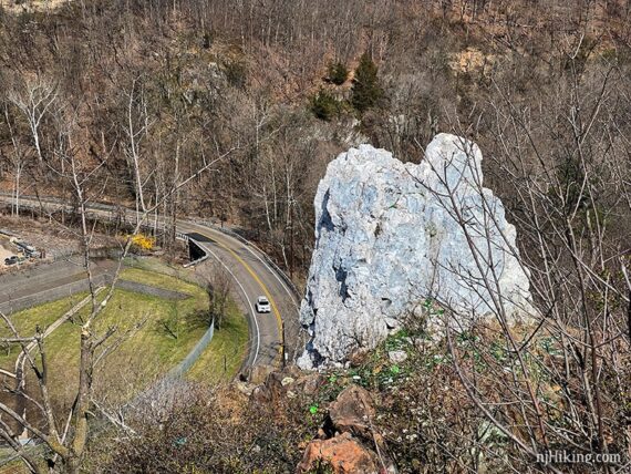
3.5 – The hawk watch viewing platform overlooks a rock quarry… so while interesting, it’s not that scenic. Hawks like it though, and a hawk count is kept from August-November.
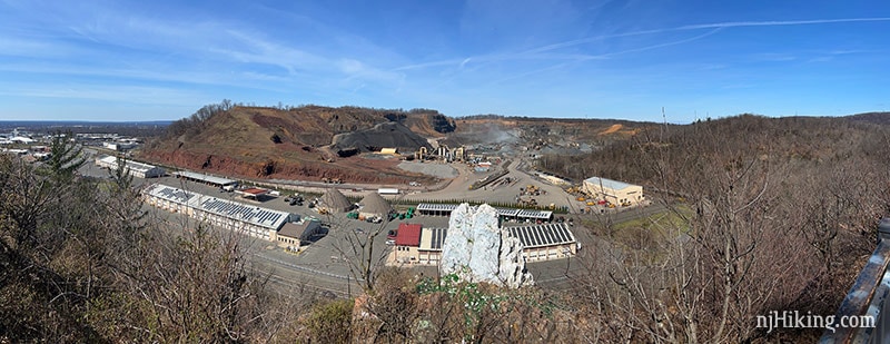
The rock painted white is “Chimney Rock”… as it sort of looks like a broken chimney stack. See Bruce Doorly’s “Chimney Rock” article for a little history and old photos as well as History Girl’s “Rocks with a View: NJ Revolutionary War Lookouts” article.
When we hiked here in 2010 the rock was covered with graffiti. Keeping it painted white is likely a solution to that.
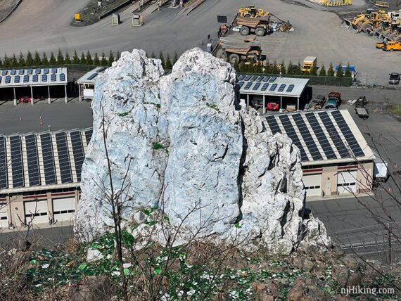
Taking a photo from the side crops out the quarry and gets more of the hillside.
From the hawk watch, continue on YELLOW. [Pass YELLOW (interior) on the right].
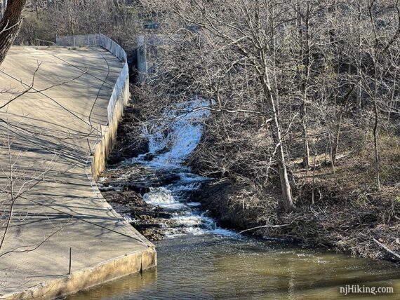
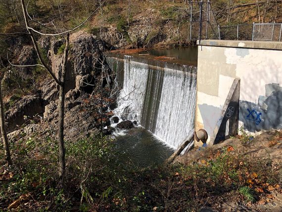
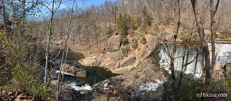
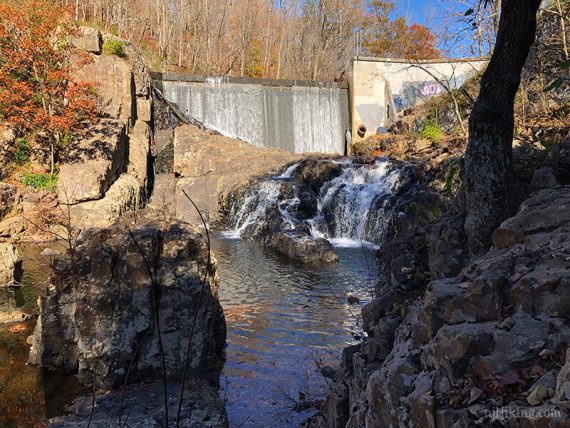
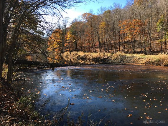
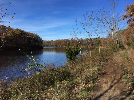
3.8 – The top of a dam can be seen on the left, below the trail. Water from the East Branch Reservoir cascading over the concrete dam is considered Buttermilk Falls.
It’s steep and scrambly in order to get down closer to the falls.
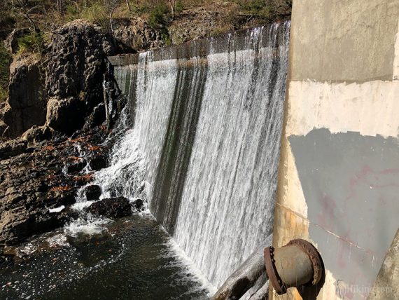
This panorama shows water in the East Branch Reservoir flowing over Buttermilk Falls down into the gorge below, where the water continues over smaller cascades into Middle Brook East Branch.
Optional: There are cascades in the water in front of the concrete dam but to see all of them requires a somewhat dicey scramble down to and then along the water’s edge:
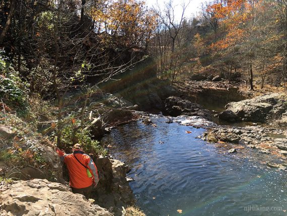
If you scramble down and along the water then the cascades in front of Buttermilk Falls can be seen.
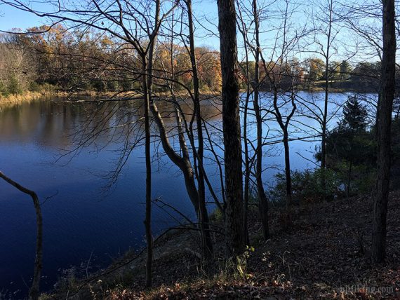
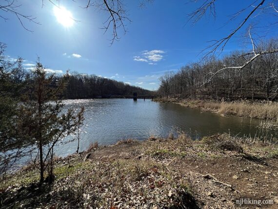
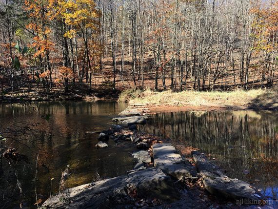
Return to the top of the dam and continue, following along the East Branch Reservoir on an unmarked trail. This isn’t technically YELLOW but soon meets back up with it.
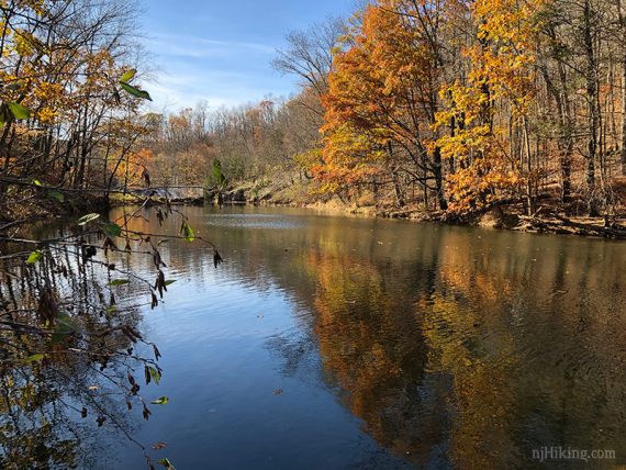
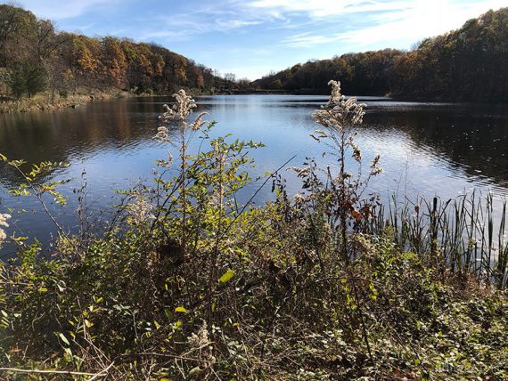
There is a small manmade dam along the East Branch Reservoir that makes for a nice break spot.
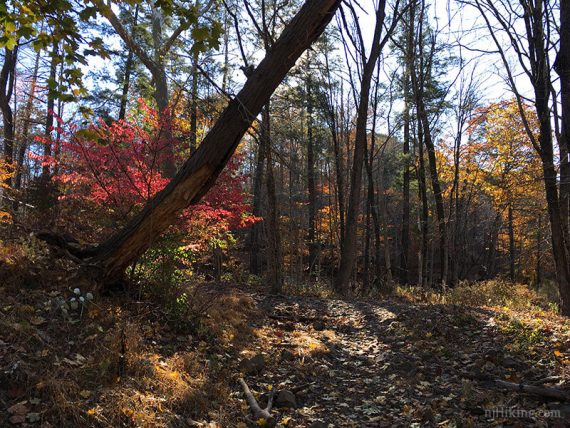
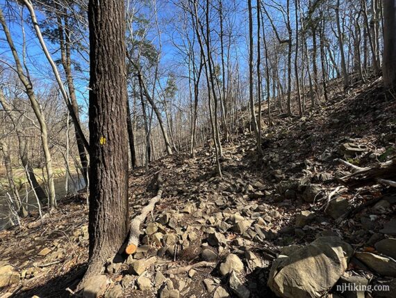
Continue following YELLOW which gets rather rocky in spots.
4.2 – Follow YELLOW back to Gilbride Road. Turn left on to the road, go over the bridge, then left again on to the trail.
Meet up with ORANGE. Veer LEFT/straight to start following ORANGE. [ORANGE also goes right, and was where this route came in earlier.]
4.3 – Continue as ORANGE switchbacks down the hill and then runs along East Branch Reservoir. If the trees are bare the trail you were on earlier can be seen across the water.
4.8 – The trail moves away from the water and heads back uphill. Pass ORANGE with BLACK DOT on the right.
5.0 – Turn LEFT and follow ORANGE back toward the road. [ORANGE also goes right, you were here earlier].
5.2 – Just before reaching Chimney Rock Rd again, there is a choice of crossing locations…
We recommend following ORANGE down to the LEFT which returns to the guardrail corner from earlier. Cross the road and walk to the RIGHT along the side of Chimney Rock Rd.
This is further from the WHITE trail, as seen in the photo below, but has some shoulder and a guardrail and is easier to see oncoming traffic.
(If you’d prefer to just skip WHITE entirely – cross the road here and turn left instead, retracing the route on RED back to the parking lot.)
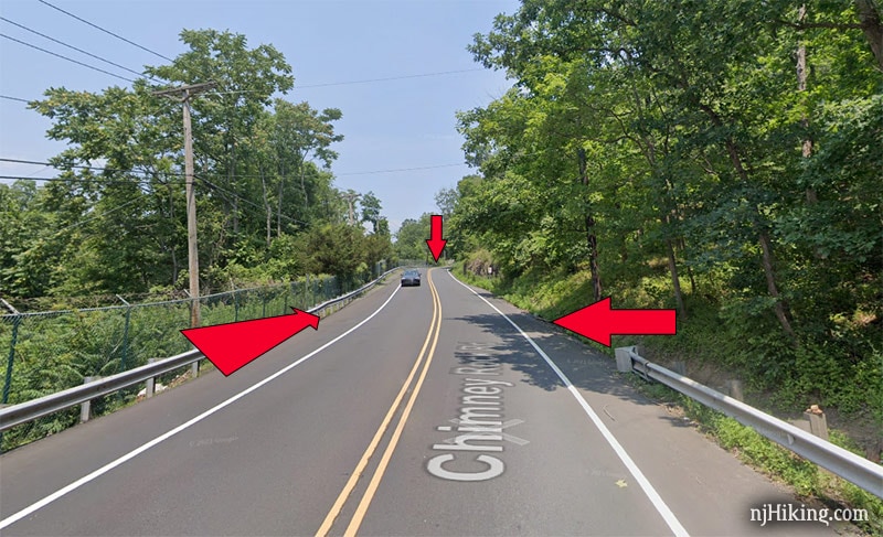
The other option is to veer RIGHT/keep straight on the unmarked trail and follow it along, just above the road. This ends directly across from the fence where the WHITE trail is, seen below, so it reduces the amount of road walk.
BUT there is a bit of a blind curve making it hard for traffic from the left to see you. When we crossed here again this time we felt it was riskier than we remembered therefore I adjusted the directions and Interactive Map accordingly – and leave the choice up to you.
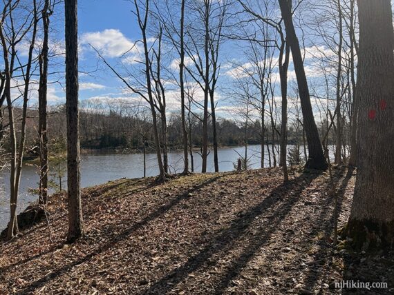
5.3 – Either way, walk through an opening in a fence to start following WHITE along the other side of the reservoir (may not have actually been marked white other than on the map).
A long bridge over a stream comes into view.
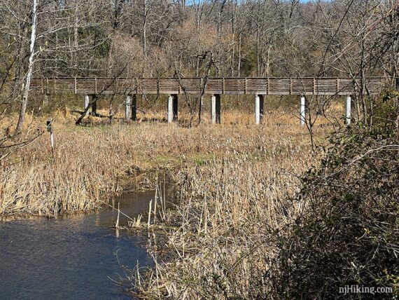
5.6 – Continue following WHITE over the long wooden bridge.
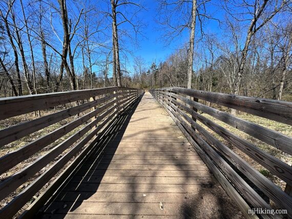
This bridge was under construction when we hiked here in 2017.
Turn LEFT just after then bridge, and then again, to hug the reservoir on WHITE. There are other trails that end up in the same place but don’t have water views.
Follow WHITE as it makes it’s way around the reservoir, getting a look at the opposite side from where the hike started.
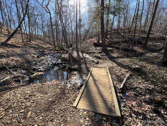
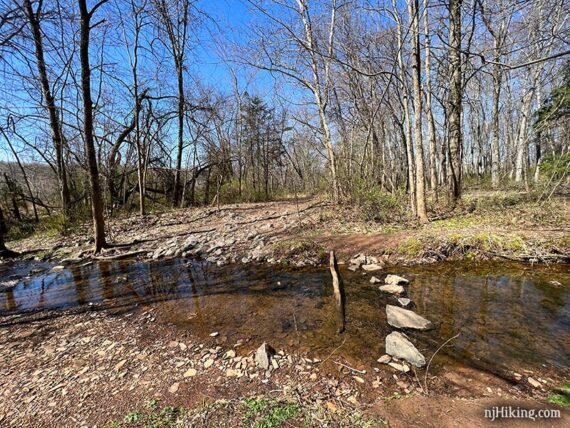
6.2 – Turn LEFT and rock hop a little stream, cross a bridge right next to the road, then back to the lot.
—
Hiked 4/2/22. Used GREEN instead of all YELLOW on east end of route.
Hiked 11/11/17. Return via WHITE instead of RED.
Hiked: 7/4/10. Trail Blog: “Washington Valley Park in Summer“
Change log: 11/2017: New photos added, slightly different route hiked and description changed (return via WHITE instead of RED, original route/photos/map archived to 2010 post), added GPX, updated Interactive Map. 3/2016: Added the newer map that has more details and is easier to follow; the description below was created prior to this map.