Casual hiking on level, easy paths through a beautiful historic estate.
6.1 or 4.2 miles, or much less. Trails are easy and mostly level; surface varies between grass/wood chips, gravel, and paved. Sunny, most paths not wooded.
| 6.1 miles | This hike guide: Instructions and photos follow below. |
| Shorter | Plenty of shorter strolls, just turn around anytime or try: 4.2 miles, paved: Central Way – Arboretum Way – West Way – Habitat Way |
| Longer | Add some interior paths in, and/or do the trail loops behind the Orientation Center (not overly exciting, so we’d recommend only doing it to add miles to your route). |
| Biking | 12+ miles of paved and gravel paths OK for biking (stay off the mulched paths). Rental available April – October. |
| Nearby | Washington Valley Park; Sourland Mountain Preserve; Six Mile Run – Canal Road; Six Mile Run – Red Trail. |
Our two cents:
Best suited for short hikes or easy strolls, and is a good place for new hikers.
This is not a rustic hiking area – it’s manicured, more “walking” than “hiking”, and very popular – but even for diehard hikers this might be worth a visit.
Time it right and be rewarded with stunning fall foliage. Good option for winter hiking when regular trails might be soggy.
There’s a lot here – easy scenic paths, a nice visitor center, a café, and lots to explore and photograph. In addition to extensive grounds there are many buildings, sculptures, and water features.
Accessibility shuttle to assist those with limited mobility (must be reserved).
Bonus: Nearby Somerville has Village Brewing and plenty of food options. AND Yestercades arcade.
Updated: 1/2026 – Minor edits; not re-hiked. 2/2024 – Page refreshed, walked a paved loop 1/2024. Older change log at page bottom.
Hike Info:
Map/Books:
Follow our Interactive Map linked above for our 6.1 mile route, or use the Duke Farms app to wander around. There was a paper map available in the Farm Barn Orientation Center.
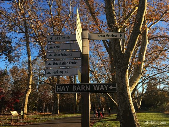
The park is marked with signposts at major intersections but with such a large network of unmarked paths it’s possible to get turned around.
Duke Farms can now be found in the book Best Day Hikes in New Jersey.
Parking: N40.54576° W74.62491°
Duke Farms, 1112 Dukes Pkwy W, Hillsborough Township, NJ 08844. Large paved lot plus overflow parking on dirt, all can fill quickly on nice weekends and closes when full.
*CHECK PARK SITE FOR CURRENT HOURS/DAYS – They change seasonally.
Restrooms:
In the Farm Barn Orientation Center plus multiple composting toilets around the property (marked on the map).
Hike Directions:
With such an extensive network of paths it’s just not feasible to provide our normal turn-by-turn hike directions.
It’s easier to wander and create your own route on the fly using the route on our Interactive Map, the park app, or the paper park map instead of trying to follow detailed route directions.
What follows is what you’ll encounter while walking around Duke Farms. This isn’t everything – there is plenty to discover while wandering around.
From the parking area, mosey on over to the Farm Barn Orientation Center for a map and restrooms. Then follow the path out to the South Gate Entrance and cross Dukes Parkway West into the park. A water feature is soon off on the left.
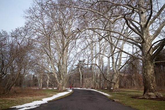
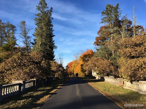
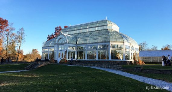
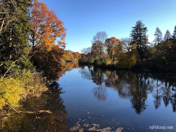
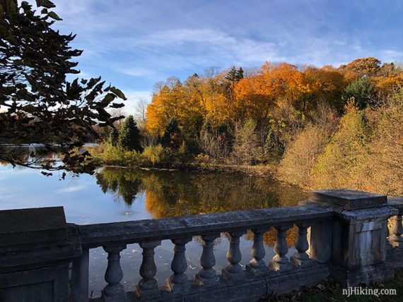
Paths at Duke Farms are a mix of dirt, mulched, mowed grass, gravel, and paved. This was once the large estate of Doris Duke so there are several buildings, statues, and man-made lakes around the property.
The paved path is lined with large trees near the Hay Barn, one of the features closest to the entrance.
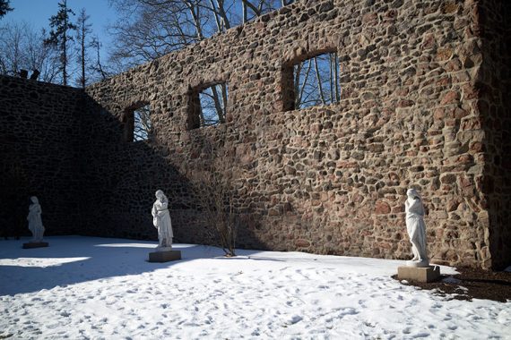
The hay barn originally held a hay press but burned in 1915 and left only the stone walls.
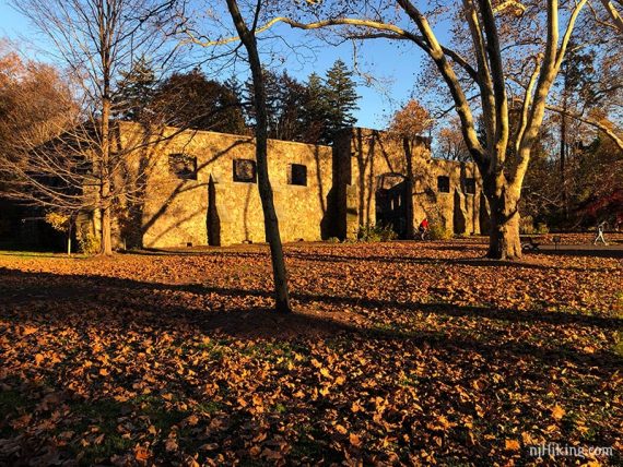
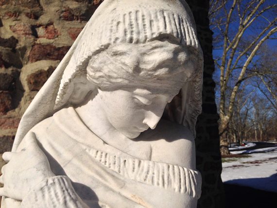
Doris Duke turned it into an outdoor gallery by placing marble statues inside.
Close up of a sculpture of woman inside the Hay Barn.
Duke Farms Fun Facts: Doris Duke (1912-1993) inherited Duke Farms from her father James Buchanan Duke, the founder of Duke Power and the American Tobacco Company, and the namesake of Duke University. In her will Doris provided her estate, Duke Farms, be used for conservation and research. Some controversy occurred when indoor display gardens she created were removed during a reorganization of the property in 2008. [Source: Duke Farms via Wikipedia].
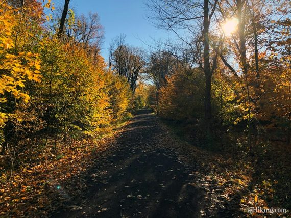
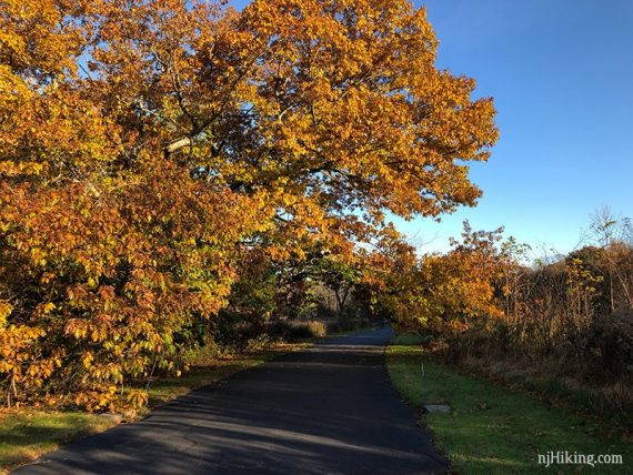
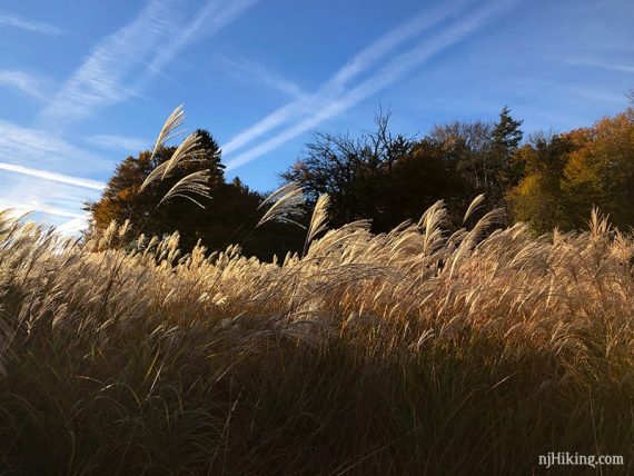
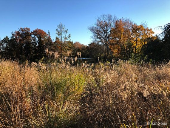
Paths at Duke Farms meander by fields and forested areas with large trees.
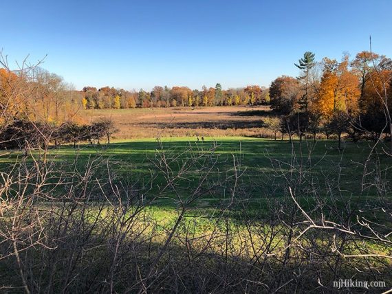
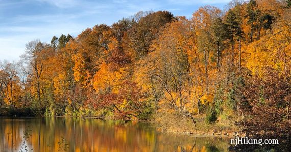
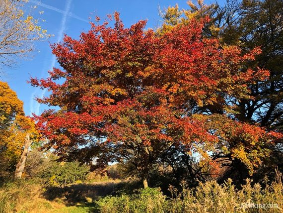
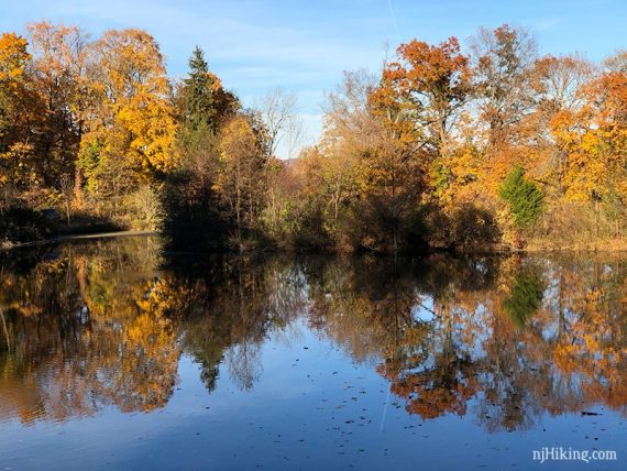
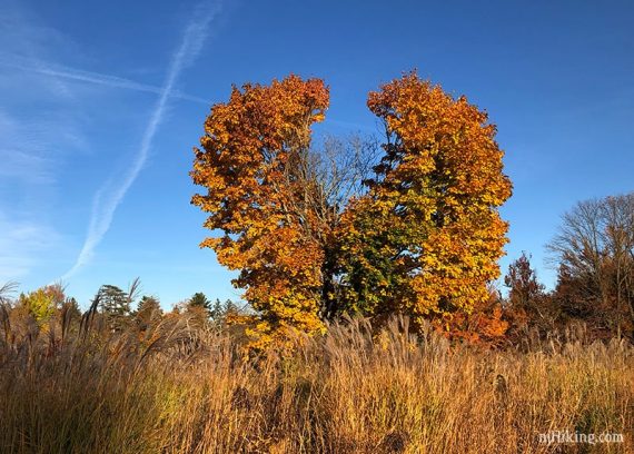
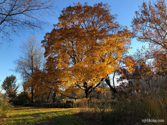
We managed to hit peak foliage in 2018 and so have an abundance of colorful foliage photos from around Duke Farms.
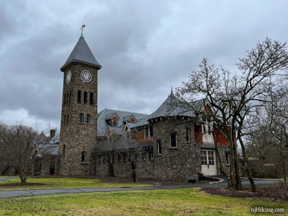
Built in 1899, the Coach Barn contained space for horses, coaches, and offices. When we hiked here in 2016 this was being restored and was covered in scaffolding.
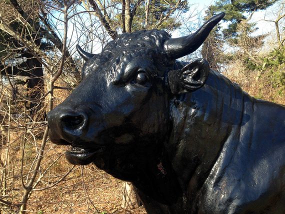
Durham Bull Stature near the Coach Barn. The bull was the trademark of a rival tobacco company acquired by J.B. Duke.
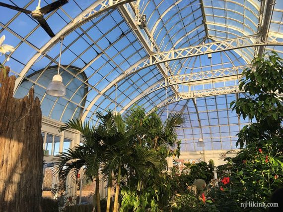
The Orchid Range displays tropical orchids and was built in 1899. Pop inside get a closer look at a variety of orchids.
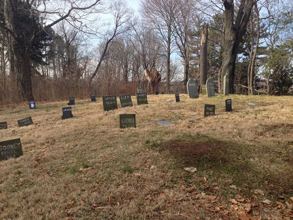
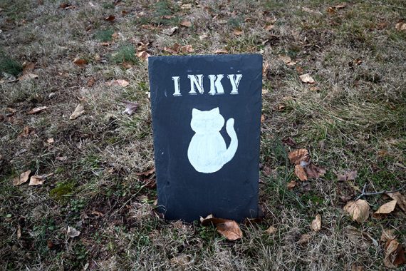
A large pet cemetery is the final resting spot of the estate’s pets… including Ernie the Toucan.
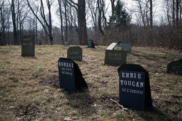
This isn’t marked on the park’s map but can be found on the Fox Hollow Lane loop around Great Falls Lake, on the opposite side that has the Great Falls. Our Interactive Map has a waypoint for the location.
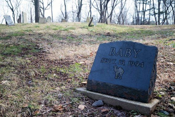
Marker for Baby the Camel. Yes, the ever fascinating Doris Duke had camels roaming the property. Because why not.
Inky the cat gravestone.
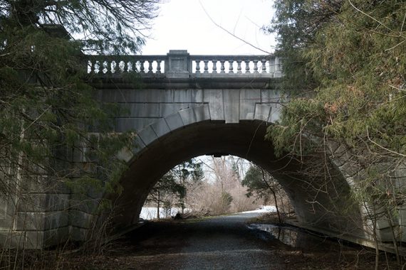
After looping around Fox Hollow Lane, a path goes under the bridge near Great Falls Lake.
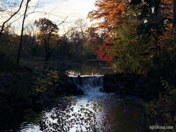
Speaking of Great Falls… we may have a ton of foliage shots around Duke Farms but not one photo of this feature. It’s a man-made stepped falls that runs several times a day in season. But it’s never been running when we strolled by so we’ve apparently never took of pic of it dry.
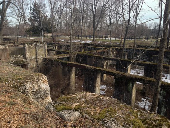
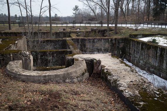
Remains of an Old Foundation for a mansion that was started in 1911 but never completed.
More pretty foliage shots, can’t help including them. There’s a lot cool trees here too.
—
Hiked: 1/24/24. 4.2 mile loop: Central – Arboretum – West – Habitat.
Hiked: 11/4/18. Wandered around in the opposite direction for 3.8 miles.
Hiked: 2/7/16. 7.5 miles. Trail Blog “Duke Farms in Winter“.
Updated: 8/2021 – Page refreshed; not re-hiked. 11/2018: Intersections are no longer numbered as in the description. We’ve left them just for rough guidance. Added fall foliage photos to the winter ones.