Hike to Mt. Minsi and Table Rock plus a second hike on the Arrow Island Trail.
Fall foliage in New Jersey usually starts in the northwest corner of the state in the Delaware Water Gap and along the Kittatinny Ridge, so on yet another nice fall day we headed out that way.
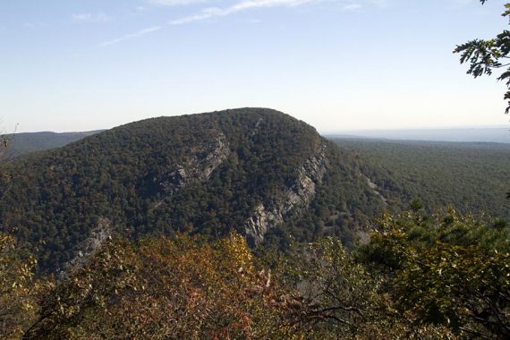
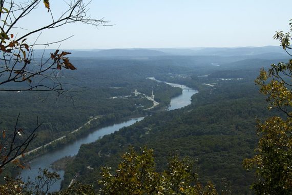
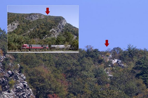
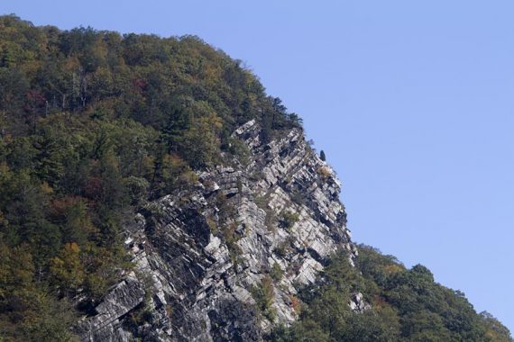
The foliage was kind of a mixed bag still, but hiking Mt. Minsi is always nice. It was quite hazy but the views were still great.
Normally when we hike Minsi we just keep going south along the AT then backtrack, and come back via the Minsi fire road which makes for a nice long hike (16.6 mile version here).
Or sometimes we “Mind The Gap”… hiking both Mt. Minsi and Mt. Tammany in one day.
And of course, you can just hike Mt. Minsi itself for a wonderful 5.1 mile trip.
This time we decided to change it up. Sometimes with really familiar routes you overlook things, and there were areas on the Kittatinny Trails we realized we’d never checked out…
Total Miles: 7.4
HIKE 1: Mt. Minsi
MILES: 5.6
PARKING: N40 58.790 W75 08.539 no facilities
ROUTE: Appalachian Trail (WHITE) – Mt. Minsi Fire Road.
For complete directions for this hike, see our main Mt. Minsi page.
After hiking to the Mt. Minsi summit and the viewpoint along the ridge, we turned around and headed down the fire road like usual.
But part-way back we took an unmarked trail on the right that leads around Lake Lettini.
This was just OK, a pleasant forest walk but not much to see really. You can skip it.
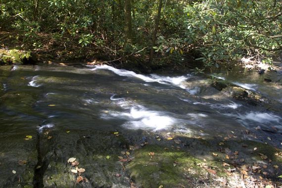
A bit further down Minsi fire road, we took a left on an unmarked woods road. A little way down there is a short trail that leads to a nice water cascade.
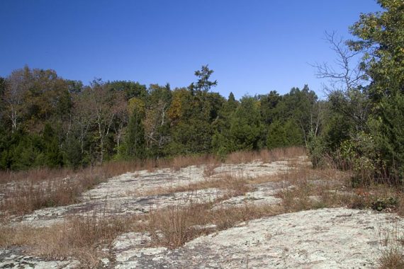
The wood road heads up and around to Table Rock… a large expanse of exposed rock.
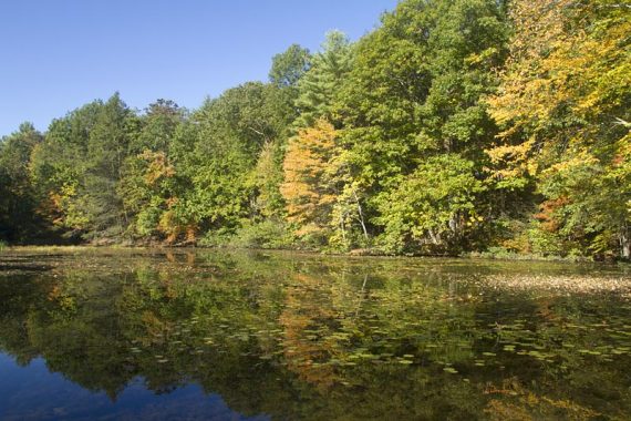
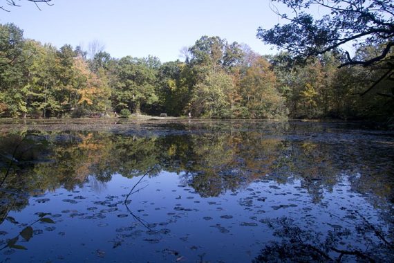
After Table Rock, the woods road becomes a trail and eventually the Minsi fire road is visible below, and then approaches above Lake Lenape (the lake passed at the beginning of the hike).
The trail drops down to the lake and a picnic table, then around the lake before heading back to the parking lot. This way back was quite nice and worth taking.
We left the Mt. Minsi lot and continued east on Rt. 611, stopping on a lot on the right side for a view of Mt. Tammany and Indian Head.
A little further is the lot for Arrow Island.
HIKE 2: Arrow Island Trail
MILES: 1.8
PARKING: N40 57.499 W75 07.276 no facilities
ROUTE: Arrow Island (WHITE) from Arrow Island parking to the lot on National Park Road.
There is a small lot, no facilities, and a small wood sign marking the trailhead. The Arrow Island trail heads uphill from the start, but for a short way. Turn left at the top of the hill and keep following the WHITE blazes.
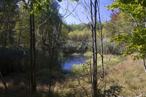
The trail runs above the road and highway noise was loud, and the trail is not that great.
It became nicer near a stream, but overall the trail is faintly blazed, hard to see, and just less than enthralling. So much so, that when we got to the parking lot at the other end, we decided to just backtrack and not explore the Slateford Loop.
Eh, you can skip this trail. If we were to check it out again, we’d start at the other lot and do the Slateford Loop from there.
Old-Timey Fun:
Whilst poking around the web I recently stumbled upon some Google Books (free) about the Delaware Water Gap from the 1800’s. Mentions of taking your horse carriage out alone make it worth a look, but the old-fashioned prose is a hoot too. The 2nd link below contains photos from around the Gap.
“Summit of Mt. Minsi… do not be persuaded that the ascent of the Summit is too difficult. Hundred of ladies and gentleman have gone before you, and few have regretted the undertaking. The journey is somewhat tiresome, and at places a little difficult; but, by resting occasionally, it can be overcome without great fatigue.”
The Delaware Water Gap: its scenery, its legends, and its early history. 1867
Nice pictures. I went by the trailhead a few weeks ago but haven’t actually climbed anything in the Gap. Looks like fun, maybe this spring!