This may be our favorite hike in the Pine Barrens.
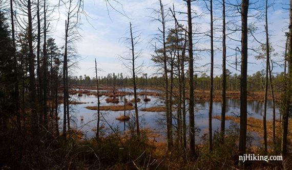
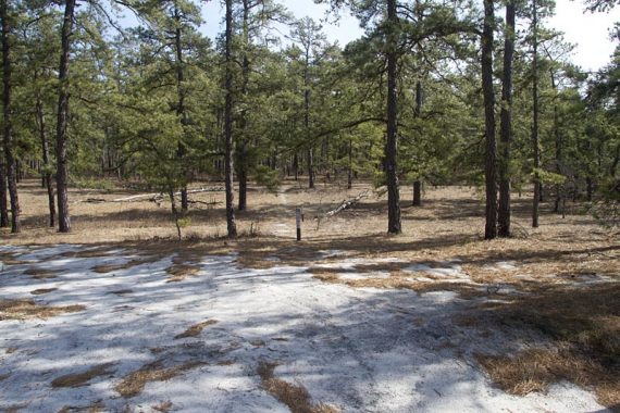
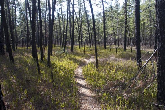
It’s the typical pine trees and packed sandy trails, but adds in views along the Mullica River and just seems to be the most scenic and pleasant route in the area.
9.6 miles. Trail surface is level, soft sand and pine needles, barely any elevation change. We’d rate it between moderate and challenging only due to length, the trail itself is very easy.
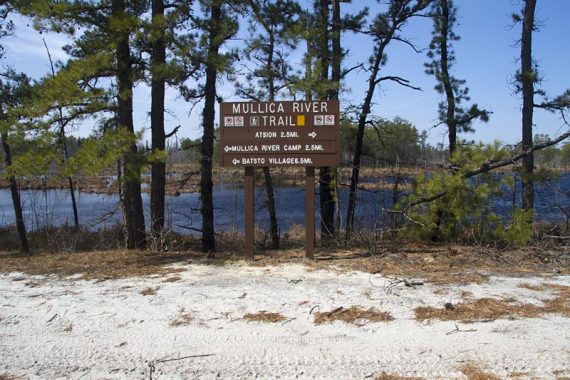
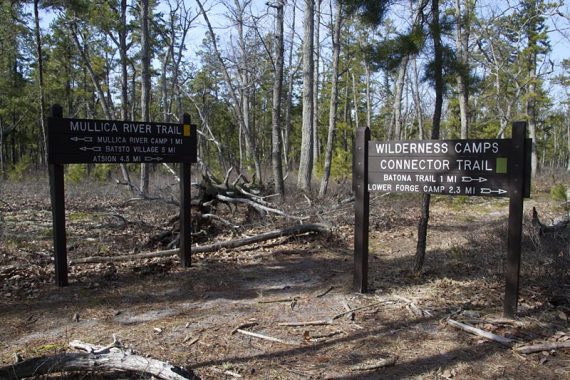
Route: Mullica River Trail (YELLOW) – Beaver Pond/Quaker Bridge Trail (PURPLE) – Wilderness Camps Connector (GREEN) – Mullica River Trail (YELLOW)
Complete hike details on our main Wharton State Forest – Atsion to Quaker Bridge page.
We decided we couldn’t bear to trudge through even one little bit of slushy snow today, so we opted to head down south again.
The weather did not disappoint – 50 sunny degrees that felt more like the end of March than February.
All trails are well marked with mileage signs along the way and at intersections.
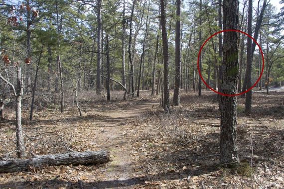
As with any hike in the pine barrens, keep an eye on the blazes to make sure you don’t wander off onto one of the many unmarked sand roads.
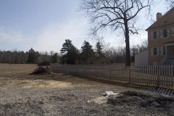
The office is closed for the winter, until Mar 31, and the trail kiosk had no maps.
The trailhead is to the right of the building, follow the YELLOW blazes down the sand road. A composting toilet is across the field.
To pick up the trail from there, walking out of the toilet, head straight to the sand road and turn left onto it.
From either starting point, follow the sand road past an old church on the left and a gun club on your right, and watch for the YELLOW blaze on a brown post on the left where the trail turns into the woods. (A building and a gate are on the right)
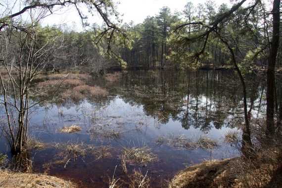
Some water views.
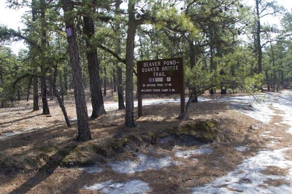
Turn LEFT, now following Beaver Pond/Quaker Bridge (PURPLE).
The GREEN (Wilderness Trail) connects Beaver Pond/Quaker Bridge (PURPLE) back with Mullica.
There are two large diagonal paint blazes on a tree but they blend in and are easy to miss. If you come out to an open area with multiple sand roads, you missed it.
GREEN (Wilderness Trail) simply connects the two main trails and isn’t overly thrilling.
Back on to the Mullica River Trail.
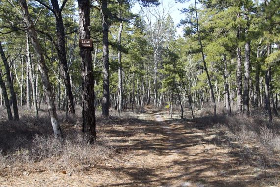
Occasional mile marker signs.
The only downside to this area is it is heavily used by off road vehicles. They are not on the trail, but on the many sand roads.
Many times it felt as if we were in a secluded pine forest, only to suddenly see a car or dirt bike drive by on a sand road we didn’t even realize was nearby.
—
2/23/22 – Archived some old photos that were replaced on the main hike guide to here.
Thanks for this blog! I’m headed out on this trail today (March 8th) and it’s my first time on it. Looking forward to it.
@Joe Collins
Enjoy your hike – looks like you have a nice day for it!
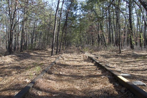
Maybe my son and I ran into you on the trail that day, as we started at Atsion and hiked the abandoned Central RR of NJ railroad tracks to the Carranza Monument and back. I posted a few photos here.
Yes we did see you that day, I recall your son’s bright red shirt. We started out around the same time, and you guys headed off on the tracks while we kept going on the trail… small world!
Dawn
How much is it to go hiking on the atsion trail?
Atsion rec area charges fees from Memorial Day through Labor Day, but not sure if that includes the parking area for the Atsion trail (which is across the street from the lake). Contact the park office to check.
Parked at the Atsion trail head for 6 hours today, no fee was charged. Hiked down along the Mullica River Trail to the Mullica River Campsite and back again…would’ve been even better if not for the ankle I twisted several days ago. 10 miles round trip, it was killing me by the time I got back, but worth it.
Hey, I am looking to possibly do this on 3/24/12, the weekend of my wife’s baby shower. However, she is nervous if she goes into labor (shower is kinda late) I won’t be reachable on my cell phone. Does anyone know if there Verizon cell service on this hike? Thanks!
Hi Bob – We’re not really sure, as we’re on AT&T. I do know that Verizon has better service in South Jersey than AT&T does – but we’re not sure about reception on the actual trail.
@Bob
you most likely will NOT have reception. You COULD climb a tree or involve the fire tower where reception does work. Ive had Sprint and AT&T, no go on ground level. Verizon is spotty, I would rely on it.
Longtime Wharton Walker