Enjoyable hike through pine barrens with informative forestry and nature displays along the way.
7.2 or 2.5 miles. Easy sand and pine needled covered trails. Mostly level, except for a few teeny hills around the center.
- Shorter: 2.5 miles – cut out YELLOW, noted below.
- Short: Several short loops lead out from the center, and it’s easy to cut trails off of this route.
- Longer: This route is pretty much all the trails.
- Nearby: Turkey Swamp, Metedeconk To Manasquan Loop, Manasquan Reservoir; Clayton Park.
- Nearby: Prospertown Lake Kayak.
Hike Info:
Our two cents:
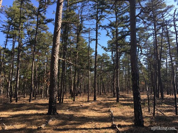
This route puts the shorter and more interesting trails first so that the long stretch of YELLOW (Pine Acres) can be easily cut out if needed. That’s a pleasant pine barrens stroll if you want the miles though.
Lots of educational stuff for kids – but it’s interesting for adults too. We didn’t get to check out the displays inside the Interpretive Center because it’s closed on weekends.
They often offer guided hikes and other programs such as Shinrin Yoku Forest Therapy; check the FREC event schedule.
Minor downside – heard low flying military jets all day long.
Updated: 7/2021 – Page refreshed, not re-hiked.
Map/Books:
Print ahead or pick up at the center. When it’s not open there should be maps in the box outside the door. A shorter route is in Best Day Hikes in New Jersey.
Parking: N40.09514° W74.32151°
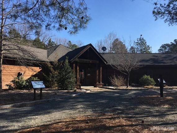
495 Don Conner Blvd Jackson, New Jersey 08527.
Large dirt lot by the interpretive center. The other side of the property is connected to the Forest Service Nursery and online or GPS might send you there. Complete directions on the park site.
Restrooms:
Accessed from the outside of the center, but these were closed when the center was (on a weekend in March).
A portable toilet is down the park road just over the bridge and is passed on this route early on. Or walk down the road first.
Another portable toilet is on the Light Green (Forest Products Loop) trail.
Hike Directions:
Overview: RED (Firewise) – WHITE (Project Learning) – Light Green (Forest Products Loop) – BLUE (Swamp Life) – RED (Firewise) – PINK (Swamp Loop) – RED (Firewise) – YELLOW (Pine Acres)
0.0 – Across the parking lot from the Interpretive Center, start following RED (Firewise) briefly, then turn RIGHT to start following WHITE (Project Learning).
Continue on WHITE (Project Learning) as it crosses and briefly joins YELLOW (Pine Acres) a few times.
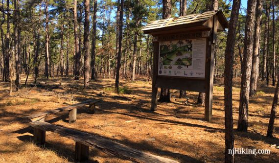
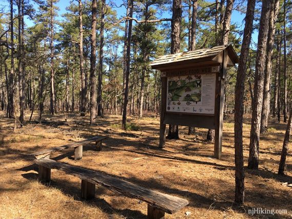
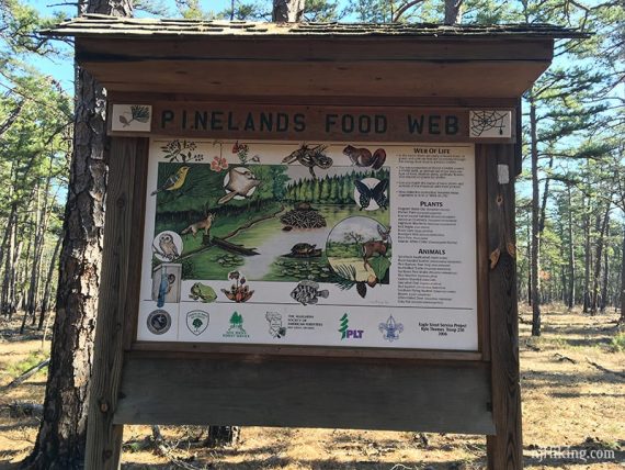
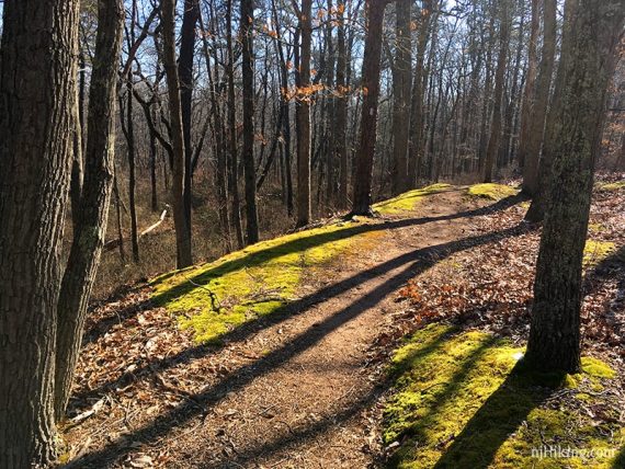
The trail is very mossy in spots and there are some display boards with various nature topics.
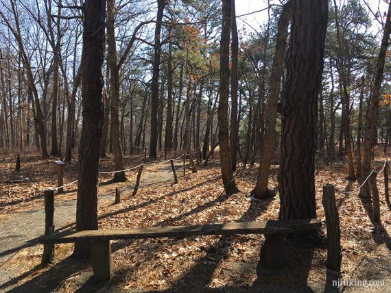
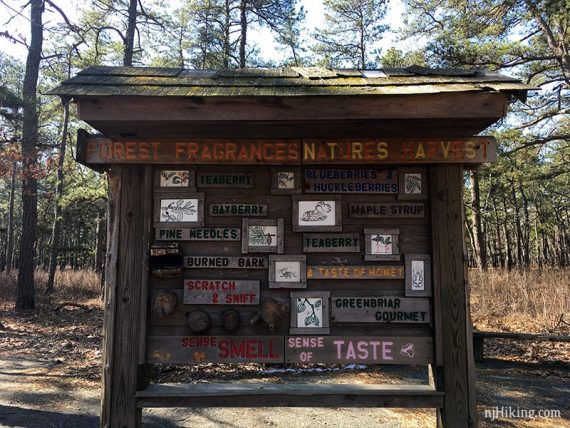
0.5 – Continue following WHITE (Project Learning) passing parts of the Sensory Trail with rope railings and the “Forest Fragrances / Natures Harvest” display.
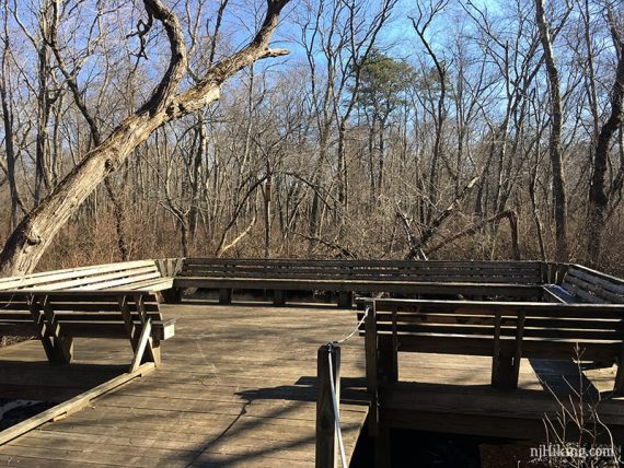
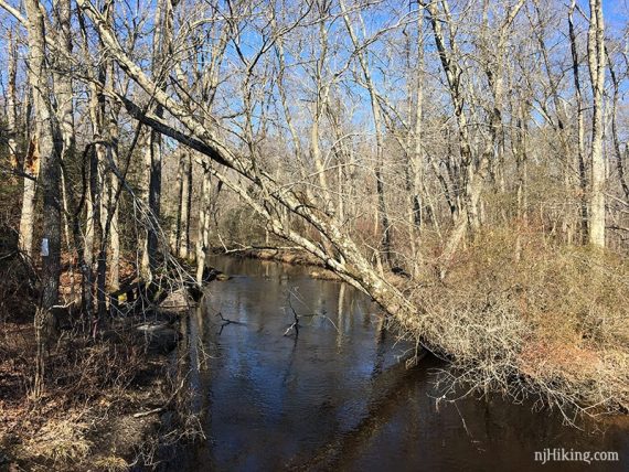
Walk out-and-back on the boardwalk platform overlooking Toms River.
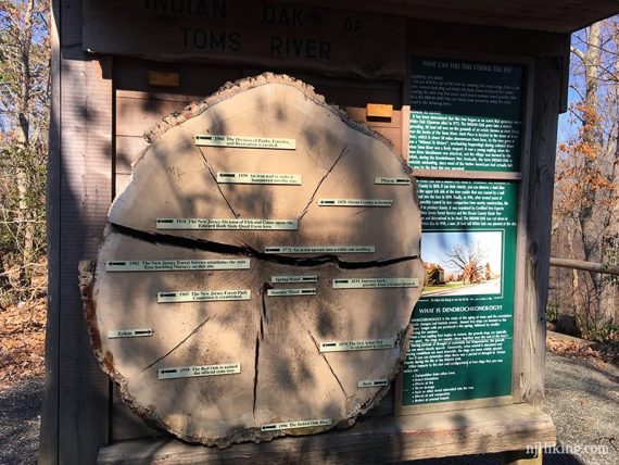
0.8 – After the “Indian Oak” tree cross section display board and a “White Oak” plaque on a tree with ORANGE and WHITE markers, turn LEFT and head towards the park road.
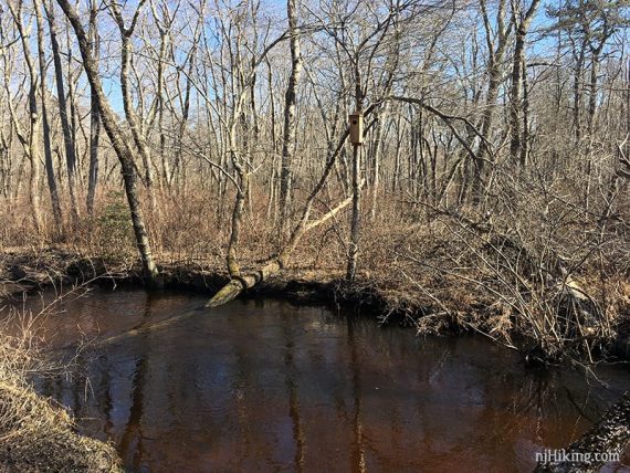
Turn LEFT to follow the park road on a bridge with another view of Toms River.
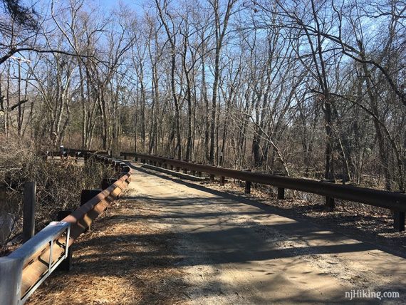
After the bridge, and before the portable toilet that might be there, turn LEFT and continue following WHITE (Project Learning).
On the trail map a “connector trail” is indicated but we didn’t notice it.
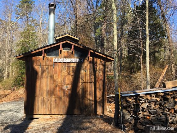
After the “Sugar Shack” the trail is marked Light Green (Forest Products Loop) – start following this in a square loop.
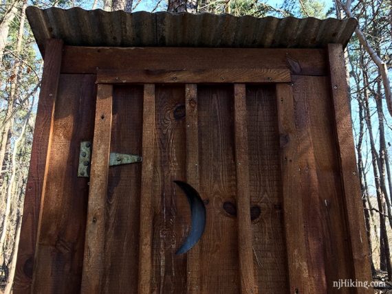
Pass a wooden old-timey-looking outhouse (was locked).
1.2 – Turn RIGHT (not really marked) on to a sand road through the nursery area. There is another portable toilet off to the left.
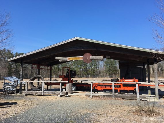
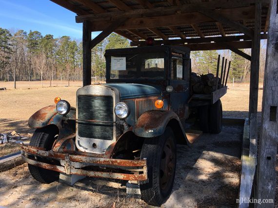
Continue on Light Green (Forest Products Loop) past the sawmill and old logging truck.
Walk under the “Forest Products Loop” sign. Turn LEFT at the Bee kiosk and head back to the bridge/portable toilet.
Continue straight a few steps (don’t turn back down the bridge) and then turn RIGHT to re-enter the woods to start following BLUE (Swamp Life).
// Alternate: Cross the bridge to shorten the route by cutting out the Swamp Life loop. //
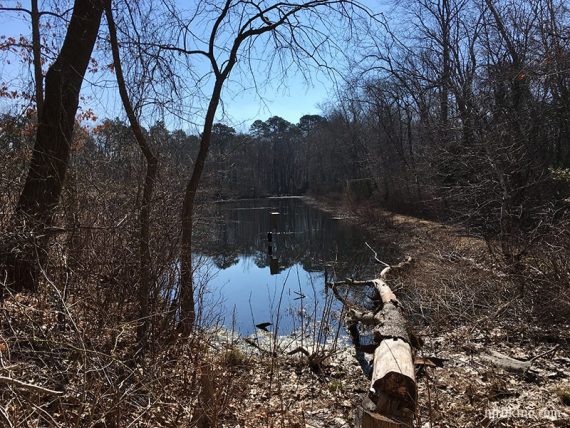
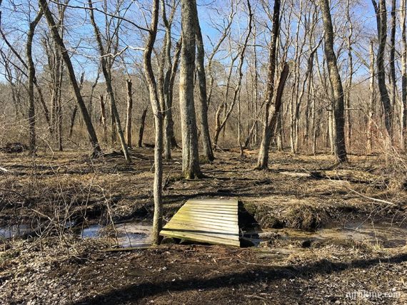
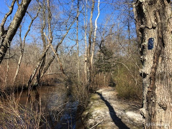
Follow BLUE (Swamp Life) along the edge of a pond, through a wet area, and back around to the park road.
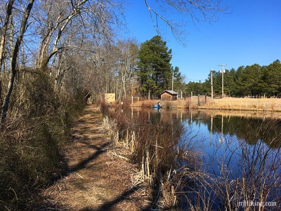
Turn LEFT on to the park road.
1.9 – Turn LEFT and start following RED (Firewise).
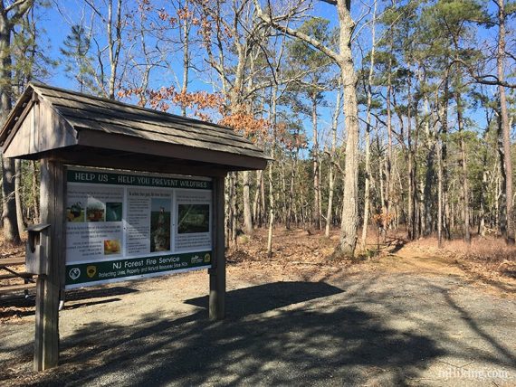
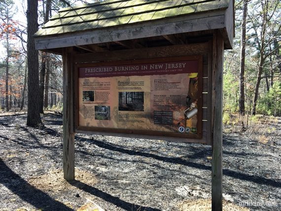
2.0 – Swamp Loop sign and a board about prescribed burns. We hiked here a day after one and the forest floor was burned in this area.
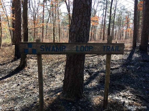
Take the path all the way to LEFT to follow PINK (Swamp Loop).
[Straight is the other end of the loop, and right is the continuation of RED to just this short not-actually-swampy trail out]
After the PINK (Swamp Loop) continue following RED (Firewise) again. Cross the park road.
2.4 – Turn LEFT to now follow YELLOW (Pine Acres) for the rest of the hike.
// Shorter version, 2.5 mile: Turn RIGHT to return to the parking lot. //
Cross Don Connor Blvd.
2.7 – Pass a side branch of YELLOW on the right that leads back to the main lot.
There are occasional blue blazes that are not on the trail map.
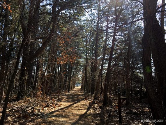
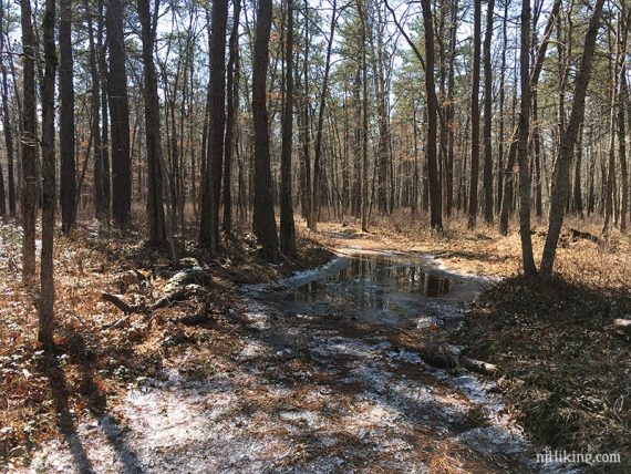
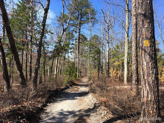
Continue following YELLOW (Pine Acres) as it turns left. We encountered some wet areas in this stretch.
3.2 – Turn LEFT on to a wide sand road to continue on YELLOW (Pine Acres). [YELLOW (Pine Acres) also goes right and will be the return route so note this intersection.]
3.4 – Turn RIGHT off of the sand road to continue on YELLOW (Pine Acres). This turn was easy to miss but there are blazes on a tree. [Sand road continues straight.]
3.6 – Bench.
3.8 – Continue on YELLOW (Pine Acres) past a BLUE blazed trail off to the right that crosses a wet area on pallets.
This is not on the trail map and we decided it wasn’t worth tottering over all that to find out if it went anywhere.
Another bench.
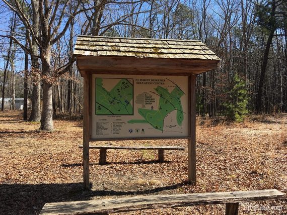
4.4 – Turn around at the trail kiosk and small dirt parking lot to start retracing the route on YELLOW (Pine Acres) back to the wide sand road from earlier.
5.6 – A few steps past where you came in, turn RIGHT to continue following YELLOW (Pine Acres) on a parallel path.
6.1 – Cross Don Connor Blvd. again.
7.1 – Cross WHITE (Project Learning)
—
Hiked: 3/9/19. Trail Blog: “Forest Resource Center after a Prescribed Burn“