Hike around Lake Sonoma and explore the beautiful forest beyond.
5.7 or 2.4 miles. Rugged, rocky surface with a few rock hops over streams. Within the northern section of Norvin Green State Forest.
| 5.7 miles | This hike guide: Detailed instructions and photos follow below. |
| Shorter | 2.4 – Out-and-back just to Lake Sonoma. Noted below. |
| Also from this lot | Lake Sonoma, Overlook Rock, Manaticut Point |
| Nearby, longer version | Horse Pond Mountain to Lake Sonoma Loop |
| Nearby | Wyanokie High Point, Chikahoki Falls, Otter Hole; Wyanokie High Point, Carris Hill, Buck Mountain; Stonetown Circular |
Our two cents:
The lake and the forest here is beautiful is any season. This route uses a somewhat newly blazed “Lake Sonoma Trail” which mixes new trail with old woods roads beyond Lake Sonoma. Also pass some interesting old rusted equipment along the way.
Portions of this route overlap our other Lake Sonoma area hikes. Small planes flying overhead somewhat frequently on our last hike (don’t recall noticing this before, maybe an event…).
Updated: 9/2025 – Minor edits, added note for short out-and-back just to Lake Sonoma; re-hiked.
Hike Info:
Map/Book:
Northern New Jersey Highlands Trails Map. Note versions of this map before 2021 will not have this trail marked on it. Follow along on your smartphone with our Interactive Map link above. Not in any books we know of.
Parking: N41.09077° W74.32124°
Manaticut Point Trailhead. Entering the street address shown on Google (2-40 Crescent Dr, Ringwood, NJ 07456) leads further down Crescent Dr and not to the trailhead.
If coming from Rt. 287 N, take exit 55; Rt. 511 to West Brook Rd.; then Magee to Burnt Meadow Rd. to Crescent Drive. Parking is on Crescent Dr. along the curb. The trailhead is near a wooden sign and large rock.
Restrooms:
None. Gas stations and convenience stores along Rt. 511.
Hike Directions:
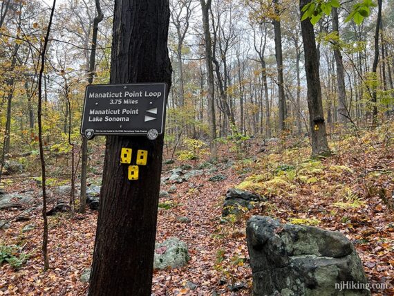
Overview: Manaticut Spur (YELLOW with BLACK DOT) – Manaticut (YELLOW) – Lake Sonoma (ORANGE) – Manaticut (YELLOW) – Manaticut Spur (YELLOW with BLACK DOT)
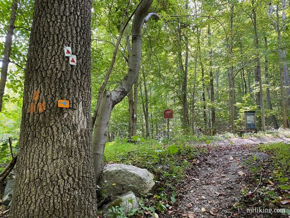
0.0 – Start following Manaticut Spur (YELLOW with BLACK DOT) at a trail sign and near a large rock.
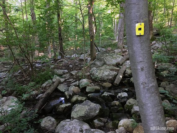
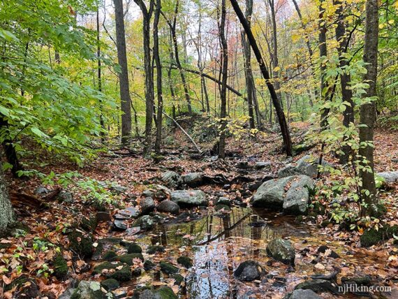
Large rocks loom above and there are several stream crossings using rocks (which might have little or no water if it’s been dry).
0.3 – At a sign for Manaticut Point, turn RIGHT to start following Manaticut (YELLOW) towards Lake Sonoma. [Manaticut (YELLOW) also goes left].
0.9 – Start following Lake Sonoma (ORANGE) to the LEFT. It is co-joined with Manaticut (YELLOW) until the end of the lake. [Lake Sonoma (ORANGE) also goes to the right and is the return route].
Soon, the trail splits. Continue following Lake Sonoma (ORANGE) to the RIGHT. [Manaticut Sonoma Connector (ORANGE-YELLOW… like candy corn!) goes left].
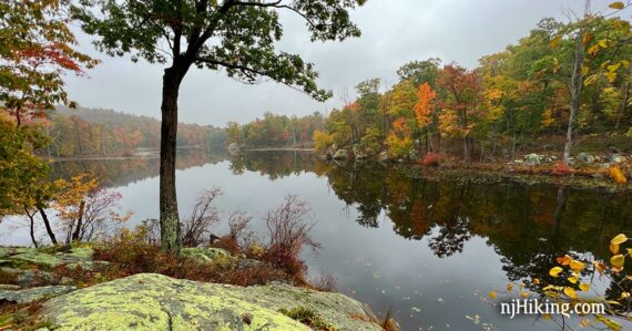
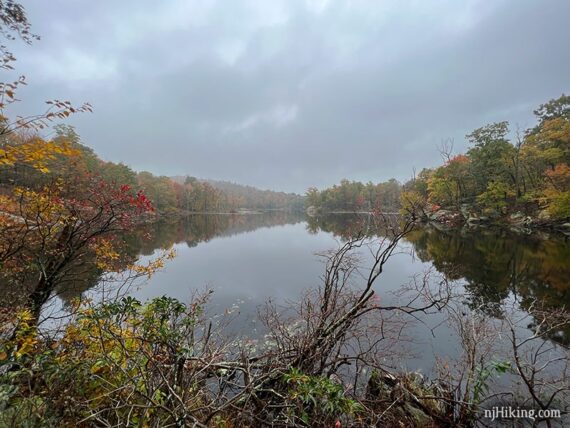
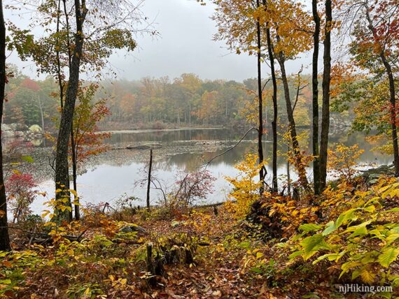
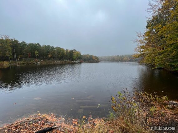
1.2 – Lake Sonoma comes into view.
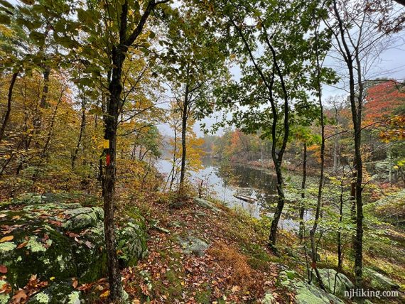
Lake Sonoma (ORANGE) runs along the edge of the water. There are several viewpoints and rocky spots to take a break.
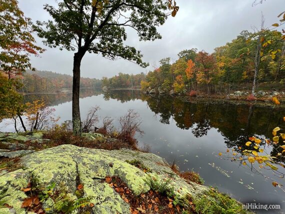
The lake is beautiful even on an overcast and foggy fall day.
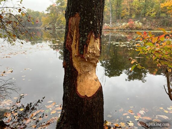
Beavers like hanging out at the lake, too.
1.4 – There is a wider open area past these initial views of the lake. After this the views get more limited and the trail pulls away from the lake.
// Shorter, 2.4-2.8 mile round trip: Instead, after the lake views, turn around and retrace the route back – distance depends on how far along the lake you went: Manaticut (YELLOW) to YELLOW Manaticut Spur (YELLOW with BLACK DOT) //
Continue on Lake Sonoma (ORANGE) along the southwestern shore of the lake.
1.5 – Continue following Lake Sonoma (ORANGE) to the RIGHT. [Manaticut (YELLOW) leaves to the left]. Soon, Lake Sonoma (ORANGE) crosses a (possibly dry) stream, and turns right, following a woods road.
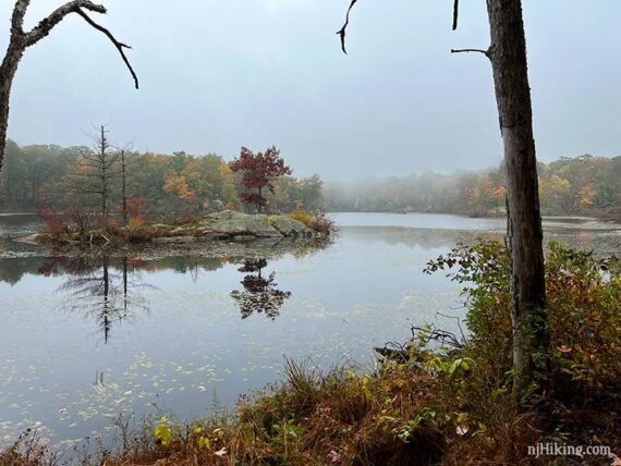
The trail continues hugging the lake for a bit more with some last glimpses before it turns away from the lake. Rocky little island just off shore:
1.7 – Follow a side trail marked with a STAR on ORANGE. This leads to an open area near a large dam and a wide view over the lake. The view is nice but the area is kinda trashy so it’s not a great break spot. Return.
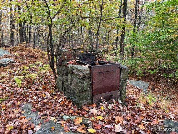
Pass an old… stove? You never know what you’ll find in the middle of the woods in Jersey…
Keep on following those orange blazes.
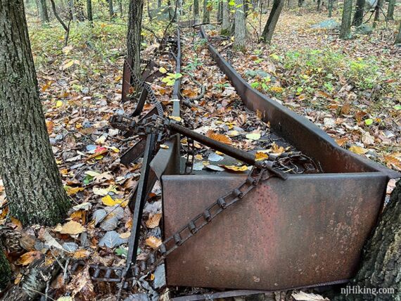
2.7 – Start seeing rusted old equipment along the way. While I couldn’t locate much information about this area, I believe this is a rock conveyor. In New Jersey it’s very common to be hiking on park land that was either farmed or mined at one point.
After this there is woods road with a downhill section full of ‘ankle-rollers’ and golf-ball sized ‘rolly-rocks’ (I just made that term up, feel free to use it) in soft-ish sand. Not a fan.
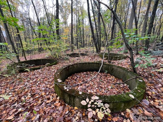
2.8 – Continue following Lake Sonoma (ORANGE) as it turns RIGHT to follow a woods road again. [Tapawingo (BLUE) is on the left]. Cross Burnt Meadow Brook (might be dry). Large concrete rings are on the right.
Soon, more rusted equipment is off on the right.
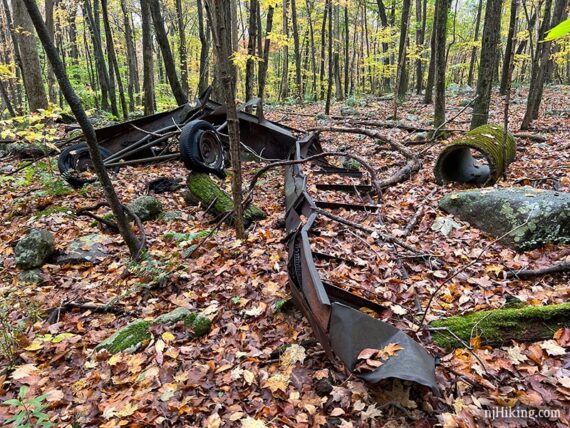
However… on our 2025 hike we spotted the “conveyor” but didn’t notice the rings or wheeled equipment. They could have been overgrown… or we might have been busy discussing when to stop for our snack and waltzed by them.
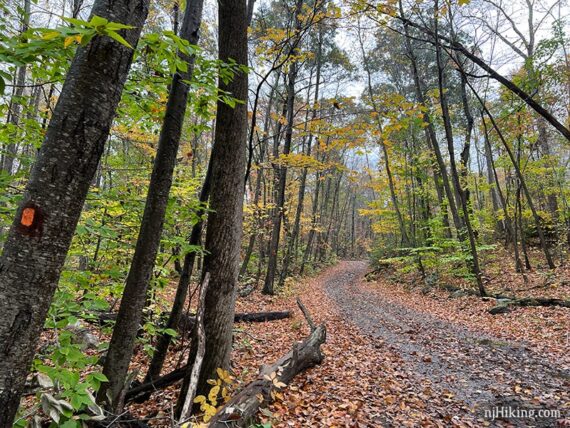
Lake Sonoma (ORANGE) follows along an old woods road, again.
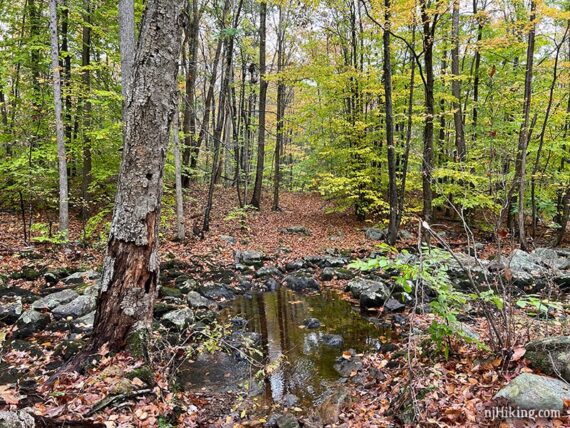
3.5 – Cross Burnt Meadow Brook where it’s marked “difficult crossing in high water” on the Northern New Jersey Highlands Trails Map trail map. This wasn’t an issue either of the times we hiked here – but your experience may differ.
3.7 – At Burnt Meadow Road (a rutted dirt road at this point), turn RIGHT to continue on ORANGE (Lake Sonoma) which is briefly co-joined with RED TRIANGLE on WHITE (Stonetown Circular).
Technically, the trails on are a path on the other side of the woods road… but you could turn right onto the woods road and the trails continue just past the concrete barrier.

(The road over the stream was muddy/washed out in years past, don’t recall these barriers or the road being in decent condition the last time here).
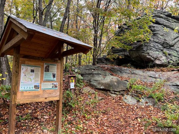
3.8 – Shortly, ORANGE (Lake Sonoma) turns to cross Burnt Meadow Road. [RED TRIANGLE on WHITE (Stonetown Circular) leaves ahead]. Just across the road is a trail kiosk with a bench attached if you’re in need of a sittin’ spot.
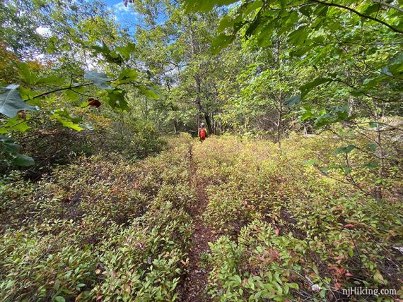
Continue following ORANGE (Lake Sonoma) through some low brush.
In an area with lots of ferns and some larger boulders there is a rock that kinda sorta looks like the profile of a gorilla, so at some point we dubbed this Gorilla Rock:
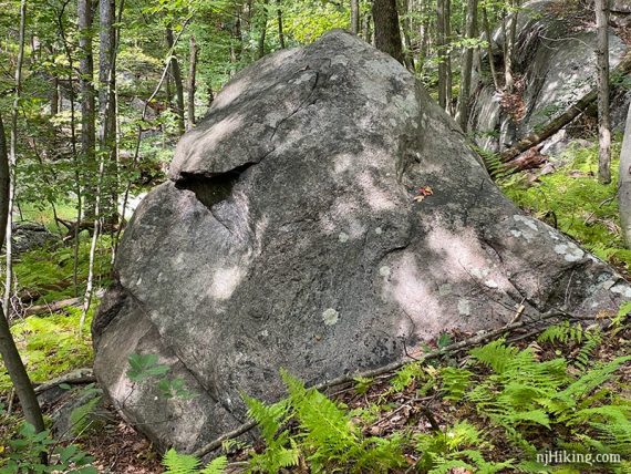
However, on this hike, I also thought it maybe slightly resembles the profile of Sam the Eagle from The Muppets – while Tom thought it looks like Jabba The Hutt. And, yes, we stood looking at this rock for several minutes having this absurd discussion.
3 minutes down the trail later Tom bursts out with “JABBA THE ROCK”, sounding very pleased with his cleverness, and that I needed to make note of that. So here we are.
4.8 – Follow ORANGE (Lake Sonoma) as it does a quick jog to the right then left, briefly following a woods road. Soon, turn LEFT to now follow YELLOW (Manaticut). [YELLOW (Manaticut) / ORANGE (Lake Sonoma) goes to the right – the direction you went earlier.]
5.4 – Now follow Manaticut Spur (YELLOW with BLACK DOT) back to the parking area. [YELLOW (Manaticut) leaves to the right].
—
Hiked: 9/1/25.
Hiked: 10/25/21.