Hike sugar sand trails around cranberry bogs in the heart of Jersey’s pine barrens.
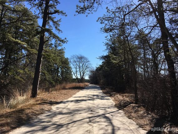
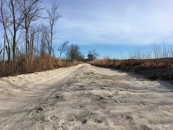
6.1 miles. Level sand trails/roads, sunny/little shade. Most of the sand is packed but there are some deep soft sections.
- Shorter: Many ways to truncate this route.
- Short: There is driving tour info available in the store if you prefer to do a short hike and then drive around some of the bogs instead.
- Longer: 7.1 – Include the Cranberry Trail loop.
- Longer: Add an out-and-back to Gaunt’s Brook Reservoir, or extend on other trails.
- Nearby: Pakim Pond to Mt. Misery.
- Similar (cranberry bogs): Double Trouble, Franklin Parker.
Hike Info:
Our two cents:
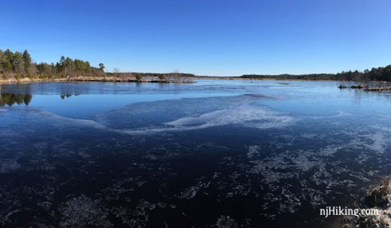
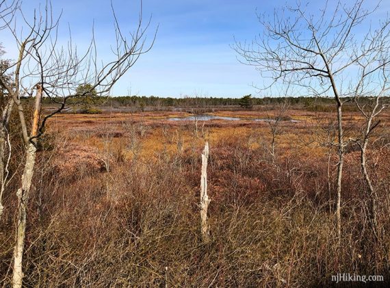
A nice place to get a winter hike in with lots of sun exposure. The contrast between green pine, blue sky and bogs, and white sand roads is visually striking and especially welcome when everywhere else is leafless and bleh.
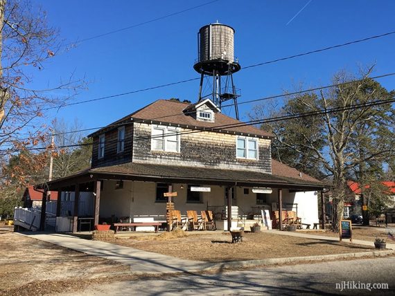
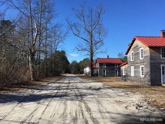
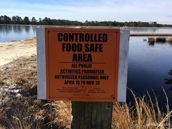
There are also historical village buildings plus a store with info, gifts, and candy. Some of the cranberry bogs are still in use and are fenced off.
Sand roads around cranberry bogs stretch our definition of “hiking” but we include them on the site since they are a unique and very “Jersey” outdoor experience.
Fun fact: Blueberries were first cultivated through the efforts of Elizabeth White at Whitesbog.
Updated: 7/2021 – Page refreshed; no re-hiked. Minor edits.
Map:
While hiking, try our Whitesbog Interactive Map for an overlay of the route with your current location.
Pick up a paper map at the general store or possibly in the map box at the trailhead. The Brendan T. Byrne State Forest park map is limited in detail for hiking, and the Whitesbog Preservation Trust site doesn’t offer a map.
Books:
A variation of this route is in Best Day Hikes in New Jersey.
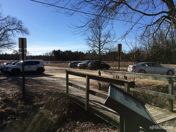
Parking: N39.95912° W74.50977°
Whitesbog Historic Village. 120 W Whites Bogs Rd # 34, Browns Mills, NJ 08015. Small dirt lot on the left.
Restrooms:
Regular bathroom in the general store (Generally open Sat. 10 -3 but check their site for current times).
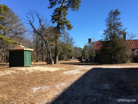
Composting toilet: Facing the store, turn left, walk down the road past a few buildings. It’s on the right, tucked back away from the road.
Hike Directions:
Note: Navigation here can be a bit challenging as the sand roads look very similar, most of the route isn’t named or blazed, and when it was it didn’t correspond to any of the maps we’d found.
We’ve numbered our GPS points in order and noted them in the description and recommend following along using our Interactive Map on your smartphone.
Hike Directions / Optional 1.0 add-on:
In order to check out the old village buildings, we first hiked the Cranberry Trail (only named on one map). This loops back to the lot so you could also add it at the end too. You can also just out-and-back to the buildings as well.
Facing the store, turn left out of the parking lot. Walk down the sand road past a few village buildings.
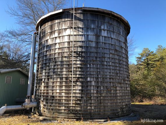
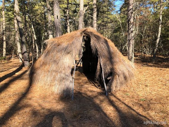
Continue past a silo and a replica native American hut.
At the split, turn LEFT and pass a cranberry bog. Follow that around as it turns left. Turn LEFT onto the park road again to get back to the lot.
Hike Directions / Main Route:
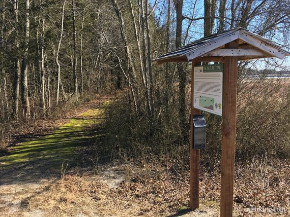
0.0 – Start following the Nature Trail at the kiosk across the road from the parking lot. [WB1]
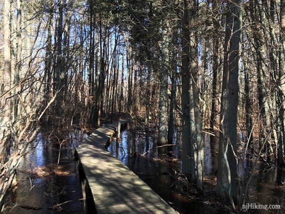
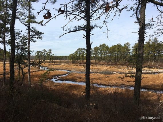
The Nature Trail meanders along a wet area, passes behind a building, a blueberry cultivating area, and eventually meets up with a sand road.
0.3 – Turn RIGHT onto the sand road.
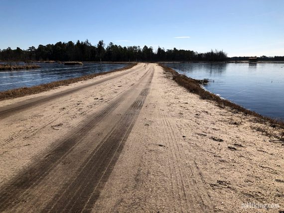
0.4 – At an intersection with wooden trail marker, turn RIGHT and follow a wide sand road between two bogs. [WB2]
[The sand road continues straight, a trail goes left.]
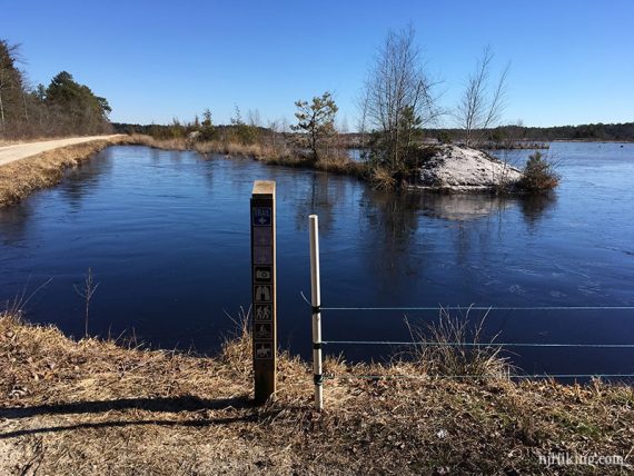
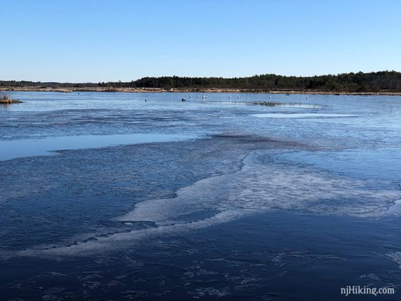
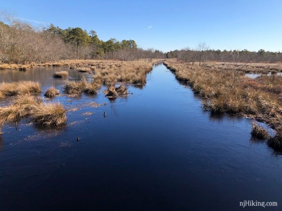
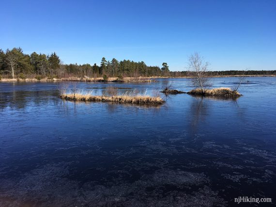
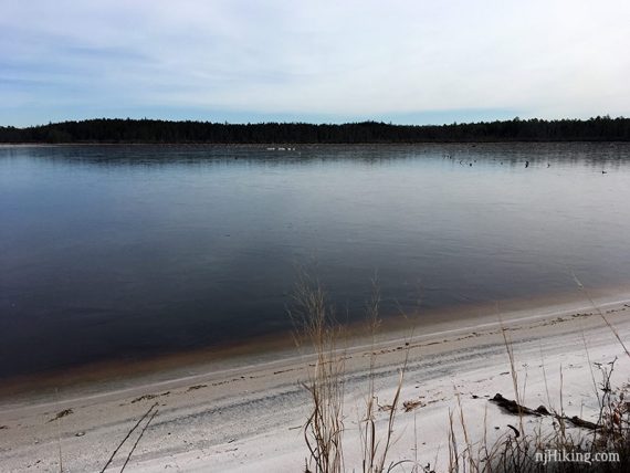
The sand road with a cranberry bog on either side.
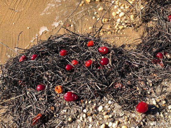
Cranberries floating against the edge of the bog.
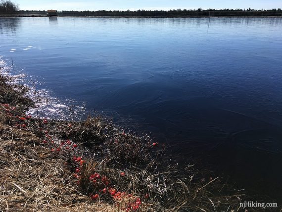
Continue along the bog.
0.6 – At a wooden post with red arrows, turn RIGHT. [WB3]
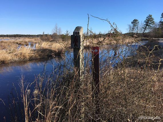
Shortly, pass a sand road on the left (you’ll return to this spot). [WB4]
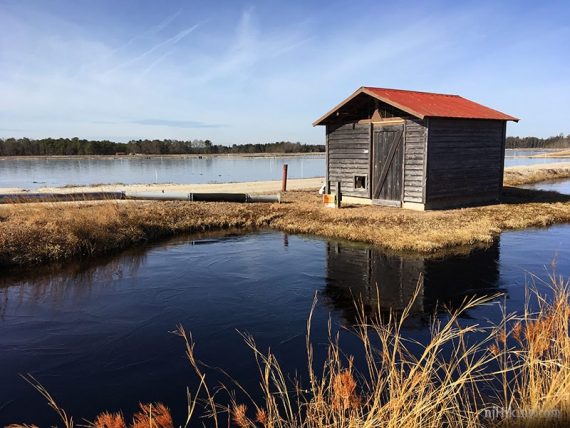
1.1 – At a wooden shack, turn around and retrace your steps. (The sand road continues ahead). [WB5]
1.5 – Turn RIGHT. [WB4]
1.6 – Turn RIGHT. Some wooden planking is in the water at right. [Sand roads also go left and straight.] [WB6]
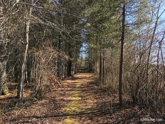
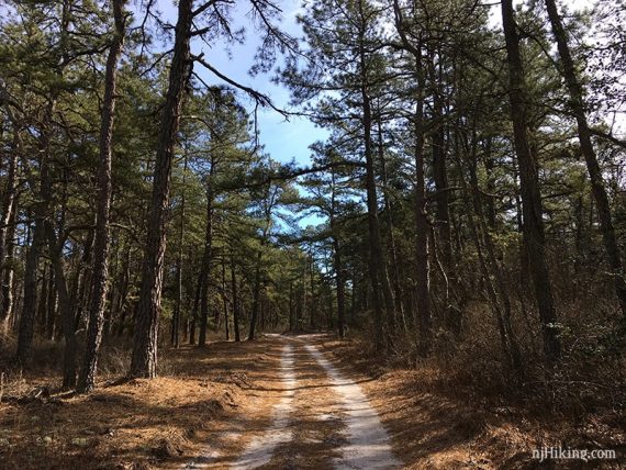
Tall pine trees line the sand road.
2.1 – Turn LEFT. There is a wooden arrow on a tree that points left. [The sand road also continues straight.] [WB7]
Bogs are along the right. Pass a sand road on the left.
2.5 – Turn RIGHT. [Sand roads also continue straight and left.] [WB8]
2.9 – Continue straight, passing a sand road on the left. [WB9]
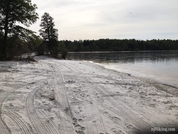
Just ahead, continue straight past a wide sandy beachy area on the right.
3.1 – The sand road curves to the LEFT. There are two red arrows, and a green arrow and a plain arrow pointing left. [WB10]
[The sand road also continues straight].
3.5 – Turn LEFT. There are arrows pointing left and a trash can. [The sand road also continues straight.] [WB11]
// Note: We planned on going straight here, and at the next intersection turned left. The trail ended up being washed out eventually, and the other option was closed so we backtracked to here. That may not always be the case so check it out if you like. //
3.9 – Turn RIGHT. [The sand road also goes left, and a path continues ahead.] [WB12]
4.2 – Turn LEFT. [The sand road also goes right]. [WB13]
4.3 – Continue straight at an intersection. A half plain half teal arrow points straight. [WB14]
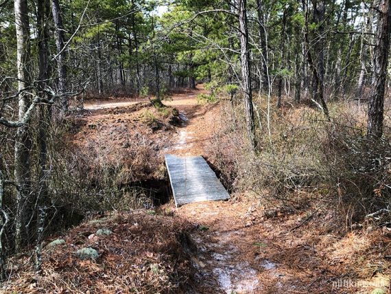
4.6 – Continue straight over a small wooden bridge. Continue straight. [The sand road also goes left]. [WB15]
Keep LEFT when the sand road splits just ahead.
4.9 – Continue as the sand road goes left. It’s mostly a straight shot back now, ignore any side trails.
There was a flooded out section at one point we had to go side around; your results may vary.
Cross a wide open sandy section.
5.9 – Veer LEFT at the split and walk along the blueberry triangle field. [WB16]
Turn LEFT towards the back of the general store. The parking lot is just past that.
—
Hiked: 2/10/19. Trail Blog: “Whitesbog in Winter“