Easy trails plus a playground and picnic area makes this a great destination for families.
3.7 miles. Mostly flat, easy, packed sand and pine needles.
| 3.7 miles | This hike guide: Detailed instructions, photos, and video follow below. |
| Shorter | 1.6 – Use RED to shorten this route. Noted below. 1.3 – Tindey (BLUE) to Interpretive (GREEN) and return the same way on BLUE Or use one of the many other woods roads on the map to create shorter loops. |
| Longer | 4.9 – add the Swamp Trail spur and Interpretive loop. See “Jakes Branch – Tindey, Swamp, and Interpretive Trails“ |
| Nearby | Double Trouble (minutes away); Cattus Island Park; Island Beach State Park; Wells Mills County Park; Barnegat Branch Trail. |
Our two cents:
Easy intro to the Pine Barrens with plenty of bail-out options to shorten the loop. Be sure to check out the displays in the visitor center and head to the top for a panorama over the pine barrens.
If you’ve got kids you’ll definitely want to check out the Play Trail (PURPLE) loop with cool playground equipment stations along the trail – nifty idea. On its own the trail is 0.5 miles or bail off the end of this route and take it back instead.
The park is easily accessed from the Garden State Parkway – but its close proximity also means road noise along most of the trail.
Updated: 3/2025 – minor edits. 1/2023 – page refreshed; re-hiked. Older change log at page bottom.
Hike Info:
Map/Books:
Get a map at the visitor center or at the trail kiosk, or print out the trail map ahead. Not mentioned in any hiking books we have.
Parking: N39.92925° W74.21403°
“Jakes Branch Nature Center”, 1100 Double Trouble Rd #2448, Beachwood, NJ 08722.
Garden State Parkway South: Exit 80 to Rt 9 South. Keep left at the fork, then turn left onto Double Trouble Rd. – there is a sign for the park. Park entrance is down the road a bit, on the right.
Restrooms:
Inside the visitor center. (They are accessed by an outside entrance so it’s possible the restrooms could be available when the park opens at 7 am, before the center is open).
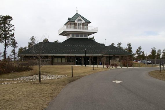
Visitor Center:
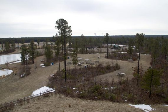
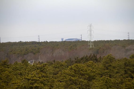
Check out the super swanky visitor center with an ADA accessible observation deck that’s 5-stories up for outstanding views of the Pine Barrens and of the park below.
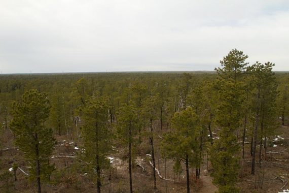
Bonus: the hanger the Hindenburg was kept in is viewable in the distance.
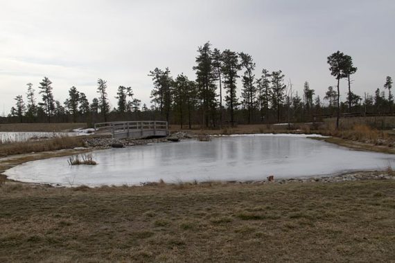
Pond near the visitor center:
Hike Directions:
Overview: BLUE (Tindey) for this entire route.
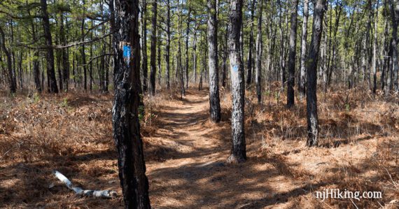
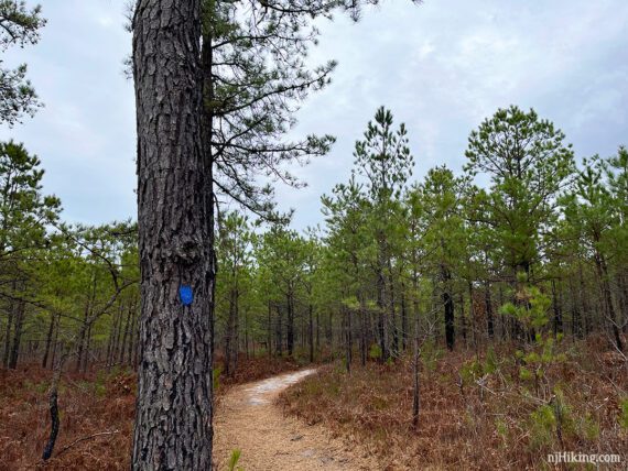
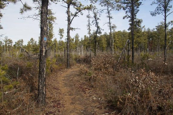
0.0 – Trail starts near the big sign at the edge of the parking lot, on the right of the visitor center. A few steps in, veer right on BLUE (Tindey) [BLUE also goes left].
Continue on BLUE (Tindey) when YELLOW crosses it. This is a bike/multi use trail that will intersect a few times on this route. Pass Chestnut Street, one of several sand roads marked with a wooden post.
Neither the YELLOW trail or marked roads are integral to the directions so we’ve not created waypoints or indicated them all in the description.
1.0 – Pass RED (Spruce St.) on the left.
// Shorter Option, 1.6 miles total: Turn left and use this trail to shorten the hike.
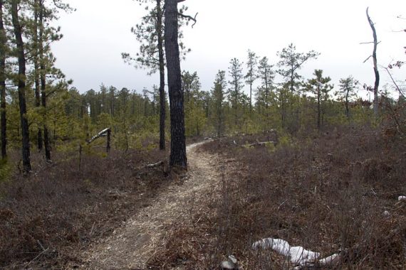
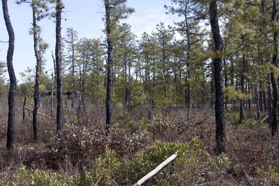
Several woods roads cross over the trail and there are a few wooden benches. Trees become shorter with evidence of fire damage, and the area is more open.
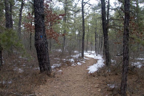
To get an idea of how the forest bounces back, this photo was taken in this area in 2023:
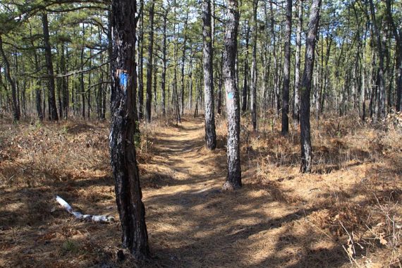
And this photo was taken back in 2011:
2.2 – Veer RIGHT to continue on BLUE (Tindey) when playground equipment on the Play Trail (PURPLE) comes into view.
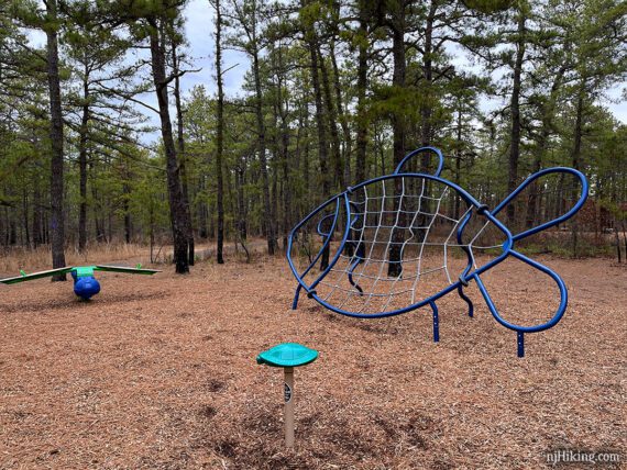
// Optional: Take Play Trail (PURPLE) back instead. This should reduce the total by ~1.2 miles. //
2.6 – Pass WHITE (Swamp Spur) on the right. There was trail work just before this intersection the last time we hiked here (1/2023) so Swamp Spur may become a loop or change in some way.
// Optional add-on: Take WHITE (Swamp Spur) out and back to add an additional 0.4 miles total. //
Vehicles can be seen through the trees as BLUE (Tindey) briefly parallels Double Trouble Road with the Parkway behind it.
Pass intersections with the PURPLE trail and playground equipment. Continue on BLUE (Tindey) as it winds through pine forest.
3.4 – Pass GREEN (Interpretive Trail) on the left. [Optional add-on: This loop adds 0.7 miles].
Shortly after, pass RED (Spruce St.) on the left. Continue on BLUE (Tindey) as it winds around the back of the visitor center and ends up at the trail sign.
—
Hiked: 1/22/23.
Hiked: 1/7/18. Snowshoe. Trail Blog: “Snowshoeing at Jakes Branch“
Hiked: 3/23/14. Trail Blog: “Jakes Branch – Tindey, Swamp, and Interpretive Trails“
Hiked: 2/13/11. Trail Blog: “Jakes Branch – Pine Barrens Panoramic View“
Updated: 1/2018 – re-hiked (snowshoe); minor description tweaks to reflect new PURPLE Play trail; updated map link, GPX, and Interactive Map. 3/24/14 – re-hiked, updated GPX added.