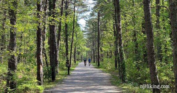
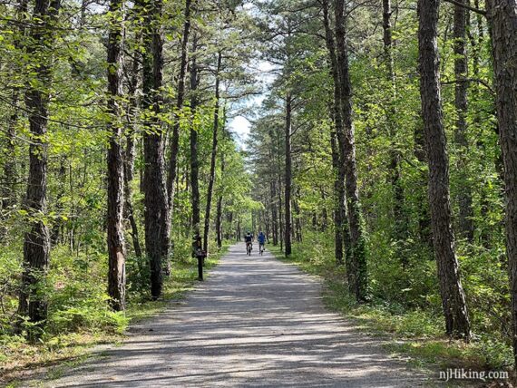
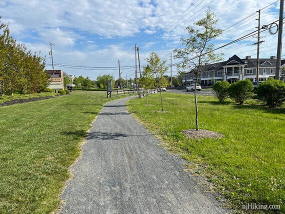
Flat gravel path that traverses a section of New Jersey’s pine barrens.
13.4 or 6.0… or less, total round trip. Level surface of packed crushed stone/gravel; some pavement. Mixed shade + sun. Multiple road crossings.
| 13.4 miles | This biking guide: Detailed instructions, photos, and video follow below. |
| Shorter | 6.0 – Turn around point noted below. Less – Simply turn back sooner. |
| Longer | ~23.9 – Continues after a dirt section, noted in description. |
| Nearby | Wells Mills County Park; Double Trouble; Jakes Branch; Cattus Island; Island Beach State Park; Bass River. |
Our two cents:
Enjoyable easy walking or biking through pine barrens. Downside: the middle section is through a busy shopping area along a road; road noise.
If on foot… the first 3.0 miles is the nicest (from Burr St. to Wells Mills Road) and is a solid choice for a flat-n-easy up to 6.0 mile round trip.
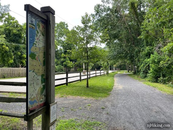
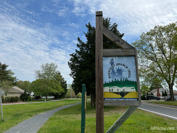
Detailed signs explaining area history are are along the trail and can also be found on the park site.
Updated: 1/2025 – Minor edits, not re-biked.
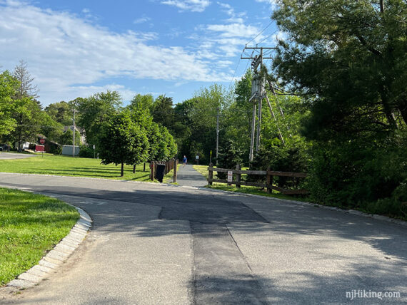
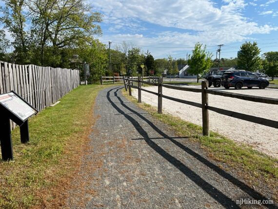
Parking: N39.75419° W74.22395°
“Barnegat Branch Trail, South Trailhead Parking”. 115 Railroad Ave, Barnegat, NJ 08005. From the Garden Parkway heading south take exit 67A toward Co Rd 554. (GSP heading north, take exit 67).
After the Wawa turn R on W. Bay Ave. Turn L on Railroad Ave where there are paved parking spaces in front of houses.
There are other lots at Country Lane, Wells Mills Road, and Station Drive which are marked on our Barnegat Branch Interactive Map.
Biking Info:
Trail Maps/Books:
The park site has maps. No paper maps at trailheads but large map signs are posted along the way. Mile markers along the trail. Follow along on a smartphone with our Barnegat Branch Trail Interactive Map. Appears in Rail-Trails New Jersey & New York.
Restrooms:
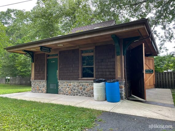
None at the Railroad Ave. / Burr St. parking but 2.4 miles in is a restroom building at the Country Lane parking area. No others along the way, but there are many stores.
If approaching Railroad Ave. / Burr St. parking via the the Garden State Parkway there is a Wawa soon after exiting.
Refreshments:
Trailside Gardens at Wells Mills Rd crossing around 3 miles in has ice cream (but we’re always here before they are open). Plenty of stores along Route 9.
Enjoy craft beer? Oyster Creek Brewery is along the trail. Nearby on the drive home heading north is Battle River and Toms River Brewing, and Manafirkin is to the south.
What type of bike to use for rail-trails?
Overall, a hybrid bike is good. This bike type works for flat dirt trails as well as asphalt (but maybe not on true mountain bike trails).
Gravel bikes and mountain bikes are good for rail-trails. A road bike might be alright. Skinny tires are not ideal unless it’s paved, and even then there might be the occasional buckled asphalt from roots.
Currently, we love our chain-less, no maintenance Priority 600 bikes for all fun and no fuss. If you’re new to biking and don’t want to commit, try renting, Craigslist for used, or start with an inexpensive bike.
Related: NJ Bike Trails overview page.
The Details:
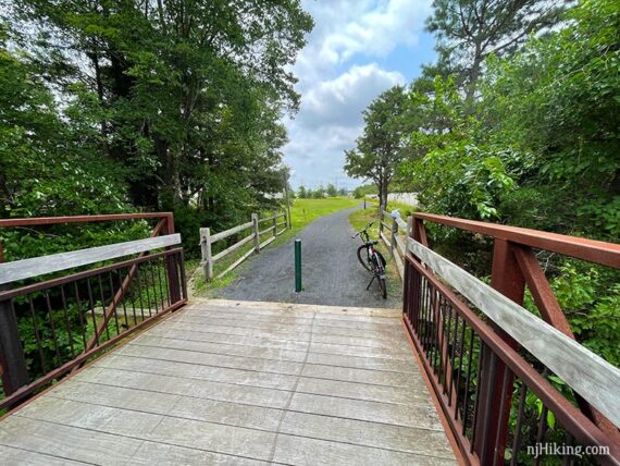
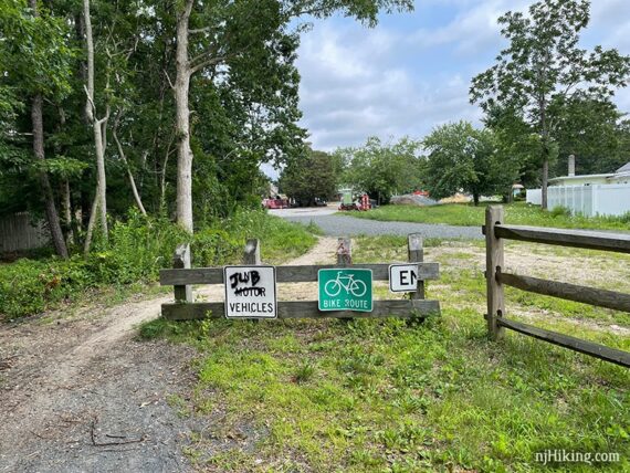
0.0 – Start following the Barnegat Branch Trail from the far end of the Railroad Ave. / Burr St. parking area.
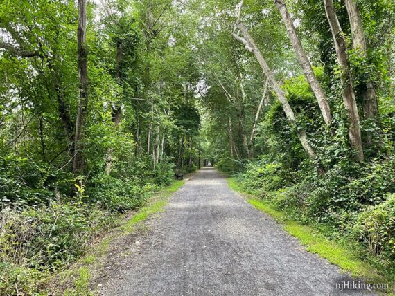
The wide packed gravel path is lined with trees and is mostly shaded in this section. At one point is a parallel path that would allow for a short loop in this southern section (we’ve not done this).
Fun Facts: The Barnegat Branch Trail (BBT) is a “rail to trail” using the abandoned Barnegat Branch Division of the Central Railroad of New Jersey. Construction began in 2007 and the trail will eventually be 16 miles one-way, from Barnegat Township to Toms River Township.
The first two or three miles is our favorite stretch. The wide path is lined with beautiful pine trees.
Of note, it’s slightly annoying to weave between the two green vertical cylinders that act as vehicle barriers at some crossings.
2.4 – Country Lane parking area and restrooms.
3.0 – Pass a large fitness station (probably the nicest/fanciest we’ve ever seen, even has weights…). Just after is a parking lot near the intersection of Wells Mills Road.
// Shorter: 6.0 miles round trip. Turn around here. Or maybe cross the road for ice cream first… //
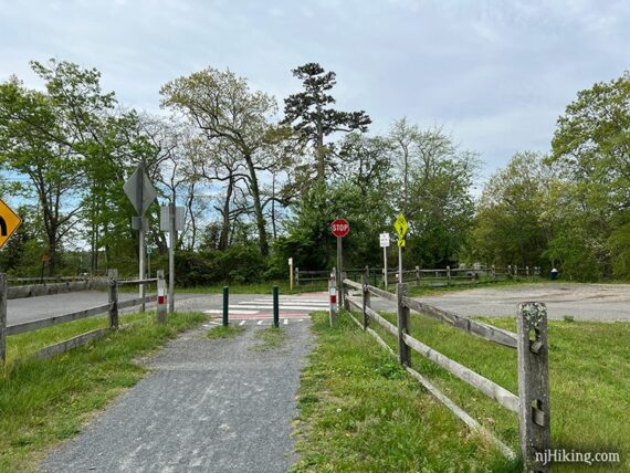
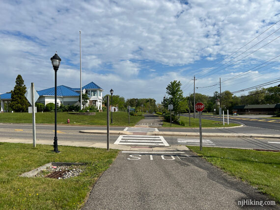
Cross busy Wells Mills Road. The garden center on the corner has ice cream.
The Barnegat Branch Trail starts to parallel Route 9, running adjacent to the road on a gravel path. The trail will be in full sun for awhile.
While this is our least favorite section – it’s basically passing shopping centers along a highly trafficked road – it’s not bad, just different than what a rail trail normally is.
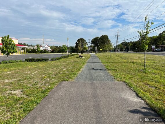
The path winds up to a sidewalk briefly then back to gravel. There wasn’t much traffic, if any, when crossing the many store driveways but we’re here early on weekends.
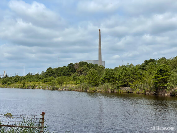
4.4 – Cross a fenced bridge over Oyster Creek.
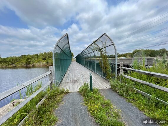
The tall structure off in the distance is part of the Oyster Creek Generating Station, a nuke plant that ceased operating in 2018.
This next short section between a fence and busy Route 9 tends to have looser, deeper gravel. Soon there are trees again between the trail and road.
5.1 – Cross another fenced bridge over the South Branch of the Forked River.
5.6 – Cross a bridge over the Middle Branch of the Forked River. This is usually our break spot on the return trip as there’s a bench and a patch of shady grass near the Wawa if the bench is too sunny.
Eons ago we somehow started a tradition of hitting Wawa for a Snickers ice cream bar on the drive home from biking the D&R Canal Towpath – but here we can get one basically on the trail. Even though it was 9:30 in the morning. Because it’s never too early for ice cream.
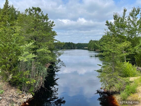
View of the Middle Branch of the Forked River from the bridge.
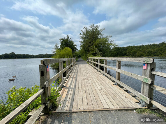
6.4 – Cross a bridge over Lower Lake.
Pass the small dirt Lower Lake parking area on the left. There is a large sign and grass on either side of the trail as it runs through a neighborhood.
6.7 – The trail ends unceremoniously at a fence. Turn around and retrace the route back – but technically, The Barnegat Branch Trail does continue… see below.
Continuation of the Barnegat Branch Trail (we’ve not done this):
I’d scoped out the route online after biking this once before but didn’t feel it was worth a busy crossing just to turn around in a mile, and we didn’t have time to try the whole adventure.
Overall… From here there is another mile of trail, then about a mile of unfinished trail, then the next finished section of 3.25 miles. Doing all of it should be ~23.9 miles round trip.
To do so, continue past the “end of trail” fence and into a large paved lot. Cross busy Lacey Road. The trail runs along Railroad Ave for about a mile, passing a large shopping center, to Musket Rd.
After this is a “missing” section of about a mile that will be completed someday but not yet as per my research.
Looking around online, the trail appears to be a narrow dirt track that looked manageable. It’s probably equivalent to biking sections of Paulinskill Valley or Sussex Branch. And of course you could ride the road around it too.
After the mile dirt section is a parking area at William Hebrew Park at Cedar St and Railroad Ave. From here the next completed section of the Barnegat Branch Trail continues for another 3.25 miles, including a cool trestle bridge over Cedar Creek.
There’s another gap then one more mile of trail (not included in the 23.9 total).
—
Biked 5/22/22.
Biked 7/25/21.