Since it was a weekday we wanted a park that was mostly no-hunting so we decided to hit up Hartshorne Woods Park.
Plus we didn’t feel like driving far so we decided to hit up Hartshorne Woods Park.
We took a little time off around the holidays so of course we needed to get some hikes in.
It was also forecast to be very cold (like in the mid-30s brr) so we wanted a park we could bail on if we had enough. Of course, the forecast for the next day changed from rain to the 50s as we were heading out the door. Ah, well.
Miles: 9.1 miles (8.7 if you skip the boring Command Loop like we should have done)
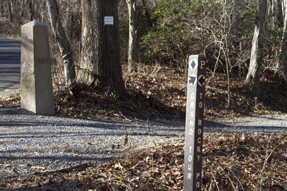
Route: Laurel Ridge – Grand Tour – Rocky Point – Battery Loop – Cuestra Ridge – Laurel Ridge
Detailed hike info on our main Hartshorne Woods page.
We knew it was a long time since we’d been to this park, but until I couldn’t find an entry in our Trail Blog (which goes back to 2006) I didn’t realize how long.
I had to root through our photos to discover we’d last been in 2003.
Yikes.
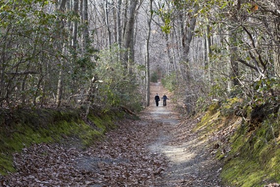
It’s a very nice park but we had found the multi-use trails a nuisance – not that the bike riders were anything but polite – we just prefer to hike without the possibility of a bike whizzing ’round the corner, so we had put the park on a back burner.
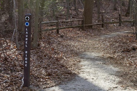
The trails are not blazed but are marked with signposts at intersections, which mostly works ok – but make sure you pick up or print out a map.
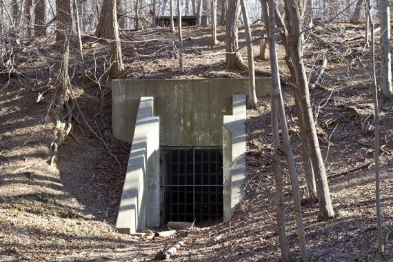
We managed to piece together a decent size route by combining the outer trails of the entire park, and checking out some of the battery/bunker buildings.
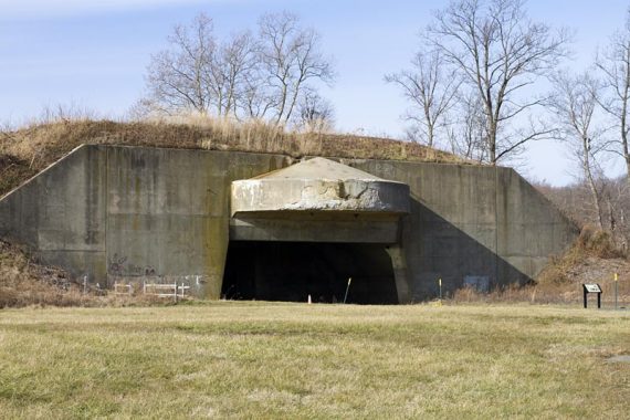
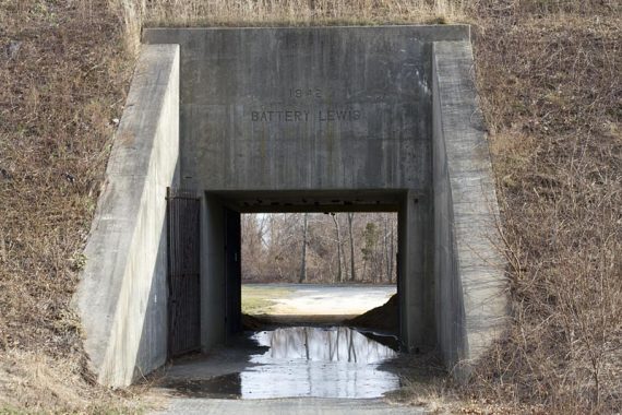
The Rocky Point end of the park was used as a military coastal defense position in WWII, and there are some bunkers to check out.
Battery Lewis:
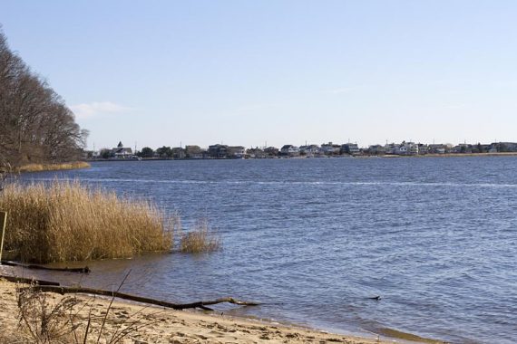
View of the ocean from atop of Battery Lewis
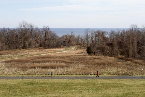
There are also views of the Navesink River and the ocean.
Black Fish Cove:
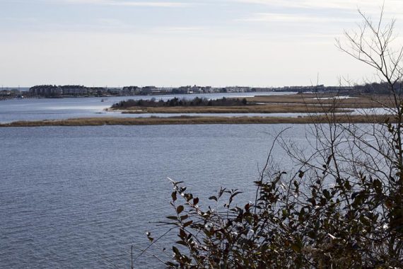
View of Sea Bright and the river off of Rocky Point:
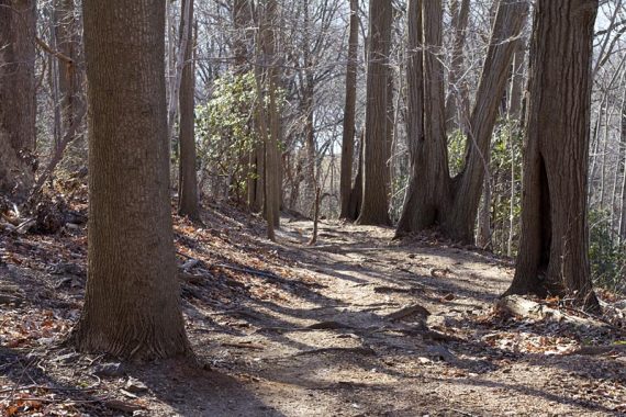
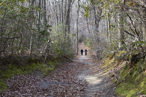
Cuestra Ridge Trail:
Snack Time: Clif Bar recently sent us this cute little box with some samples. On this hike we tried the White Chocolate Macadamia Mojo Bar and the Chocolate Peanut Butter Builder’s Bar.
White Chocolate Macadamia Mojo Bar Verdict: 2 thumbs sideways. While the bar tasted good, we probably wouldn’t purchase them. Mojos are usually salty-savory and we get them when we want a change from the usual energy bar, so we didn’t see a benefit to making it taste like a sweet bar.
Chocolate Peanut Butter Builder’s Bar Verdict: 1 thumbs up, 1 “eh”. The bar tastes good, with chocolate and peanut butter over a crisp rice layer. But bars with crisp layers can be on the hard side, especially in the cold, so I gave it an “eh”.
I found the trail system (symbols rather than colored blazes) confusing to follow, even with a map. I ended up on a suburban street and had to ask a local for directions back to my car. After 2 hours we gave up and went to Sandy Hook to play on the beach.