Easy paved rail-trail that rolls along a tree-lined path between Marlboro and Matawan.
9.7 miles or less, total round trip. Paved, with bumps from roots. Mostly level, some gentle hills. Sun exposure on a lot of the route.
| 9.7 miles | This biking guide: Detailed instructions, photos, and video follow below. |
| Shorter | Simply turn back sooner. |
| Nearby biking: | Henry Hudson Trail – Marlboro to Freehold; Henry Hudson Trail and the Bayshore Bike Trail. |
| Nearby hiking | Holmdel Park; Holmdel Park – Ramanessin; Thompson Park – Monmouth |
Biking Info:
Our two cents:
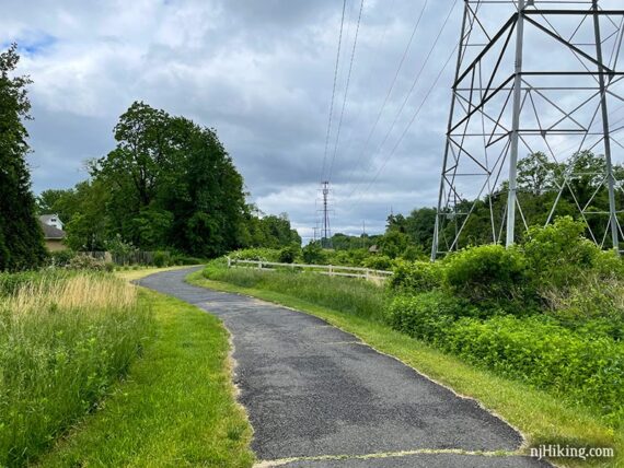
When we want a quick, relatively mellow ride, we pop over to the middle section of the Henry Hudson. The paved path runs between a tree buffer behind houses and utility right-of-way with large towers and power lines. The north bit becomes a little more utilitarian as it runs behind businesses.
Street crossings are mostly low traffic though a couple are busy. A few make a sharp dip down to road level and then back up which is awkward.
Suitable for strollers, sections possibly OK for wheelchairs. Technically could link up to the other two portions of Henry Hudson but since we’ve got zero interest in road riding we’ve never tried that.
Updated: 9/2024 – Minor edits.
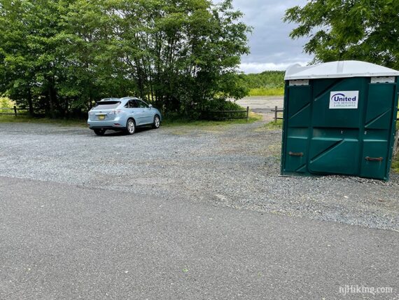
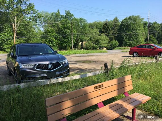
Parking: N40.36610° W74.25057°
431 Route 79, Marlboro Township. Wickatunk Recreation Area; lot is NOT shown on the park map. This is the closest street address but NOT the exact location; the Google link above goes to the exact lot location. Look for an unmarked driveway just north of the Conover Road intersection and south of Mt. Sinai Cemetery.
Alternate: Small unmarked dirt lot in the middle of the trail with room for ~6 cars; not on park map: 43 Tennent Rd, Morganville, NJ 07751.
NOTE – Church St Lot: As of 5/2022, the lot shown on the park map at Church St. no longer seems to allow parking. This is the obvious start point since it’s at one end of the trail, there’s a big trail sign, and is where we used to park but the last time there we encountered “police parking only” signs.
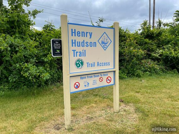
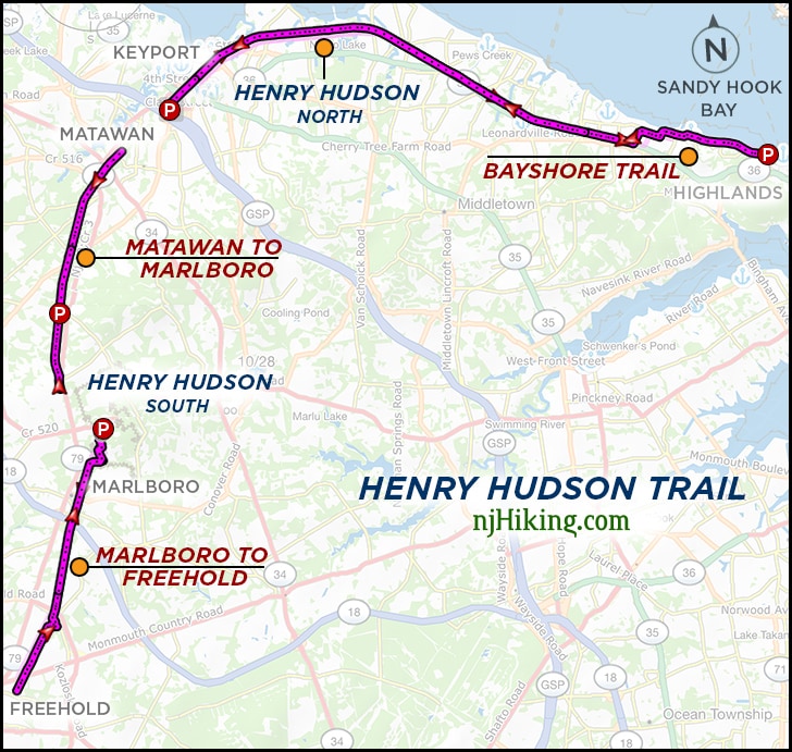
There are three separate sections of the Henry Hudson Trail, one north and two in the southern portion. The Bayshore Trail is at the eastern end of the HHT.
Related: Henry Hudson overview page.
Restrooms:
Portable toilet in the Wickatunk Rec Area lot (as of 5/2022).
Trail Maps/Books:
Print out the map from the park site. Follow along on a smartphone with our Henry Hudson Marlboro to Matawan Interactive Map. Appears in Rail-Trails New Jersey & New York.
What type of bike to use for rail-trails?
Overall, a hybrid bike is good. This bike type works for flat dirt trails as well as asphalt (but maybe not on true mountain bike trails).
Gravel bikes and mountain bikes are good for rail-trails. A road bike might be alright. Skinny tires are not ideal unless it's paved, and even then there might be the occasional buckled asphalt from roots.
Currently, we love our chain-less, no maintenance Priority 600 bikes for all fun and no fuss. If you're new to biking and don't want to commit, try renting, Craigslist for used, or start with an inexpensive bike.
Related: NJ Bike Trails overview page.
The Details:
The Wickatunk lot is not at the very end of the trail. This route goes south from the Wickatunk parking lot to where the trail ends at Wyncrest Road (no parking) and then returns.
Some of these photos were taken when riding in the opposite direction (north to south) of this route.
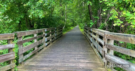
0.0 – From the lot turn RIGHT to start following the Henry Hudson Trail south over a wooden bridge.
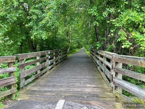
This section is one of the nicest tree lined stretches.
1.1 – Cross Station Road – or you may want to turnaround here and not bother with the last 0.3 miles. After crossing Station Rd, the trail heads uphill and adjacent to busy Rt 79.
1.4 – The trail ends at the intersection of Wyncrest and Rt 79. Turnaround and head right back downhill.
2.8 – Pass the parking lot you started at. Soon, cross the driveway for a cemetery.
3.8 – Pass a bench near small dirt parking lot off of Tenant Road. Just after this, cross busy Tenant Road.
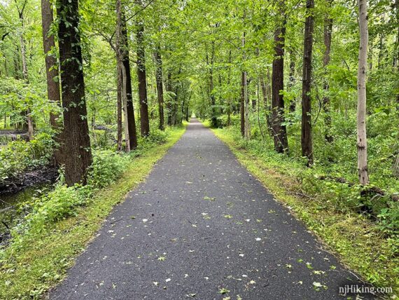
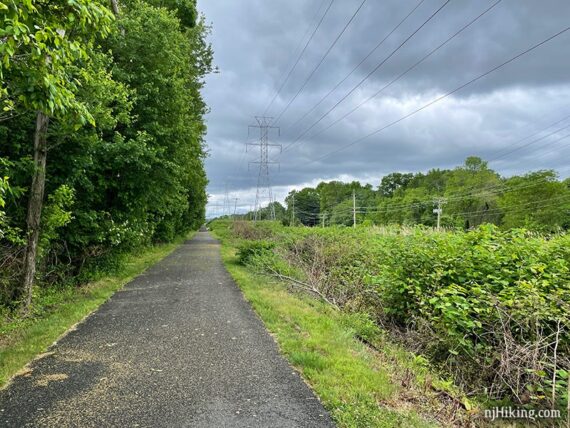
The wide, paved rail trail continues along, passing trees and vegetation as well as power line towers.
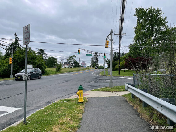
4.9 – Cross busy Texas Road and continue following the paved trail.
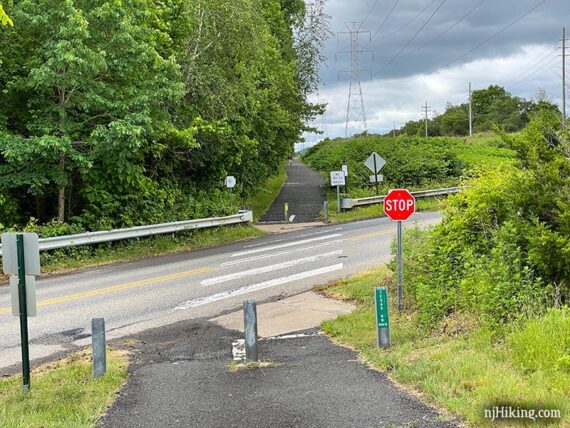
5.4 – The trail jogs over – cross Main Street/Rt 79 then turn left and cross Claire Ct.
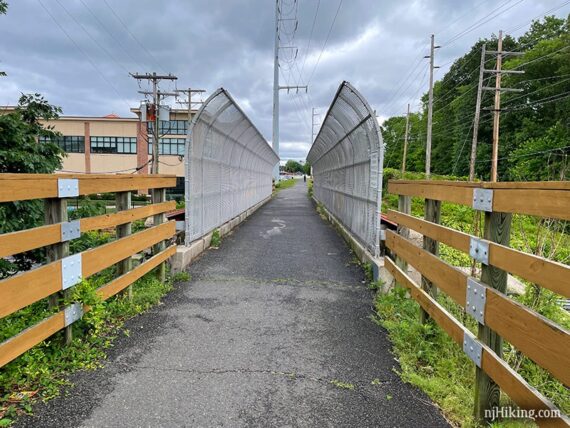
5.8 – Go over a bridge with curved fenced sides. Just before this bridge we’ve seen cats hanging out next to the trail near plates of food – so watch for any running across the trail.
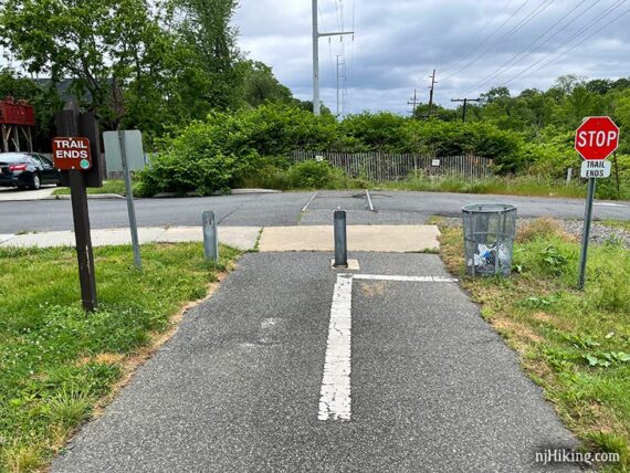
6.1 – Cross Church Street – or turnaround here if the crossing is too busy as there is just 0.1 mile of trail remaining.
6.2 – Trail ends at Stillwell Street. Retrace the route back to the lot.
9.7 – Back at the parking lot.
—
Biked 5/21/22.
Biked 5/31/21.
Biked 11/16/17. D w/ B&T