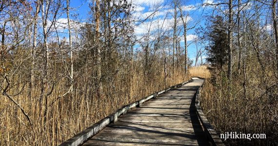
Easy romp through the Pine Barrens that includes a long and rather nifty section of boardwalk.
6.4 or 4.0 miles. Super easy – flat, level, packed sand. The trails are multi-use.
| 6.4 miles | This hike guide: Detailed instructions, photos, and video follow below. |
| Shorter | 4.0 – Take the boardwalk at the start, and skip the entire south section of this route. Noted in bold in the directions below. |
| ADA accessible | 3.6 – Out-and-back on the Swamp Trail, a 1.8 mile fully accessible elevated wooden nature trail. |
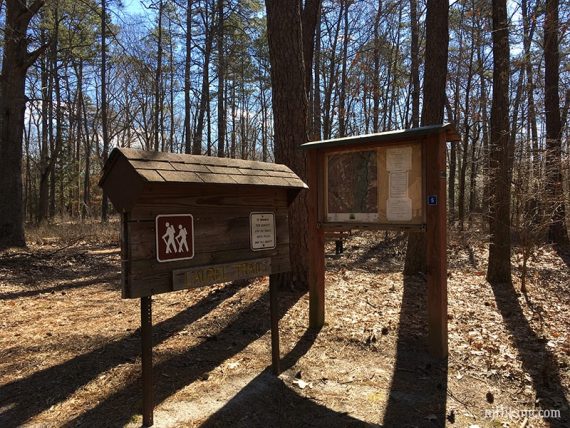
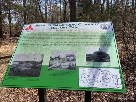
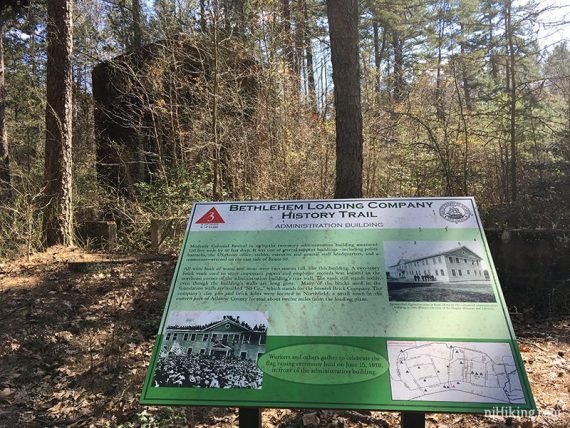
| History Trail | Follow the numbered info boards to visit the remains of the Bethlehem Loading Company. |
| Longer | Route could be extended by hiking the Duck Farm loop in the mountain bike area in the north end of the park, but we didn’t so we don’t know if it would be worth it. |
| Nearby | Belleplain S.F. – East Creek and Sunset Road Loop; Belleplain S.F.; Corson’s Inlet State Park; Edwin B. Forsythe NWR; Peek Preserve; Maurice River Bluffs. |
Our two cents:
This park is more of a ‘hey let’s go for a walk or have a picnic” kinda park and not a really a hiking-focused park but there’s quite a bit to see and the long boardwalk is neat to hike.
The flat wide trails could be nice option in the winter when there is snow cover, and sand roads crisscross the entire park allowing for many route options.
Bikes can even be rented from the nature center to ride instead of hike most paths or the loop drive (no bikes allowed on the boardwalk trail). The north end of the park contains mountain bike trails.
Note: Ticks are utterly in love with the Pine Barrens… so be prepared for them. For the most part, trails here were pretty wide and not brushy however.
Updated: 1/2025 – Minor edits, not re-hiked.
Hike Info:
Map/Books:
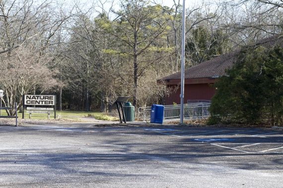
There were paper maps outside the door of the nature center as well inside (and with a lot of other info, such as a Bethlehem Loading Company History Trail packet), or print the trail map ahead.
Follow along on your smartphone with our Interactive Map link above. Note: There have been some minor changes to the trail map since we last hiked here, on Laurel and Exercise trails between the nature center and the cemetery.
A different route is found in Best Day Hikes in New Jersey. A similar but shorter route appears in Hiking New Jersey (2023), listed as “Belcoville and the South River”.
Parking: N39.39824° W74.74275°
Warren E. Fox Nature Center, 109 NJ-50, Mays Landing, NJ 08330. If approaching from Garden State Parkway South, take exit 38A for Atlantic City Expressway W, toward Camden/Philadelphia. Exit 12 for Rt. 40W. Left onto 50S. Park entrance is on left, there is a sign.
Restrooms:
In the nature center. Some porta-johns in the picnic area by the soccer fields and Veteran’s Cemetery.
Hike Directions:
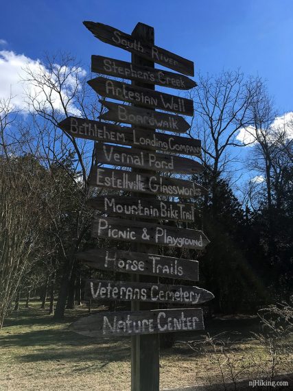
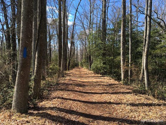
The trails are not really blazed, there are some directional signage at junctions, and blue blazes appear… but it’s vague.
We use the trail names in the description below to match up with the map, but a lot of the time when on the actual trail there are no markings or names. For this route the map is really needed to follow along.
Overview: Pond Trail – Exercise Trail – Glassworks Trail – Center Trail – Exercise Trail – Point Trail – Cribbers Road – Swamp Trail – Smokeless Powder Trail – Duck Farm Trail – North End Trail
0.0 – The Pond Trail starts behind the nature center. If facing the front door, walk to the left of it on a paved path. Pass a tall wooden sign of directional arrows.
Shortly, reach wooden trail kiosk. On the left is the start of boardwalk, called the Gunpowder Trail on the map.
A few steps past the kiosk, bear RIGHT to continue on the Pond Trail.
/// Shorter 4.0 mile option: Turn LEFT onto the boardwalk (Gunpowder) and follow it until coming to a T with another boardwalk – continue where indicated below. ///
Follow Pond Trail as it turns LEFT over a wooden foot bridge.
0.4 – At the big wooden trail sign with “Laurel Trail” a blue number 5 on it, veer RIGHT to now follow Exercise Trail [Laurel Trail goes to the left. A picnic area come into view off on the right.]
0.5 – Turn RIGHT over a footbridge, through the gap in the fence, and across the park road towards the Glassworks ruins. There are several display boards explaining the buildings and the glass making process.
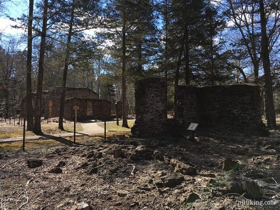
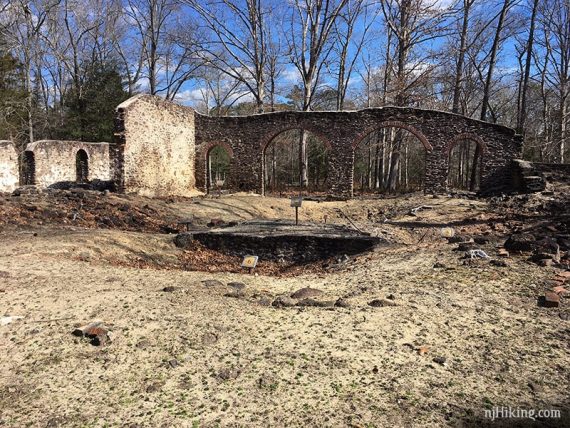
When ready, continue walking past the ruins (not marked). Follow the Glassworks Trail as it turns LEFT past the ruins.
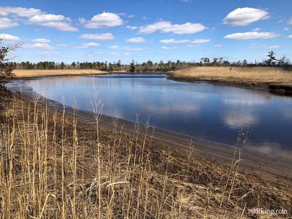
0.8 – End up at the Stephens Creek observation deck with a bench.
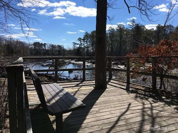
Posts from a old bridge are visible in the water. The water level was much lower than when we visited in 2012.
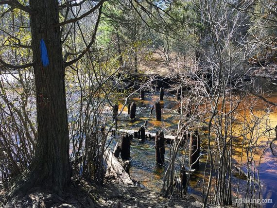
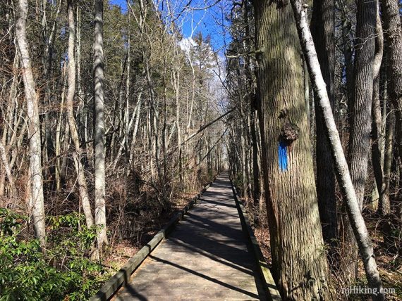
When ready to continue, backtrack a few steps and turn RIGHT to now follow Center Trail, there are now large blue blazes on trees.
Cross the park road (Purple Heart Drive).
1.1 – Turn RIGHT and now follow the Exercise Trail.
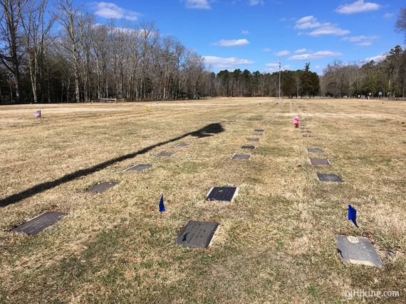
1.4 – The Exercise Trail comes out to a cleared area near the park road with Veterans Cemetery across the park road .
/// Optional add-on: Visit Veterans Cemetery as well as Steelman’s Creek burial ground behind that. ///
Turn LEFT and walk along the park road towards a playground and soccer field and follow the road as it curves around.
1.5 – Just after a field and the end of a wooden fence turn RIGHT onto Point Trail. There are two blue blazes indicating a right turn.
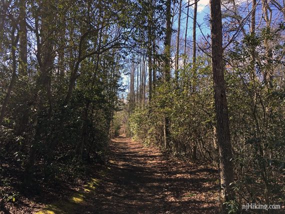
The path has a chain blocking vehicles and is torn up, but then turns into a trail, with blue blazes.
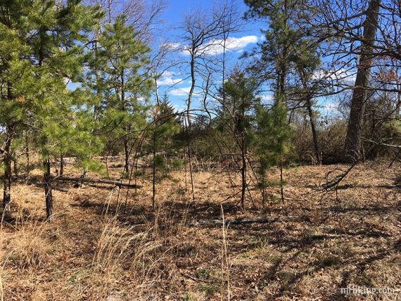
1.7 – Past the bird/bat shelter on a pole is a metal dome frame in an area marked Native American Village on some maps, no longer marked on others.
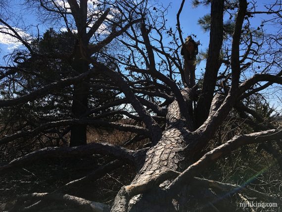
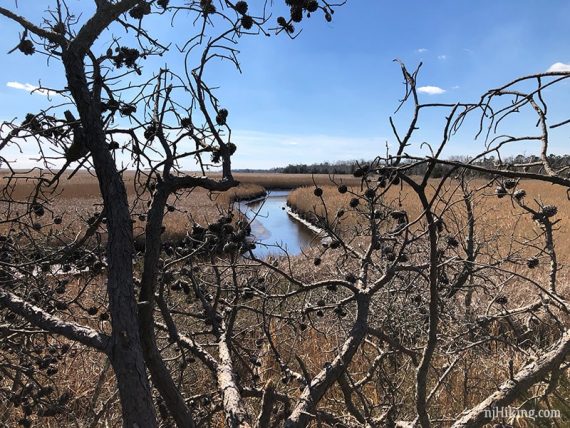
The path continues a little further back to a large downed tree that can be (carefully!!) walked up for a view over the marsh.
Backtrack to just after the pole and veer RIGHT to now follow Cribbers Road.
2.1 – Pass Oak Barrel Trail on the left. (not marked and we didn’t notice it the last time we hiked).
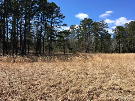
2.4 – Cribbers field. Off on the left is an observation blind that overlooks the field.
Continue past the end of the field (don’t turn left). The trail was a little overgrown and hard to spot.
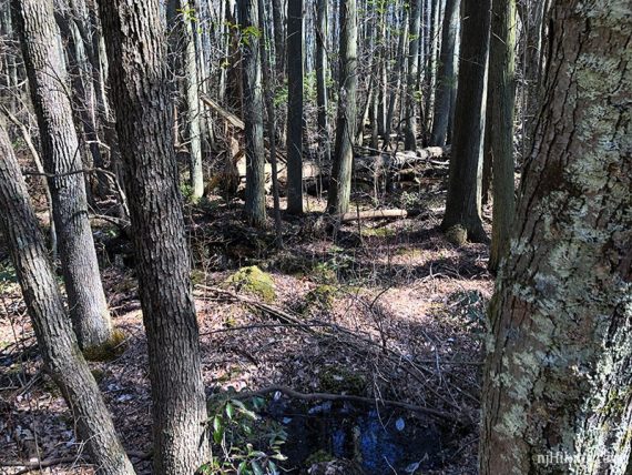
Shortly, hop over a little stream and continue in a little overgrown area.
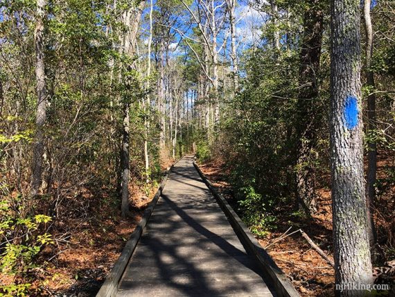
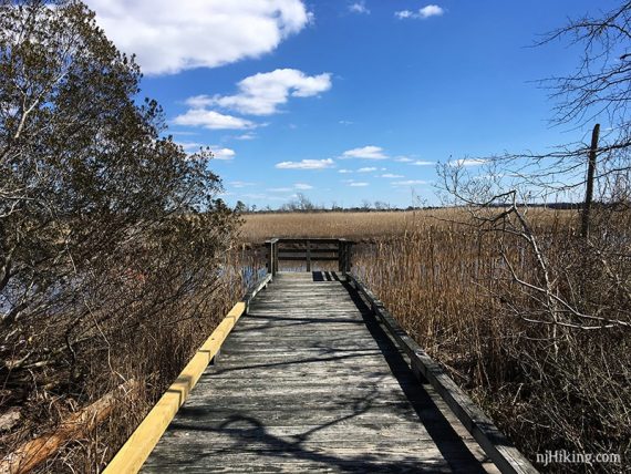
2.9 – Cribbers Road ends at a T. Turn RIGHT at this T-intersection to start following the boardwalk Swamp Trail.
/// **Continuation of the Shorter 4.0 mile option: Turn LEFT on the boardwalk, now called Swamp Trail. Follow the rest of these directions. ///
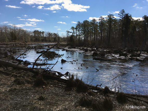
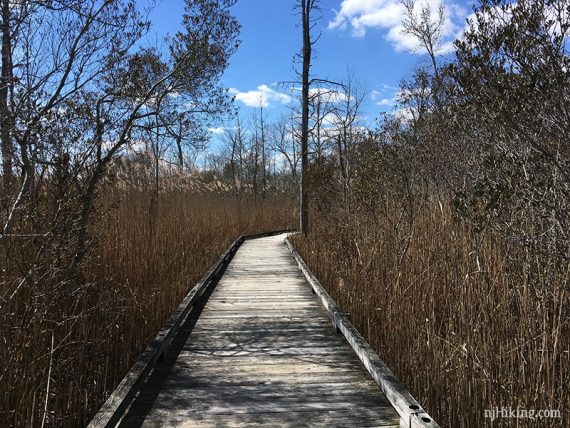
Follow a looong section of boardwalk through coastal forest and a cedar swamp. Intersecting trail names are on plaques on the boardwalk.
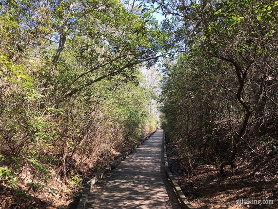
The Swamp Trail travels through a cedar swamp.
3.6 – Pass a boardwalk that leaves to the left.
[We took this left turn on the boardwalk to see if there was anything interesting… there’s not. It leads to Crossover Field observation deck with absolutely nothing to see so we backtracked. Continuing on it would lead to Oak Ridge Trail.]
There are two platforms on the right side that look out over the South River.
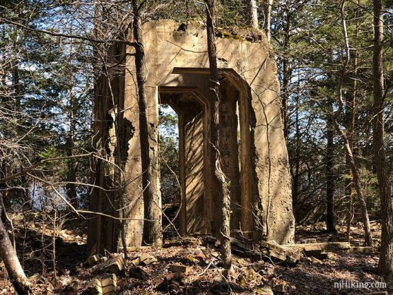
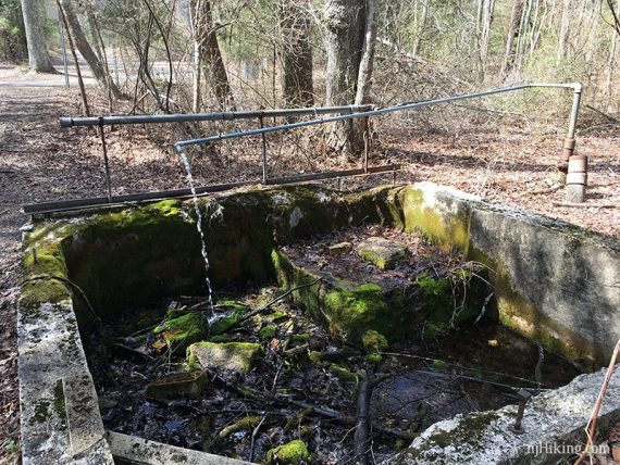
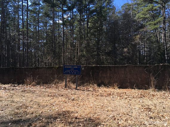
4.4 – At the end of the boardwalk, make a short side trip to the right to check out the Power Plant ruins.
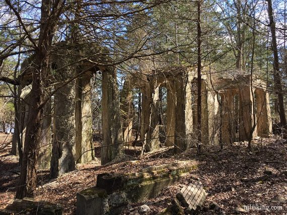
The pipe with water coming out are the remains of an Artesian Well… not suitable to drink!
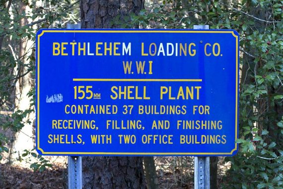
There are interpretive signs at key areas around the park. This one explains the Power Plant.
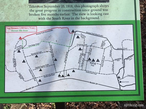
Each info board has a map showing the numbered locations.
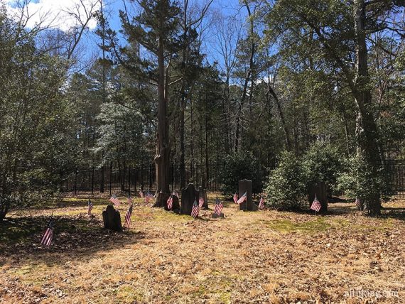
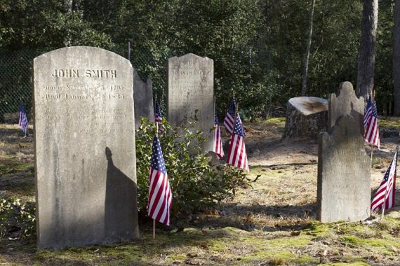
Return to the boardwalk and turn RIGHT to follow a section of boardwalk to the small Smith/Ireland Cemetery.
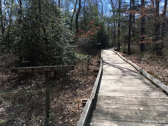
The Smith/Ireland Cemetery has graves dating from the 1800s.

Continue past the cemetery to covered picnic tables. Cross Artesian Well Road.
4.6 – Follow the path along the left of the parking lot. Pass info board #11, Magazine.
4.8 – Follow the path as it curves left, now called Smokeless Powder Trail on the map. [A path is also on the right, called Camping Loop.]
5.0 – Smokeless Powder Trail ends at a T with Duck Farm Road. Turn LEFT and now follow Duck Farm Road.
Duck Farm woods road curves to the left at a parking area.
5.3 – Cross Artesian Well Road (drivable) and the trail becomes North End Trail.
5.7 – Optional add-on: Check out a side trail loop on the right that leads to a few Administration building ruins, #s 5, 4, 3.
Pass the remains of a water tower reservoir, well, and pump station on the right.
Pass trails on the left that were once roads when this was a munitions plant. Some are marked, with names like “TNT Road”.
6.4 – At info board #1, turn RIGHT onto the park road. There will be several park buildings in the area.
Walk a short distance back to the nature center and parking lot.
—
Hiked: 3/17/19. Trail Blog: “Estell Manor – Glassworks and a Cedar Swamp“
Hiked: 1/7/12. Trail Blog: “Estell Manor Park – Pine Barrens and Military History“