First time hiking at Point Mountain Reservation.
This is a local park more suitable for someone looking for scenic easy/short hikes under 4 miles, for a short hike to a viewpoint, or stroll along a river.
3.7 miles. BLUE (briefly from lot) to ORANGE to overlook to BLUE along the river.
For complete hike directions visit our main Point Mountain page.
This is not the park for a hiker looking for a challenge (update: more trails were added since we originally hiked this).
In fact, we did this trail in the morning, then headed to nearby Musconetcong Gorge and did a trail there in the afternoon.
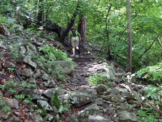
The trail did have a quick rocky climb to the summit, however.
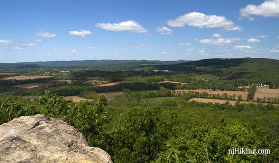
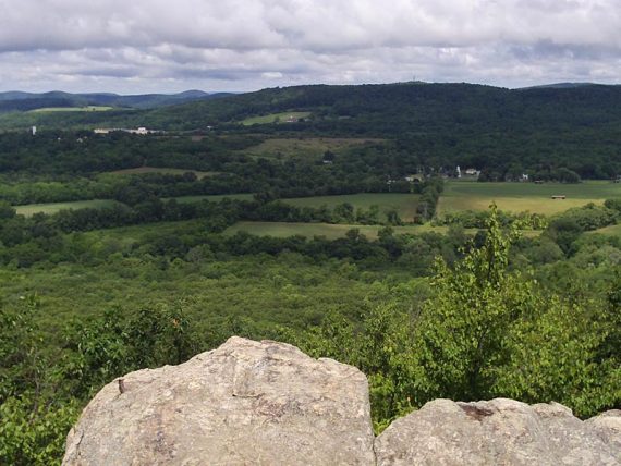
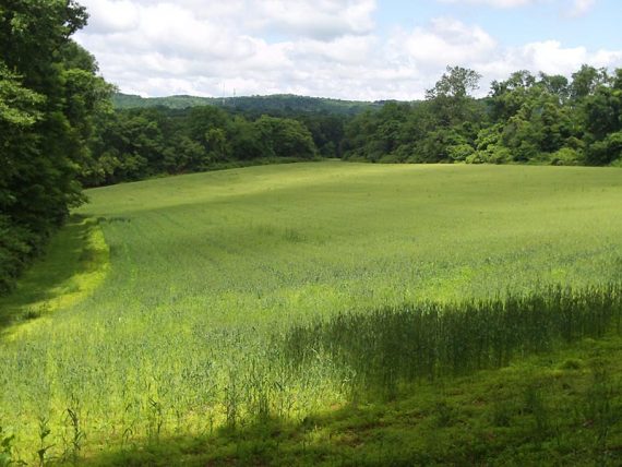
That goes to an panoramic view over the valley and hills in the surrounding area.
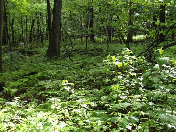
The trail then followed the ridge but with no more views. Some of the hike skirts field edges.
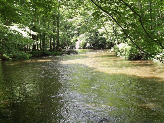
The runs along the Musconetcong River.
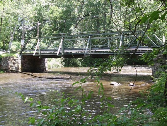
Bridge over the river, near the parking area.
The overlook and river areas are quite pretty. Lots of Poison Ivy on the trail edges however.
The section of the BLUE (Riverwalk Trail) after it crosses the road is quite overgrown and not really worth it – the main trail by the river is quite nice.
We did briefly spot a fox in this section – we think – only got a glimpse.
Parking: Rt 287 to 78 W to 31 N, check the park site for the detailed directions. It took us about 1-1.25 hours from central Jersey (New Brunswick area).
Thanks to RidgeSearchers for the hike suggestion.
I would agree with not taking the River Walk (Blue) across Point Mountain Road. The trail itself is pretty well blazed, although the trail itself is so overgrown if it weren’t for the blazes on the tree you’d never know the trail was there. I guess so little people ever took it, nobody kept it up. The area with the lookout is only the “Central” section as there are actually 3 parts: North (Crossing Penwell Road on White to Old Turnpike Road), and South (crossing Point Mountain Road on White to an old farm, now open space at Mountain Top Road). I suppose not as many take all the trails a lot and mainly head to the central section for the overlook and to walk along the river. I live about 4 or 5 miles from the park on the Morris County side and frequent this park for a quick afternoon hike.
Did 8/4/2018. Agree with the overgrown issue. lost the trail briefly twice. Due to recent storms a few trees down and blocking trails. Had to bushwhack thru the prickers to get around. Many cuts and spider webs in the face. Made it work and did 6 miles thru many of the trails. If it rains heavy, the river overflows and when it recedes it left dry land with knee deep water to go thru. Overall any time hiking is better than house work and afterward it was a good feeling to finish.