Hike to scenic Steamboat Landing on Cheesequake Creek.
Steamboat Landing can be accessed from the intersection of the GREEN trail and Museum Road in Cheesequake State Park.
This guide assumes you’ve landed here from our Cheesequake – Green Trail or Cheesequake – Yellow, Blue, and Green hike guides but works if you’ve hiked from another route too.
Detailed directions to add a 1.3 mile round trip hike to Steamboat Landing from this intersection follow below.
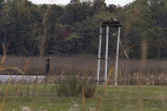
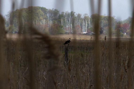
There is a good spot for birding and you may even see an osprey soaring above or sitting in the platform. It’s helpful to have camera with a telephone lens or binoculars just in case (we always hike with our trusty compact monocular).
How to hike to Steamboat Landing
This is no longer shown on the current Cheesequake State Park’s trail map or the park map (dated 9/2020) so I marked the locations on the park map:
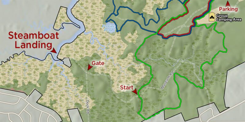
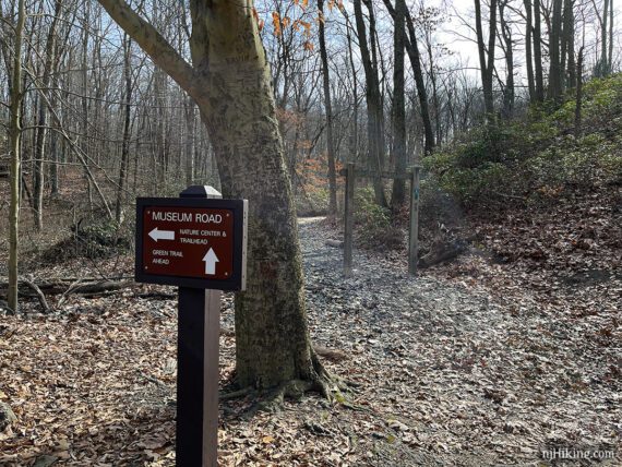
After hiking the GREEN trail over a boardwalk through a cedar swamp, the trail meets Museum Road.
Instead of continuing ahead on the GREEN trail, turn RIGHT to now follow Museum Road (shown on the park map as a double dotted line).
Continue following Museum Road on a wide flat dirt road that has remnants of asphalt paving.
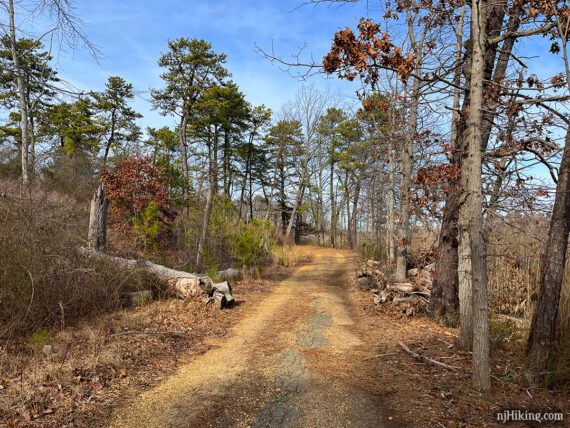
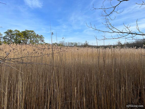
To the right is a large area of tall grasses in a marsh.
Pass a trail on the left. This just leads to Dock Road and was once marked ORANGE (didn’t notice if it still was marked).
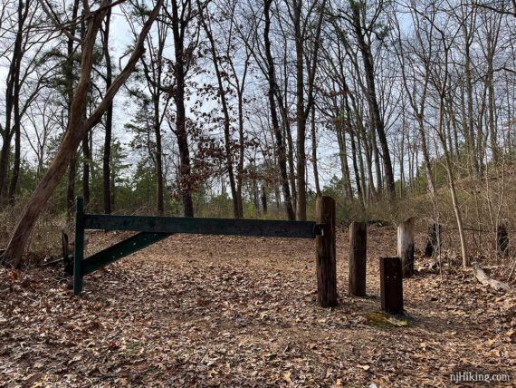
Walk around the large gate at the intersection with Dock Road (also marked with a double dotted line on the park map but not marked anywhere in real life).
Turn RIGHT to now follow Dock Road. [Dock Road also goes to the left.] You might notice a trail up on the hill – this can be the return route. (Or you could take it now and reverse this – you do you.)
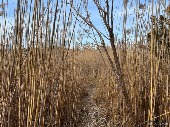
Follow Dock Road to where it ends in a mass of tall reeds/grasses (unsure of the technical name for these but you get the idea). Find the little opening in the grasses and walk in.
Note…. Steamboat Landing could potentially be a wet muddy mess if there’s been rain or flooding and the whole next section might not be doable. If that’s the case you can still see the area somewhat when taking the trail back up the hill on the return. When we last hiked this 2/2023 it was fine but it was also a little frozen.
Pop out of the grass in a few steps and the trail opens up to a wide path of mashed down grass. Keep following this out.
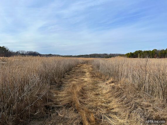
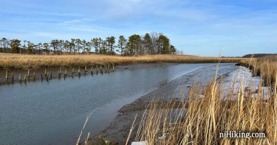
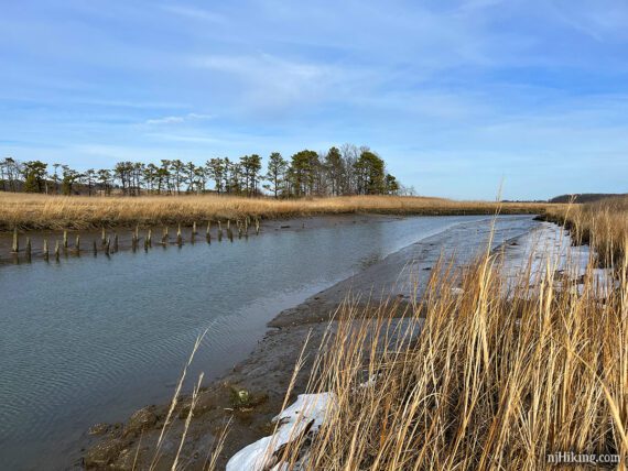
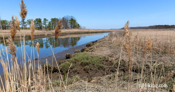
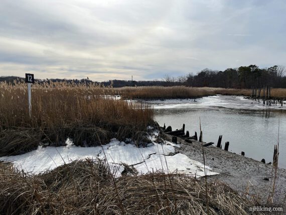
The trail ends at Cheesequake Creek. The wood pilings that can be see in either direction are the remains of a dock for steamboats.
In the 1800s, steamboats traveled the creek to bring goods such as farm produce, flour, and wood to New York City.
It was abandoned in the 1920s when cheaper methods of transport became available. [Sources: Old Bridge Township History; Wild New Jersey].
It’s hard to imagine steamboats chugging down this bird-filled remote spot but a few photos and a little info for Steamboat Landing can be found in Old Bridge, NJ – Images of America and that same info appears on Google Books (image on page 55).
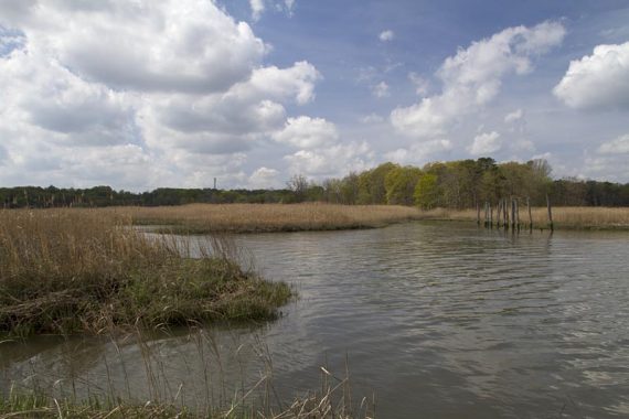
Looking in the same direction, April 2016:
In February of 2023 the water was low so more of the pilings were visible. The tall pilings on the far right of this photo have very thin bottoms from often being under water.
This is the same spot with a fuller creek. The water was much higher the first time we hiked to Steamboat Landing, in 2012.
On our 2/2023 hike we saw a crow sitting in the osprey platform but spotted two osprey soaring overhead. In 2012 we saw one osprey sitting on a post and another on the nesting platform (installed in 2007; source: 60 Hikes Within 60 Miles: New York City).
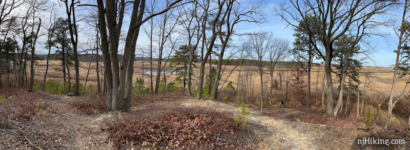
When ready, follow the path back out of the reeds. You can retrace Dock and Museum Roads but we like to take the hill path back.
With your back to the reeds, look ahead for a faint path that leads up the hill. There’s another path that goes around the hill to the right but that peters out into nothing.
Hike up to the top of the hill and turn around for an overview of the area.
The path continues along the top of the hill for just a short distance before the gate comes into view.
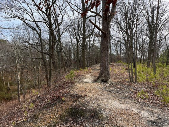
Head somewhat steeply back down. The ground has a lot of clay here and this hill was slippery even though didn’t appear wet.
Walk back to the gate and turn LEFT back on to Museum Road and follow it back to the intersection with GREEN. Turn RIGHT to continue on GREEN.
Return to the hike guide you were following – Cheesequake – Green Trail or Cheesequake – Yellow, Blue, and Green or take another way back.
—
Hiked: 2/5/23. with BLUE and GREEN.
Hiked: 4/17/16. convoluted – yellow, crabbing bridge, blue, green, Museum Road
Hiked: 4/21/12. Trail Blog: “Steamboat Landing”