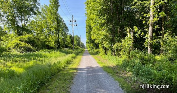
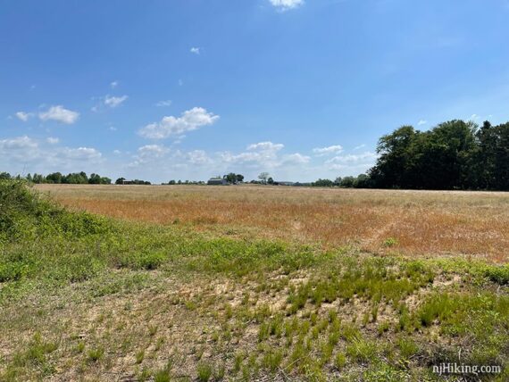
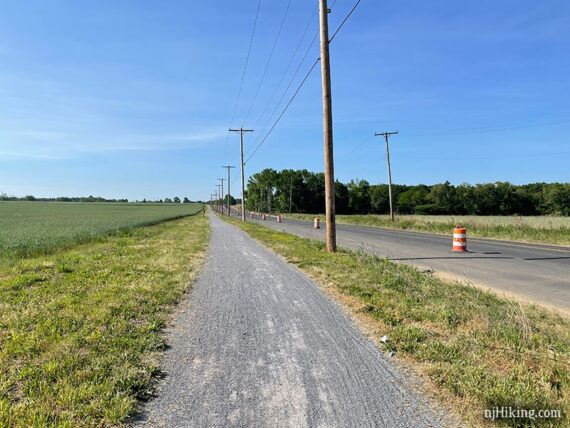
Sunny rail trail that rolls through farmland and fields in Monmouth County.
16.7 or less – or up to 19.7 miles total round trip. Crushed stone surface with a few loose slippy areas. Mostly sunny; if it’s windy you’ll feel it near open fields. Multi-use: hikers, bikers, horses.
| 16.7 miles | This biking guide: Detailed instructions and photos follow below. |
| Shorter | 12.6 – Sharon Station Rd to Jonathon Homes Rd.; noted below. Less – Simply turn back sooner. |
| Longer | up to 19.7 – Extend to the end of the trail, past the parking lots. 16.7 plus: +1.7 miles round trip – continue past the northern-most parking lot. +1.3 miles round trip – continue past the southern-most parking lot. |
| Nearby | Clayton Park; Perrineville Lake Park; Mercer County Park. |
| Nearby kayak | Prospertown Lake Kayak. |
Our two cents:
We’ve biked this both north-to-south (this hike guide) and south-to-north and don’t feel one is better than the other. There is little grade but it does go up and down throughout the ride. Least favorite part: not quite mid-way the trail has minor rolling hills and looser gravel where it briefly runs near a road.
For hiking we recommend starting at the southern end, going 2 to 3 miles – or whatever – then turn around. This is the nicest and most scenic portion when on foot. Use Millstream Rd parking info and reverse the directions below.
A few bikers seem to ride this racing fast and pass with little or no warning; noting this as we don’t generally encounter that on rail trails.
Updated: 9/2025 – New pic of farm stand; re-biked south to north. 7/2025 – Minor edits, added location of new parking lot, re-biked north to the southern-most end of trail just past the last lot. 1/2025 – Minor edits, not re-biked.
What type of bike to use for rail-trails?
Overall, a hybrid bike is good. This bike type works for flat dirt trails as well as asphalt (but maybe not on true mountain bike trails).
Gravel bikes and mountain bikes are good for rail-trails. A road bike might be alright. Skinny tires are not ideal unless it’s paved, and even then there might be the occasional buckled asphalt from roots.
Currently, we love our chain-less, no maintenance Priority 600 bikes for all fun and no fuss. If you’re new to biking and don’t want to commit, try renting, Craigslist for used, or start with an inexpensive bike.
Related: NJ Bike Trails overview page.
Parking:
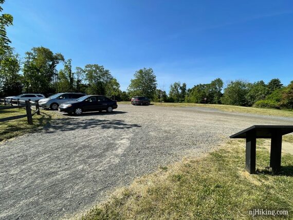
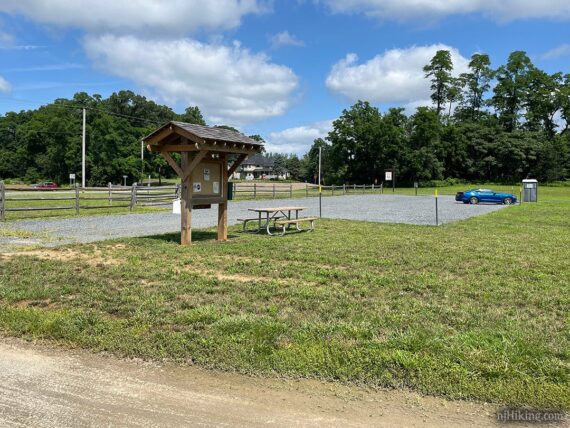
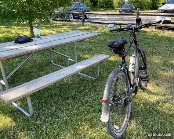
There are four parking areas. The northern lot is at Sharon Station Rd and the southern lot is at Millstream Rd. The newest is about mid-way where the trail runs along Sharon Station Rd and the fourth is at Jonathon Holmes Rd two miles before the Millstream Rd lot. All are noted on our Union Transportation Trail Interactive Map.
N40.20609° W74.53660° [Sharon Station Rd]
70 Herbert Road Upper Freehold, NJ 08514. Herbert Road intersects with Station Road. This address is the best for GPS purposes but is a bit past the intersection. Large dirt/gravel lot with a fence. This guide starts from this northern-most lot.
N40.09565° W74.52134° [Millstream Rd]
8 Millstream Road Upper Freehold, NJ 08514. Large dirt/gravel lot. This is the southern-most lot.
Restrooms
Portable toilet should be in each of the parking lots – that’s FOUR in under 20 miles! Hydrate away!
Biking Info:
Trail Maps/Books:
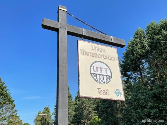
The park site has maps and there may be a map brochure in the trail kiosk at the lots. Follow along on a smartphone with our Union Transportation Trail Interactive Map. Appears in Rail-Trails New Jersey & New York.
9/2025 – If the map on the park’s site is still missing, use the map on the Crosswicks Creek Park page – they share the trail map PDF.
Refreshments:
Just around the corner from the Millstream Rd. lot is a farm veggie stand. Within 10-15 minutes of any trailhead are: Screamin Hill Brewery, Bent Iron Brewing, Working Dog Winery, Cream Ridge Winery, and Old Hights Brewing… which is next door to Pie Girl (featuring pie, of course, but also sandwiches – limited days/hours check their Instagram).
There is a farm fresh eggs-n-more self-pay stand literally ON the trail that you can swing by afterwards (unless you’d like to carefully tote a dozen eggs in your bike bag…) It’s towards the southern end at the intersection with Arneytown-Hornerstown Rd.
The Details:
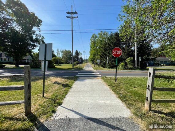
0.0 – With your back to the parking lot, turn RIGHT to begin.
Optional add-on: The trail continues to the left and dead-ends at Old York Road. Including that section adds 1.7 miles round trip.]
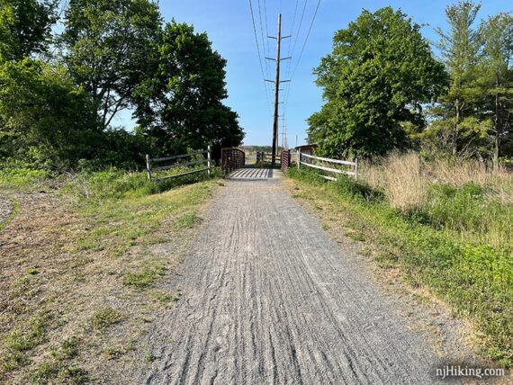
There are a few bridges along the way in order to cross small streams. Sometimes there is a little lip at the edge to hop up.
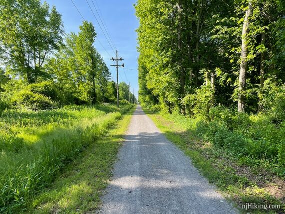
Scenery varies from fields and farms to tree-lined trail.
Fun Facts: This was once the route of the Pemberton & Hightstown Railroad that was created to connect area dairy farms to larger railroads and ran from 1868 to the 1950s. Passenger service stopped in 1931 and freight in 1977 at which point JCP&L acquired it to use for a power line. Converting it to a trail began in 2010 and was completed in 2017.
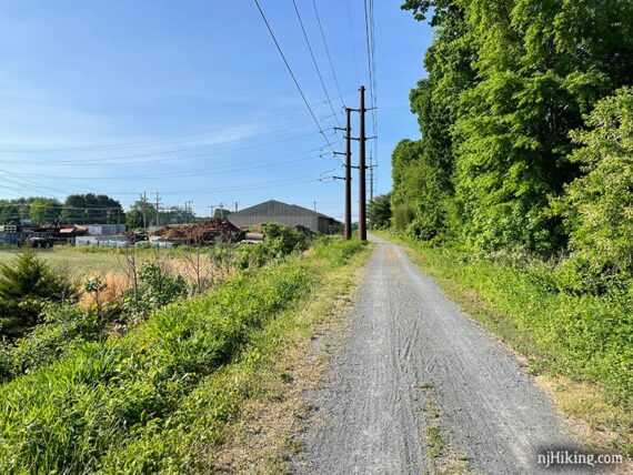
The northern section has a more utilitarian/industrial feel in areas. These are active farms so it’s possible that tractors or other farm vehicles may cross the trail.
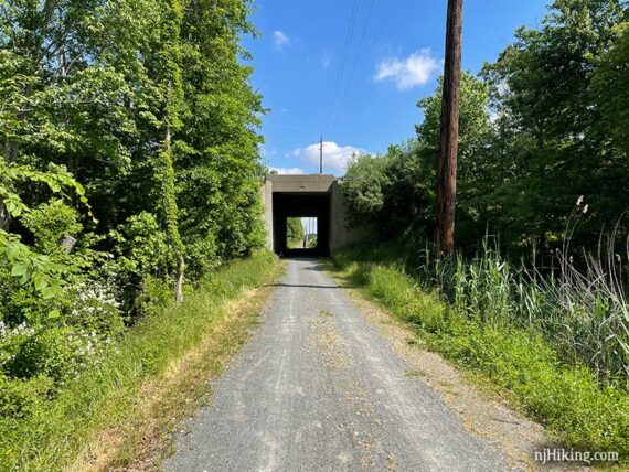
2.0 – Head through a tunnel to cross under I95.
There are multiple street crossings but most had little traffic (at least not early morning on a weekend).
3.3 – The trail turns to the RIGHT, leaving the actual route of the rail way, and heads towards Sharon Station Road. There are a few rolling hills and possible pockets of deep loose gravel in this area.
Another parking area is at the corner where the trail turns LEFT. Trail kiosk, picnic table, portable toilet.
The trail now closely parallels the road for a bit, dipping down then right back up where it crosses a driveway.
Follow it as it veers to the LEFT again before crossing Davis Station Road.
6.3 – Pass Jonathon Homes Rd. parking lot on the left. Trail kiosk, picnic table, portable toilet.
// Shorter, 12.6 miles roundtrip – turn around here. //
7.2 – The trail curves around to cross Forked River Road. This might have fast moving traffic but there is a button to trigger a crossing light.
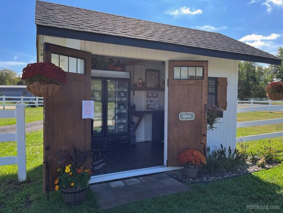
7.6 – Pass small a self-pay farm stand with a refrigerator that may have fresh eggs, a selection of meats, honey, all sorts of farm things. There is a cash box and it even takes Venmo! It’s all honor system so be cool and don’t walk off with stuff.
We briefly thought about it just for the novelty – how often can you buy eggs ON a trail? – but our practical side won out and we stopped after our ride.
This what the farm stand originally looked like – basically a refrigerator:
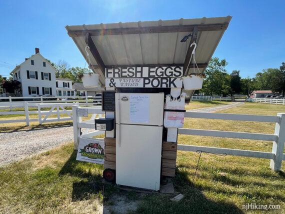
Now the stand is fully tricked out and is a little enclosed building complete roof, doors, and plants.
8.3 – Cross Millstream Road and into the parking area. There’s a trail kiosk, portable toilet, and a shady picnic table just asking you to take a break (pick up the table and move it into the shade as needed!).
Turn around and retrace the route when ready.
Optional add-on: The trail continues beyond this parking lot until the finished surface dead ends at a sign. There is a narrow path that continues but we weren’t interested in biking in. Including that section adds 1.3 miles round trip.
—
Biked 9/28/25. South to northern end of trail; 18.5 miles total.
Biked 7/12/25. North to southern end of trail; 18.1 miles total
Biked 9/5/21. South to northern end of trail; 18.3 miles total.
Biked 5/23/21. North to south; 16.7 miles total.