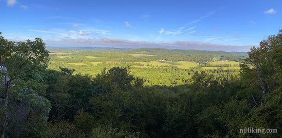
Rocky hike that quickly arrives at a panorama over the surrounding hills, valleys, and farmland and returns along a stream.
3.0 or 6.3 miles. Steep and rocky at the beginning; the remainder is less rocky with hills and a few field edges.
- Really Short: 1.0 – To the overlook then just come back down for a short-n-steep hike with a great payoff.
- Shorter: <2.0 – Riverwalk (BLUE) follows the river and loops around.
- Long: 6.3 – Add a loop in the North section, directions below.
- Longer, nearby lot: 9.7 – see “Point Mountain Reservation – Mountain Top Road” for a route that goes through the entire park.
- Nearby: Voorhees State Park; Merrill Creek Reservoir; Schooley’s Mountain; Columbia Trail.
Hike Info:
Our two cents:
This hike is short enough to be manageable but still feels like a “hike” and includes a nice viewpoint in the beginning with riverwalk at the end.
The initial rocky climb might be challenging for novice hikers but the view makes the effort worthwhile.
For avid hikers, extend the hike with the options listed above. While neither the north or south section contain anything outstanding it’s a way to get a decent length hike in.
Updated: 9/2020 – Re-hiked, description changes, photos added. Remainder of change log to bottom of page.
Map:
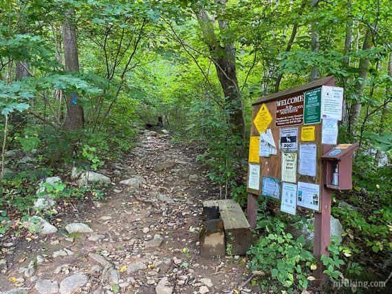
We’ve linked to the entire trail map but there are detail maps/and brochures found at the park site link. Trail kiosk was empty the day we came – best bet is to print it from the site.
The trails are still named in the park brochure (Riverwalk, etc) so we’ve left them in the description but those names are no longer on the trail map.
Our Interactive Map contains a layer that can be toggled on for the longer hike version.
Book:
This route in the opposite direction is now in 50 Hikes in New Jersey. A similar route to the one described here can be found in Hiking the Jersey Highlands.
Parking: N40.76610° W74.91023°
Rt 287 to 78 W to 31 N – visit the park page for detailed directions. There is a small parking lot with room for about 5 cars, and a few parking areas along the other side of the road.
Restrooms:
None. There are a couple of gas stations on 31 N.
Hike Directions:
Overview: BLUE (Riverwalk) – ORANGE (Ridge) – BLUE (Riverwalk)
0.0 – Start following BLUE (Riverwalk) at the trail kiosk.
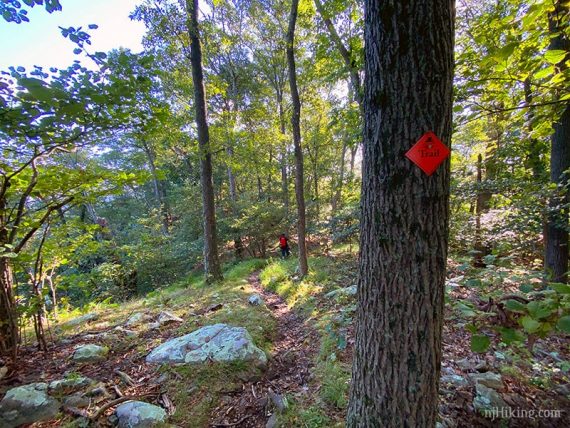
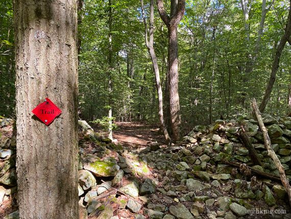
Not very far in, the trail splits. Start following ORANGE (Ridge) uphill. [BLUE (Riverwalk) leaves left].
Point Mountain Road and some homes peek through the trees in spots and there is a slight road noise.
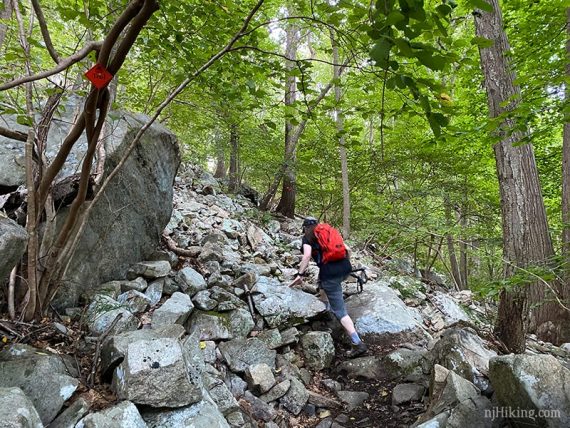
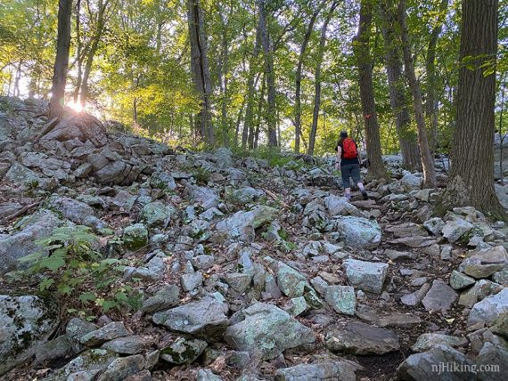
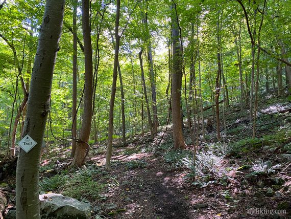
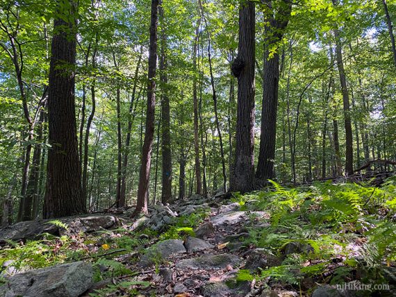
This short section of trail to the overlook is very rocky and somewhat steep.
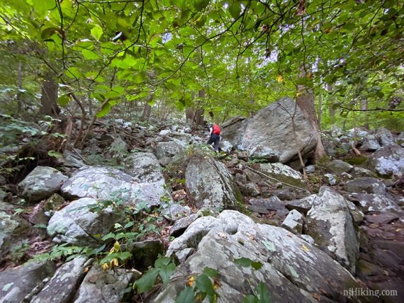
There is a mostly obvious path on the rocks, sometimes with stones set as steps, even if it appears otherwise in the photos.
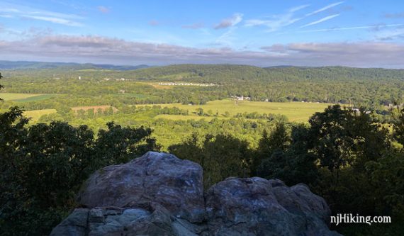
0.5 – Arrive at a large rocky outcrop with a wide view over the surrounding area. Fields and hills are visible in the distance.
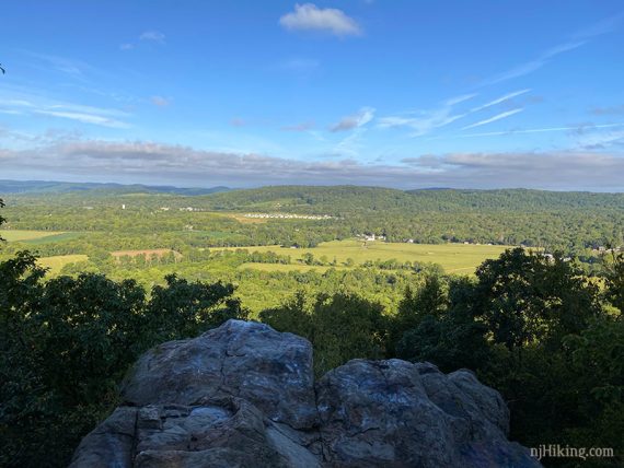
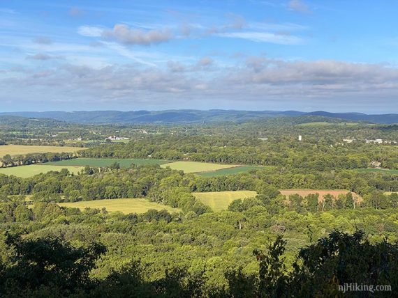
There is a second rocky overlook right next to it that requires a short scramble to.
After the overlooks, continue following ORANGE (Ridge) as it turns left. [YELLOW (Overlook) goes down ahead but is easy to miss].
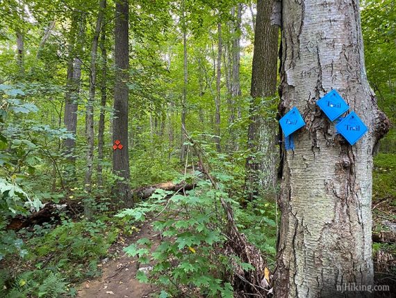
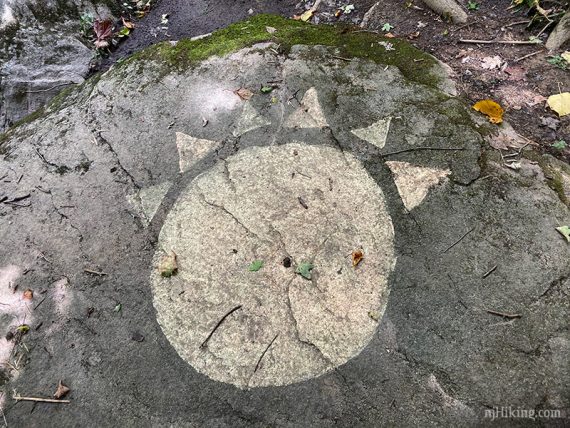
There are no more open views along the ridge (marker looks a little red in the photo, but this is the orange trail).
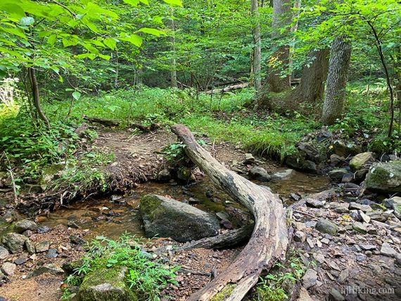
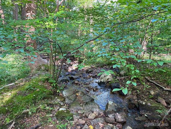
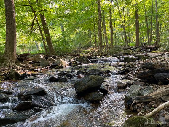
1.6 – A little stream crossing and a wet area.
1.8 – Continue straight on ORANGE (Ridge). [WHITE starts to the right and leads to the north section of the park].
// Optional 3.3 mile extension – Turn LEFT on WHITE to do a loop in the north section. See directions BELOW then return here to continue. //
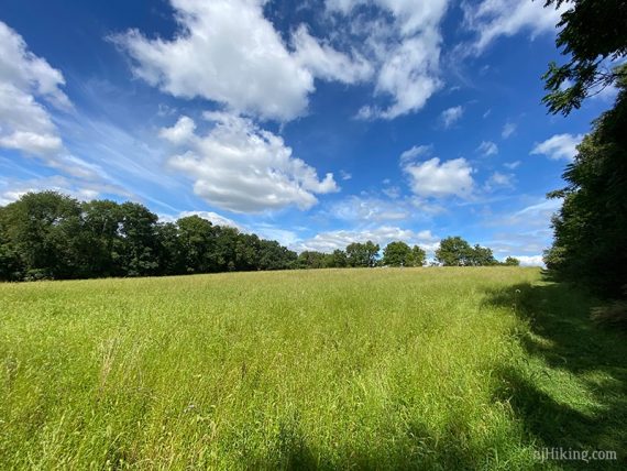
Arrive at the edge of a field. Off to the left is an orange marker with a faint trail heading back into the woods – but that isn’t the route.
Walk along the mowed edge of the field, eventually there is another marker for ORANGE (Ridge).
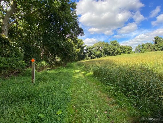
At the end of the field, turn left and go through the woods briefly.
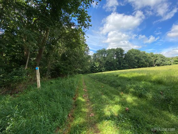
2.0 – Arrive at another field and a wooden marker post.
Turn LEFT along the mowed edge of the field to now follow BLUE (Riverwalk). [ORANGE (Ridge) leaves to the left].
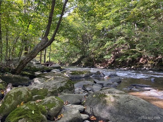
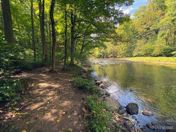
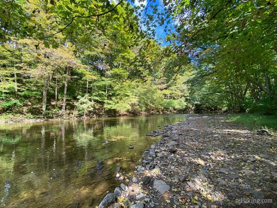
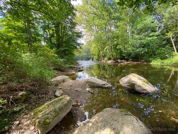
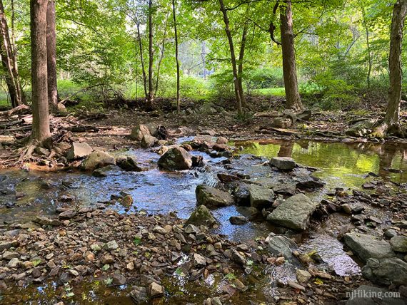
2.2 – Continue on BLUE (Riverwalk) as it hugs the Musconetcong River.
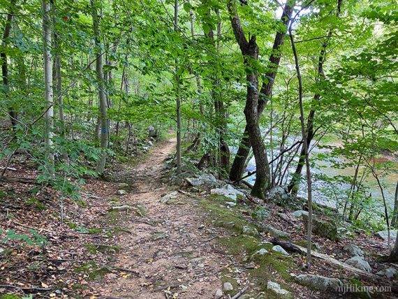
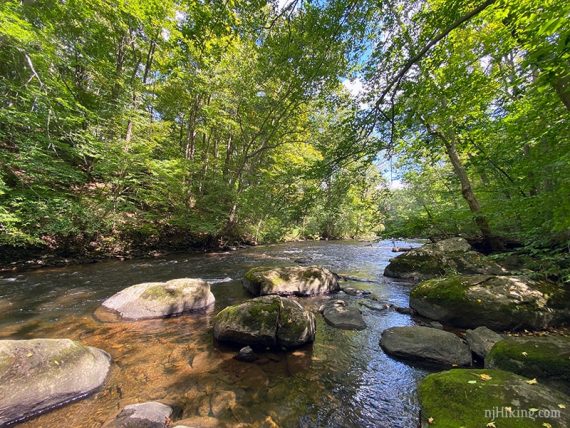
There are multiple spots to get to the edge of the river for a closer look and plenty of rocks to take a break on.
2.5 – The trail splits in a Y which may not be obvious. Keep RIGHT and follow the trail along the river.
[Optional: Veering LEFT goes to the parking lot as well but doesn’t follow along the river for the rest of the route].
Eventually a bridge becomes visible.
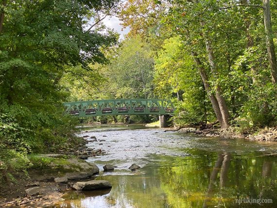
2.9 – Arrive at Point Mountain Road with the bridge off to the right.
Turn LEFT and walk a short distance down the road to the parking lot.
Optional extension:
To extend from the junction of the ORANGE and WHITE trails at 1.8 above:
1.8 – Turn RIGHT to now follow WHITE into the north section of the park. [ORANGE (Ridge) continues straight].
2.2 – Cross a stream on rocks.
2.4 – Cross Pennwell Road and turn LEFT. There was a marker before crossing the road but we didn’t spot any indication for the continuation.
Look for a NO OUTLET sign and a pile of rocks at the edge of a driveway to continue on WHITE.
3.0 – Turn LEFT to continue following WHITE. [RED leaves straight].
3.3 – At a T-intersection, turn LEFT to continue following WHITE. [BLUE leaves to the right].
3.4 – Turn SHARP RIGHT to now follow BLUE (we blew right by this at first. WHITE starts curving to the left and BLUE was easy to miss).
[WHITE continues straight until reaching a parking area on Old Turnpike Road, and there is another small loop off of that].
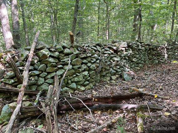
3.8 – Turn LEFT to now follow RED. [BLUE leaves to the right]. Pass through a large stone wall.
4.0 – Back at the start of the loop from earlier, start following WHITE again.
Retrace the route back to where WHITE was first picked up and return to the directions above.
The remaining mile-markers in the directions should be off by 3.3 miles.
—
Hiked: 9/12/20. Plus the north section.
Hiked: 5/25/13. Variation. Trail Blog: “Point Mountain Reservation – Mountain Top Road”.
Hiked: 6/14/09. Trail Blog: “Point Mountain in June“
—
6/2013: Removed the directions for the overgrown section, and updated the trail description in general; which revises this hike from 3.7 miles to 3. 8/2012: The Riverwalk trail (BLUE) was overgrown when we hiked this in 2009, and recent reports indicate it’s worse. Best bet is to skip that section.