Hike from beautiful Crater Lake and enjoy views along the Appalachian Trail to Rattlesnake, Bird, and Blue Mountains.
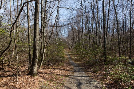
8.6 or 5.6 miles: Woods road at the beginning, then rugged and rocky trail; gradual elevation changes; short steep rocky section on the approach to Rattlesnake.
| 8.6 miles | This hike guide: Detailed instructions and photos follow below. |
| Shorter | 5.6 – To Rattlesnake Mountain out-and-back. Noted below. |
| Same parking lot | Crater Lake and Hemlock Pond Loop. |
| Alternate version | Start at Buttermilk Falls parking instead; or do the loop in Hiking New Jersey (2023) that is 6.4 miles. |
| Nearby | Blue Mountain Lake Loop; Buttermilk Falls (falls only); Silver Spray Falls; Van Campens Glen; Millbrook Village and Van Campens Glen; Catfish Fire Tower; Tillman Ravine. |
Our two cents:
This starts and ends at a pretty lake and then serves up several nice viewpoints without requiring a lot of elevation change.
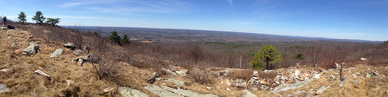
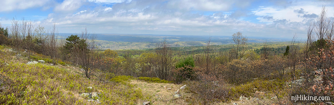
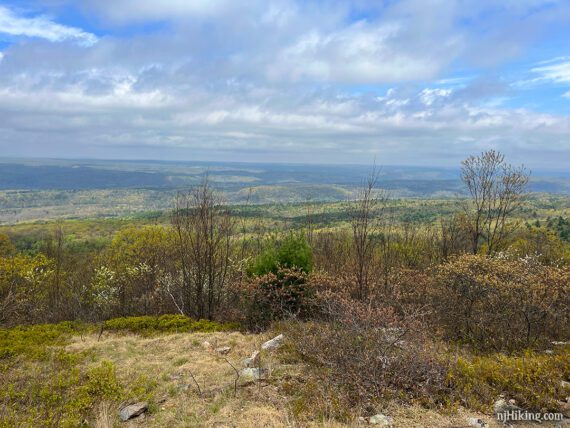
The view from Blue Mountain is a wide panorama – 180 degrees, plus.
Many hikers will want to turn around at Rattlesnake to keep this a medium length hike (5.6 miles), and that view is worthwhile – so you aren’t getting shortchanged.
There is a eastern view from a pull-off along Skyline Drive.
Updated: 4/2025 – Minor edits. 5/2023 – Minor edits; re-hiked. Older change log at page bottom.
Hike Info:
Map:
Kittatinny Trails is best. Follow along on your smartphone with our Interactive Map link above.
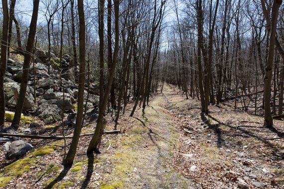
This route uses an unmarked woods road and trail to get to the Appalachian Trail. Kittatinny Trails, either paper or Avenza, is correct. Some apps don’t show these unmarked trails while Google Maps shows the Appalachian Trail in the wrong area for many parts of the route – but our track is the correct location.
Note: this hike does not go to the Blue Mountain Lakes area – Blue Mountain is on the Appalachian Trail in the other direction.
Books:
This route isn’t in any books we know of, but individual trails in this area are detailed in Kittatinny Trails. A loop that starts at another parking (Buttermilk) and goes to Rattlesnake is in Hiking New Jersey (2023).
A long backpack on the Appalachian Trail that skirts near Crater Lake can be found in 50 Hikes in New Jersey.
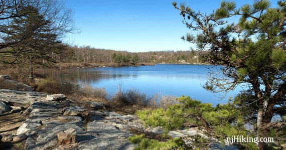
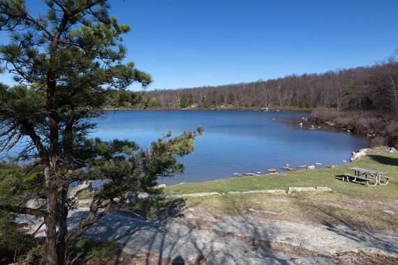
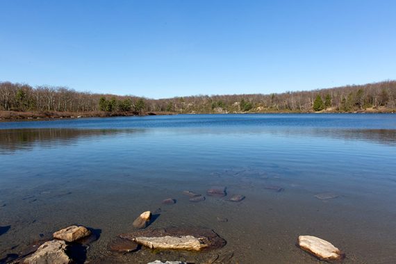
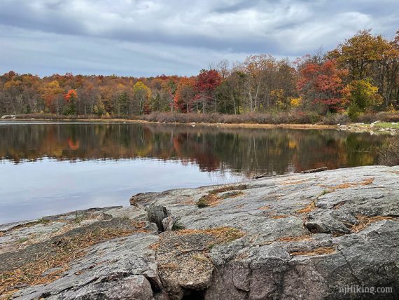
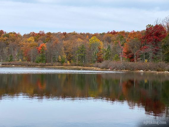
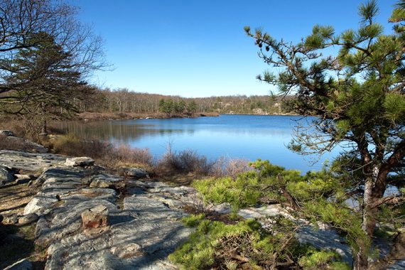
Check out Crater Lake before or after your hike – it’s right at the parking lot.
Parking: N41.10920° W74.89288°
Crater Lake, Layton, NJ 07851. If coming in via Rt 602 Millbrook Road to the Delaware Water GAP NRA; bear right at the Y at Millbrook Village, turn right onto Blue Mountain Lakes Road, at the end of that turn left onto Skyline Drive.
Watch if using Google directions as it might keep changing the route to an area outside of the park, with no way of connecting to the parking lot.
Notes! Skyline Drive and therefore access to Crater Lake parking lot is closed seasonally. There is a gate just beyond the Blue Mountain Lakes parking lot. Winter closure is generally from Jan 1 to Apr 15. It is also closed weekends from May 21 to October 2. Be sure to check the park site or Facebook page for current status, or call the park.
If Skyline Drive is closed: A hiker lot is on Blue Mountain Lakes Rd to access Blue Mountain Lake Trail and area. The trails connect to Hemlock Pond and Crater Lake for an alternate hike.
If Skyline Drive is too rough: Skyline Drive was in good condition as of 4/2023, but in the past it’s been rough and may not be suitable for a regular car. There is a pullout parking area for some cars at the end of Blue Mountain Lakes Road just after turning LEFT onto Skyline to access the Appalachian Trail.
There is a picnic table by the lake and plenty of rocky spots to sit.
Restrooms:
Composting toilet in the lot, also in the lot for Blue Mountain Lake trail which is passed on the way here. Millbrook Village has restrooms when open.
Hike Directions:
Overview: Crater Lake (ORANGE) – Unmarked Woods Road/Unmarked Trail – Appalachian Trail (WHITE) and then retrace route
0.0 – From the parking lot, facing the lake, look off to the right for the metal gate blocking a woods road, which is actually the Crater Lake (ORANGE) trail.
Start following Crater Lake (ORANGE).
0.2 – At the T, turn RIGHT to start following an unmarked gravel-filled woods road uphill. [Crater Lake (ORANGE) continues to the left].
0.3 – Veer LEFT off of the woods road to follow an unmarked path. [The unmarked woods road continues ahead and leads to the Mount Paradise area on the map.]
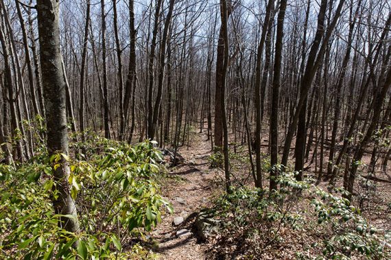
This path eventually narrows and becomes relatively unused. Fun Fact: This is an old route of the Appalachian Trail.
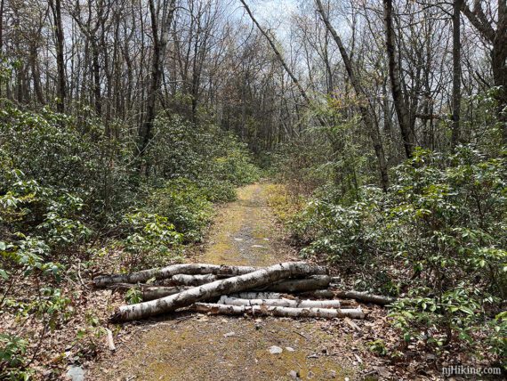
0.9 – The unmarked path ends at the Appalachian Trail (WHITE). There was a large stack of logs across the trail to indicate this path isn’t the A.T. (as of 4/2023).
Continue straight to start following the Appalachian Trail (WHITE). [The Appalachian Trail also goes left].
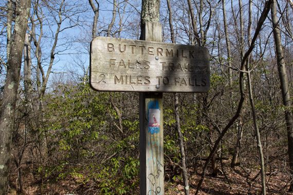
Very shortly, pass the Buttermilk Falls trail at a large wooden signpost on the left. [Buttermilk Falls is 2 miles away, steeply downhill, so then right back uphill if you were considering adding it.]
Note: There are multiple views along the route, we only marked a few of the better ones.
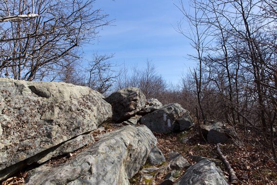
1.8 – Optional side trail on the LEFT that leads to a slanted rocky outcrop with a few evergreen trees. There is a limited view but it’s more open if you follow the outcrop out to the end.
Keep following Appalachian Trail (WHITE).
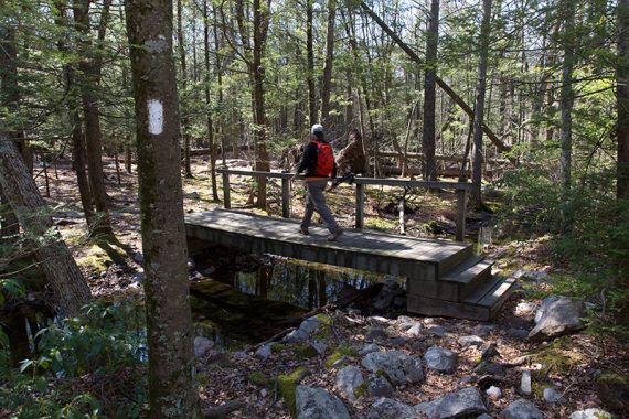
2.4 – Stream crossing on wooden bridge. Continue on Appalachian Trail (WHITE).
A little steep and rocky section up to Rattlesnake Mountain, just before the view.
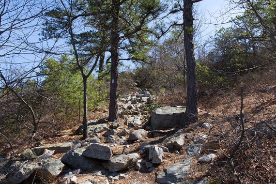
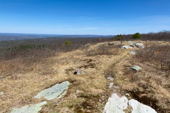
2.8 – View from Rattlesnake Mountain. Off on the right, away from the view, is a large rock to sit on. Continue on Appalachian Trail (WHITE).
// Shorter Option: Turn around here for a 5.6 mile hike. //
3.6 – A unmarked trail comes in from the left. Then pass a side trail on the left to a view (we didn’t bother to check it out) just before reaching Bird Mountain.
4.0 – Pass an Appalachian Trail sign at an intersection with an unmarked trail.
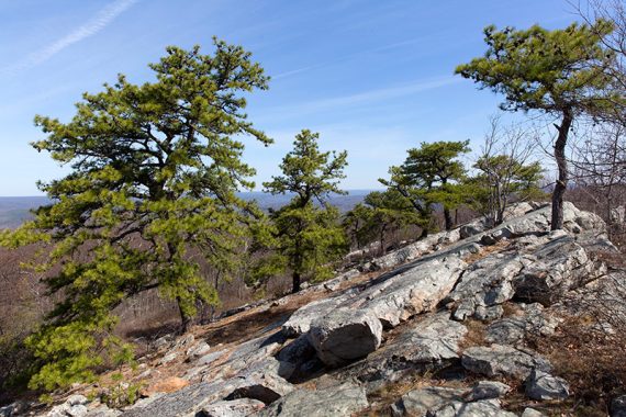
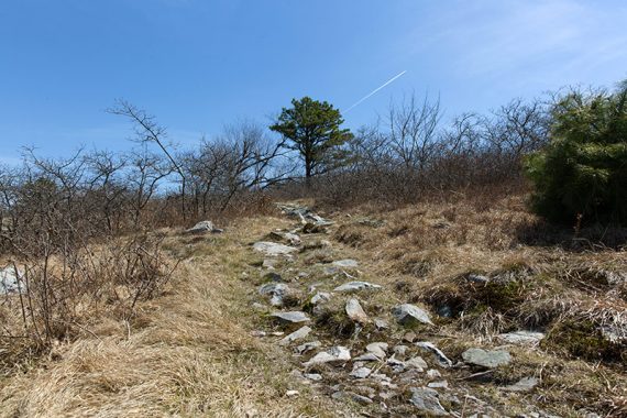
4.2 – Approaching Blue Mountain is a large rock that looks nice for sittin’ but in just a bit is another one where the view opens up more. Or continue between the tall evergreens flanking the trail for more views along the ridge.
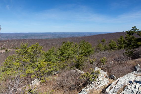
The view from Blue Mountain is over NJ and into PA in a big, open (and potentially windy) area.
High Point Monument may be visible in the distance – but not directly over the valley. If looking out on the valley, High Point would off on the right, more in line with the A.T and northeast of here.
We saw these rock stacks in 2016 but didn’t notice them in 2023.
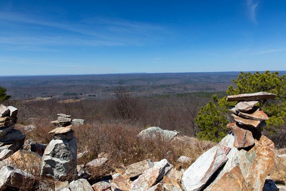
Overlooking New Jersey with Pennsylvania in the distance.
When ready to tear yourself away from the view, turn around and retrace the route.
5.9 – Pass Rattlesnake Mountain again.
6.3 – Cross the footbridge again. Continue on Appalachian Trail (WHITE).
7.6 – Soon after passing the Buttermilk Falls sign, keep STRAIGHT to follow the unmarked path again. [Appalachian Trail (WHITE) goes right.]
The unmarked path runs into the unmarked woods road. Follow the woods road until the intersection with Crater Lake (ORANGE). Turn LEFT to follow Crater Lake (ORANGE) back to the lot.
—
Hiked: 4/22/23.
Hiked: 4/16/16.
Updated: 4/2023 – Parking edits. 6/2022 – Parking edits. 10/2020 – Adjusted parking/restroom info. 4/2020: Page refreshed, not re-hiked.