Hike a double loop to visit Crater Lake and Hemlock Pond.
3.4 or 1.6 miles, total round trip. Mix of rocky trail and easier woods roads; somewhat steep down to Hemlock Pond and back.
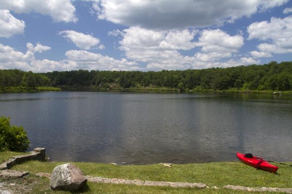
| 3.4 miles | This hike guide: Detailed instructions, photos, and video follow below. |
| Shorter | 1.6: Crater Lake (ORANGE) only. |
| Longer | Includes this route, 7.2: Buttermilk Falls, Crater Lake, Hemlock Pond. |
| Same parking lot | Crater Lake to Blue Mountain. |
| Nearby | Blue Mountain Lake Loop; Buttermilk Falls (falls only); Silver Spray Falls; Van Campens Glen; Millbrook Village and Van Campens Glen; Tillman Ravine; Catfish Fire Tower. |
Our two cents:
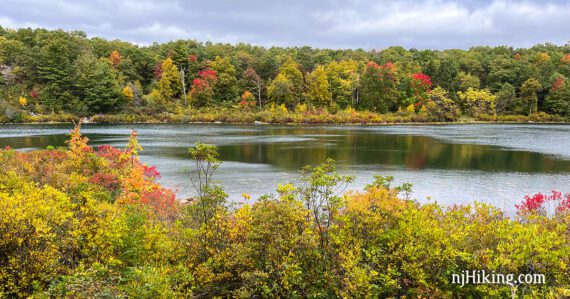
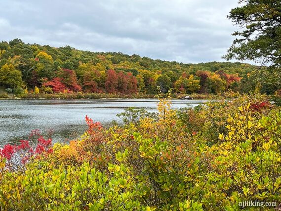
This figure-8 loop packs in lots of lake views, a viewpoint, and plenty of break spots in a rugged but manageable route. Just do the loop around Crater Lake to keep it short-n-sweet.
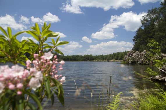
Visit May thru early-July to try and catch mountain laurel and rhododendron in bloom.
Hike Info:
Map:
Kittatinny Trails. Follow along on your smartphone with our Interactive Map link above.
Note: There have been major trail color changes around Crater Lake and Hemlock Pond. Versions of Kittatinny Trails before 2021 are out of date in these areas.
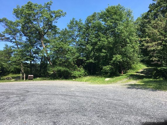
Parking: N41.10920° W74.89288°
Crater Lake, Layton, NJ 07851. If coming in via Rt 602 Millbrook Road to the Delaware Water GAP NRA; bear right at the Y at Millbrook Village, turn right onto Blue Mountain Lakes Road, at the end of that turn left onto Skyline Drive.
Watch if using Google directions as it might keep changing the route to an area outside of the park, with no way of connecting to the parking lot.
Notes! Skyline Drive and therefore access to Crater Lake parking lot is closed seasonally. There is a gate just beyond the Blue Mountain Lakes parking lot. Winter closure is generally from Jan 1 to Apr 15. It is also closed weekends from May 21 to October 2. Be sure to check the park site or Facebook page for current status, or call the park.
If Skyline Drive is closed: A hiker lot is on Blue Mountain Lakes Rd to access Blue Mountain Lake Trail and area. The trails connect to Hemlock Pond and Crater Lake for an alternate hike.
If Skyline Drive is too rough: Skyline Drive was in good condition as of 4/2023, but in the past it’s been rough and may not be suitable for a regular car. There is a pullout parking area for some cars at the end of Blue Mountain Lakes Road just after turning LEFT onto Skyline to access the Appalachian Trail.

Restrooms:
Composting toilet in the lot, also in the lot for Blue Mountain Lake trail passed on the way here. Millbrook Village has restrooms when open.
Hike Directions:
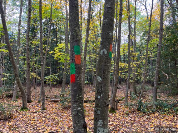
Overview: Crater Lake (ORANGE) – Hemlock Crater Connector (ORANGE-GREEN) – Hemlock Pond (GREEN) – Hemlock Crater Connector (ORANGE-GREEN) – Crater Lake (ORANGE)
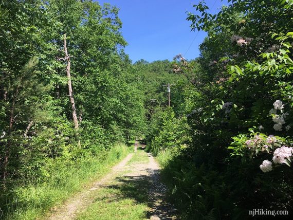
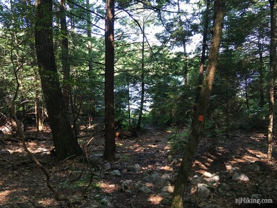
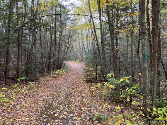
0.0 – From the parking area start following Crater Lake (ORANGE) beyond a metal barricade (to the right in the photo). Crater Lake (ORANGE) is on the woods road, not the informal path near the lake.
A power line is visible along the woods road.
0.2 – At the end of the lake, Crater Lake (ORANGE) bears LEFT. [A woods road goes right and leads to the “Mount Paradise” area marked on the map.]
0.3 – Follow Crater Lake (ORANGE) as it turns RIGHT. [A woods road continues straight as well.] In just a bit, Crater Lake (ORANGE) turns LEFT.
Soon Crater Lake (ORANGE) meets the Appalachian Trail (WHITE). The trails are briefly co-joined in both directions.
Turn RIGHT to continue on Crater Lake (ORANGE)/Appalachian Trail (WHITE). [Crater Lake (ORANGE)/Appalachian Trail (WHITE) also continues straight].
// Shorter Option, 1.6 miles total: Instead of turning RIGHT, continue straight on Crater Lake (ORANGE)/Appalachian Trail (WHITE). Follow Crater Lake (ORANGE) for a bit then pick up the description at 2.5 below. //
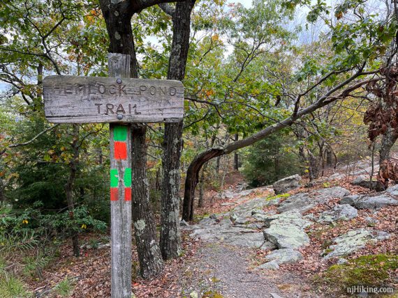
0.4 – At the sign for Hemlock Pond, continue straight to now follow Hemlock Crater Connector (ORANGE-GREEN). Trail descends on a rocky footpath.
0.7 – Continue following Hemlock Crater Connector (ORANGE-GREEN) as the trail jogs to the RIGHT and then a quick LEFT when crossing an unmarked trail.
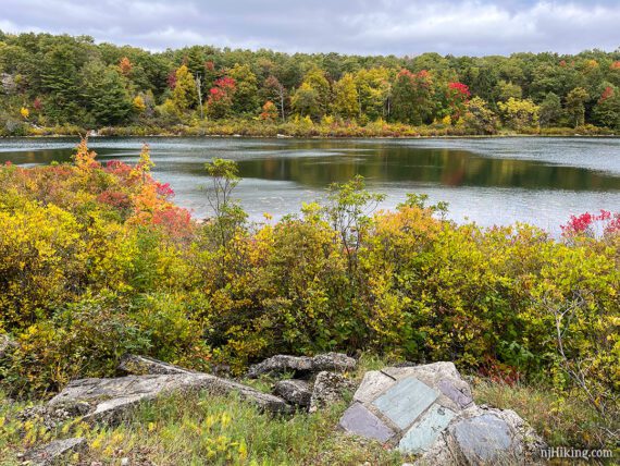
At a T-junction with Hemlock Pond (GREEN), Hemlock Pond will be visible ahead. Continue ahead on the ORANGE trail, thought the blaze may be hard to spot.
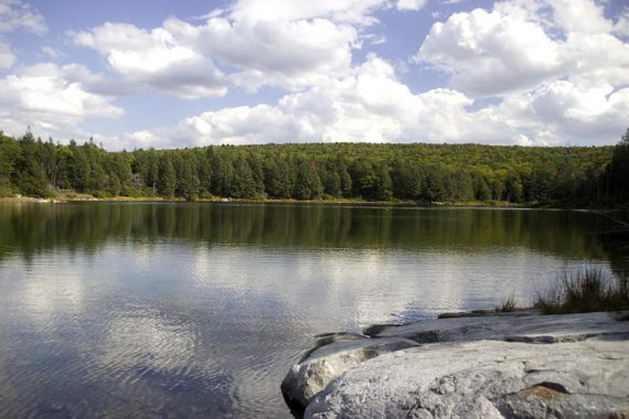
Continue to the waters edge, where there is a spot to sit and get a view of Hemlock Pond.
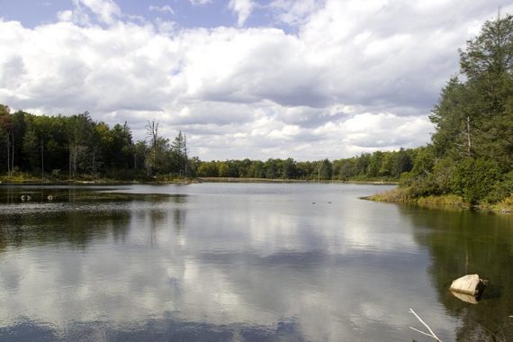
Backtrack to the junction and turn RIGHT to now follow Hemlock Pond (GREEN), an easy woods road around Hemlock Pond. The pond is somewhat visible through the trees on the right.
0.9 – Pass Blue Mtn Lakes Outer Loop (BLUE) on the left (this leads to Blue Mountain Lakes area). There may be BLUE blazes co-joined with this section of trail. Continue following Hemlock Pond (GREEN).
1.2 – At the end of the Pond turn RIGHT. [Blue Mtn Lakes Outer Loop (BLUE) leaves left and leads to Blue Mountain Lakes.]
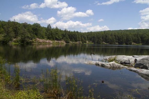
A large rock outcrop makes a good break spot with nice views of Hemlock Pond.
1.3 – Continue following Hemlock Pond (GREEN) along the pond edge and then follow it LEFT down a faint trail.
1.4 – Turn RIGHT to continue on Hemlock Pond (GREEN). [Woods Road (YELLOW) starts ahead.]
1.8 – Turn LEFT to now retrace Hemlock Crater Connector (ORANGE-GREEN) back uphill.
2.2 – Reach the Hemlock Pond Trail sign again. Continue ahead to now follow Crater Lake (ORANGE). The trail is co-joined with the Appalachian Trail (WHITE) for the next bit. [Appalachian Trail (WHITE) also goes left].
Shortly, follow Crater Lake (ORANGE)/Appalachian Trail (WHITE) to the RIGHT. [Crater Lake (ORANGE) also goes left and is a shorter route back to the lot (you came up that way)].
2.5 – Now briefly split off from Crater Lake (ORANGE) and follow Appalachian Trail (WHITE) as it bears RIGHT over a long rock slab. [Crater Lake (ORANGE) continues straight and meets with the A.T. in a bit if you miss it.]
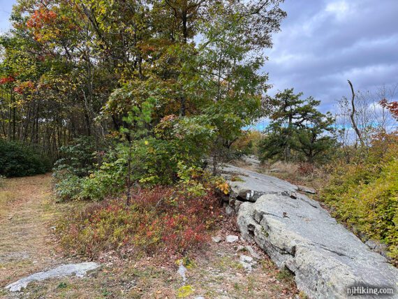
Continue over the rock slab to a viewpoint and a rock to sit on for a break.
Follow Appalachian Trail (WHITE) as it curves around and very soon ends up back at a T-intersection with Crater Lake (ORANGE).
Turn RIGHT to now follow Crater Lake (ORANGE). [Appalachian Trail (WHITE) is straight ahead. There is also an orange marker near it.]
// Alternate: Continuing straight on Appalachian Trail (WHITE) is a short steep scramble down and will meet up with this route in a bit, reducing the mileage a little. //
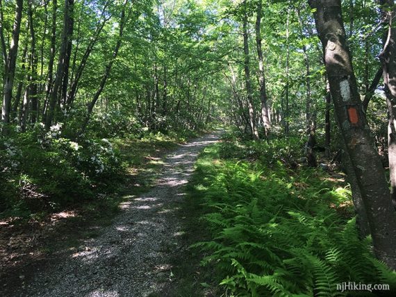
Continue following Crater Lake (ORANGE) on an easy woods road. It will loop around and gently go downhill.
2.9 – Continue straight on Crater Lake (ORANGE) where the Appalachian Trail (WHITE) crosses it. [If you took the AT shortcut down, this is where you rejoin the route.]
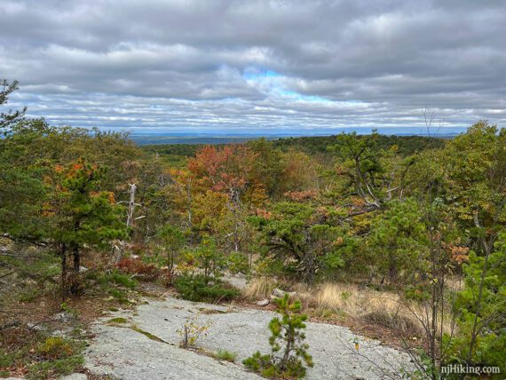
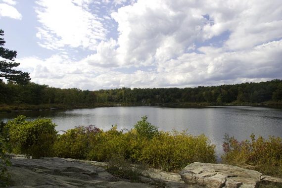
3.1 – Optional: Take the unmarked trail on the LEFT for a view over Crater Lake. This short trail leads to a small open area with a nice view over the lake.
A few building remnants are scattered about.
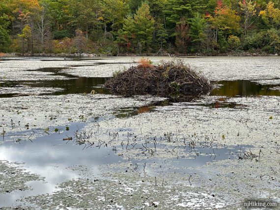
3.3 – Optional: Take the unmarked trail on the RIGHT for a view over Lake Success and a beaver lodge. This side trail has a good view of the lodge but in a few steps there is another that might be more open if you want to take a break.
There are rocky outcrops to sit on at the edge of the lake as the trail approaches the Crater Lake Parking Lot.
—
Hiked: 10/8/22.