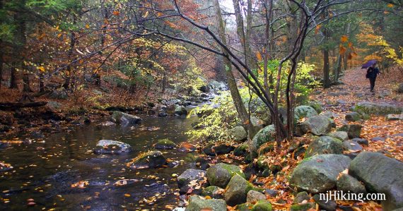
Very scenic hike that loops around Pine Meadows Lake in Harriman State Park, New York.
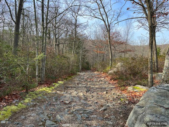
7.2 or 5.4 miles, total round trip. Rocky; steady gentle uphill to the lake so slightly downhill on the return.
| 7.2 miles | This hike guide: Detailed instructions, photos, and video follow below. |
| Shorter | 5.4 or 5.0 miles: Out-and-back to Pine Meadow Lake instead of the loop around (noted below) |
| Longer | Huge network of trails = endless options. |
| Same lot | Seven Hills, HTS, Pine Meadow; Seven Hills, HTS, Raccoon Brook, Pine Meadow; Seven Hills, HTS, Reeves Brook. |
| Nearby | Almost Perpendicular, Elbow Brush; Kakiat County Park to Pine Meadow Lake; Black Rock and Hogencamp Mountain; Sterling Forest; Governor Mountain. |
Our two cents:
Harriman State Park is located in New York just over the New Jersey border and has an extensive (and popular) network of hiking trails. This manageable hike has a pretty lake as the destination with plenty of interest along the way.
After reaching the lake, this route loops around it using an unmarked trail – many hikers will want to keep it simple and do the 5.4 mile total out-and-back version instead (still worthwhile!).
The description includes an optional side trip to the Conklin Cemetery and nearby ruins of a CCC (Civilian Conservation Corps) camp.
Updated: 5/2024 – Page refreshed, not re-hiked. 2/2023: Route changed to avoid a bridge out, added the peninsula and cemetery/CCC, added/replaced photos, description/interactive map updated; re-hiked 12/2022.
Hike Info:
Map/Books:
Harriman-Bear Mountain Trails is best for the network of trails in Harriman State Park, or use the map on the park’s site. Follow along on your smartphone with our Interactive Map link above (though we did lose cell service a few times in this area).
Hikes in this area are in Circuit Hikes in Harriman, Hike of the Week, Take a Hike New York City. Harriman Trails: A Guide and History lists mileage breakdown of every trail in the park (not loop hikes), as well as the history of the area and trails.
Parking: N41.17412° W74.16862°
“Reeves Meadow Visitor Center”, 100 Seven Lakes Dr, Sloatsburg, NY 10974. Garden State Parkway North to 17 N to Rt 287 N to Rt 87/17N. Take exit 15A and turn left onto Rt 17 N. R on Seven Lakes Dr.
The visitor center is on the right with a small lot, and another small lot just down the road on the left… but they will be full unless you arrive super early so you’ll likely need to park along the road.
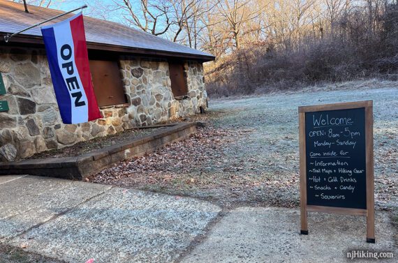
Restrooms/Visitor Center:
In the Reeves Meadow Visitor Center at the main parking lot; open 7:30am – 5pm every day, year round. The visitor center opens at 8am but the restrooms should be open at 7:30am (as per staff).
The AMC (Appalachian Mountain Club) took over in July of 2021 which allows the visitor center/bathroom to be available more (always a plus!). The center also offers trail maps, snacks, candy, and hot and cold drinks… so like us you can shovel a post-hike chocolate bar into your mouth.
Hike Directions:
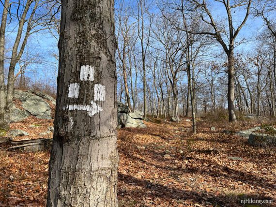
Overview: RED SQUARE on WHITE (Pine Meadows) – WHITE (Conklins Crossing) – Unmarked – Woods Road (Pine Meadow Road West) – RED SQUARE on WHITE (Pine Meadows)
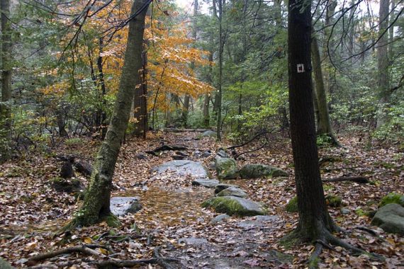
0.0 – From the parking lot, behind the visitor center, pick up the wide very obvious main path which is RED SQUARE on WHITE (Pine Meadows).
Shortly, keep following RED SQUARE on WHITE (Pine Meadows) straight as WHITE goes to the right.
0.4 – Bear RIGHT to keep following RED SQUARE on WHITE (Pine Meadows). [YELLOW (Stony Brook) goes to the left]
Pass through an open area for a gas pipeline.
1.2 – Continue straight on RED SQUARE on WHITE (Pine Meadows) passing ORANGE (H-TS) on the left, and then in a bit again on the right.
Pine Meadow Brook becomes more visible through the trees off on the left. Pass BLUE (Seven Hills) on the right.
1.5 – Turn LEFT and follow RED SQUARE on WHITE (Pine Meadows) over a bridge. [WHITE (Kakiat) continues straight but you might not notice it, we didn’t this last time].
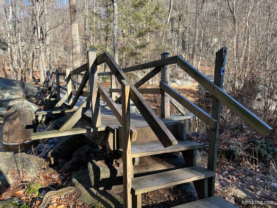
Just over the bridge, turn RIGHT and continue following RED SQUARE on WHITE (Pine Meadows). [WHITE (Kakiat) and BLUE (Seven Hills) go off to the left].
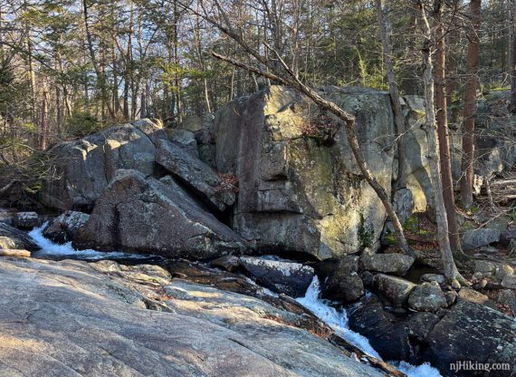
1.8 – Off to the right near Pine Meadows Brook is a cascade in front of very large boulders, called Gus-Nah-Quah Rock (“Stone Giants” according to Harriman Trails: A Guide and History).
We think the largest looks like a face – eye on the right, nose, with a top lip jutting over the bottom.
2.1 – Veer left to continue on RED SQUARE on WHITE (Pine Meadows) where a wider flat unmarked path continues ahead.
RED SQUARE on WHITE (Pine Meadows) heads up to pass an old building foundation noted as “CCC Ruins” on the TC map. According to Harriman Trails: A Guide and History this is the remains of the Civilian Conservation Corps headquarters in Harriman State Park.

2.2 – Turn RIGHT to continue on RED SQUARE on WHITE (Pine Meadows). [YELLOW (Diamond Mountain Tower) goes to the left and straight].
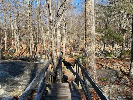
Continue over a small footbridge. The trail widens and heads up to the lake.
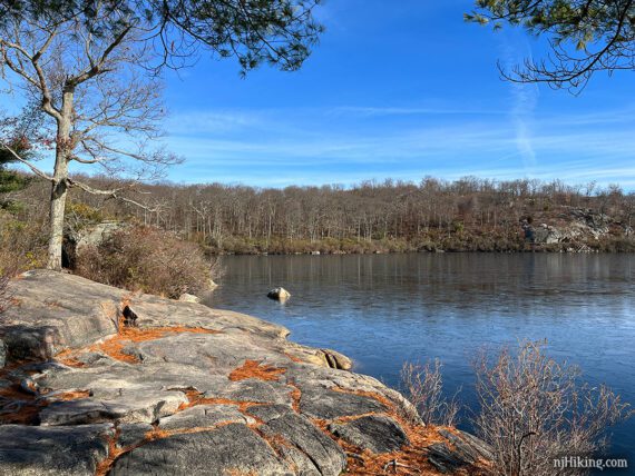
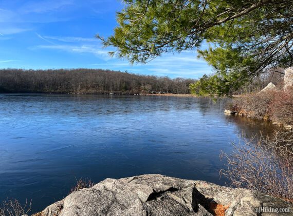
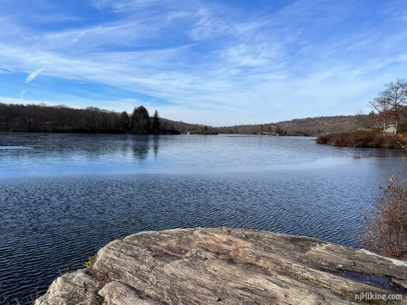
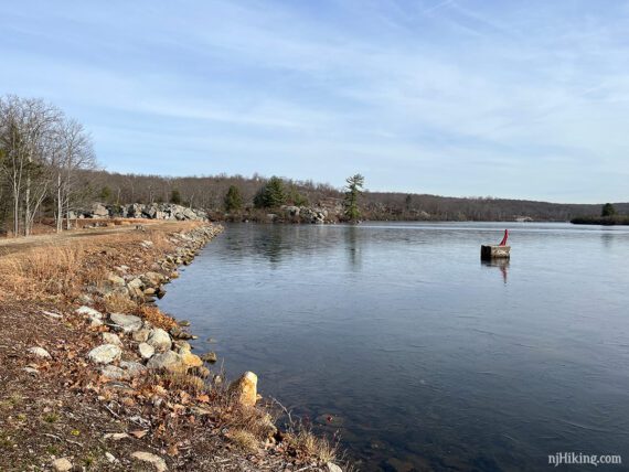
2.4 – Arrive at an intersection with a woods road (Pine Meadow Road West). Pine Meadow Lake can be seen off on the right. Nice view and plenty of areas to sit and take a break, or continue a bit ahead to more break spots.
// Shorter Version, 5.0 miles round trip: Instead, turn RIGHT along Pine Meadow Road West for views of the lake, take a break, and then retrace the route back on RED SQUARE on WHITE (Pine Meadows). //
Cross the woods road and continue ahead on RED SQUARE on WHITE (Pine Meadows).
2.5 – Turn RIGHT and follow one of the casual trails out onto a peninsula of land. Continue to the end for the best views over Pine Meadow Lake, it’s about a tenth of a mile one-way.
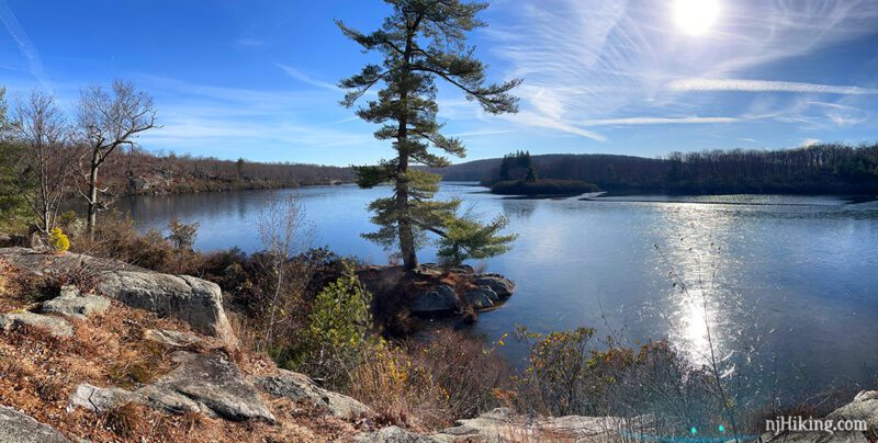
There are plenty of open rocky spots along the sides to choose for a break too.
When ready, retrace the casual paths back to the intersection with RED SQUARE on WHITE (Pine Meadows), and turn RIGHT to continue following it.
// Shorter Version, 5.4 miles round trip: Instead, turn LEFT and retrace the route back on RED SQUARE on WHITE (Pine Meadows). //
Continue on RED SQUARE on WHITE (Pine Meadows) as it hugs the lake. Look back to see the peninsula you were just on.
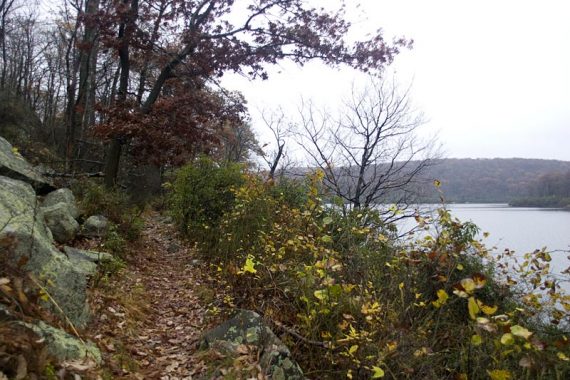
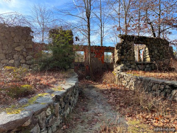
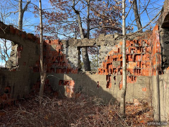
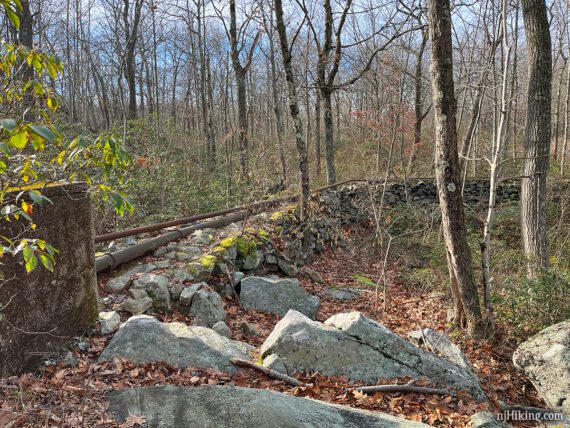
3.1 – The old foundation on the right are the ruins of a pumphouse. This was for camps that were supposed to built around the lake but never were (this and any other facts about the area are from the Harriman Trails book).
The interior walls of the pumphouse.
There are also short square cement structures and an old pipeline found around the lake, built in 1934.
3.3 – Conklin Cabin sign. The Harriman Trails book has a little history and a photo of the cabin before it was in ruins around 1942.
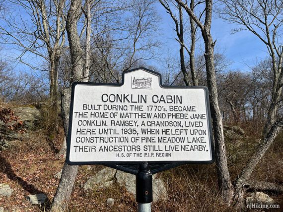
Notice something about the wording? We didn’t until another hiker happened by and pointed out that technically “ancestors” came before and only “descendents” could still live nearby.
We weren’t sure where the cabin once stood, but across from the sign is a flat area with yet another nice view over Pine Meadow Lake.
3.4 – Turn RIGHT to start following WHITE (Conklins Crossing). [RED SQUARE on WHITE (Pine Meadows) continues ahead].
3.6 – At a T-intersection where WHITE (Conklins Crossing) leaves to the left and there is a relatively obvious unmarked trail to the right, turn RIGHT to now follow the unmarked trail.
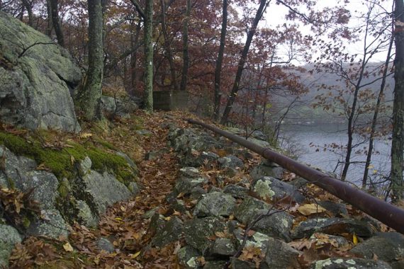
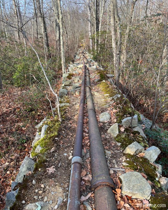
The trail around this side of the lake is a bit unique… at points the trail is up on raised berms that still have pipes running on them (from an unfinished sewer system).
There’s a long stretch of walking next to the pipeline on top of the berm, which is a few feet off the ground.
4.1 – The unmarked trail ends at a T-intersection with a woods road* (Pine Meadow Road West). Turn LEFT to now follow the woods road.
*The woods road is unmarked and names are only shown on the Trail Conference map. This route technically is on Torne Valley Road briefly first but we’re using just “Pine Meadow Road West” for simplicity.
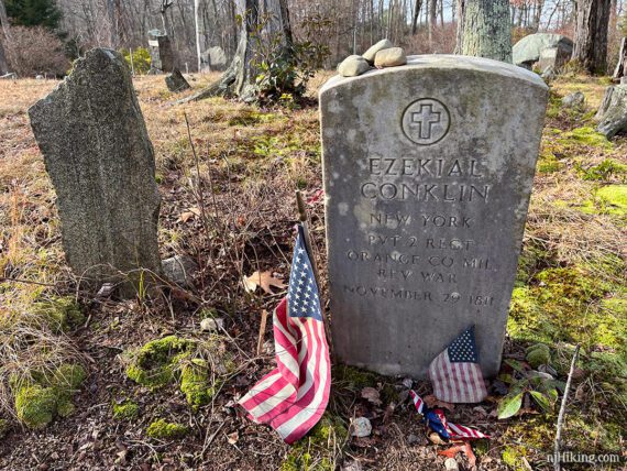
//Optional add-on side trip: Instead, turn RIGHT for an out-and-back to Conklin Cemetery and CCC Ruins. The area is unmarked and could be confusing, we recommend only with a GPS or app.
There are multiple casual paths and no set route to the ruins and cemetery, but waypoints are on our interactive map. The added distance will vary on how far and where you walk, it added about 0.6 miles for us.
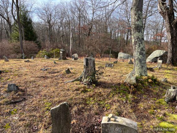
The cemetery is tucked back on a hill with a few graves for the Conklin family, including a Revolutionary War veteran, Ezekial Conklin. The way we meandered over from the lake edge near some evergreens had us hopping over a little stream, but we left via a different path.
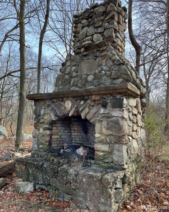
There are various remnants here and there, including a stone chimney, from a CCC camp established in 1933. For a little general history see CCC in New York State Parks.
// End of optional side trip. Return to the intersection with the unmarked trail and continue ahead on the woods road (Pine Meadow Road West).
Whether you did the side trip or not… continue following the woods road (Pine Meadow Road West) as it curves up and around, getting closer to the edge of Pine Meadow Lake.
Keep veering right when another woods road leaves to the left – might not even notice this.
4.5 – Pass YELLOW DOT on WHITE (Poached Egg) on the left.
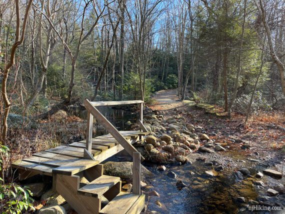
4.8 – Arrive at the edge of Pine Meadow Lake. Continue over the bridge to where you were earlier. Turn LEFT to follow RED SQUARE on WHITE (Pine Meadows) again.
5.0 – Turn LEFT to continue on RED SQUARE on WHITE (Pine Meadows) at the intersection with YELLOW (Diamond Mountain Tower).
5.6 – Turn LEFT over the bridge where you crossed the brook earlier. Continue following RED SQUARE on WHITE (Pine Meadows), retracing the route back to the lot.
// Alternate return route: This hike guide originally went straight here but a bridge at the end is out. If the water is low or the bridge is repaired in the future: instead of turning here do WHITE (Kakiat) – YELLOW (Stony Brook) – RED SQUARE on WHITE (Pine Meadows). The route description is archived here. //

—
Hiked: 12/5/2022. Revised route to skip missing bridge.
Hiked: 6/24/13. +Conklin Cemetery. Trail Blog: “Pine Meadow Lake Loop and Conklin Cemetery in Spring“
Hiked: 10/31/09. Trail Blog: “Halloween Hike at Harriman“