This route takes in several view points along Mountain, SMB and Raccoon Brook Hill trails, Lake Wanoksink, and Pine Meadow Lake.
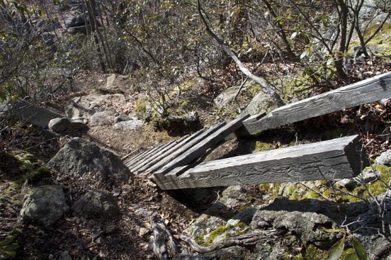
| 8.6 miles | Decent uphills and rugged sections, especially Raccoon Brook which has lots of large rocks, a little scrambling and a ladder to make this hike challenging. |
| Shorter/Longer | Huge network of trails = endless options. |
| Nearby | Pine Meadows Loop; Seven Hills, HTS, Pine Meadow; Seven Hills, HTS, Raccoon Brook, Pine Meadow; Seven Hills, HTS, Reeves Brook. |
Our two cents:
Headed to Harriman again on yet another unseasonably warm February day. This time is was to Pine Meadow Lake from Kakiat County Park.
The last time we’d started from here was back in September of 2007 where we took Suffern-Bear Mountain trail south but had cut it short and bailed off to the power line cut back to Mountain trail… can’t recall why.
This route takes in several view points – along Mountain, S-BM and Raccoon Brook Hill trails.
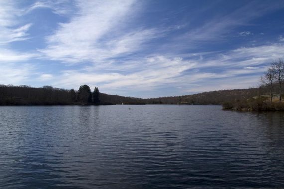
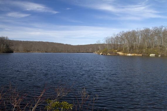
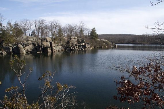
Pine Meadow Lake was a lovely break spot as usual and we also decided to take a woods road over to see Lake Wanoksink which was pretty.
We actually aren’t huge fans of either trail from this lot, but they are good to access other areas in Harriman.
We just had a loose route in mind, and were going to decide which trails we felt like taking as we went along (which you should not do without a good map and a very good idea of how far you can hike!!).
Updated: 5/2024, 6/2020: Page refreshed, not re-hiked. Hiked in 2012.
Hike Info:
Map:
We prefer Harriman-Bear Mountain Trails but the park site has one too.
Parking: N41 08.729 W74 06.754
Kakiat County Park.
Restroom:
Bathroom in the lot was open.
Route:
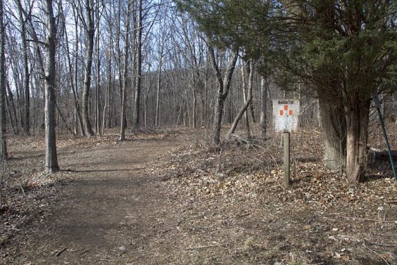
Mountain (Orange) – SBM (Suffern-Bear-Mountain Yellow) – Conklins Crossing (WHITE) – Pine Meadow (Red Square on White) – Conklin Road & unmaintained trail to Lake Wanoksink – Woods road – Pine Meadow (Red Square on White) – Pine Meadow Road – Poached Egg (Yellow Circle on White) – Raccoon Brook Hills (Black Dot on White) – KAKIAT (White)
From the Kakiat County Park lot, walk over a bridge and pass Old Mill and Kakiat Trails on the right.
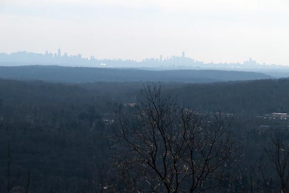
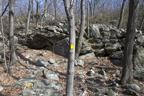
Mountain Trail (Orange) starts a little ahead and heads steeply up a rocky woods road, with 2 viewpoints where the NYC skyline is visible in the distance.
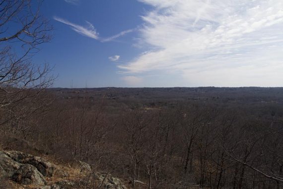
After a pipeline cut, turn left onto Kakiat (WHITE). At the intersection with SBM (Yellow), turn right. Some views along SMB.
Turn left onto Conklins Crossing (WHITE). Pick up Pine Meadow (Red Square on White) as it goes around the lake. There are great places to hang out and have a snack.
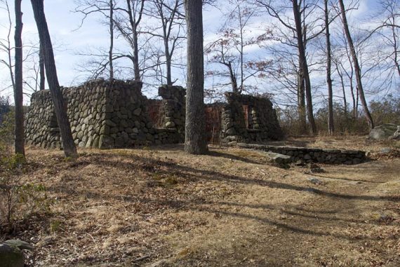
There is a woods road (Conklin Road) on the right just after the ruins of a building and it was one of those “hey let’s check this out” days so off we went.
After climbing over a couple blowdowns and going a short ways on a woods road, we veered to the left on an unmaintained trail to Lake Wanoksink.
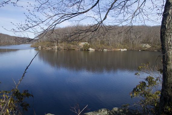
The trail hugged the water until hitting a T-intersection at a bunch of pine trees. We turned left and made our way back, turning right back onto Pine Meadow (Red Square on White) again.
Just keep heading towards the lake and bridge, there are several trails in this area and it’s not real clear. More nice views of Pine Meadow Lake and popular lunch spots on this side of the lake.
We followed the woods road around the lake until coming to the start of Poached Egg (Yellow Circle on White.. get it? it looks like a egg…)
Poached Egg goes a short ways and ends at Raccoon Brook Hills (Black Dot on White). Turn left onto this (it comes in from the right). Raccoon Brook Hills heads uphill for a limited view of Pine Meadow Lake.
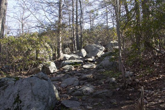
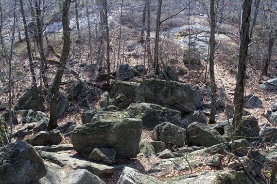
There are some steep sections when it starts going downhill, some rocks to scramble over, as well as a ladder (which while not too tough for humans, Fido may be less than thrilled).
Turn left onto Kakiat (WHITE). As you approach the powerline cut in a rocky area, watch for a left turn to cross a stream. It’s easy to miss – even though there was a rock with a stick on it, we walked right on by.
Continue on Kakiat, crossing over SBM, then the pipeline cut. Back within the County park, Kakiat turns right when it comes out to a stone fence, take this out to the main path from earlier and make a left back to the lot.
—
Hiked 2/19/12.
How many miles from the parking lot to the lake? Thanks!
Dave – roughly 3.2 miles from the parking to first getting near the lake, another .2 to a good break spot and view of the lake.
–Dawn