Hike along striking white cliff edges while enjoying panoramic views of the Shawangunk region of New York.
7.1 or 6.4 miles, total round trip. Surface is a mix of wide, graded carriage roads and trail. There are several somewhat steep downhill/uphill sections. Cliff edges have exposed sheer drop-offs.
| 7.1 miles | This hike guide: Detailed instructions, photos, and video follow below. |
| Shorter | 6.4 – Instead of the full loop, do this as an out-and-back to Gertrude’s Nose (or turn around even sooner). Noted below. ~2.0 easy – Instead, just circle the lake using the Lake Minnewaska Carriage Road (RED). |
| Longer | Add in Awosting Falls for an extra 1.8 round trip. Directions below. Or, extend the route past Millbrook Mountain. |
| Longer, variation: | Start at the Jenny Lane lot. Directions below. |
| Variation, other lot | Approach from West Trapps trailhead in Mohonk Preserve. |
| Nearby | Labyrinth and the Lemon Squeeze; Bonticou Crag; Sam’s Point Preserve – Ice Caves, Verkeerder Kill Falls, High Point. |
| Combine two hikes into getaway | “The Gunks Overnighter: Gertude’s Nose, Labyrinth and the Lemon Squeeze“ |
Our two cents:
The reward-to-effort on this hike is in your favor with wide, long-lasting views. Fall foliage is especially striking against the white Shawangunk conglomerate rock. Abundant mountain laurel in spring.
All of this can make for a popular/crowded hike… hit it on a weekday if you can. And the lot doesn’t open till 9 am – early-bird hikers, see the note on Jenny Lane.
Avoid this hike when icy, and the Gertrude’s Nose trail may close in winter. The directions below include how to also visit Awosting Falls.
This counter-clockwise loop can be hiked in the other direction… I debated going clockwise to put Millbrook Mountain Trail’s rocky and nearly viewless downhill-uphill early on which leaves the easier stuff for later… but decided I’d still rather get to the big scenic views and interesting trail first while fresher.
Updated: 9/2025 – Minor edits. 8/2024 – Minor updates, added/replaced photos, changed return route to other side of lake; re-hiked. Older change log at page bottom.
Hike Info:
Map:
Shawangunk Trails is better than the online Minnewaska State Park map. They likely give you a park map at the gate but we always prefer TC maps and don’t bother to ask.
Most intersections in this park have large map boards with “you are here” marks and highlighted trails but it’s always a good idea to have a map with you.
Follow along on your smartphone with our Interactive Map link above. Our map shows this route plus the optional add-on to Awosting Falls.
Books:
A similar route in the opposite direction is in Take a Hike New York City, plus it has several other good hikes in the area.
A different hike from this parking lot plus a different approach to Millbrook is in Hike of the Week. Gertrude’s Nose from Trapps is in 50 Hikes in the Lower Hudson Valley.
Scenes & Walks in the Northern Shawangunks describes the trails and carriage roads in Minnewaska, Mohonk, and Sam's Point, featuring beautiful illustrations, maps, and historical background.
Parking: N41.72886° W74.23717° [Main lot]
Lake Minnewaska Visitor Center / 5281 Route 44-55 Kerhonkson, NY 12446. The lot is gated until 9 am. $10 per vehicle; Empire Pass accepted. This hike starts at the Upper parking area (the lots closest to the visitor center and lake).
If these lots are full you’ll be adding a walk from the Lower lot and may as well hit up Awosting Falls on the way there or back. (There is no parking right at Awosting Falls – the map shows a parking icon, but that is handicap access only).
Parking, longer variation: N41.74258° W74.25440° [Jenny Lane lot]
Jenny Ln, Kerhonkson, NY 12446. This small parking area is an option for hikers who like to start earlier than 9 am (or avoid a fee). This will add distance to the hike – roughly 2.5 mile each way – and might involve a rock hop over a stream. You could also add Awosting Falls on the way.
To hike this route from Jenny Lane: Wawarsing Turnpike Trail to the intersection with High Peters Kill then cross the road to enter the park at the Lower parking lot and continue towards the Upper lots. Here is where you can optionally add on a short out-and-back to visit Awosting Falls (or do so on the return).
Follow Sunset Carriage Road up to the Upper parking lots and pick up the directions below. Note: While we researched this option, we did not end up hiking it.
Refreshments/Overnight:
Nearby New Paltz has a main street packed with restaurants, coffee, ice cream, and there’s a farm stand just outside the city. On our last visit we hit Clemson Bros. Brewery as usual for dinner and a pint (2025: this appears to have closed), and tried Lola’s Cafe the next day (tasty sandwiches) because the falafel place we always go to was sadly gone.
From north New Jersey this is close enough for a day trip… but from central or south this is 2+ hours away and you may as well make it an overnighter! This is an easy and fun way to get two hikes in.
This last trip we again stayed at America’s Best Value Inn (affordable, clean, basic, simple breakfast). We’ve also stayed at the Hampton Inn next to it which is a bit nicer (but on this past trip would have been nearly double the price!).
We’ve got a couple Trail Blogs in our On The Road section with suggestions on how to combine hikes into an overnight trip.
Restrooms:
Visitor center has restrooms and a water bottle filling station. There are also composting toilets by the swimming area of Lake Minnewaska Carriage Road, passed on this route. Portable toilets in the parking lot.
Carriage Roads:
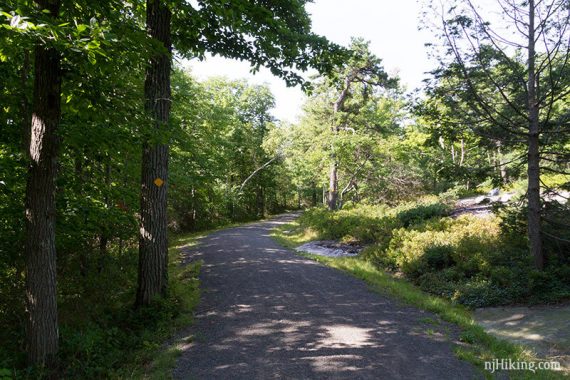
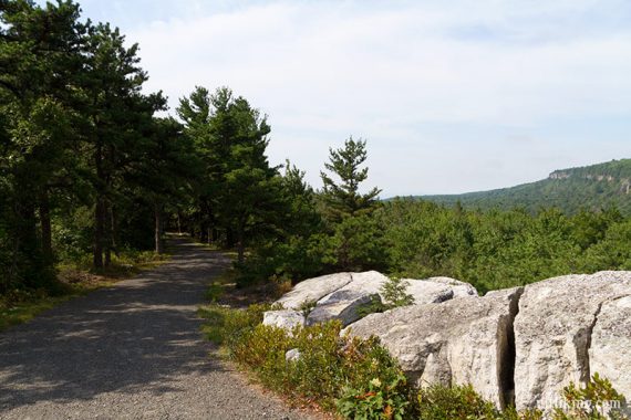
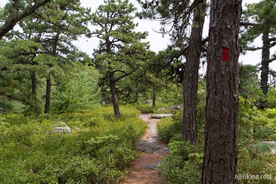
A portion of this route uses some of the network of “carriage roads” that are criss-cross Minnewaska, Mohonk Preserve, and Sam’s Point. These are wide, maintained paths of finely crushed gravel created over 100 years ago, with a mostly gentle elevation change and a much easier surface than a hiking trail.
Carriage roads can be biked but be aware they have hills unlike most rail-trails (we once went out to Lake Awosting via bike and did not enjoy it!). The carriage roads may be blazed sparsely but there are map signs at many intersections.
Hike Directions:
Overview: Lake Minnewaska Carriage Road (RED) – Millbrook Mountain Carriage Road (YELLOW) – Gertude’s Nose (RED) – Millbrook Mountain Trail (RED) – Lake Minnewaska Carriage Road (RED)
0.0 – From the far end of the last parking lot, a path leads down to Lake Minnewaska but many paths lead to the lake from the various lots.
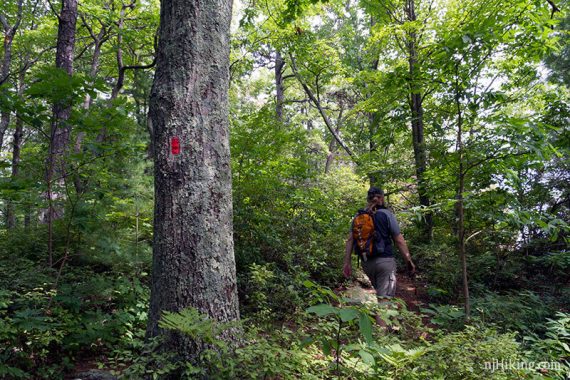
Basically… get to the lake and then follow the wide gravel Lake Minnewaska Carriage Road (RED) as it hugs the lake – while keeping the lake on your left side.
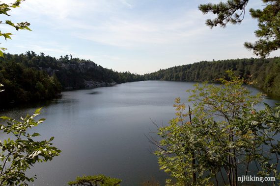
Lake Minnewaska Carriage Road (RED) circles the lake, but for this route, it makes more sense to start this way.
Keep following Lake Minnewaska Carriage Road (RED)… kept left past the start of the Sunset Carriage Road (this leads to Awosting Falls if you’d like to check that out later).
Pass the Upper Awosting Carriage Road (GREEN), composting toilets, and the Castle Point Carriage Road (BLUE).
There is a large network of “carriage roads” across Minnewaska and connect to Mohonk Preserve. These are wide, maintained paths of finely crushed gravel with a mostly gentle elevation change and are a much easier surface than a hiking trail.
They can be biked but be aware they have hills and are not flat like a rail-trail. The carriage roads may be blazed sparsely but there are map signs at many intersections.
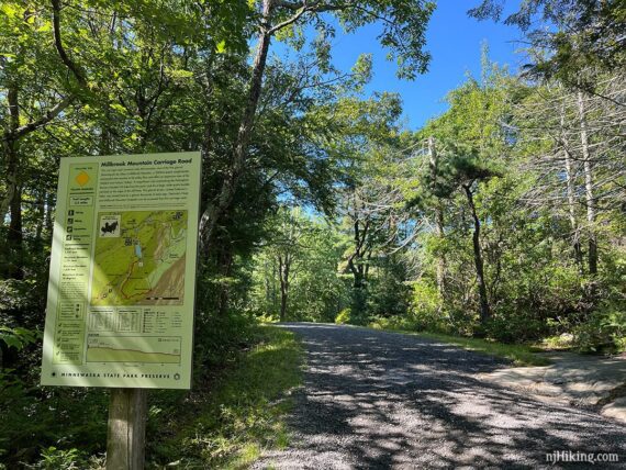
0.8 – Turn RIGHT and now follow Millbrook Mountain Carriage Road (YELLOW).
1.0 – Veer LEFT to continue on Millbrook Mountain Carriage Road (YELLOW). [Hamilton Point Carriage Road veers to the right].
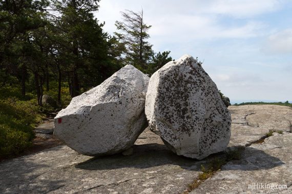
1.5 – Patterson’s Pellet. This is a “glacial erratic” left behind by receding glaciers and one of many along this route.
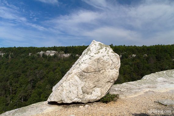
Continue on Millbrook Mountain Carriage Road (YELLOW). It was roughly 30 minutes of walking on easy gravel carriage roads to get to this point.
2.0 – Veer RIGHT and now follow Gertude’s Nose (RED) on a trail [Millbrook Mountain Carriage Road continues straight].
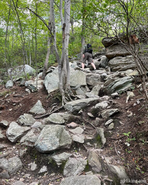
2.4 – Gertude’s Nose (RED) starts to head downhill steeply. This downhill now has a long section of stone steps crafted into the hill, replacing the jumble of rocks that had to be negotiated with a more sustainable trail surface.
These stone steps were created by the Jolly Rovers trail crew from 2023-24. This crew handles most of the fancy rock work on trails that you’ll encounter over northern NJ and southern NY.
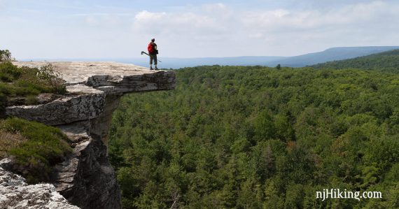
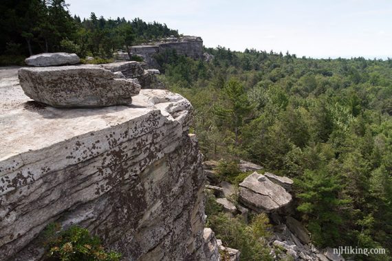
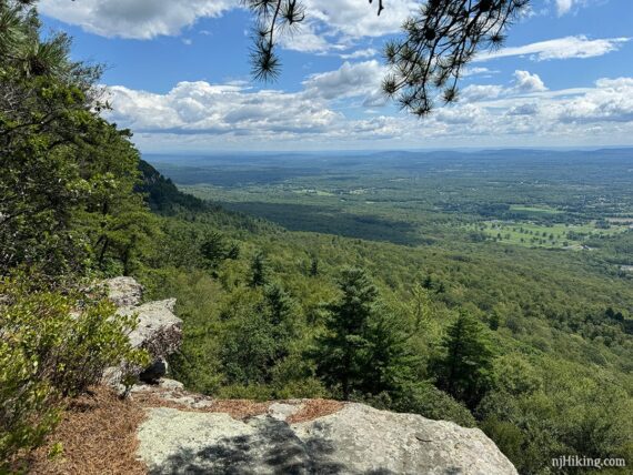
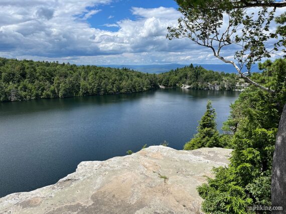
Eventually cross a power line and then go back up a bit. Continue on Gertrude’s Nose (RED) along the edge of a cliff with outstanding views.
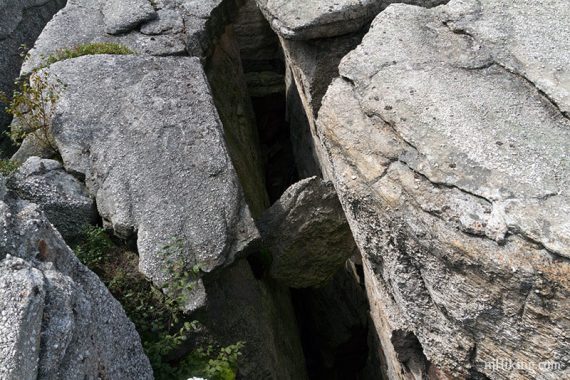
Note! It always goes without saying to be careful with your footing and aware of your surroundings, but here it is especially important.
There are large crevices, sheer drop-offs, and overhanging rocks… just be cautious and not stupid when striking your Intrepid Adventurer poses for Facebook and Instagram.
This looks like I’m much closer to the edge than I am – you can get a cool shot without taking chances. However, this photo is from 2016…
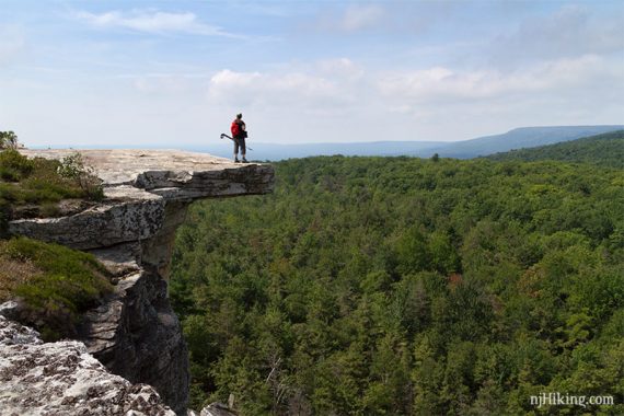
When hiking in 2024, there was a “restoration in progress” sign posted at that ledge. Of note, we never walked over this gap to get out to the ledge… there was a safe access point in just a few steps (which now wasn’t obvious). But we’re mindful of rules so this time we just kept on truckin’.
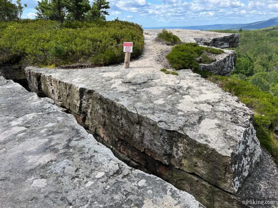
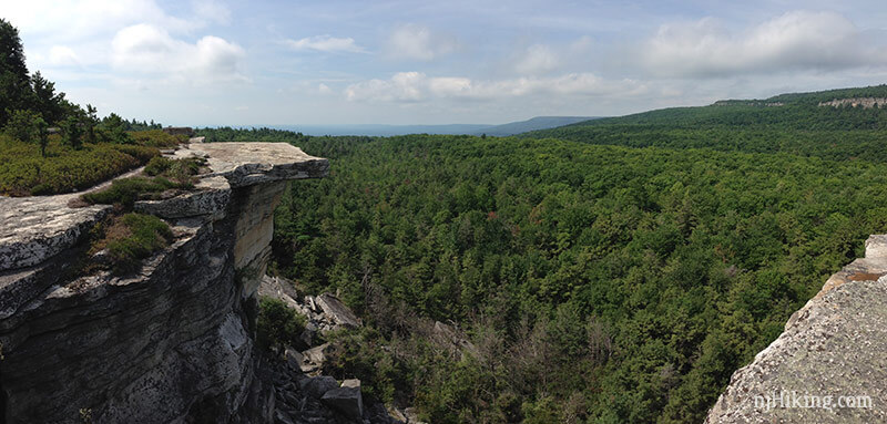
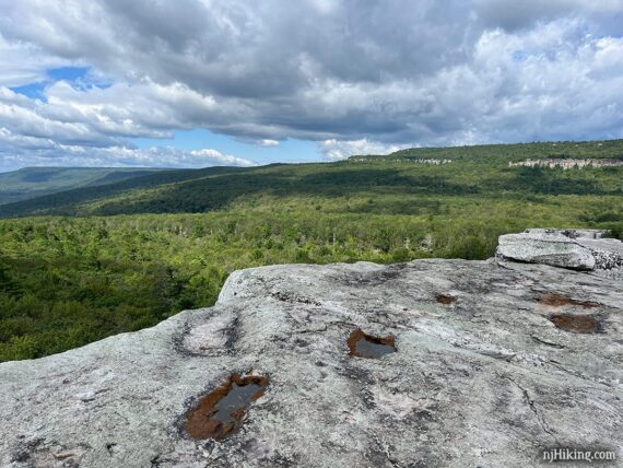
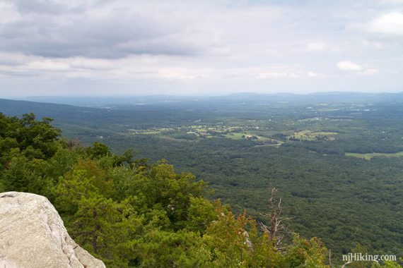
The trail meanders along the cliff edge, with the white fractured rock making really interesting shapes along the way.
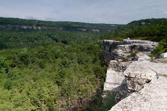
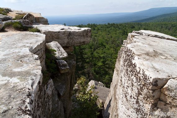
This entire stretch is just one jaw-dropping view after another. We have so many photos it was very hard to narrow them down. We also lucked out with blue skies, fluffy clouds, and lovely weather.
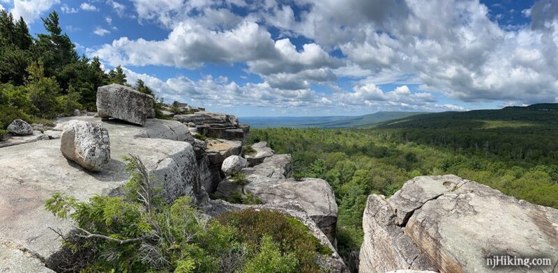
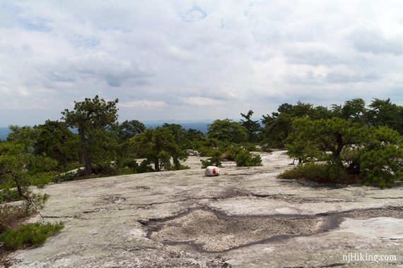
3.2 – The trail rounds a point – this is actually “Gertrude’s Nose” – before starting to head back into the forest. View from the tip of the Gertrude’s Nose trail:
Who was Gertrude and what’s the deal with her nose? This endpoint is named for Gertrude Bruyn, whose name appears on a 1682 deed regarding a land purchase in the Shawangunk valley.
The “nose” is likely because the trail comes to a point at this outcrop or it possibly resembles a nose when viewed from elsewhere, like Hamilton’s Point. But I couldn’t locate a definitive on the ‘nose’ origin.
// Shorter/Easier variation, 6.4 miles, total round trip: Instead of continuing, retrace the entire route back: Gertrude’s Nose (RED) to Millbrook Mountain Carriage Road (YELLOW), then turn LEFT back on to Lake Minnewaska Carriage Road (RED). You lose some views but also several downhill/uphills and lots of rocky trail.
Continue on Gertrude’s Nose (RED) as it starts to head downhill to the power line again.
The trail meanders through forest with a few spots to take in the view over the valley below, and towards New Paltz.
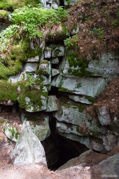
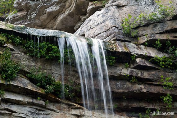
4.3 – Once the power line cut is crossed, look for a casual side trail on the right side. This leads to a nearby rock opening with very cold air coming out of it. Nifty and super refreshing on a hot day.
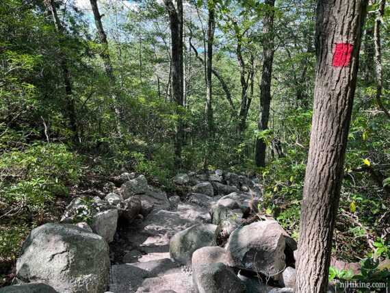
Continue on Gertrude’s Nose (RED) as it heads up – very steeply – with a long section of rocks, a few steps, and some scrambling.
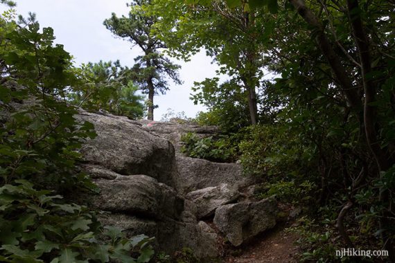
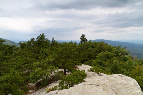
The trail opens up to a wide expanse of rock with short trees. Continue on Gertrude’s Nose (RED) across this.
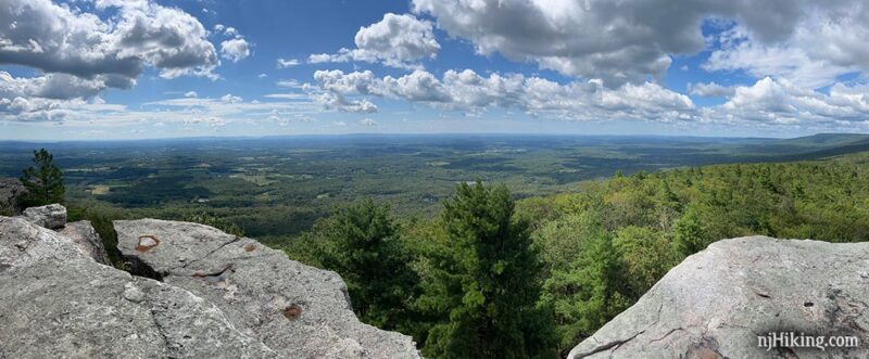
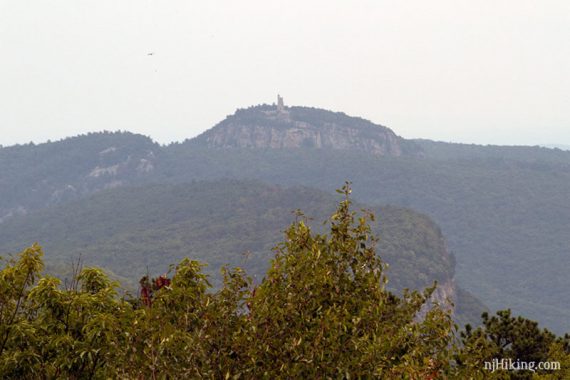
5.1 – Arrive at Millbrook Mountain. Continue on Gertrude’s Nose (RED) past the sign, and veer to the right to the edge of the cliff to a viewpoint looking over New Paltz and towards Skytop Tower at Mohonk Mountain House.
Skytop Tower on Mohonk Mountain House seen from Millbrook Mountain (in 2016 we hiked to this the next day during the Labyrinth & Lemon Squeeze hike):
Head back down the rock slab from the viewpoint. Look for the sign for Millbrook Mountain Trail (RED) and Millbrook Ridge Trail (BLUE) where a carriage road ends in a turnaround.
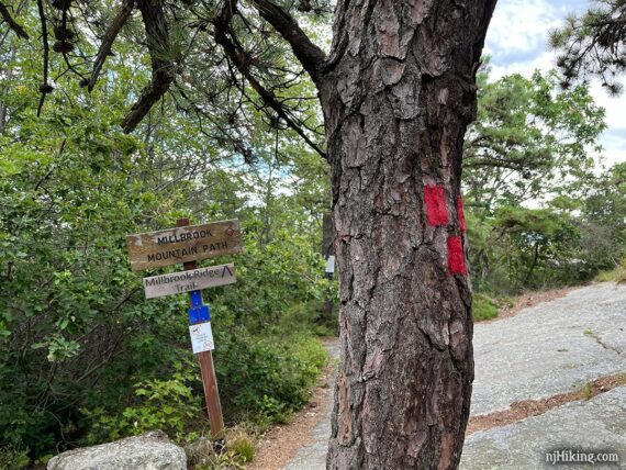
Follow BLUE for a few steps to another sign and turn LEFT to now follow Millbrook Mountain Trail (RED) – there is also a sign pointing in that direction to Lake Minnewaska.
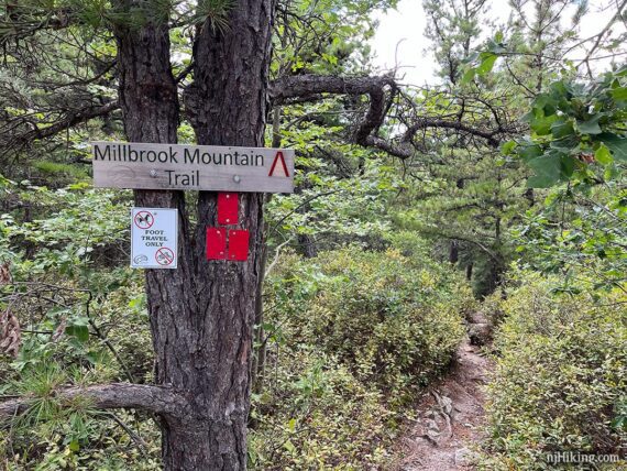
5.3 – Pass Coxing Trail on the right. Continue on Millbrook Mountain (RED) downhill, often over large stretches of flat rock slabs.
I’d read that this section of the trail can get and stay wet. We hiked this after a week of heavy rain and while quite wet it was manageable by taking care.
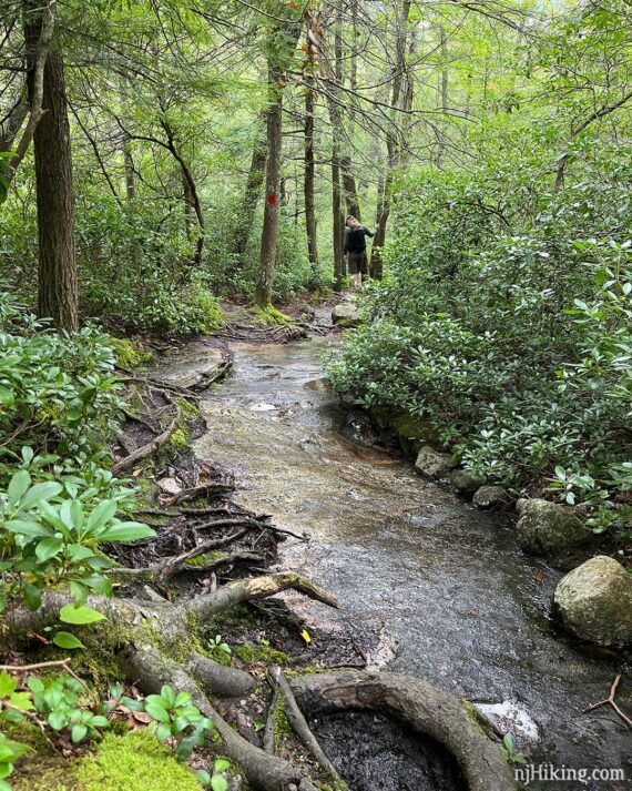
Cross Coxing Kill on large rocks (Fun Fact: The suffix “kill” is Dutch for “body of water”… in this case a small stream). Soon, start heading uphill back to Lake Minnewaska.
6.3 – Arrive back at Lake Minnewaska and choose what side of the lake you’d like return along, we’ve described them as Option 1 and 2. The distances are the same.
Having done both, we prefer Option 1 so we can wind down our hike with a spot to sit overlooking Lake Minnewaska (…and another have snack, let’s be honest here). If you want to add-on Awosting Falls, you’re better off with Option 2.
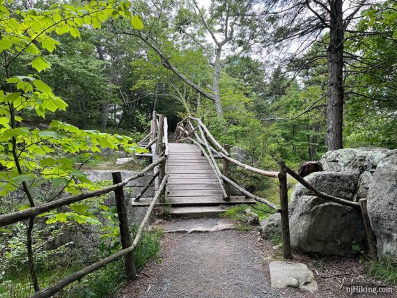
Option 1 – Turn RIGHT and now follow Lake Minnewaska Carriage Road (RED). This briefly hugs the lake then snakes it’s way up to a wide grassy area overlooking the lake, with lots of picnic tables.
Several carriage roads make their way back to the lot. When a regular hiking trail appeared we followed that over a fancy wooden bridge known as “Dry Bridge”. Arrive at one end of the parking lot and turn LEFT back towards the visitor center and/or your parking spot.
Option 2 – Turn LEFT and now follow Lake Minnewaska Carriage Road (RED), retracing the route past the carriage road trailheads from earlier in the day. Pass the bathrooms near the swim area and head back up to the lot. If you’re adding a side trip to Awosting Falls, the trail is from this side of the lake.
Optional Add-on: Awosting Falls
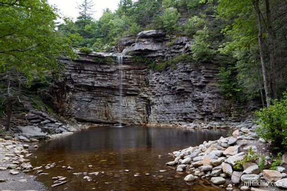
This adds about 1.8 miles round trip.
Nearly back to the parking lot, start following the Sunset Carriage Road (ORANGE) and take it to Awosting Falls Carriage Road (RED).
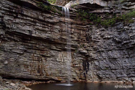
These are wide, gravel roads that snake downhill the entire way to the Falls… which means you need to hike uphill on the return.
The falls are very nice but keep in mind there are not going to be as impressive in summer or drier months.
—
Hiked: 8/12/24.
Hiked: 8/25/16. Trail Blog: “The Gunks Overnighter: Gertrude’s Nose, Labyrinth and the Lemon Squeeze“
Updated: 6/2021 – Minor updates, not re-hiked. 4/2020 – Page refreshed, not re-hiked.