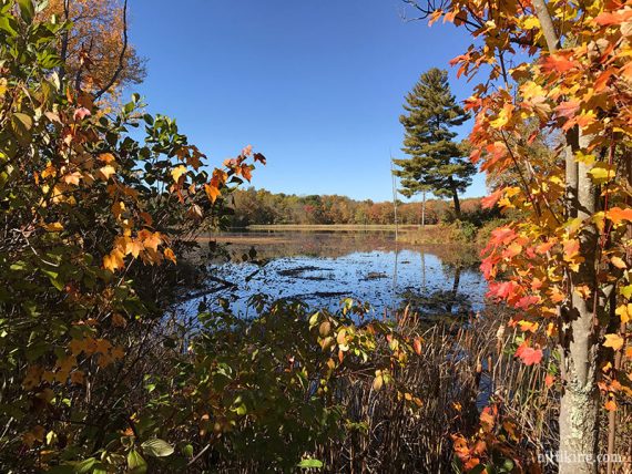
Hike with views of Lake Aeroflex, Whites Pond, and planes taking off from a small airport.
5.1 or 3.2 miles, total round trip. Roots and dirt, not as rocky as north Jersey can be. Minor elevation changes overall. Multi-use trails.
| 5.1 or 3.2 miles | This hike guide: Detailed instructions and photos follow below. |
| Shorter | 3.2 – Lake and airport views, removing RED and BLUE from the directions below. |
| Longer | Add in the trails around Twin Lakes or a portion of the Sussex Branch rail trail |
| Same park | Lake Aeroflex Kayak |
| Nearby | Paulinskill Valley Trail – Cedar Ridge to Aqueduct; Paulinskill Valley Trail – Warbasse Junction to Cedar Ridge; Great Valley Trail Loop; Allamuchy Mountain S.P. North; Mahlon Dickerson/Beaver Brook to Lost Lake; Swartswood S.P. – Spring Lake; Swartswood Grist Mill. |
Our two cents:
Moderate hike in a compact park with many trail options. WHITE trail along the lake has the nicest views. The shorter 3.2 mile version is a solid pick if you prefer less mileage – get lake and airport views, though you miss Whites Pond.
Bonus: Near the runway, there are benches where you can watch planes take off. Note: No hunting in the main section of the park, between Goodale Rd. and Limecrest Rd.
Updated: 1/2026 – Minor edits; not re-hiked. 8/2022 – Description, route, interactive map, parking info improved and adjusted; re-hiked 6/2022. 4/2020 – Page refreshed, not re-hiked.
Hike Info:
Map:
Print out ahead, or check the visitor center. Follow along on your smartphone with our Interactive Map link above
Parking: N41.01669° W74.74306°
“Kittatinny Valley State Park”, 199 Goodale Rd, Newton, NJ 07860. If approaching from Rt 80, take 206 N towards Stanhope/Newton. At a park sign and red building, turn R on Goodale Rd.
Follow Goodale Rd to another large park sign and turn R into a large paved lot. Park here and don’t continue further into the park unless going to the visitor center/park office.
Restrooms:
Composting toilet in the parking lot; bathrooms at the visitor center.
Hike Directions:
Overview: WHITE (Glacial) – Park Road – RED (Andover Junction) – Sussex Branch – BLUE (Limestone) – YELLOW (Explorer)
NOTE: While this park is pretty well marked there are multiple unmarked paths or park roads that end up in the same place.
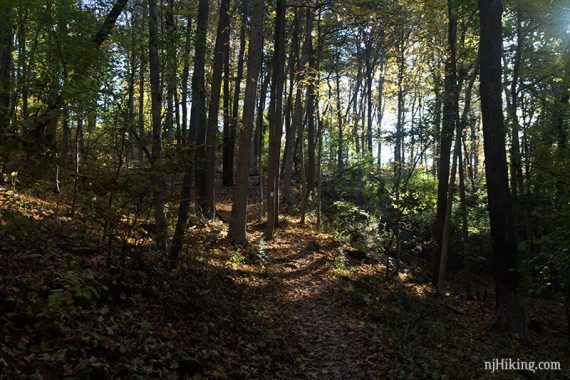
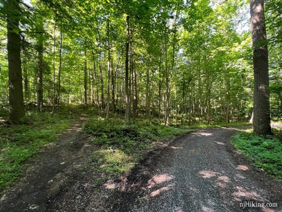
0.0 – Start following WHITE (Glacial) near the composting toilet at the corner of the parking lot. The trail is mostly shady.
Follow WHITE (Glacial) as it makes its way around towards Lake Aeroflex. The trail is clear of leaves here because of a race being held the next day.
Pass a few unmarked connector trails that lead to an interior trail loop (Black) – might not even notice these.
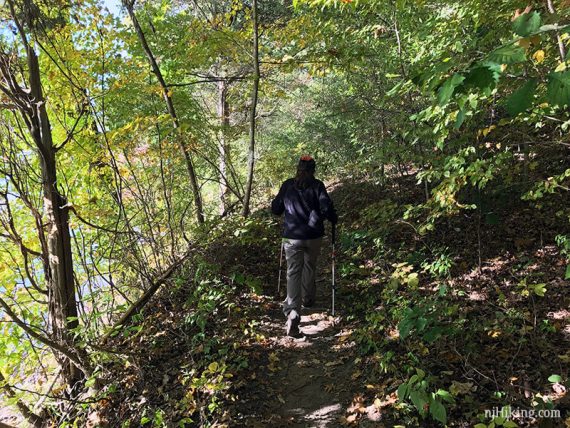
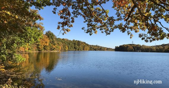
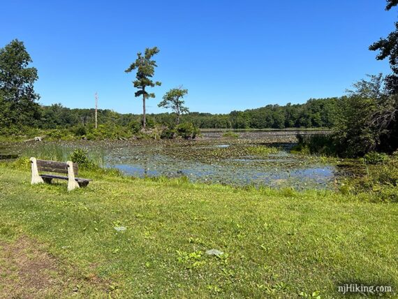
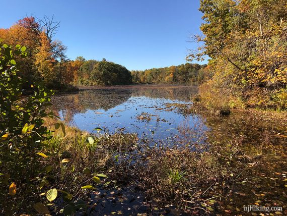
1.4 – After curving around through a narrow grassy trail in an open area, WHITE (Glacial) follows the edge of the lake.
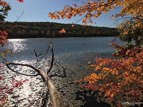
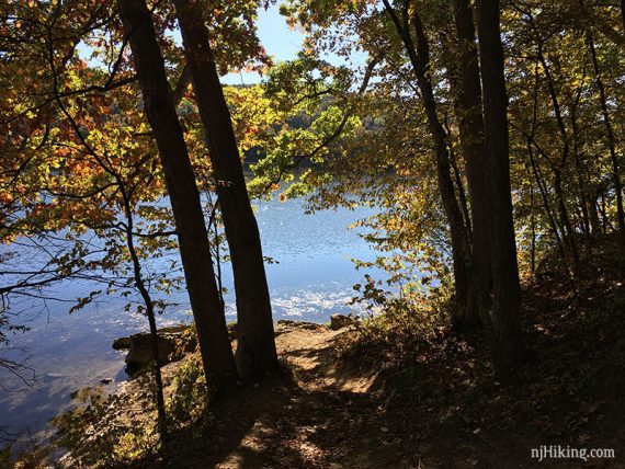
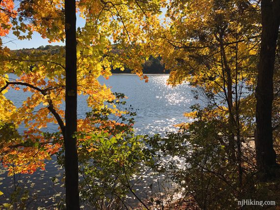
There are multiple spots for a view of the Lake Aeroflex from WHITE (Glacial).
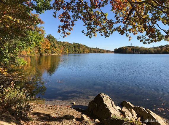
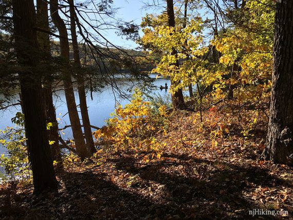
1.8 – Arrive at a short stone wall (there is a path around the right) and a small dock. Continue on WHITE (Glacial). Eventually, the trail will veer off to the left to continue closer to the water, while another trail continues ahead – don’t think this was marked.
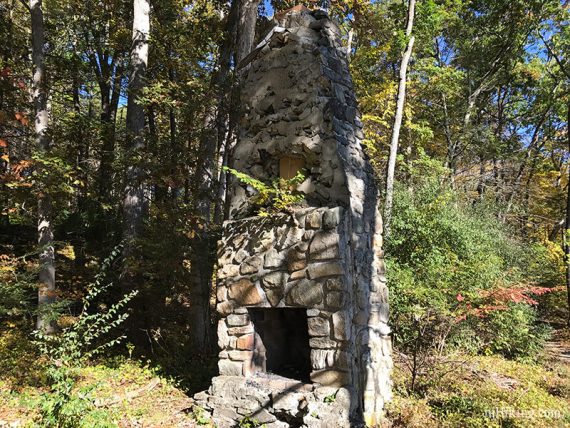
Pass old foundations along the water and an old stone chimney along the way.
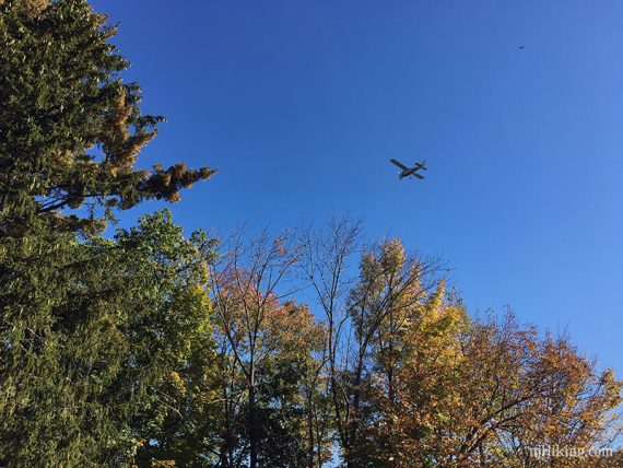
2.3 – Arrive at an open grassy area near the runway for Aeroflex-Andover Airport, with a few benches nearby. [WHITE (Glacial) ends]. The first bench is a little sunny, the next one closer to the runway is in shade.
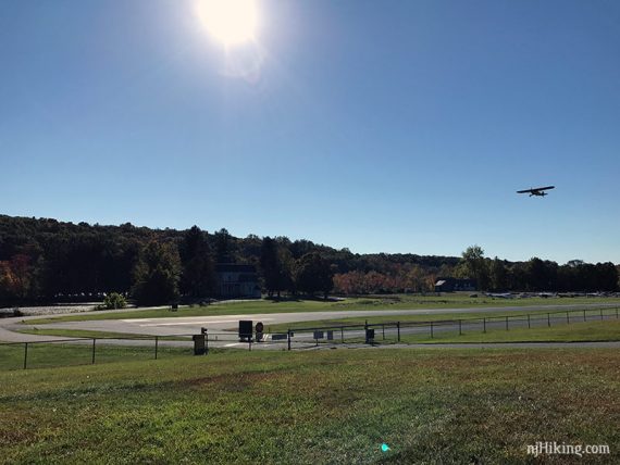
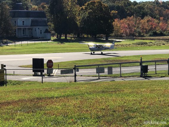
There may be small planes taking off and landing at Aeroflex-Andover Airport.
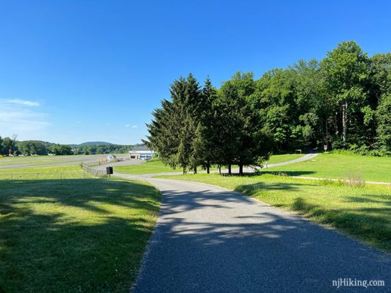
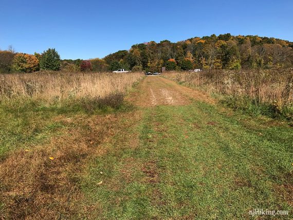
Start following the park road that runs from the grassy area that the WHITE trail ended up at. Follow this towards the airport. After the group of large trees shown below is the “trail” sign in the next step.
2.5 – Turn RIGHT just after those trees to a sign that says “TRAIL”. Follow where the arrow points on an unmarked gravel path.
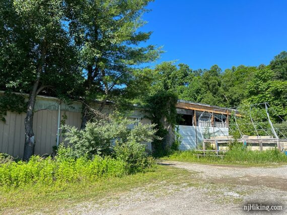
Follow the path straight past an old building that is being over taken by trees.
A path may also veer right across a mowed section of field – it’s fine if you follow this instead. Either way the path comes to a T with YELLOW (Explorer). Turn LEFT to briefly follow YELLOW (Explorer) – though there might not be yellow markers here.
2.7 – In a short bit, the path splits. Continue STRAIGHT to now follow RED (Andover Junction). [YELLOW (Explorer) curves off to the right.]
// Shorter option, 3.2 miles total – Instead, follow YELLOW (Explorer) to the RIGHT. Continue on YELLOW (Explorer) as it loops back until reaching a field with the parking area just beyond. //
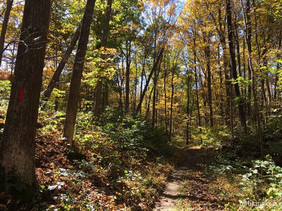
RED markers might not be obvious right away.
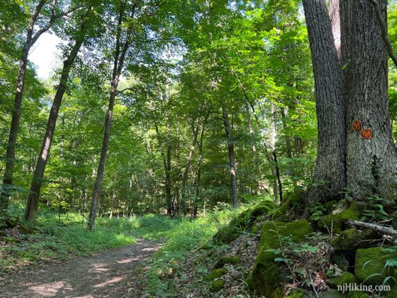
3.4 – ORANGE (Andover Loop) comes in from the left and is co-joined for a bit.
3.5 – Start following just ORANGE (Andover Loop) straight. [RED (Andover Junction) continues to the left and will loop around to meet up in the same spot very soon. This seemed unnecessary so we removed it from this route.]
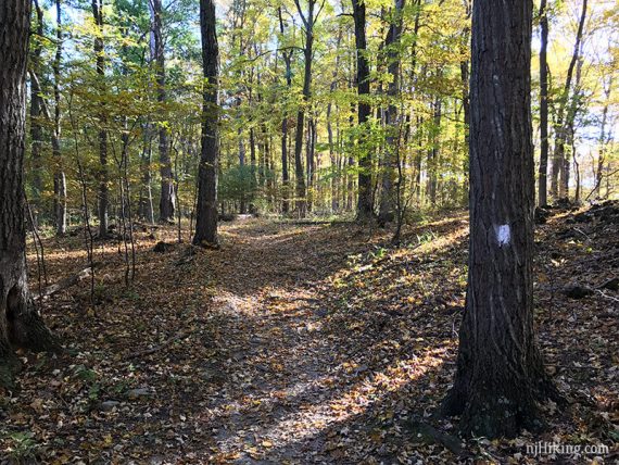
Soon meet up with RED (Andover Junction) again and turn RIGHT to continue on RED (Andover Junction)/ORANGE (Andover Loop). This area has several unmarked paths – follow the blazed trails.
3.6 – Come to a T-intersection and follow RED (Andover Junction)/ORANGE (Andover Loop) to the RIGHT.
Very shortly, turn LEFT to follow RED (Andover Junction)/ORANGE (Andover Loop). An ORANGE triangle was on a brown post on the left, and an unmarked trail went to the right.
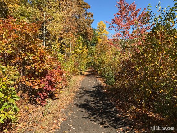
Turn RIGHT to now follow Sussex Branch /ORANGE (Andover Loop). There’s a trail sign at the intersection, and the path is wider and gravel. [RED (Andover Junction) ends].
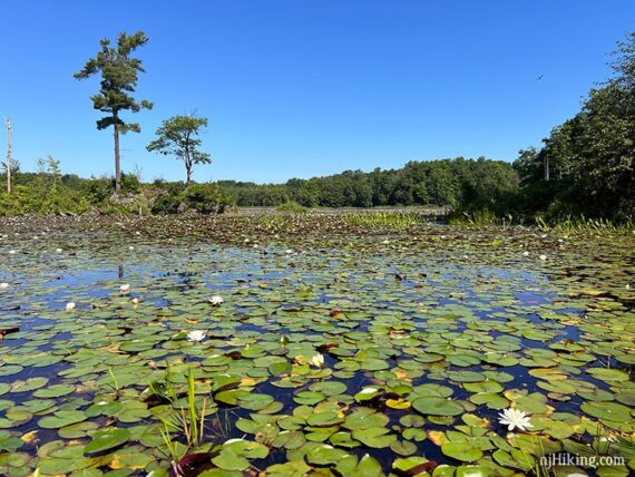
3.8 – Turn LEFT on an unmarked path to Whites Pond. A bench is in a large open grassy area with a view over the pond.
The pond was filled with lily pads the day we hiked and a pair of swans were in the distance. The footbridge over a spillway didn’t seem to lead anywhere.
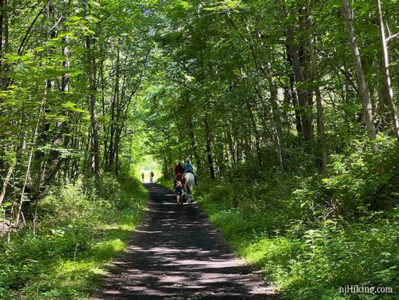
Retrace and turn LEFT back on to Sussex Branch /ORANGE (Andover Loop) to continue. Trails are multi-use so you may spot bikers and horses.
In Jersey, you just never know what you’ll see while hiking… a guy on a mountain unicycle rolled up while we were at Whites Pond. That’s right, mountain biking on one wheel. We didn’t know that was even a thing.
3.9 – Pass BLUE (Limestone) on the right, just for now, and continue to another view over Whites Pond.
Retrace and start following BLUE (Limestone). Soon, come to a T-intersection and continue following BLUE (Limestone) to the LEFT. [Unmarked trail is to the right]. You may notice a few more unmarked trails along the way.
4.6 – At a 4-way intersection, turn LEFT and now follow YELLOW (Explorer), a gravel path. [BLUE (Limestone) continues straight. YELLOW (Explorer) also goes to the right].
There may not be many or any YELLOW blazes but the path is obvious. Pass a few more unmarked trails.
4.9 – Arrive at a mowed path across a field. Cross this to return to the parking lot.
—
Hiked: 6/25/22.
Hiked: 10/15/16.
Hiked: 7/9/06. Trail Blog “Kittatinny State Park“